|
Khamti Airport
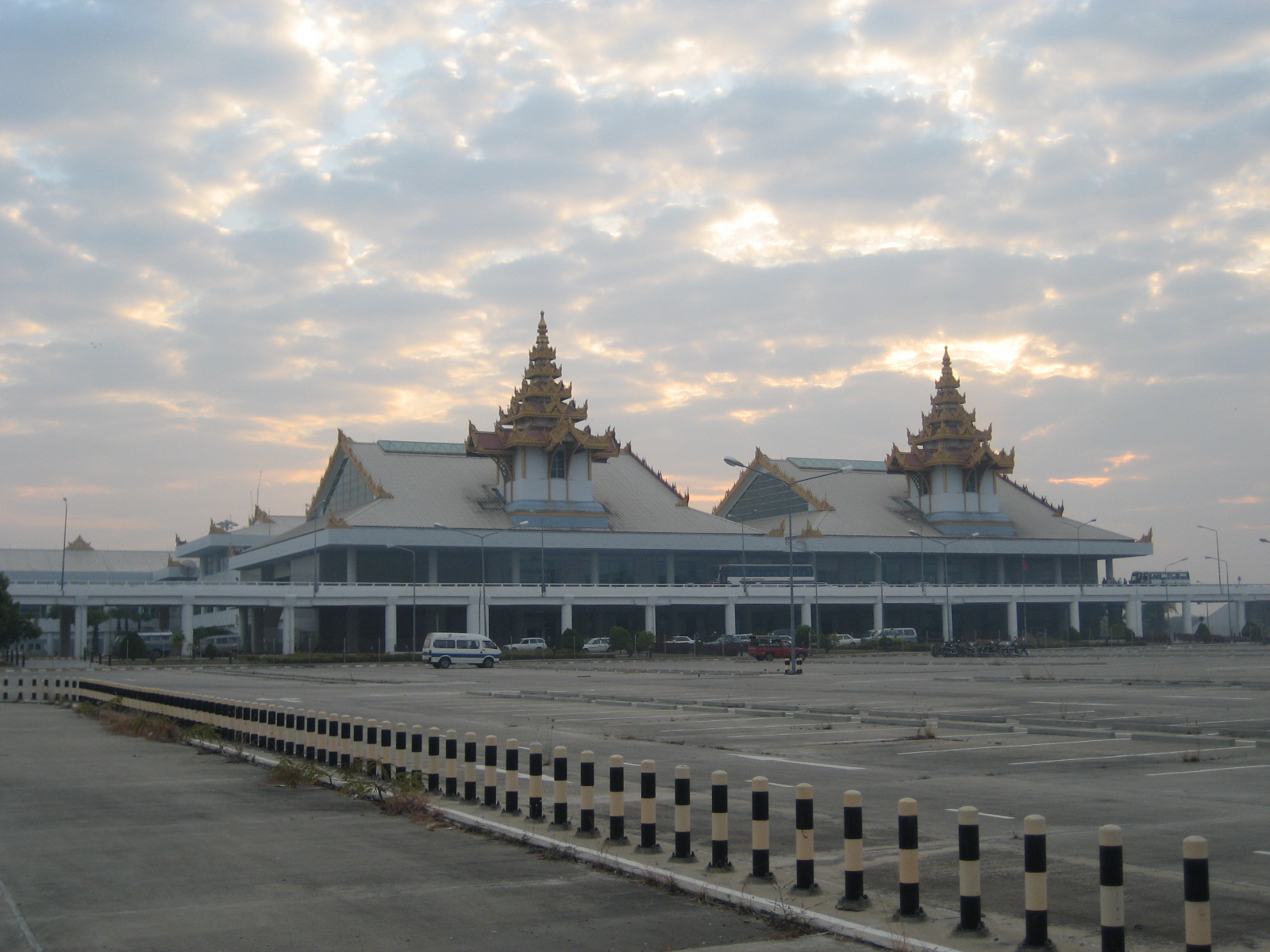
Khamti Airport , also known as Hkamti Airport, is an airport serving Khamti (Hkamti), a town in the Khamti (Hkamti) District of the Sagaing Division in northwestern Myanmar. Facilities The airport is at an elevation of above mean sea level. It has one runway According to the International Civil Aviation Organization (ICAO), a runway is a "defined rectangular area on a land aerodrome prepared for the landing and takeoff of aircraft". Runways may be a man-made surface (often asphalt, concre ... which measures . The runway was extended in 2005.MNA (18 January 2005"Extension of Hkamti Airport runway under way: Lt-Gen Ye Myint makes inspection tour of Sagaing Division"''The New Light of Myanmar'' 12(277): p. 1, 8 Airlines and destinations References External links * {{authority control Hkamti Township Airports in Myanmar Sagaing Region ... [...More Info...] [...Related Items...] OR: [Wikipedia] [Google] [Baidu] |
Singkaling Hkamti
Khamti, Hkamti, Singkawng, Kanti The Permanent Committee of Geographic Names (PCGN), United Kingdom, p. 3, from of 25 September 2007 or Kantee"Map of Sagaing Division" ''Myanmar's NET'', accessed 8 October 2009 is a town in |
Myanmar
Myanmar, ; UK pronunciations: US pronunciations incl. . Note: Wikipedia's IPA conventions require indicating /r/ even in British English although only some British English speakers pronounce r at the end of syllables. As John Wells explains, the English spellings of both Myanmar and Burma assume a non-rhotic variety of English, in which the letter r before a consonant or finally serves merely to indicate a long vowel: mjænmÉË, ËbÉËmÉ So the pronunciation of the last syllable of Myanmar as ÉËror of Burma as ÉËrmÉby some speakers in the UK and most speakers in North America is in fact a spelling pronunciation based on a misunderstanding of non-rhotic spelling conventions. The final ''r'' in ''Myanmar'' was not intended for pronunciation and is there to ensure that the final a is pronounced with the broad ''ah'' () in "father". If the Burmese name my, áá¼ááºáá¬, label=none were spelled "Myanma" in English, this would be pronounced at the end by all ... [...More Info...] [...Related Items...] OR: [Wikipedia] [Google] [Baidu] |
Airport
An airport is an aerodrome with extended facilities, mostly for commercial air transport. Airports usually consists of a landing area, which comprises an aerially accessible open space including at least one operationally active surface such as a runway for a plane to take off and to land or a helipad, and often includes adjacent utility buildings such as control towers, hangars and terminals, to maintain and monitor aircraft. Larger airports may have airport aprons, taxiway bridges, air traffic control centres, passenger facilities such as restaurants and lounges, and emergency services. In some countries, the US in particular, airports also typically have one or more fixed-base operators, serving general aviation. Operating airports is extremely complicated, with a complex system of aircraft support services, passenger services, and aircraft control services contained within the operation. Thus airports can be major employers, as well as important hubs for t ... [...More Info...] [...Related Items...] OR: [Wikipedia] [Google] [Baidu] |
Hkamti District
Hkamti District or Khamti District (sometimes Naga Hills District) is a district in northern Sagaing Division of Burma (Myanmar). Its administrative center is the town of Singkaling Hkamti. Townships The district consists of the two townships: * Hkamti Township, and * Homalin Township Prior to 2010, it additionally controlled Lahe, Lay Shi (Lashe), and Nanyun townships, which were transferred under the 2008 Constitution (in BurmeseConstitution PDF to the Naga population. Borders Hkamti District is bordered"Myanmar States/Divisions & Townships Overview Map" Myanmar Information Management Unit (MIMU) by: * India to the west * Naga Self-Administered Zone to the west and north, * Myitkyina District and Mohnyin District of Kachin State to the east. * Katha Di ... [...More Info...] [...Related Items...] OR: [Wikipedia] [Google] [Baidu] |
Sagaing Division
Sagaing Region ( my, á á áºááá¯ááºá¸ááá¯ááºá¸áá±ááá¼á®á¸, ; formerly Sagaing Division) is an administrative region of Myanmar, located in the north-western part of the country between latitude 21° 30' north and longitude 94° 97' east. It is bordered by India's Nagaland, Manipur, and Arunachal Pradesh States to the north, Kachin State, Shan State, and Mandalay Region to the east, Mandalay Region and Magway Region to the south, with the Ayeyarwady River forming a greater part of its eastern and also southern boundary, and Chin State and India to the west. The region has an area of . In 1996, it had a population of over 5,300,000 while its population in 2012 was 6,600,000. The urban population in 2012 was 1,230,000 and the rural population was 5,360,000. The capital city of Sagaing Region is Monywa. Capital city The Capital city of Sagaing Region is Monywa. History The Pyu were the first to in recorded history to populate the area of Sagaing Re ... [...More Info...] [...Related Items...] OR: [Wikipedia] [Google] [Baidu] |
Elevation
The elevation of a geographic location is its height above or below a fixed reference point, most commonly a reference geoid, a mathematical model of the Earth's sea level as an equipotential gravitational surface (see Geodetic datum § Vertical datum). The term ''elevation'' is mainly used when referring to points on the Earth's surface, while '' altitude'' or '' geopotential height'' is used for points above the surface, such as an aircraft in flight or a spacecraft in orbit, and '' depth'' is used for points below the surface. Elevation is not to be confused with the distance from the center of the Earth. Due to the equatorial bulge, the summits of Mount Everest and Chimborazo have, respectively, the largest elevation and the largest geocentric distance. Aviation In aviation the term elevation or aerodrome elevation is defined by the ICAO as the highest point of the landing area. It is often measured in feet and can be found in approach charts of the aerodrome. It i ... [...More Info...] [...Related Items...] OR: [Wikipedia] [Google] [Baidu] |
Mean Sea Level
There are several kinds of mean in mathematics, especially in statistics. Each mean serves to summarize a given group of data, often to better understand the overall value (magnitude and sign) of a given data set. For a data set, the '' arithmetic mean'', also known as "arithmetic average", is a measure of central tendency of a finite set of numbers: specifically, the sum of the values divided by the number of values. The arithmetic mean of a set of numbers ''x''1, ''x''2, ..., x''n'' is typically denoted using an overhead bar, \bar. If the data set were based on a series of observations obtained by sampling from a statistical population, the arithmetic mean is the ''sample mean'' (\bar) to distinguish it from the mean, or expected value, of the underlying distribution, the ''population mean'' (denoted \mu or \mu_x).Underhill, L.G.; Bradfield d. (1998) ''Introstat'', Juta and Company Ltd.p. 181/ref> Outside probability and statistics, a wide range of other notions of mean ... [...More Info...] [...Related Items...] OR: [Wikipedia] [Google] [Baidu] |
Runway
According to the International Civil Aviation Organization (ICAO), a runway is a "defined rectangular area on a land aerodrome prepared for the landing and takeoff of aircraft". Runways may be a man-made surface (often asphalt, concrete, or a mixture of both) or a natural surface ( grass, dirt, gravel, ice, sand or salt). Runways, as well as taxiways and ramps, are sometimes referred to as "tarmac", though very few runways are built using tarmac. Takeoff and landing areas defined on the surface of water for seaplanes are generally referred to as waterways. Runway lengths are now commonly given in meters worldwide, except in North America where feet are commonly used. History In 1916, in a World War I war effort context, the first concrete-paved runway was built in Clermont-Ferrand in France, allowing local company Michelin to manufacture Bréguet Aviation military aircraft. In January 1919, aviation pioneer Orville Wright underlined the need for "distinctly m ... [...More Info...] [...Related Items...] OR: [Wikipedia] [Google] [Baidu] |
Air KBZ
Air KBZ ( my, á¡á²áá±áá®áááº) is a privately owned domestic Myanmar airline based in Yangon. Air Kanbawza, otherwise known as AIR KBZ, was established in June 2010. The airline began operations with a Yangon- Bagan- Nyaung Oo- Mandalay-Heho-Yangon flight on 2 April 2019. In 2015 Air KBZ began codesharing international flights with its partner Myanmar Airways International, but on 2 December 2016 Air KBZ itself expanded internationally, launching its first scheduled service outside Myanmar with flights connecting Yangon and Chiang Mai in neighboring Thailand. Destinations Air KBZ serves the following destinations as of February 2020: Codeshare agreements Air KBZ has codeshare agreement A codeshare agreement, also known simply as codeshare, is a business arrangement, common in the aviation industry, in which two or more airlines publish and market the same flight under their own airline designator and flight number (the "airli ... with the following airline: ... [...More Info...] [...Related Items...] OR: [Wikipedia] [Google] [Baidu] |
Mandalay Airport
Mandalay International Airport ( my, ááá¹ááá±á¸ á¡áá¼ááºáá¼ááºááá¯ááºáᬠáá±ááááº; ), located 35 km south of Mandalay in Tada-U, is one of three international airports in Myanmar. Completed in 1999, it was the largest and most modern airport in the country until the modernization of Yangon International Airport in 2008. The airport connects 11 domestic and seven international destinations. Its runway is the longest runway in use in Southeast Asia and has the capacity to handle up to 3 million passengers a year. The airport is the main operating base of Golden Myanmar Airlines. History The Mandalay International Airport project was first conceived by the Burmese military government in the mid-1990s as a way to increase overall levels of foreign investment and tourism in Myanmar. With Yangon boasting the only other international airport in the whole country, the new Mandalay airport was regarded as crucial in achieving a plann ... [...More Info...] [...Related Items...] OR: [Wikipedia] [Google] [Baidu] |
Yangon Airport
Yangon International Airport ( ) is the primary and busiest international airport of Myanmar. The airport is located in Mingaladon, north of central Yangon. All ten Myanmar carriers and about 30 international airlines operate at Yangon International Airport. The airport is also colloquially known as Mingaladon Airport due to its location. History During World War II, the airfield was called RAF Mingaladon and served as an operating base for fighter aircraft such as: *No. 60 Squadron RAF from February 1941 to February 1942 flying Bristol Blenheim I * No. 67 Squadron RAF from October 1941 to March 1942 flying Brewster F2A Buffalo and Hawker Hurricane IIs * No. 135 Squadron RAF from JanuaryâFebruary 1942 flying Hawker Hurricane IIs * No. 681 Squadron RAF from June to September 1945 flying Supermarine Spitfire *3rd Squadron of 1st American Volunteer Group (Flying Tigers) of the Chinese Air Force flying Curtiss P-40s There was also a Communication Flight of the Burma Voluntee ... [...More Info...] [...Related Items...] OR: [Wikipedia] [Google] [Baidu] |
Myanmar National Airlines
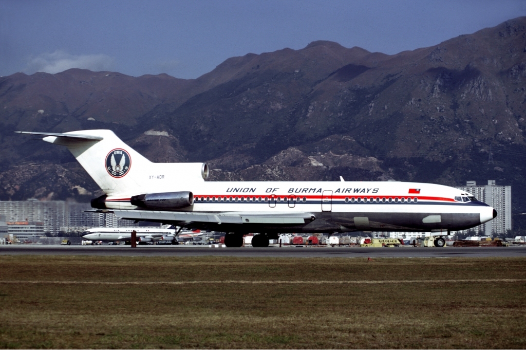
Myanmar National Airlines ( my, áá¼ááºáá¬á¡áá»áá¯á¸áá¬á¸áá±áá¼á±á¬ááºá¸ ), formerly Union of Burma Airways, Burma Airways, and Myanma Airways, is a state-owned airline and the flag carrier of Myanmar, based in Yangon. Founded in 1948, the airline operates scheduled services to all major domestic destinations and to regional destinations in Asia. Its main base is Yangon International Airport. History The airline was founded by the government after independence on 15 September 1948, as the Union of Burma Airways (UBA). It initially operated domestic services only, but added limited international services to neighboring destinations in 1950. In 1993 the airline withdrew from its international routes. After a 23-year absence, they relaunched foreign services in 2016 with service to Singapore. The name was changed to Burma Airways in December 1972, and to Myanma Airways on 1 April 1989, following the renaming of the country from Burma to Mya ... [...More Info...] [...Related Items...] OR: [Wikipedia] [Google] [Baidu] |


