|
Kent Wildlife Trust
Kent Wildlife Trust (KWT) is a conservation charity in the United Kingdom that was founded in 1958, previously known as the Kent Trust for Nature Conservation. It aims to "work with people to restore, save and improve our natural spaces" and to "ensure that 30% of Kent and Medway – land and sea – is managed to create a healthy place for wildlife to flourish". In 2016 it had thirty-one thousand members and an annual income of £4 million. KWT manages over sixty-five nature reserves, of which twenty-four are Sites of Special Scientific Interest, two are national nature reserves, nine are Nature Conservation Review sites, seven are Special Areas of Conservation, three are Special Protection Areas, seven are local nature reserves, one is a Geological Conservation Review site, thirteen are in Areas of Outstanding Natural Beauty and one is a scheduled monument. Kent is a county in the southeastern corner of England. It is bounded to the north by Gre ... [...More Info...] [...Related Items...] OR: [Wikipedia] [Google] [Baidu] |
Chalk Cliffs, Pegwell Bay - Geograph
Chalk is a soft, white, porous, sedimentary carbonate rock. It is a form of limestone composed of the mineral calcite and originally formed deep under the sea by the compression of microscopic plankton that had settled to the sea floor. Chalk is common throughout Western Europe, where deposits underlie parts of France, and steep cliffs are often seen where they meet the sea in places such as the Dover cliffs on the Kent coast of the English Channel. Chalk is mined for use in industry, such as for quicklime, bricks and builder's putty, and in agriculture, for raising pH in soils with high acidity. It is also used for "Blackboard, blackboard chalk" for writing and drawing on various types of surfaces, although these can also be manufactured from other carbonate-based minerals, or gypsum. Description Chalk is a fine-textured, earthy type of limestone distinguished by its light color, softness, and high porosity. It is composed mostly of tiny fragments of the calcite shells or ... [...More Info...] [...Related Items...] OR: [Wikipedia] [Google] [Baidu] |
North Sea
The North Sea lies between Great Britain, Norway, Denmark, Germany, the Netherlands and Belgium. An epeiric sea, epeiric sea on the European continental shelf, it connects to the Atlantic Ocean through the English Channel in the south and the Norwegian Sea in the north. It is more than long and wide, covering . It hosts key north European shipping lanes and is a major fishery. The coast is a popular destination for recreation and tourism in bordering countries, and a rich source of energy resources, including wind energy, wind and wave power. The North Sea has featured prominently in geopolitical and military affairs, particularly in Northern Europe, from the Middle Ages to the modern era. It was also important globally through the power northern Europeans projected worldwide during much of the Middle Ages and into the modern era. The North Sea was the centre of the Viking Age, Vikings' rise. The Hanseatic League, the Dutch Golden Age, Dutch Republic, and the Kingdom of Grea ... [...More Info...] [...Related Items...] OR: [Wikipedia] [Google] [Baidu] |
Tunbridge Wells Borough Council
Tunbridge may refer to the following places: * Tunbridge, Illinois, United States * Tunbridge, North Dakota, see Locations in the United States with an English name#North Dakota * Tunbridge, Tasmania, Australia * Tunbridge, Vermont, United States * The old spelling of Tonbridge, Kent, England ** Tunbridge (UK Parliament constituency) * Royal Tunbridge Wells Royal Tunbridge Wells is a town in Kent, England, southeast of central London. It lies close to the border with East Sussex on the northern edge of the High Weald, whose sandstone geology is exemplified by the rock formation High Rocks ..., Kent, England See also * Tonbridge (other) {{geodis ... [...More Info...] [...Related Items...] OR: [Wikipedia] [Google] [Baidu] |
Tonbridge And Malling Borough Council
Tonbridge ( ) is a market town in Kent, England, on the River Medway, north of Royal Tunbridge Wells, south west of Maidstone and south east of London. In the administrative borough of Tonbridge and Malling, it had an estimated population of 41,293 in 2018. History The town was recorded in the Domesday Book 1087 as ''Tonebrige'', which may indicate a bridge belonging to the estate or manor (from the Old English tun), or alternatively a bridge belonging to Tunna, a common Anglo-Saxon man's name. Another theory suggests that the name is a contraction of "town of bridges", due to the large number of streams the High Street originally crossed. Until 1870, the town's name was spelt ''Tunbridge'', as shown on old maps including the 1871 Ordnance Survey map and contemporary issues of the Bradshaw railway guide. In 1870, this was changed to ''Tonbridge'' by the GPO due to confusion with nearby Tunbridge Wells, despite Tonbridge being a much older settlement. Tunbridge Wells has ... [...More Info...] [...Related Items...] OR: [Wikipedia] [Google] [Baidu] |
Thanet District Council , in the ICS Geologic timescale, the latest age or uppermost stratigraphic stage of the Paleocene Epoch
{{disambiguation ...
Thanet may refer to: *Isle of Thanet, a former island, now a peninsula, at the most easterly point of Kent, England *Thanet District, a local government district containing the island *Thanet College, former name of East Kent College * Thanet Canal, a short branch of the Leeds and Liverpool Canal *Earl of Thanet, a title in the Peerage of England created in 1628 * Thanet Formation, a geological formation found in the London Basin of southeastern England * HMS ''Thanet'' (H29), an S-class destroyer of the Royal Navy See also *Thanetian The Thanetian is, in the ICS Geologic timescale, the latest age or uppermost stratigraphic stage of the Paleocene Epoch or Series. It spans the time between . The Thanetian is preceded by the Selandian Age and followed by the Ypresian Age ( ... [...More Info...] [...Related Items...] OR: [Wikipedia] [Google] [Baidu] |
Maidstone Borough Council
Maidstone is the largest town in Kent, England, of which it is the county town. Maidstone is historically important and lies 32 miles (51 km) east-south-east of London. The River Medway runs through the centre of the town, linking it with Rochester and the Thames Estuary. Historically, the river carried much of the town's trade as the centre of the agricultural county of Kent, known as the Garden of England. There is evidence of settlement in the area dating back before the Stone Age. The town, part of the borough of Maidstone, had an approximate population of 100,000 in 2019. Since World War II, the town's economy has shifted from heavy industry towards light industry and services. Toponymy Saxon charters dating back to ca. 975 show the first recorded instances of the town's name, ''de maeides stana'' and ''maegdan stane'', possibly meaning ''stone of the maidens'' or ''stone of the people''. The latter meaning may refer to the nearby megalith around which gatherings t ... [...More Info...] [...Related Items...] OR: [Wikipedia] [Google] [Baidu] |
Gravesham Borough Council
Gravesham ( ) is a local government district with borough status in north-west Kent, England. Its administrative centre and largest town is Gravesend, which was known as ''Gravesham'' in ancient times. Gravesham was formed on 1 April 1974 by the merger of the Municipal Borough of Gravesend with Northfleet Urban District and part of Strood Rural District, under the Local Government Act 1972. It borders the Borough of Dartford and Sevenoaks District to the west, the Borough of Tonbridge and Malling to the south, the Medway unitary authority to the east and the Thurrock unitary authority of Essex to the north, via the River Thames. Gravesham is twinned with Cambrai in Hauts-de-France, France. The present borders of Gravesham parliamentary constituency are almost the same as those of the borough. History Robert Heath Hiscock LL.B., F.S.A., Chairman of the Gravesend Historical Society, in the foreword to his book, 'A History of Gravesend' (Phillimore, 1976) wrote: :"The name Gra ... [...More Info...] [...Related Items...] OR: [Wikipedia] [Google] [Baidu] |
Folkestone & Hythe District
Folkestone and Hythe is a local government district in Kent, England, in the south-east of the county. Its council is based in the town of Folkestone. The authority was renamed from Shepway in April 2018, and therefore has the same name as the Folkestone and Hythe parliamentary constituency, although a somewhat narrower area is covered by the district. Most of the population live in the coastal towns of Folkestone and Hythe. The north of the district mainly consists of landscape villages interspersed with woods along parts of the North Downs, while the south features a coastal expanse of lower lying, periodically reclaimed villages in less forested Romney Marsh, which has a number of communities extensively built in the medieval period and 17th century as centres of the Romney Marsh wool trade. The district's economy is influenced by the Channel Tunnel Rail Link and the M20 motorway, while the tourism and allied retail sectors provide key sources of employment. History The ... [...More Info...] [...Related Items...] OR: [Wikipedia] [Google] [Baidu] |
Dover District Council
Dover () is a town and major ferry port in Kent, South East England. It faces France across the Strait of Dover, the narrowest part of the English Channel at from Cap Gris Nez in France. It lies south-east of Canterbury and east of Maidstone. The town is the administrative centre of the Dover District and home of the Port of Dover. Archaeological finds have revealed that the area has always been a focus for peoples entering and leaving Britain. The name derives from the River Dour that flows through it. In recent times the town has undergone transformations with a high-speed rail link to London, new retail in town with St James' area opened in 2018, and a revamped promenade and beachfront. This followed in 2019, with a new 500m Pier to the west of the Harbour, and new Marina unveiled as part of a £330m investment in the area. It has also been a point of destination for many illegal migrant crossings during the English channel migrant crisis. The Port of Dover prov ... [...More Info...] [...Related Items...] OR: [Wikipedia] [Google] [Baidu] |
Dartford Borough Council
Dartford is the principal town in the Borough of Dartford, Kent, England. It is located south-east of Central London and is situated adjacent to the London Borough of Bexley to its west. To its north, across the Thames estuary, is Thurrock in Essex, which can be reached via the Dartford Crossing. The town centre lies in a valley through which the River Darent flows and where the old road from London to Dover crossed: hence the name, from ''Darent + ford''. Dartford became a market town in medieval times and, although today it is principally a commuter town for Greater London, it has a long history of religious, industrial and cultural importance. It is an important rail hub; the main through-road now by-passes the town itself. Geography Dartford lies within the area known as the London Basin. The low-lying marsh to the north of the town consists of London Clay and the alluvium brought down by the two rivers—the Darent and the Cray—whose confluence is in this area. The ... [...More Info...] [...Related Items...] OR: [Wikipedia] [Google] [Baidu] |
Canterbury City Council
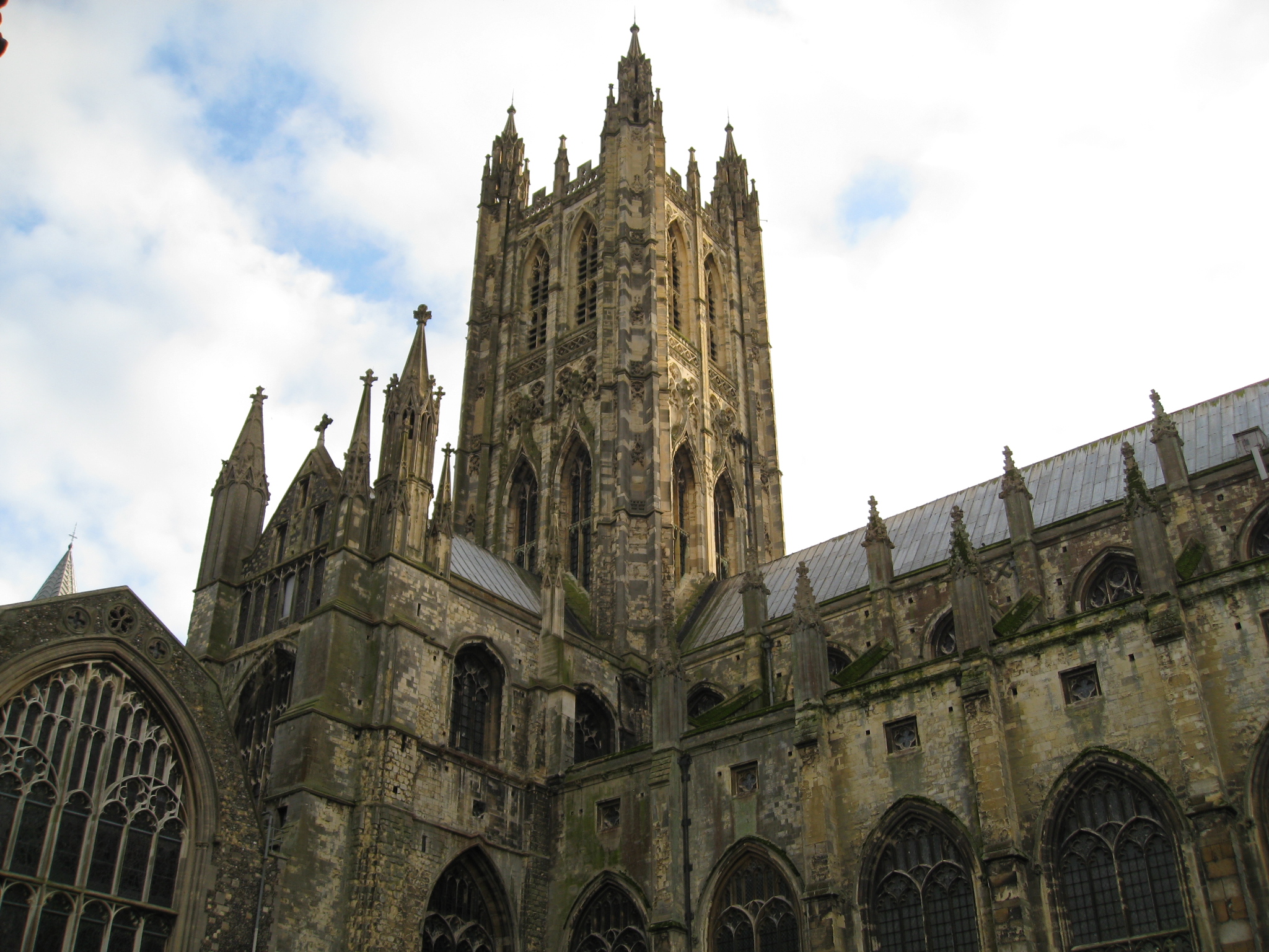
Canterbury (, ) is a cathedral city and UNESCO World Heritage Site, situated in the heart of the City of Canterbury local government district of Kent, England. It lies on the River Stour. The Archbishop of Canterbury is the primate of the Church of England and the worldwide Anglican Communion owing to the importance of St Augustine, who served as the apostle to the pagan Kingdom of Kent around the turn of the 7th century. The city's cathedral became a major focus of pilgrimage following the 1170 martyrdom of Thomas Becket, although it had already been a well-trodden pilgrim destination since the murder of St Alphege by the men of King Canute in 1012. A journey of pilgrims to Becket's shrine served as the frame for Geoffrey Chaucer's 14th-century classic '' The Canterbury Tales''. Canterbury is a popular tourist destination: consistently one of the most-visited cities in the United Kingdom, the city's economy is heavily reliant upon tourism. The city has been occupied si ... [...More Info...] [...Related Items...] OR: [Wikipedia] [Google] [Baidu] |

%2C_Western_Negev%2C_Israel.jpg)


