|
Kennedy Meadows (Tulare)
Kennedy Meadows is a portion of the Kern Plateau in the southern section of the Sierra Nevada Mountain Range in Tulare County, California. It is a mixture of private and public land surrounded by wilderness and national forest. It is bounded by the South Sierra Wilderness to the north and west, by the Sacatar Trail Wilderness to the east and by the Domeland Wilderness to the south. The area was a summer camp for Indians of the Owens Valley. There are traces of Indian encampments throughout the area indicated by the presence of Obsidian shards and arrowheads. Obsidian is not native to the area and had to be transported in. The area was homesteaded in the latter part of the 1800s with family ranches. There are two well known businesses in the area. The Kennedy Meadows General Store is the world-famous destination of hikers on the Pacific Crest Trail which passes a few hundred yards from the store along the South Fork of the Kern River. The store holds large quantities of resup ... [...More Info...] [...Related Items...] OR: [Wikipedia] [Google] [Baidu] |
Unincorporated Area
An unincorporated area is a region that is not governed by a local municipal corporation. Widespread unincorporated communities and areas are a distinguishing feature of the United States and Canada. Most other countries of the world either have no unincorporated areas at all or these are very rare: typically remote, outlying, sparsely populated or uninhabited areas. By country Argentina In Argentina, the provinces of Chubut, Córdoba, Entre Ríos, Formosa, Neuquén, Río Negro, San Luis, Santa Cruz, Santiago del Estero, Tierra del Fuego, and Tucumán have areas that are outside any municipality or commune. Australia Unlike many other countries, Australia has only one level of local government immediately beneath state and territorial governments. A local government area (LGA) often contains several towns and even entire metropolitan areas. Thus, aside from very sparsely populated areas and a few other special cases, almost all of Australia is part of an LGA. Unin ... [...More Info...] [...Related Items...] OR: [Wikipedia] [Google] [Baidu] |
Pacific Time Zone
The Pacific Time Zone (PT) is a time zone encompassing parts of western Canada, the western United States, and western Mexico. Places in this zone observe standard time by subtracting eight hours from Coordinated Universal Time ( UTC−08:00). During daylight saving time, a time offset of UTC−07:00 is used. In the United States and Canada, this time zone is generically called the Pacific Time Zone. Specifically, time in this zone is referred to as Pacific Standard Time (PST) when standard time is being observed (early November to mid-March), and Pacific Daylight Time (PDT) when daylight saving time (mid-March to early November) is being observed. In Mexico, the corresponding time zone is known as the ''Zona Noroeste'' (Northwest Zone) and observes the same daylight saving schedule as the U.S. and Canada. The largest city in the Pacific Time Zone is Los Angeles, whose metropolitan area is also the largest in the time zone. The zone is two hours ahead of the Hawaii–Ale ... [...More Info...] [...Related Items...] OR: [Wikipedia] [Google] [Baidu] |
Tulare County, California
Tulare County ( ) is a county located in the U.S. state of California. As of the 2020 census, the population was 473,117. The county seat is Visalia. The county is named for Tulare Lake, once the largest freshwater lake west of the Great Lakes. Drained for agricultural development, the site is now in Kings County, which was created in 1893 from the western portion of the formerly larger Tulare County. Tulare County comprises the Visalia- Porterville, CA Metropolitan Statistical Area. The county is located south of Fresno, spanning from the San Joaquin Valley east to the Sierra Nevada. Sequoia National Park is located in the county, as is part of Kings Canyon National Park, in its northeast corner (shared with Fresno County), and part of Mount Whitney, on its eastern border (shared with Inyo County). As of the 2020 census, the population was 473,117, up from 442,179 at the 2010 census. History The land was occupied for thousands of years by the Yokuts. Beginning in the ... [...More Info...] [...Related Items...] OR: [Wikipedia] [Google] [Baidu] |
Golden Trout Wilderness
The Golden Trout Wilderness is a federally designated wilderness area in the Sierra Nevada, in Tulare County and Inyo County, California. It is located east of Porterville within Inyo National Forest and Sequoia National Forest. It is in size and was created by the US Congress in 1978 as part of the National Wilderness Preservation System. The wilderness is managed by the U.S. Forest Service. The wilderness is named for and protects the habitat of California's state freshwater fish, the golden trout. Elevations range from about to . Within the wilderness are portions of the Kern Plateau, the Great Western Divide's southern extension, and the main stem of the Kern River, the South Fork of the Kern and the Little Kern River. The wilderness area is bordered on the northeast and northwest by the high peaks of the southern Sierra Nevada. Cirque Peak is the high point at . Kern Plateau The Kern Plateau is a large tableland with sprawling meadows, narrow grasslands alon ... [...More Info...] [...Related Items...] OR: [Wikipedia] [Google] [Baidu] |
Sierra Nevada (U
The Sierra Nevada () is a mountain range in the Western United States, between the Central Valley (California), Central Valley of California and the Great Basin. The vast majority of the range lies in the state of California, although the Carson Range spur lies primarily in Nevada. The Sierra Nevada is part of the American Cordillera, an almost continuous chain of mountain ranges that forms the western "backbone" of the Americas. The Sierra runs north-south and its width ranges from to across east–west. Notable features include General Sherman (tree), General Sherman, the largest tree in the world by volume; Lake Tahoe, the largest alpine lake in North America; Mount Whitney at , the highest point in the contiguous United States; and Yosemite Valley sculpted by glaciers from one-hundred-million-year-old granite, containing List of waterfalls in Yosemite National Park, high waterfalls. The Sierra is home to three national parks, twenty wilderness areas, and two national mon ... [...More Info...] [...Related Items...] OR: [Wikipedia] [Google] [Baidu] |
South Sierra Wilderness
The South Sierra Wilderness is a federally designated wilderness area in the Southern Sierra Nevada, in eastern California. It is located northeast of Bakersfield, and is southwest of Owens Lake and Olancha. Geography Created with the passage of the California Wilderness Act of 1984 by the U.S. Congress, the South Sierra Wilderness is in size. It is managed by the U.S. Forest Service, and within Sequoia National Forest and Inyo National Forest. The South Sierra Wilderness is the southernmost Forest Service-managed section of a continuous chain of wilderness areas protecting the Sierra Nevada crest from Walker Pass to Lake Tahoe. Elevations range from about near Kennedy Meadows, up to at Olancha Peak. The Wild and Scenic South Fork of the Kern River bisects the wilderness on the east side, in a north–south direction. Ecology Wildlife includes the large Monache mule deer herd, the sensitive Sierra Nevada red fox, pine martens, mountain lions, and American black be ... [...More Info...] [...Related Items...] OR: [Wikipedia] [Google] [Baidu] |
Sacatar Trail Wilderness
The Sacatar Trail Wilderness is a federally designated wilderness area located northwest of Ridgecrest, California USA. It was created in 1994 with the passage of the California Desert Protection Act - Public Law 103-433 - and is managed by the Bureau of Land Management (BLM). The wilderness is in size and protects portions of the southern Sierra Nevada Mountain Range. History The Sacatar Trail was the only route into the Owens Valley from the west before the road over Walker Pass was built. Cattle, soldiers, and commercial traffic used this trail. It is the only designated hiking trail within the wilderness and is about nine miles (14 km) in length. Landscape Elevations in the wilderness are from to . The wilderness contains an "ecotone" formed by the convergence of desert and Sierran vegetative communities and encompasses a narrow band along the southern Sierra crest between Nine Mile Canyon in the south and Sequoia National Forest to the north. The boundary inc ... [...More Info...] [...Related Items...] OR: [Wikipedia] [Google] [Baidu] |
Domeland Wilderness
The Domeland Wilderness is a federally designated wilderness area located northeast of Bakersfield, California USA. It encompasses , is jointly managed by the U.S. Forest Service and Bureau of Land Management (BLM) and is mostly within the Sequoia National Forest.Adkinson, Ron ''Wild Northern California''. The Globe Pequot Press, 2001 pp.10-16 History Domeland Wilderness was created by the federal Wilderness Act of 1964 and expanded by the California Desert Protection Act of 1994, adding of BLM land. The Manter wildfire in July 2000 burned more than of the wilderness. Geography Elevations range from up to . The wilderness protects the southern area of the Kern Plateau with the Wild and Scenic South Fork Kern River bisecting the wilderness down the middle from north to south. The highest area of the plateau is the middle of the wilderness with large expanses of bedrock with cliffs, domes and spires that give the wilderness its name. One of the most outstanding rock forma ... [...More Info...] [...Related Items...] OR: [Wikipedia] [Google] [Baidu] |
Owens Valley
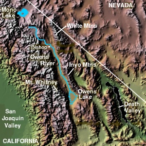
Owens Valley ( Numic: ''Payahǖǖnadǖ'', meaning "place of flowing water") is an arid valley of the Owens River in eastern California in the United States. It is located to the east of the Sierra Nevada, west of the White Mountains and Inyo Mountains, and north of the Mojave Desert. It sits on the west edge of the Great Basin. The mountain peaks on the West side (including Mount Whitney) reach above in elevation, while the floor of the Owens Valley is about , making the valley the deepest in the United States. The Sierra Nevada casts the valley in a rain shadow, which makes Owens Valley "the Land of Little Rain." The bed of Owens Lake, now a predominantly dry endorheic alkali flat, sits on the southern end of the valley. The valley provides water to the Los Angeles Aqueduct, the source of one-third of the water for Los Angeles, and was the area at the center of one of the fiercest and longest-running episodes of the California Water Wars. These episodes inspired aspects ... [...More Info...] [...Related Items...] OR: [Wikipedia] [Google] [Baidu] |
Pacific Crest Trail
The Pacific Crest Trail (PCT), officially designated as the Pacific Crest National Scenic Trail, is a long-distance hiking and equestrian trail closely aligned with the highest portion of the Cascade and Sierra Nevada mountain ranges, which lie east of the U.S. Pacific coast. The trail's southern terminus is next to the Mexico–United States border, just south of Campo, California, and its northern terminus is on the Canada–US border, upon which it continues unofficially to the Windy Joe Trail within Manning Park in British Columbia; it passes through the states of California, Oregon, and Washington. The Pacific Crest Trail is long and ranges in elevation from roughly above sea level near the Bridge of the Gods on the Oregon–Washington border to at Forester Pass in the Sierra Nevada. The route passes through 25 national forests and 7 national parks. Its midpoint is near Chester, California (near Mt. Lassen), where the Sierra and Cascade mountain ranges meet. It was ... [...More Info...] [...Related Items...] OR: [Wikipedia] [Google] [Baidu] |
South Fork Kern River
The South Fork Kern River is a tributary of the Kern River in the Sierra Nevada of the U.S. state of California. It is one of the southernmost rivers on the western slope of the mountains, and drains a high, relatively dry plateau country of along the Sierra Crest. The upper South Fork flows through a series of rugged canyons, but it also drains a flat, marshy valley before joining the Kern River at Lake Isabella. Course It rises in the Inyo National Forest on the Tulare side of the Inyo County- Tulare County line, in a small meadow on the Sierra Crest near the Pacific Crest Trail. The river flows south through meadows and broad valleys, drawing very close to Golden Trout Creek, a tributary of the Kern River to the west. Much of the river's course south is just to the west of Owens Valley, which lies to the east at the base of the Sierra. The river then enters the Sequoia National Forest and receives Trout Creek from the right. Entering a gorge, the river courses through a ... [...More Info...] [...Related Items...] OR: [Wikipedia] [Google] [Baidu] |
Thru-hikers
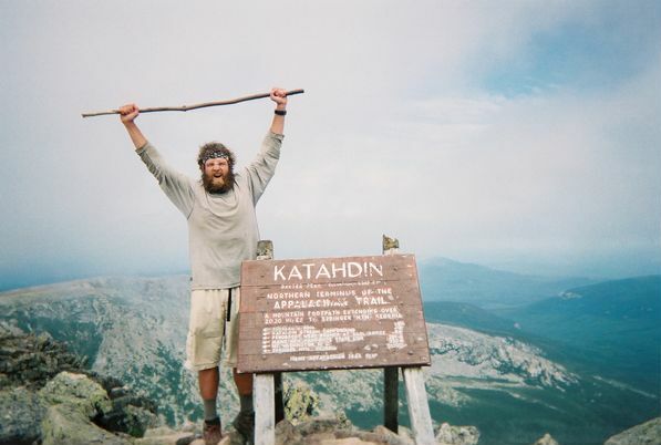
Thru-hiking, or through-hiking, is the act of hiking an established end-to-end trail or long-distance trail with continuous footsteps. In the United States, the term is most commonly associated with the Appalachian Trail (AT), the Pacific Crest Trail (PCT), and the Continental Divide Trail (CDT), but may also refer to other end-to-end hikes. Other examples of thru-hikes include Te Araroa in New Zealand, the Camino de Santiago in Spain and France, the HexaTrek in France, the Via Francigena in France and Italy, the Va Sentiero in Italy, the Lycian Way in Turkey, the Israel National Trail, and the Great Divide Trail (GDT) in Canada. The Appalachian Trail Conservancy (ATC) defines a thru-hike as a hike of the entire AT in 12 months or less. A “2,000-miler” is a hiker who has walked the entire length of the AT and reported his or her hike completion to the ATC, which has kept records of thru-hike completions since 1937. (The ATC uses the term “2,000-miler” since the exact ... [...More Info...] [...Related Items...] OR: [Wikipedia] [Google] [Baidu] |

.jpg)


