|
Kempston
Kempston is a town and Civil parishes in England, civil parish in the Borough of Bedford, Bedfordshire, England. It had a population of 19,330 in the 2011 census. Kempston is part of Bedford, Bedford's built-up area and is situated directly south-west of Bedford proper. The River Great Ouse separates it from the Queens Park, Bedford, Queen's Park area of Bedford. History Until the 19th century Kempston was a mainly rural parish. It was one of the largest in Bedfordshire with an area of 5,025 acres (20 km2) at the time of enclosure in 1804, and was in Redbournestoke Hundred. Historically there was no central village, but instead settlement was divided between a number of hamlets called "Ends", for example, Up End, Bell End, Wood End and Box End. Kempston's parish church, All Saints, was in Church End, which was not the largest end but is fairly central. In the 19th century East End, Bell End and Up End began to coalesce into a larger settlement. In 1870 developers began to a ... [...More Info...] [...Related Items...] OR: [Wikipedia] [Google] [Baidu] |
Kempston Urban District
Kempston was an urban district in Bedfordshire, England between 1896 and 1974. Formation The historic parish of Kempston covered a large area to the south-west of the town of Bedford. From 1835 Kempston had been part of the Bedford Poor Law Union, and therefore became part of the Bedford Rural Sanitary District under the Public Health Acts of 1872 and 1875. The Bedford Rural Sanitary District became the Bedford Rural District under the Local Government Act 1894. By this time, the north-eastern part of Kempston parish (closest to Bedford) was becoming increasingly urbanised. Within months of the Bedford Rural District being established, work began to create an urban district council for the more built-up part of the parish. In June 1895 Bedfordshire County Council decided that the parish of Kempston should be split between a Kempston Urban District and a new parish for the remainder called Kempston Rural which was to stay in the Bedford Rural District. These changes came into f ... [...More Info...] [...Related Items...] OR: [Wikipedia] [Google] [Baidu] |
Kempston Gravel Pit Railway
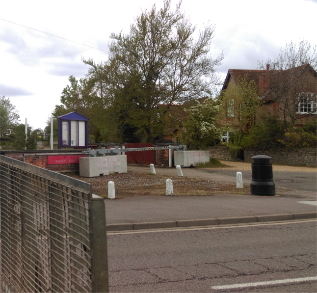
Kempston gravel pit railway was a narrow-gauge tramway which connected a gravel pit in the Hill Grounds area of Kempston, Bedfordshire to Bedford Road. There are a small number of records of its operation in the late 1910s and 1920s and perhaps some years early. The terminus lay by the entrance to the Robert Bruce School site on what is now Bedford Road. The gravel pit lay on the banks of the River Great Ouse. The tramway is shown on sheet 84 of the Ordnance Survey Ordnance Survey (OS) is the national mapping agency for Great Britain. The agency's name indicates its original military purpose (see ordnance and surveying), which was to map Scotland in the wake of the Jacobite rising of 1745. There was a ... Popular Edition Map, which was surveyed between 1912 and 1923 and first published in 1919. According to this map, the track was about long and ended in the area where Mahew Court now stands on Emmerton Road. Trains consisting of three or four trucks were pulled by hor ... [...More Info...] [...Related Items...] OR: [Wikipedia] [Google] [Baidu] |
Kempston Rural
Kempston Rural is a civil parish in the Borough of Bedford in Bedfordshire, England. History Kempston Rural was formed in 1896 when the old parish of Kempston was split into two parts - Kempston Urban District (now the town of Kempston), and Kempston Rural parish. Historically Kempston was a large but lightly populated parish, with a decentralised population pattern. The typical parish in pre-Industrial England had one main village, perhaps complemented by a few hamlets, but in Kempston the settlement around the church - Church End - has never had more than a dozen or so houses, so it has never dominated the parish. When urban growth arrived in Kempston in the 19th century it was concentrated in the eastern parts of the parish, around the neighbouring ends of East End and Up End (i.e. the area around the High Street and St John Street) and in Kempston New Town, close to the boundary of Bedford. Geography Kempston Rural is to the west of the town of Kempston, and comprises a ... [...More Info...] [...Related Items...] OR: [Wikipedia] [Google] [Baidu] |
Bedford (UK Parliament Constituency)
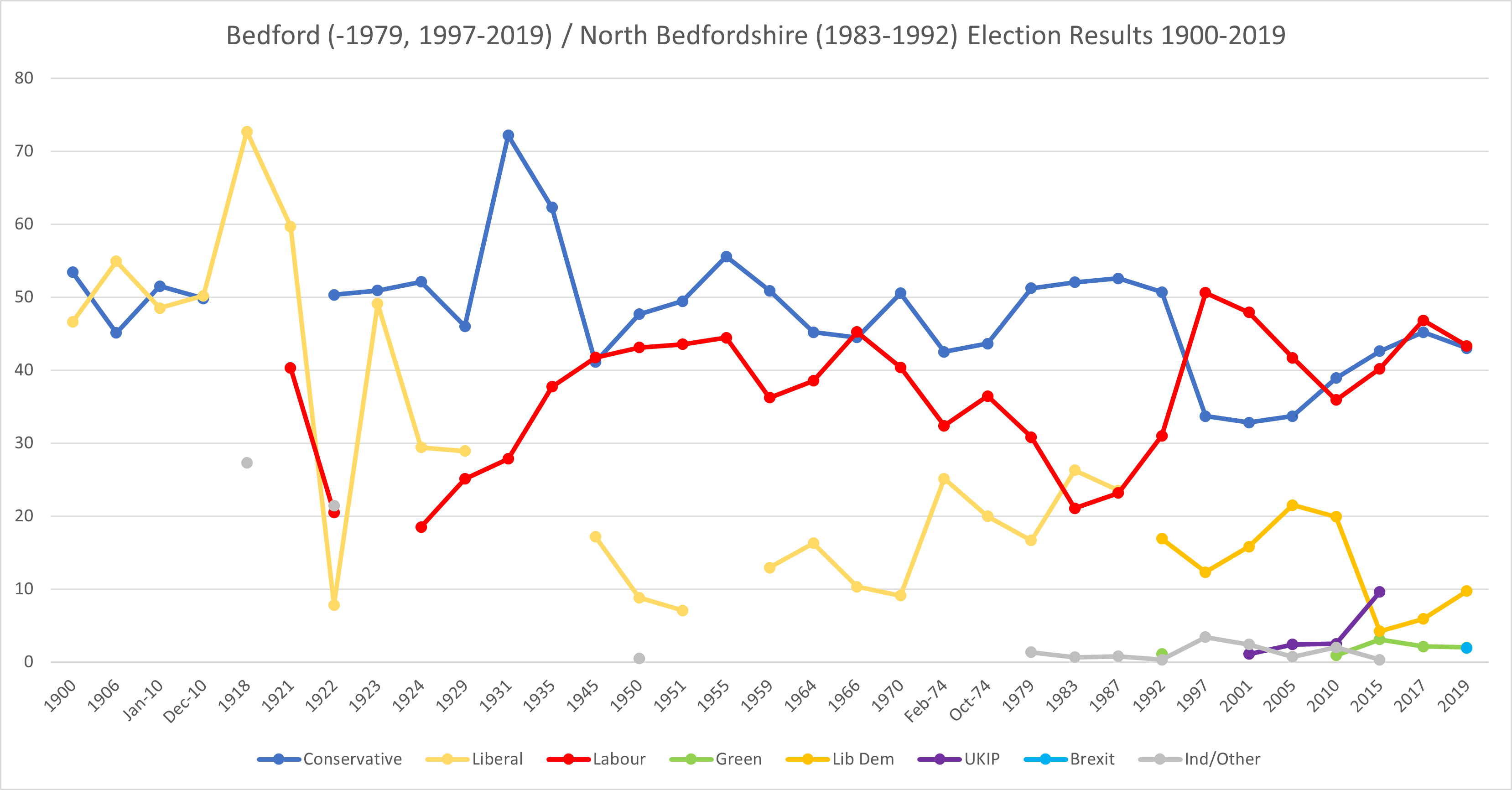
Bedford is a constituency represented in the House of Commons of the UK Parliament since 2017 by Mohammad Yasin of the Labour Party. The seat dates to the earliest century of regular parliaments, in 1295; its double representation was halved in 1885, then being altered by the later-termed Fourth Reform Act in 1918. Constituency profile ;Geographical and economic profile Bedford is a marginal seat between the Labour Party and the Conservatives. The main settlement is Bedford, a well-developed town centre with a considerable amount of social housing relative to Bedfordshire and higher poverty index but on a fast railway link to London and other destinations, the town is at the north end of the Thameslink service to Brighton and is not far from Milton Keynes which has a larger economy. The smaller and contiguous town of Kempston is also in the constituency. History Bedford was first represented in the Model Parliament of 1295. The constituency was originally a parliamentary ... [...More Info...] [...Related Items...] OR: [Wikipedia] [Google] [Baidu] |
Kempston Barracks
Kempston Barracks is a military installation at Kempston in Bedfordshire. History The barracks were built in the Fortress Gothic Revival Style and completed between 1875 and 1876. Their creation took place as part of the Cardwell Reforms which encouraged the localisation of British military forces. The barracks became the depot for the two battalions of the 16th (Bedfordshire) Regiment of Foot. Following the Childers Reforms, the regiment evolved to become the Bedfordshire Regiment with its depot in the barracks in 1881. The barracks went on to be the depot for the Bedfordshire and Hertfordshire Regiment in 1919. The building was used as a convalescent centre during the Second World War. The barracks were closed when the regiment was merged with the Essex Regiment to form the 3rd East Anglian Regiment (16th/44th Foot) on 2 June 1958; much of the site has been developed for residential use and the keep is now occupied by a masonic lodge A Masonic lodge, often termed a pr ... [...More Info...] [...Related Items...] OR: [Wikipedia] [Google] [Baidu] |
Kempston North
Kempston North is an electoral ward and area within the town of Kempston, Bedfordshire, England. The boundaries of Kempston North are approximately the River Great Ouse to the north west, with Kempston High Street and Bedford Road to the south east. The Hillgrounds neighbourhood is within Kempston North. The area used to be a hamlet ''The Tragedy of Hamlet, Prince of Denmark'', often shortened to ''Hamlet'' (), is a tragedy written by William Shakespeare sometime between 1599 and 1601. It is Shakespeare's longest play, with 29,551 words. Set in Denmark, the play depicts ... called Kempston Up End, but was absorbed into the Kempston Urban District in 1896. Today, Addison Howard Park and Kempston Pool are located within the boundaries of Kempston North. Kempston Wards of Bedfordshire {{bedfordshire-geo-stub ... [...More Info...] [...Related Items...] OR: [Wikipedia] [Google] [Baidu] |
Kempston Central And East
Kempston Central and East is an electoral ward and area within Kempston, Bedfordshire, England. The boundaries of the ward are approximately the River Great Ouse to the north, the Midland Main Line railway line to the east, Elstow Road to south and Bedford Road to the west. The area used to be a hamlet known as Kempston East End, but was absorbed into the Kempston Urban District in 1896. Today, Kempston Barracks and the Saxon shopping centre (including a Sainsbury's J Sainsbury plc, trading as Sainsbury's, is the second largest chain of supermarkets in the United Kingdom, with a 14.6% share of UK supermarket sales. Founded in 1869 by John James Sainsbury with a shop in Drury Lane, London, the company ... supermarket) are located within the boundaries of the ward. Previously known as Kempston East, the ward's name was changed for the 5th May 2011 local elections and it became Kempston Central and East. References Kempston Wards of Bedfordshire {{Bedfordsh ... [...More Info...] [...Related Items...] OR: [Wikipedia] [Google] [Baidu] |
Kempston South
Kempston South is an electoral ward and area within the town of Kempston, Bedfordshire, England. The boundaries of Kempston South are approximately Elstow Road to the north, the A421 road The A421 is an important road for east/west journeys across south central England. Together with the A428, the A43 and A34, it forms the route from Cambridge through Milton Keynes to Oxford. The section between the A1 (near St Neots) and ... to the south and east and Woburn Road to the west. The area was developed from 1870 onwards under the name of Kempston New Town. In 1896 the settlement was absorbed into the Kempston Urban District. Today, Kempston Interchange Retail Park and the headquarters of Bedfordshire and Luton Fire and Rescue Service are located within the boundaries of Kempston South. References Kempston Wards of Bedfordshire {{Bedfordshire-geo-stub ... [...More Info...] [...Related Items...] OR: [Wikipedia] [Google] [Baidu] |
Borough Of Bedford
The Borough of Bedford is a unitary authority area with borough status in the ceremonial county of Bedfordshire, England. Its council is based in Bedford, its namesake and principal settlement, which is the county town of Bedfordshire. The borough contains one large urban area, the 71st largest in the United Kingdom that comprises Bedford and the adjacent town of Kempston, surrounded by a rural area with many villages. 75% of the borough's population live in the Bedford Urban Area and the five large villages which surround it, which makes up slightly less than 6% of the total land area of the Borough. The borough is also the location of the Wixams new town development, which received its first residents in 2009. Formation The ancient borough of Bedford was a borough by prescription, with its original date of incorporation unknown. The earliest surviving charter was issued c. 1166 by Henry II, confirming to the borough the liberties and customs which it had held in the reign o ... [...More Info...] [...Related Items...] OR: [Wikipedia] [Google] [Baidu] |
Kempston West
Kempston West is an electoral ward and area within the town of Kempston, Bedfordshire, England. The boundaries of Kempston West are approximately the River Great Ouse to the north, Woburn Road to the south and east and Kempston Rural Kempston Rural is a civil parish in the Borough of Bedford in Bedfordshire, England. History Kempston Rural was formed in 1896 when the old parish of Kempston was split into two parts - Kempston Urban District (now the town of Kempston), and K ... to the west. The ward was created in 2011 and was first contested in the 2011 local elections. Today, Kempston Academy and the headquarters of Bedfordshire Police are located within the boundaries of Kempston West. References Kempston Wards of Bedfordshire {{Bedfordshire-geo-stub ... [...More Info...] [...Related Items...] OR: [Wikipedia] [Google] [Baidu] |
Bedford
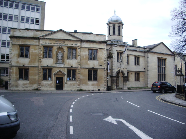
Bedford is a market town in Bedfordshire, England. At the 2011 Census, the population of the Bedford built-up area (including Biddenham and Kempston) was 106,940, making it the second-largest settlement in Bedfordshire, behind Luton, whilst the Borough of Bedford had a population of 157,479. Bedford is also the historic county town of Bedfordshire. Bedford was founded at a ford on the River Great Ouse and is thought to have been the burial place of King Offa of Mercia, who is remembered for building Offa's Dyke on the Welsh border. Bedford Castle was built by Henry I of England, Henry I, although it was destroyed in 1224. Bedford was granted borough status in 1165 and has been represented in Parliament since 1265. It is known for its large Italians in the United Kingdom, population of Italian descent. History The name of the town is believed to derive from the name of a Saxon chief called Beda, and a Ford (crossing), ford crossing the River Great Ouse. Bedford was a marke ... [...More Info...] [...Related Items...] OR: [Wikipedia] [Google] [Baidu] |
River Great Ouse
The River Great Ouse () is a river in England, the longest of several British rivers called "Ouse". From Syresham in Northamptonshire, the Great Ouse flows through Buckinghamshire, Bedfordshire, Cambridgeshire and Norfolk to drain into the Wash and the North Sea near Kings Lynn. Authorities disagree both on the river's source and its length with one quoting and another . Mostly flowing north and east, it is the fifth longest river in the United Kingdom. The Great Ouse has been historically important for commercial navigation, and for draining the low-lying region through which it flows; its best-known tributary is the Cam, which runs through Cambridge. Its lower course passes through drained wetlands and fens and has been extensively modified, or channelised, to relieve flooding and provide a better route for barge traffic. The unmodified river would have changed course regularly after floods. The name ''Ouse'' is from the Celtic or pre-Celtic *''Udso-s'', and probably ... [...More Info...] [...Related Items...] OR: [Wikipedia] [Google] [Baidu] |


