|
Kingsessing
Kingsessing is a neighborhood in the Southwest section of Philadelphia, Pennsylvania, United States. On the west side of the Schuylkill River, it is next to the neighborhoods of Cedar Park and Elmwood Park, as well as the borough of Yeadon in Delaware County. It is roughly bounded by the SEPTA Regional Rail Media/Wawa Line to the northeast, Baltimore Avenue to the northwest, Cobbs Creek and 60th Street to the southwest, and Woodland Avenue to the southeast. History The name Kingsessing, also spelled Chinsessing, comes from a Delaware word meaning "a place where there is a meadow". The historic Lenape, or Delaware as the English called them, had a village of the same name that roughly occupied the same site as where the current neighborhood was later developed. When the township was organized to encompass where the Lenape and a later Swedish village stood, it also was named as Kingsessing. Mount Moriah Cemetery was founded next to Cobbs Creek in 1855. The neighborhood ne ... [...More Info...] [...Related Items...] OR: [Wikipedia] [Google] [Baidu] |
Southwest Philadelphia
Southwest Philadelphia (formerly Kingsessing Township) is a section of Philadelphia, Pennsylvania, United States. The section can be described as extending from the western side of the Schuylkill River to the city line, with the SEPTA. The northern border is defined by the Philadelphia City Planning Commission as east from the city line along Baltimore Avenue moving south along 51st Street to Springfield Ave. It follows the train tracks until 49th Street. From 49th and Kingsessing Ave the line moves east along Kingsessing Ave. The line then moves south along 46th St to Paschall Ave where it jogs to join Grays Ferry where the line runs to the Schuylkill River. Southwest Philadelphia is also described by the city as being the area south of Baltimore Avenue; at the turn of the 20th century, Baltimore Avenue between 49th and 52nd Streets was known as "The Hub of Southwest Philadelphia" . Historically home to many Irish American neighborhoods, the section now has a large African Am ... [...More Info...] [...Related Items...] OR: [Wikipedia] [Google] [Baidu] |
Grays Ferry Bridge
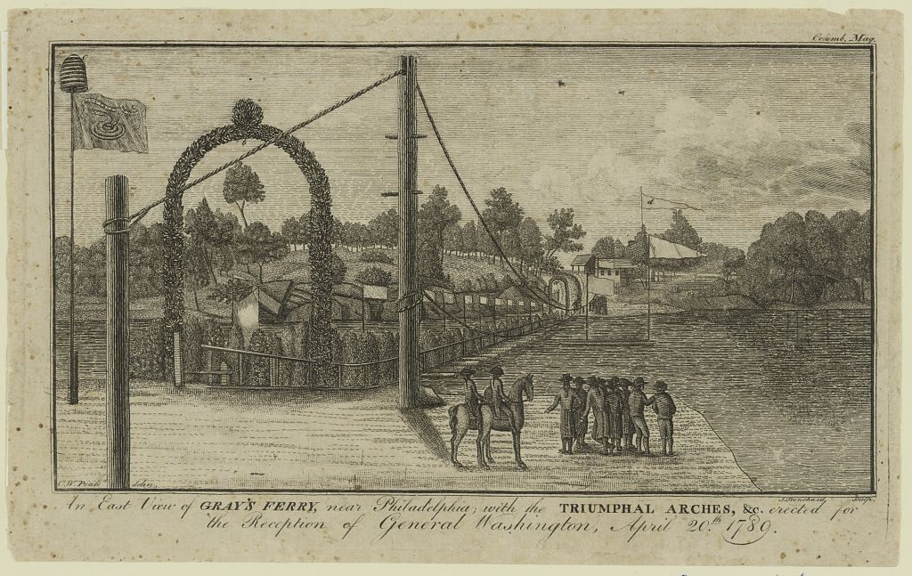
Grays Ferry Bridge (previously spelled as Gray's Ferry Bridge) has been the formal or informal name of several floating bridges and four permanent ones that have carried highway and rail traffic over the Schuylkill River in Philadelphia. The bridge today is a four-lane divided highway bridge, built in 1976, that carries Grays Ferry Avenue from the Grays Ferry, Philadelphia, Grays Ferry neighborhood on the east bank, over the river and the Northeast Corridor railroad tracks, to the Southwest Philadelphia neighborhood of Kingsessing, Philadelphia, Kingsessing. In 1902, rail traffic was shifted to the adjacent Philadelphia, Wilmington and Baltimore Railroad Bridge No. 1, which was demolished in 2018. Its pilings support an under-construction bridge for use by cyclists and pedestrians traveling the Schuylkill River Trail. Ferry Before bridges crossed the Schuylkill, three ferry, ferries provided the main connections between Philadelphia and points west and south. Two of them crossed ... [...More Info...] [...Related Items...] OR: [Wikipedia] [Google] [Baidu] |
List Of Philadelphia Neighborhoods
The following is a list of Neighbourhood, neighborhoods, District#United States, districts and other places located in the city of Philadelphia, Pennsylvania, United States. The list is organized by broad geographical sections within the city. Common usage for Philadelphia's neighborhood names does not respect "official" borders used by the city's police, planning commission or other entities. Therefore, some of the places listed here may overlap geographically, and residents do not always agree where one neighborhood ends and another begins. Philadelphia has 41 ZIP Code, ZIP-codes, which are often used for neighborhood analysis. Historically, many neighborhoods were defined by incorporated townships (Blockley, Roxborough), districts (Belmont, Kensington, Moyamensing, Richmond) or boroughs (Bridesburg, Frankford, Germantown, Manayunk) before being incorporated into the city with the Act of Consolidation, 1854, Act of Consolidation of 1854. [...More Info...] [...Related Items...] OR: [Wikipedia] [Google] [Baidu] |
Bartram's Garden
Bartram's Garden is a 50-acre public garden and National Historic Landmark in Southwest Philadelphia, Pennsylvania, situated on the banks of the Tidal Schuylkill River. Founded in 1728 by botanist John Bartram (1699–1777), it is the oldest Botanic garden, botanical garden to survive in North America. The Garden is operated by the non-profit John Bartram Association in coordination with Philadelphia Parks & Recreation, Philadelphia Parks and Recreation. Bartram's Garden has the only recreational access to the Tidal Schuylkill River and its wetlands. Its trails make up segments of the East Coast Greenway. The garden acts as an outdoor classroom for learning about the plants and history of Southwest Philadelphia. The John Bowman Bartram Special Collections Library contains an extensive collection of documents and materials related to the history of the Garden, the history of Philadelphia, and the development of the field of botany. The garden also serves as a venue for art. The g ... [...More Info...] [...Related Items...] OR: [Wikipedia] [Google] [Baidu] |
Mount Moriah Cemetery (Philadelphia)
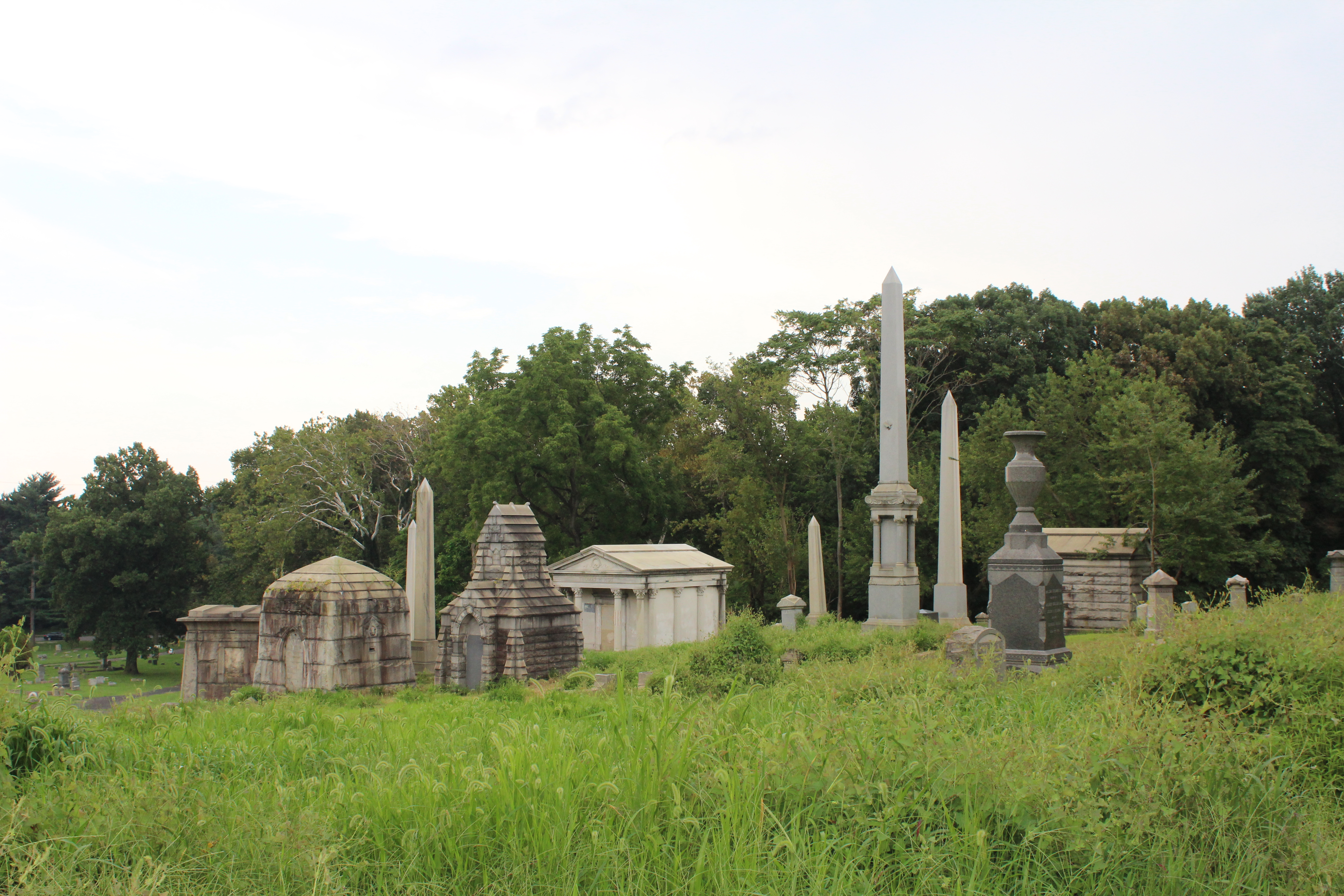
Mount Moriah Cemetery is a historic rural cemetery that spans the border between Southwest Philadelphia and Yeadon, Pennsylvania. It was established in 1855 and is the largest cemetery in Pennsylvania. It is 200 acres in size and contains 150,000 burials. It differed from Philadelphia's other rural cemeteries such as Laurel Hill Cemetery and the Woodlands Cemetery in that it was easily accessible by streetcar; allowed burials of African-Americans, Jews and Muslims; and catered to a more middle-class clientele. The cemetery is a part of the United States National Cemetery System dating back to the American Civil War. It contains two military burial plots that are maintained by the United States Department of Veterans Affairs. The Soldiers' Lot on the Philadelphia side of the cemetery contains 406 burials and the Naval Plot on the Yeadon side contains 2,400 burials. The cemetery closed its gates in April 2011 and had no owner when the last member of the board of directors ... [...More Info...] [...Related Items...] OR: [Wikipedia] [Google] [Baidu] |
Free Library Of Philadelphia
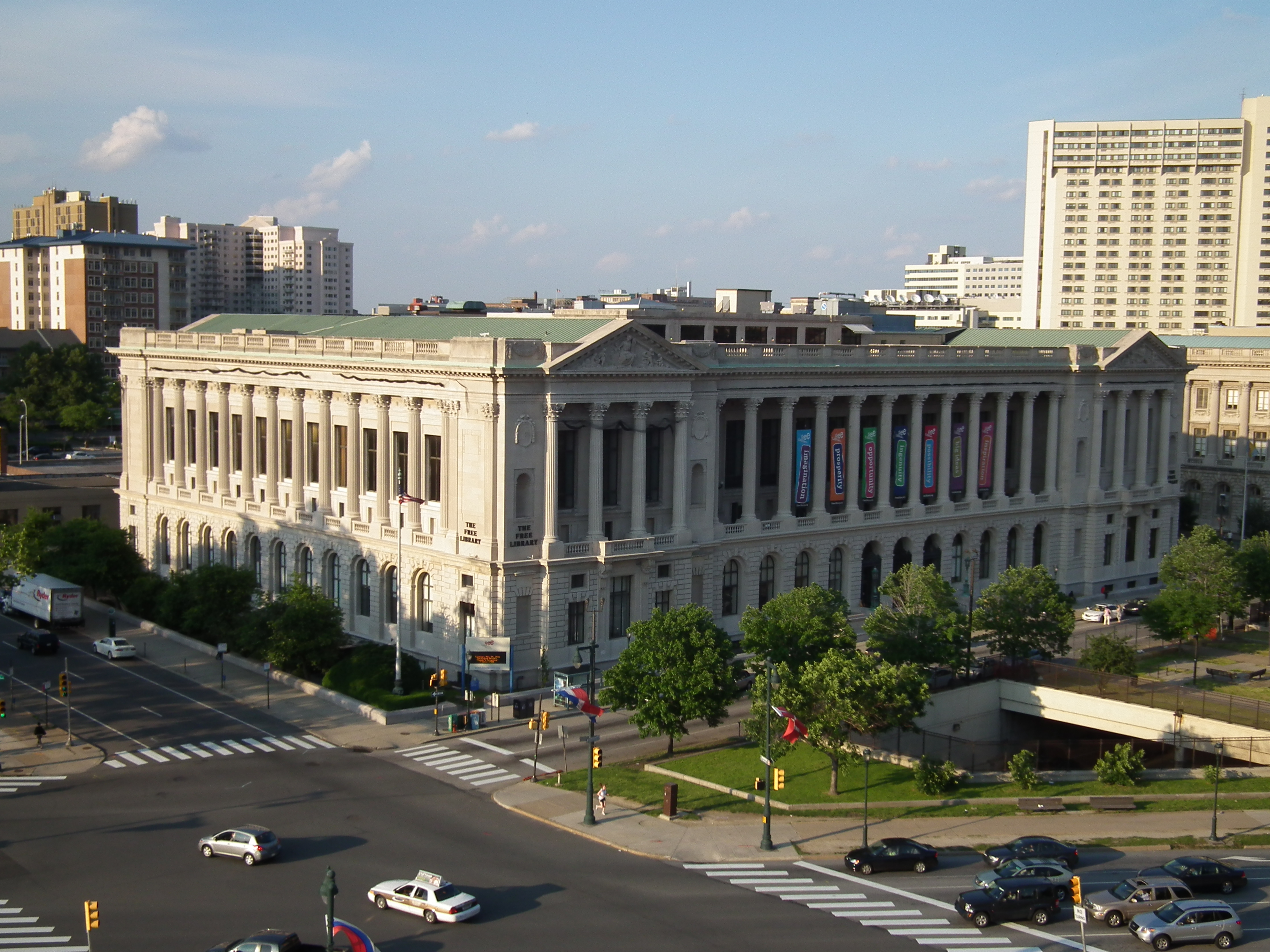
The Free Library of Philadelphia is the public library system that serves the city of Philadelphia, Pennsylvania. It is the 16th-largest public library system in the United States. The Free Library of Philadelphia is a non-Mayoral agency of the City of Philadelphia governed by an independent Board of Trustees as per the Charter of the City of Philadelphia. The Free Library of Philadelphia Foundation is a separate 501(c)(3) non-profit with its own board of directors and serves to support the mission of the Free Library of Philadelphia through philanthropic dollars. History Founding The Free Library of Philadelphia was chartered in 1891 as "a general library which shall be free to all", through efforts led by William Pepper, Dr. William Pepper, who secured initial funding through a $225,000 bequest from his wealthy uncle, George S. Pepper. However, List of libraries in 19th century Philadelphia, several libraries claimed the bequest, and only after the courts decided the money was ... [...More Info...] [...Related Items...] OR: [Wikipedia] [Google] [Baidu] |
John Bartram
John Bartram (June 3, 1699 – September 22, 1777) was an American botanist, horticulturist, and explorer, based in Philadelphia, Pennsylvania, for most of his career. Swedish botanist and taxonomist Carl Linnaeus said he was the "greatest natural botanist in the world." Bartram corresponded with and shared North American plants and seeds with a variety of scientists in England and Europe. He started what is known as Bartram's Garden in 1728 at his farm in Kingsessing (now part of Philadelphia). It was considered the first botanic garden in the United States. His sons and descendants operated it until 1850. Still operating in a partnership between the city of Philadelphia and a non-profit foundation, it was designated a National Historic Landmark in 1960. Early life Bartram was born into a prominent Quaker political and farming family in Marple Township, Pennsylvania, Marple near Darby, Pennsylvania, on June 3, 1699. His parents were William Bartram (Pennsylvania politician), W ... [...More Info...] [...Related Items...] OR: [Wikipedia] [Google] [Baidu] |
Media/Wawa Line
The Media/Wawa Line is a SEPTA Regional Rail service that runs from Center City, Philadelphia, Center City Philadelphia west to Wawa Station, Wawa in Delaware County, Pennsylvania, Delaware County. It uses the West Chester Branch, which connects with the SEPTA Main Line at 30th Street Station. Under the Pennsylvania Railroad, service continued to West Chester, Pennsylvania. On September 19, 1986, however, service was truncated to Elwyn station, Elwyn. On August 21, 2022, service was restored to Wawa Station, west of the Elwyn station. , most inbound Media/Wawa Line trains continue onto the Manayunk/Norristown Line, Manayunk/Norristown and Fox Chase Line, Fox Chase lines. Route Media/Wawa Line trains use the West Chester Branch, a former Pennsylvania Railroad line, which diverges from the SEPTA Main Line at 30th Street Station. At Arsenal Interlocking, just south of Penn Medicine Station, there is a junction with Amtrak's Northeast Corridor where Airport Line (SEPTA), Airport a ... [...More Info...] [...Related Items...] OR: [Wikipedia] [Google] [Baidu] |
Elmwood Park, Philadelphia
Elmwood Park, also known simply as Elmwood, is a neighborhood in the Southwest section of Philadelphia, Pennsylvania, United States. It borders the city line with Delaware County at Cobbs Creek, and extends to the Schuylkill River. The Eastwick neighborhood borders it to the southwest, and Kingsessing borders it on the northeast. Poles and Irish Americans had long been the majority in the neighborhood, organized around Catholic parishes established throughout the early to mid 20th century. In 1985, Mayor Wilson Goode declared a state of emergency as white rioters demonstrated outside two houses in Elmwood, creating an "imminent danger of civil disturbance." One home had been sold to an African-American family and the other to an interracial couple. Between 1990 and 2000, the white population decreased by 57.39% while the African American population increased by 55.40%. Vietnamese American refugees and West African immigrants have joined African Americans in making today's ... [...More Info...] [...Related Items...] OR: [Wikipedia] [Google] [Baidu] |
Cobbs Creek
Cobbs Creek is an U.S. Geological Survey. National Hydrography Dataset high-resolution flowline dataThe National Map, accessed April 1, 2011 tributary of Darby Creek in Delaware County, Pennsylvania, in the United States. It forms an approximate border between Montgomery County and Delaware County. After Cobbs Creek passes underneath Township Line Road ( U.S. Route 1), it forms the border between Philadelphia County and Delaware County. It runs directly through the two sides of Mount Moriah Cemetery which spans the border of Southwest Philadelphia and Yeadon, Pennsylvania. It later joins Darby Creek before flowing into the Delaware River. History Prior to European colonization, Cobbs Creek was inhabited by the Lenape Native American tribe, who called the creek "Karakung," believed to mean "the place of the wild geese." It was used primarily for hunting, fishing, transportation, and agriculture. Additionally, at the mouth of Mill Creek, a neighboring water source, there ... [...More Info...] [...Related Items...] OR: [Wikipedia] [Google] [Baidu] |
Cedar Park, Philadelphia, Pennsylvania
Cedar Park is a neighborhood of Philadelphia, Pennsylvania, United States. Located in the larger West Philadelphia district, it stretches north to Larchwood Avenue, south to Kingsessing Avenue, east to 46th Street, and west to 52nd Street. History Originally outlying farmland, Cedar Park was built between 1850 and 1910 as a streetcar suburb of Center City. Its development as a suburb accelerated with the installation of horsecars in the 1850s and again with the arrival of electric trolley lines in 1892. The name of the neighborhood is derived from a city owned park, also called Cedar Park, that is at 50th Street and Baltimore Avenue. The land was purchased by the city in 1908 and a city ordinance was signed into law in 1911 declaring it Cedar Park. There is no official explanation as to the name, but it may have been derived from the Cedar Avenue Improvement Organization, who led efforts into ensuring there was a park. The neighborhood is racially and ethnically diverse, an ... [...More Info...] [...Related Items...] OR: [Wikipedia] [Google] [Baidu] |
Hans Månsson
Hans Månsson (1612–1691) was a Swedish soldier and a convicted criminal who was sent to New Sweden along the lower reaches of the Delaware River in what is now the United States in 1641. After serving six years on a tobacco plantation, he was freed and became a respected leader in Dutch New Netherland, serving as a spokesman for the settlers, and as commanding officer of the militia at Wicaco. He purchased land and was one of the first European settlers in what is now New Jersey. Birth and early life Hans Månsson was born in Skara Municipality, Sweden, son of Måns Persson (1595-1637) and Brita Lillebielke (1595-1612). He served as a cavalryman in the Västgöta Regiment during the Thirty Years' War, 1638–1640. Criminal conviction On his return from the war in 1640, Månsson camped with other troops near the Royal Garden at the Varnhem Abbey which was owned by the Swedish Royal family. Governor Carl Siggesson Rosendufva gave the men permission to pick apples from the ... [...More Info...] [...Related Items...] OR: [Wikipedia] [Google] [Baidu] |


