|
Kastornoye
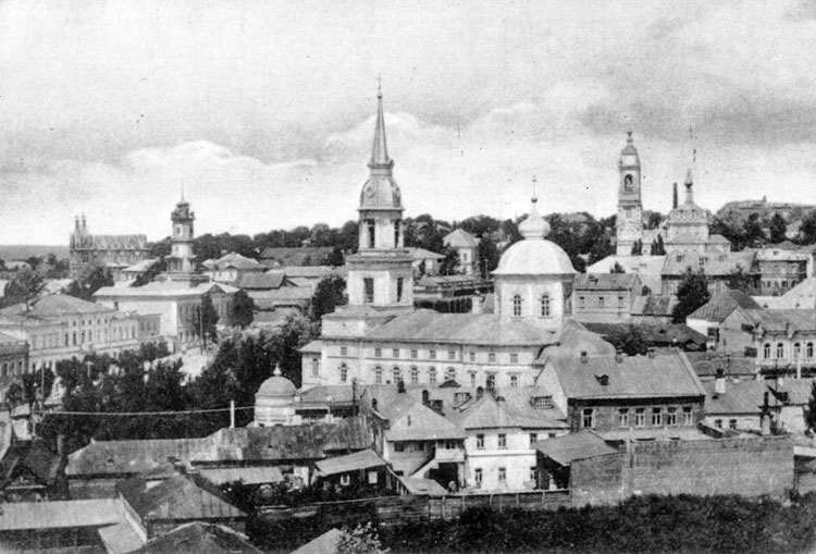
Kastornoye () is an urban locality (an urban-type settlement) and the administrative center of Kastorensky District of Kursk Oblast, Russia. Population: Telephone code: +7 47157; postal code: 306700. It was first mentioned in 1590 and was granted urban-type settlement status in 1959. At Kastornoye, 2 railway lines are crossing each other. The first one is the line Moscow – Yelets – Valuyki built in 1897, the second one is the line Kursk – Voronezh built in 1894. This gave the city a strategic importance, which led to 2 important battles during the 20th century around the city. The first one was the Voronezh–Kastornoye operation (1919) during the Russian Civil War The Russian Civil War () was a multi-party civil war in the former Russian Empire sparked by the 1917 overthrowing of the Russian Provisional Government in the October Revolution, as many factions vied to determine Russia's political future. I .... The second one was the Voronezh–Kastornoye oper ... [...More Info...] [...Related Items...] OR: [Wikipedia] [Google] [Baidu] |
Voronezh–Kastornoye Operation (1919)
The Voronezh-Kastornoye operation was an offensive operation by the Red Army during the Russian Civil War in October and November 1919, which was successfully carried out by parts of the 8th and 13th Army, which formed the left wing of the Southern Front. Plans After the failure of the White Advance on Moscow in August 1919, the Red Army had launched a successful counteroffensive. In October 1919, the command of the Southern Front, led by Alexander Yegorov, had designed a plan to * strike at the flank of the Cossack Shock Group of General Denikin, * destroy the main cavalry units of the Don and Volunteer Armies, * capture the city of Voronezh, * achieve favorable conditions for the dismemberment of Denikin's front and the launch of a subsequent offensive to the rear of the White troops in the direction of the cities of Oryol and Kursk. The main attack was to be inflicted by the 1st Cavalry Corps of Semyon Budyonny in the direction of Voronezh and Kastornoye, in order to crus ... [...More Info...] [...Related Items...] OR: [Wikipedia] [Google] [Baidu] |
Kastorensky District
Kastorensky District () is an administrativeResolution #489 and municipalLaw #48-ZKO district (raion), one of the twenty-eight in Kursk Oblast, Russia. It is located in the east of the oblast. The area of the district is . Its administrative center is the urban locality (a work settlement) of Kastornoye. Population: 24,237 ( 2002 Census); The population of Kastornoye accounts for 24.1% of the district's total population. Geography Kastorensky District is located in the east of Kursk Oblast, on the border with Voronezh to the east and Lipetsk Oblast to the north. The terrain is hilly plain averaging 200 meters above sea level; the district lies on the Central Russian Upland. The main river in the district is the Veduga River, which has its source in the district, and is ultimately a feeder to the Don River (Russia) basin. The district is 110 km east of the city of Kursk, 45 km west of the city of Voronezh, and 440 km south of Moscow. The area measures 30 km (north-south) ... [...More Info...] [...Related Items...] OR: [Wikipedia] [Google] [Baidu] |
Russian Civil War
The Russian Civil War () was a multi-party civil war in the former Russian Empire sparked by the 1917 overthrowing of the Russian Provisional Government in the October Revolution, as many factions vied to determine Russia's political future. It resulted in the formation of the Russian Soviet Federative Socialist Republic, Russian Socialist Federative Soviet Republic and later the Soviet Union in most of its territory. Its finale marked the end of the Russian Revolution, which was one of the key events of the 20th century. The List of Russian monarchs, Russian monarchy ended with the abdication of Nicholas II, Tsar Nicholas II during the February Revolution, and Russia was in a state of political flux. A tense summer culminated in the October Revolution, where the Bolsheviks overthrew the Russian Provisional Government, provisional government of the new Russian Republic. Bolshevik seizure of power was not universally accepted, and the country descended into a conflict which beca ... [...More Info...] [...Related Items...] OR: [Wikipedia] [Google] [Baidu] |
Kursk Oblast
Kursk Oblast (, ) is a federal subjects of Russia, federal subject of Russia (an oblast). Its administrative center is the types of inhabited localities in Russia, city of Kursk. As of the 2021 Russian census, 2021 census, Kursk Oblast had a population of 1,082,458. History The territory of Kursk Oblast has been populated since the end of the Last Glacial Period, last ice age. Slavic tribes of the Severians inhabited the area. From 830 the current Kursk Oblast was part of the Rus' Khaganate and Kievan Rus' states. The oldest towns in the region are Kursk and Rylsk, Russia, Rylsk, first mentioned in 1032 and 1152, respectively, both capitals of small medieval eponymous duchies. In the 13th century, the region was Mongol invasion of Kievan Rus', conquered by the Mongol Empire. In the 15th century it was part of the Grand Duchy of Lithuania under the Jagiellonian dynasty. It was lost in the 16th-century Muscovite–Lithuanian Wars to the Grand Duchy of Moscow. A real growth of t ... [...More Info...] [...Related Items...] OR: [Wikipedia] [Google] [Baidu] |
Types Of Inhabited Localities In Russia
The classification system of inhabited localities in Russia and some other post-Soviet states has certain peculiarities compared with those in other countries. Classes During the Soviet time, each of the republics of the Soviet Union, including the Russian SFSR, had its own legislative documents dealing with classification of inhabited localities. After the Dissolution of the Soviet Union, the task of developing and maintaining such classification in Russia was delegated to the federal subjects.Articles 71 and 72 of the Constitution of Russia do not name issues of the administrative and territorial structure among the tasks handled on the federal level or jointly with the governments of the federal subjects. As such, all federal subjects pass their own laws establishing the system of the administrative-territorial divisions on their territories. While currently there are certain peculiarities to classifications used in many federal subjects, they are all still largel ... [...More Info...] [...Related Items...] OR: [Wikipedia] [Google] [Baidu] |
Urban-type Settlement
Urban-type settlement, abbreviated: ; , abbreviated: ; ; ; ; . is an official designation for lesser urbanized settlements, used in several Central and Eastern Europe, Central and Eastern European countries. The term was primarily used in the Soviet Union and later also for a short time in People's Republic of Bulgaria, socialist Bulgaria and Polish People's Republic, socialist Poland. It remains in use today in nine of the post-Soviet states. The designation was used in all 15 member republics of the Soviet Union from 1922. It was introduced later in Poland (1954) and Bulgaria (1964). All the urban-type settlements in Poland were transformed into other types of settlement (town or village) in 1972. In Bulgaria and five of the post-Soviet republics (Armenia, Moldova, and the three Baltic states), they were changed in the early 1990s, while Ukraine followed suit in 2023. Today, this term is still used in the other nine post-Soviet republics – Azerbaijan, Belarus, Georgia (co ... [...More Info...] [...Related Items...] OR: [Wikipedia] [Google] [Baidu] |
Administrative Center
An administrative centre is a seat of regional administration or local government, or a county town, or the place where the central administration of a commune, is located. In countries with French as the administrative language, such as Belgium, Luxembourg, Switzerland and many African countries, a (, , ) is a town or city that is important from an administrative perspective. Algeria The capitals of Algerian provinces, districts, and communes are called . Belgium The in Belgium is the administrative centre of each of the ten provinces of Belgium. Three of these cities also give their name to their province (Antwerp, Liège and Namur). France The of a French department is known as the prefecture (). This is the town or city where the prefect of the department (and all services under their control) are situated, in a building also known as the prefecture. In every French region, one of the departments has preeminence over the others, and the prefect carries the tit ... [...More Info...] [...Related Items...] OR: [Wikipedia] [Google] [Baidu] |
Russia
Russia, or the Russian Federation, is a country spanning Eastern Europe and North Asia. It is the list of countries and dependencies by area, largest country in the world, and extends across Time in Russia, eleven time zones, sharing Borders of Russia, land borders with fourteen countries. Russia is the List of European countries by population, most populous country in Europe and the List of countries and dependencies by population, ninth-most populous country in the world. It is a Urbanization by sovereign state, highly urbanised country, with sixteen of its urban areas having more than 1 million inhabitants. Moscow, the List of metropolitan areas in Europe, most populous metropolitan area in Europe, is the capital and List of cities and towns in Russia by population, largest city of Russia, while Saint Petersburg is its second-largest city and Society and culture in Saint Petersburg, cultural centre. Human settlement on the territory of modern Russia dates back to the ... [...More Info...] [...Related Items...] OR: [Wikipedia] [Google] [Baidu] |
Yelets
Yelets or Elets () is a types of inhabited localities in Russia, city in Lipetsk Oblast, Russia, situated on the Bystraya Sosna River, which is a tributary of the Don River, Russia, Don. Population: History Yelets is the oldest center of the Central Black Earth Region. It was mentioned in historical documents as early as 1146 or 1147, when it was a fort belonging to the princes of Ryazan. The town's position at the very south of the Russian lands made it an easy prey for Turkic conquerors. The Mongols burned it in 1239, Uzbeg Khan ravaged it in 1316, Timur sacked it in 1395, and the Tatars devastated it in 1414. In 1483, the Principality of Yelets was absorbed by the Grand Duchy of Moscow, while the local Rurik Dynasty, Rurikid rulers (last heard of in the 19th century) entered the service of Ivan III of Russia, Ivan III. In 1591, Boris Godunov revived the largely deserted town by establishing a fortress there. In 1618, the fortress was captured "by subterfuge" by 20,000 ... [...More Info...] [...Related Items...] OR: [Wikipedia] [Google] [Baidu] |
Valuyki, Belgorod Oblast
Valuyki () is a town in Belgorod Oblast, Russia, located at the confluence of the Valuy and Oskol Rivers, east of Belgorod and 15 km north of the Russia–Ukraine border. Population: History Valuyki was founded in 1593 as a fortress for protection against the Crimean and Nogai Tatar raids along the Muravsky Trail. In January 1943, during ARMIR's retreat from the Don front, after days of continuous fighting, exhausted by cold and hunger, numerous men from various units of the 4th Alpine Division "Cuneense", commanded by General Emilio Battisti, converged in Valuyki. Despite their attempt to break out of encirclement and open a way to the west, the Alpini were surrounded and blocked by Soviet troops and finally forced to surrender. In early September 2015 Reuters reported that Russia was building a new army base "near Valuyki, a small town not far from Soloti." Established in connection with the war in Ukraine, the base was to have barracks for 3,500 sold ... [...More Info...] [...Related Items...] OR: [Wikipedia] [Google] [Baidu] |
Kursk
Kursk (, ) is a types of inhabited localities in Russia, city and the administrative center of Kursk Oblast, Russia, located at the confluence of the Kur (Kursk Oblast), Kur, Tuskar, and Seym (river), Seym rivers. It has a population of Kursk is the oldest city in the oblast, recorded in 1032 as part of the Kievan Rus'. It became the seat of a small eponymous principality in the 13th century, before passing to Grand Duchy of Lithuania, Lithuanian rule in the Late Middle Ages, late medieval period, and then to Grand Duchy of Moscow, Moscow in the early modern period. Kursk has served as the seat of regional administration since 1779. The area around Kursk was the site of a turning point in the Soviet–German struggle during World War II and the site of the Battle of Kursk, single largest battle in history. Geography Urban layout Kursk was originally built as a fortress city on a hill dominating the plain. The settlement was surrounded on three sides by the Kur (Kursk Oblast), K ... [...More Info...] [...Related Items...] OR: [Wikipedia] [Google] [Baidu] |
Voronezh
Voronezh ( ; , ) is a city and the administrative centre of Voronezh Oblast in southwestern Russia straddling the Voronezh River, located from where it flows into the Don River. The city sits on the Southeastern Railway, which connects western Russia with the Urals and Siberia, the Caucasus and Ukraine, and the M4 highway (Moscow–Voronezh– Rostov-on-Don– Novorossiysk). In recent years the city has experienced rapid population growth, rising in 2021 to 1,057,681, up from 889,680 recorded in the 2010 Census, making it the 14th-most populous city in the country. History Foundation and name The first chronicle references to the word "Voronezh" are dated 1177, when the Ryazan prince Yaropolk, having lost the battle, fled "to Voronozh" and there was moving "from town to town". Modern data of archeology and history interpret Voronezh as a geographical region, which included the Voronezh river (tributary of the Don) and a number of settlements. In the lower rea ... [...More Info...] [...Related Items...] OR: [Wikipedia] [Google] [Baidu] |


