|
Karmsund
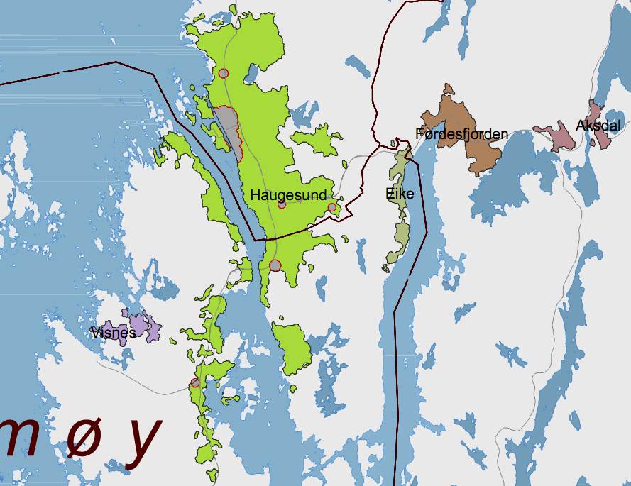
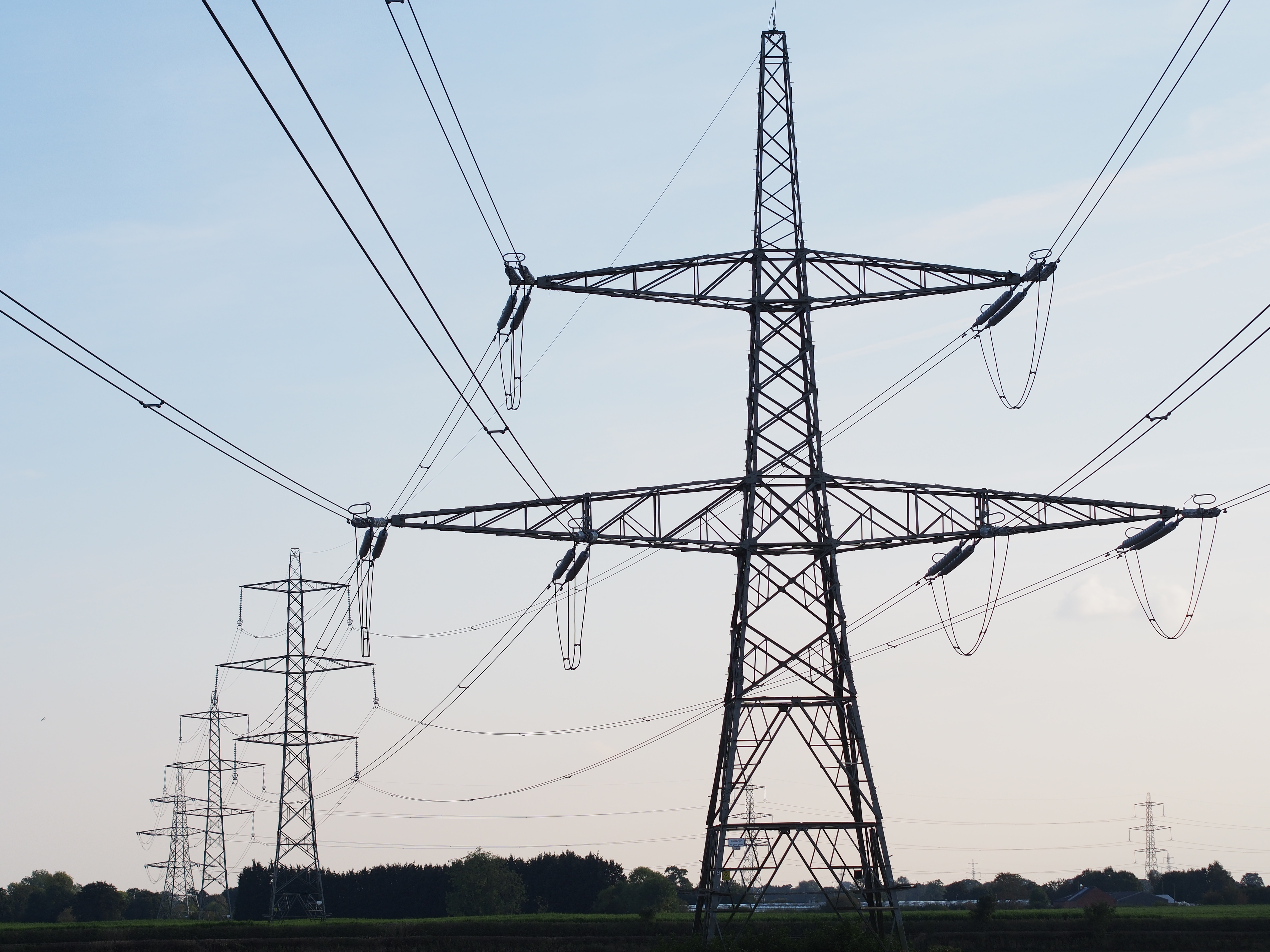
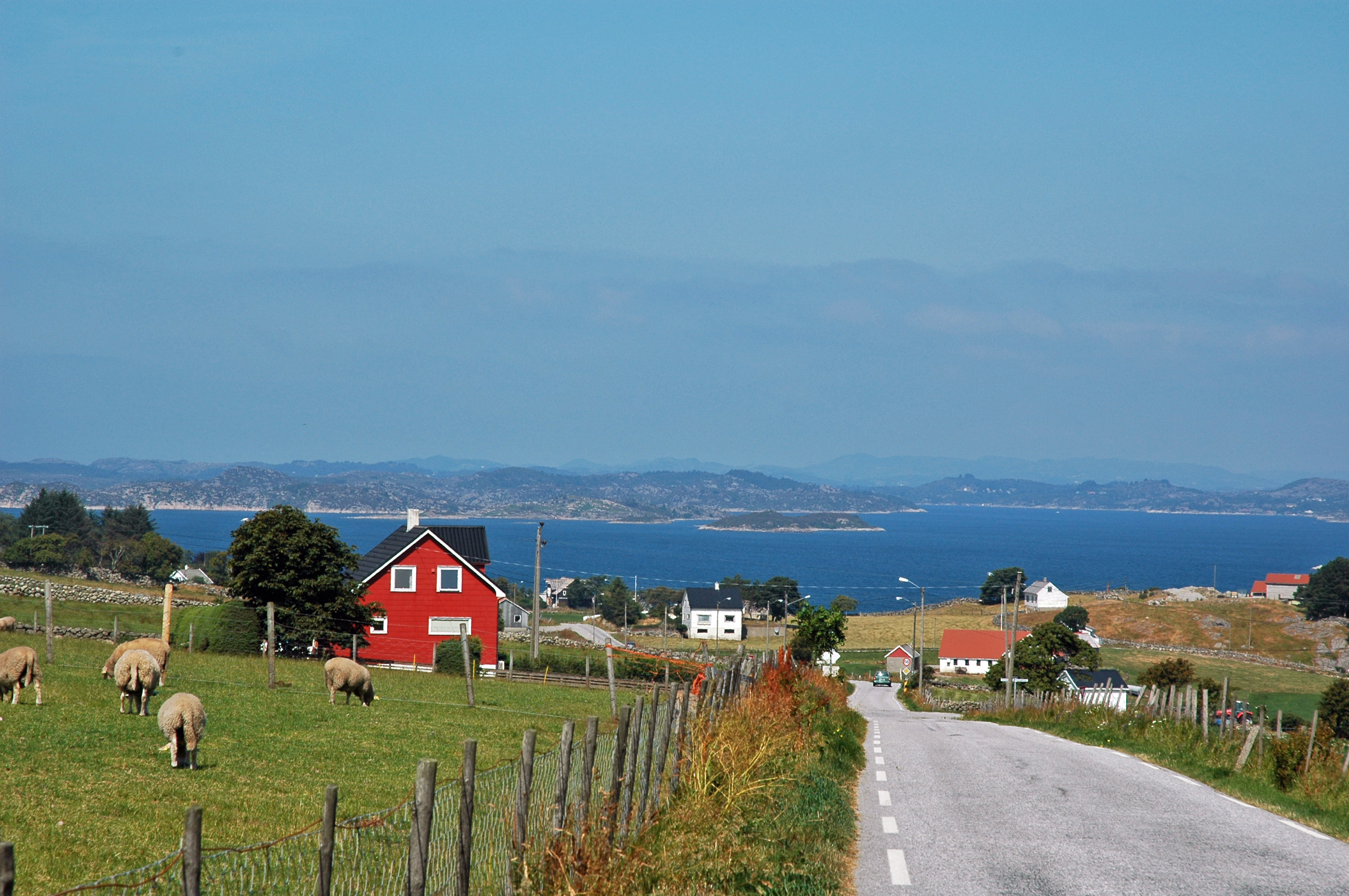
Karmsund is a strait located in Rogaland county, Norway. The long strait separates the island of Karmøy on the west and the mainland of Norway and island of Vestre Bokn in the east. The strait runs through the municipalities of Haugesund, Karmøy, and Bokn. The town of Haugesund lies at the northern end of the strait and the town of Kopervik lies in the central part of the strait, and the town of Skudeneshavn lies near the southern end where the strait flows into the Boknafjorden. The Karmsund Bridge, a part of the European route E134 highway, links Karmøy to the mainland. The bridge was completed in 1955. The small islands of Vibrandsøy, Risøy, and Hasseløy lie in the strait at the northern end, just off shore from the town of Haugesund. Near the Norsk Hydro Factory on Karmøy, there are three powerlines that cross the Karmsund on tall electricity pylons, which are the tallest in Norway. A local newspaper in this area is named after the strait: ''Karmsun ... [...More Info...] [...Related Items...] OR: [Wikipedia] [Google] [Baidu] |
Karmsund Bridge
Karmsund Bridge () is a bridge over the Karmsundet strait in Rogaland county, Norway. The bridge is located in Karmøy municipality and it links the island of Karmøy to the Norwegian mainland. The steel arched road bridge carries the European route E134 highway. It is in length with of clearance below the bridge. There are 37 spans on the bridge and the main span is wide. It was completed in 1955.. Retrieved 2015-11-04. See also *List of bridges in Norway *List of bridges in Norway by length *List of bridges *List of bridges by length This is a list of the world's longest bridges that are more than in length sorted by their full length above land and water. The main span is the longest span without any ground support. ''Note: There is no standard way to measure the total ... References Bridges in Rogaland Bridges completed in 1955 Through arch bridges 1955 establishments in Norway {{Rogaland-geo-stub ... [...More Info...] [...Related Items...] OR: [Wikipedia] [Google] [Baidu] |
Karmøy
Karmøy is a municipality in Rogaland county, Norway. It is southwest of the town of Haugesund in the traditional district of Haugaland. The administrative centre of the municipality is the town of Kopervik. Most of the municipality lies on the island of Karmøy. The island is connected to the mainland by the Karmøy Tunnel and the Karmsund Bridge. It is known for its industries, as well as for fishing. Karmøy is also well known in Norway for its beautiful heather moors and the white sand surfing beaches. The municipality is the 294th largest by area out of the 356 municipalities in Norway. Karmøy is the 25th most populous municipality in Norway with a population of 42,903, making it one of the largest in the region. The municipality's population density is and its population has increased by 4.3% over the previous 10-year period. The island itself is the 4th most populated island in all of Norway. General information The municipality of Karmøy is a recent creation. ... [...More Info...] [...Related Items...] OR: [Wikipedia] [Google] [Baidu] |
Haugesund (town)
Haugesund () is a municipality and town on the North Sea in Rogaland county, Norway. As of December 2023, the municipality of Haugesund has a population of 37,855. The vast majority of the population (37,008) live in the Haugesund urban area in the municipality's southwest. The Haugesund urban area also extends into neighboring Karmøy municipality and has a combined population of 46,359. Haugesund is the main commercial and economic centre of the Haugaland region in northern Rogaland and southern Vestland. The majority of the municipality outside this area is rural or undeveloped. The municipality is the 338th largest by area out of the 356 municipalities in Norway. Haugesund is the 28th most populous municipality in Norway with a population of 37,855. The municipality's population density is and its population has increased by 5.9% over the previous 10-year period. The Haugesund urban area, which extends into the neighboring municipality of Karmøy, makes up about of the m ... [...More Info...] [...Related Items...] OR: [Wikipedia] [Google] [Baidu] |
Haugesund
Haugesund () is a municipalities of Norway, municipality and List of towns and cities in Norway, town on the North Sea in Rogaland county, Norway. As of December 2023, the municipality of Haugesund has a population of 37,855. The vast majority of the population (37,008) live in the Haugesund urban area in the municipality's southwest. The Haugesund urban area also extends into neighboring Karmøy municipality and has a combined population of 46,359. Haugesund is the main commercial and economic centre of the Haugaland region in northern Rogaland and southern Vestland. The majority of the municipality outside this area is rural or undeveloped. The municipality is the 338th largest by area out of the 356 municipalities in Norway. Haugesund is the 28th most populous municipality in Norway with a population of 37,855. The municipality's population density is and its population has increased by 5.9% over the previous 10-year period. The Haugesund urban area, which extends into the n ... [...More Info...] [...Related Items...] OR: [Wikipedia] [Google] [Baidu] |
Karmøy (island)
Karmøy (locally called ''Karmøyne'' or ''Karmøynå'') is an island in the northwestern part of Rogaland county, Norway. The island makes up the majority of the municipality of Karmøy, along with the islands of Feøy, some smaller surrounding islands, and part of the mainland south of the municipality of Haugesund. It is the largest island in Rogaland county. The island is separated from the mainland by the Karmsundet strait. The Boknafjorden lies to the south and southeast of the island. The Sirafjorden lies to the west, separating Karmøy from the islands of Utsira and Feøy. The island of Karmøy is the location of the towns of Kopervik, Skudeneshavn, and Åkrehamn. The island has a population of 33,101 people (2014). The island is connected to the mainland by the Karmsund Bridge in the north and the Karmøy Tunnel in the central part. Haugesund Airport, Karmøy is located on the island at the western terminus of the European route E134 highway. See also *List ... [...More Info...] [...Related Items...] OR: [Wikipedia] [Google] [Baidu] |
Harald Fairhair
Harald Fairhair (; – ) was a Norwegian king. According to traditions current in Norway and Iceland in the eleventh and twelfth centuries, he reigned from 872 to 930 and was the first Monarchy of Norway, King of Norway. Supposedly, two of his sons, Eric Bloodaxe and Haakon the Good, succeeded Harald to become kings after his death. Much of Harald's biography is uncertain. A couple of praise poems by his court poet Þorbjörn Hornklofi survive in fragments, but the extant accounts of his life come from sagas set down in writing around three centuries after his lifetime. His life is described in several of the Kings' sagas, none of them older than the twelfth century. Their accounts of Harald and his life differ on many points, but it is clear that in the twelfth and thirteenth centuries Harald was regarded as having unified Norway into one kingdom. Since the nineteenth century, when Union between Sweden and Norway, Norway was in a personal union with Sweden, Harald has b ... [...More Info...] [...Related Items...] OR: [Wikipedia] [Google] [Baidu] |
Transmission Tower
A transmission tower (also electricity pylon, hydro tower, or pylon) is a tall structure, usually a lattice tower made of steel that is used to support an overhead power line. In electrical grids, transmission towers carry high-voltage transmission lines that transport bulk electric power from generating stations to electrical substations, from which electricity is delivered to end consumers; moreover, utility poles are used to support lower-voltage sub-transmission and distribution lines that transport electricity from substations to electricity customers. There are four categories of transmission towers: (i) the suspension tower, (ii) the dead-end terminal tower, (iii) the tension tower, and (iv) the transposition tower. The heights of transmission towers typically range from , although when longer spans are needed, such as for crossing water, taller towers are sometimes used. More transmission towers are needed to mitigate climate change, and as a result, transmiss ... [...More Info...] [...Related Items...] OR: [Wikipedia] [Google] [Baidu] |
Vestre Bokn
Vestre Bokn is an island in Bokn municipality in Rogaland county, Norway. The island is the main island of the municipality. It lies on the northern side of the Boknafjorden at the southern end of the Karmsundet strait. Vestre Bokn lies between the islands of Karmøy (to the west) and Austre Bokn and Ognøya (to the northeast). The main population centre on the island is the village of Føresvik, the administrative centre of the whole municipality. There are about 661 inhabitants on the island (as of 2014). Vestre Bokn is connected to the mainland via a series of bridges on the European route E39 highway which connect to Austre Bokn, then to Ognøya, and then to the mainland. There is a regular ferry route from the island across the Boknafjorden to the island of Rennesøy, which in turn is connected to the city of Stavanger by a series of roads, bridges, and tunnels. The Rogfast tunnel, which is currently under construction, will connect this island to the mainland Sta ... [...More Info...] [...Related Items...] OR: [Wikipedia] [Google] [Baidu] |
Bokn
Bokn is a List of municipalities of Norway, municipality in Rogaland county, Norway. It is located in the Traditional districts of Norway, traditional district of Haugaland. The administrative centre of the municipality is the village of Føresvik, the only urban area in Bokn. Other villages in Bokn include Arsvågen, Trosnavåg, and Loten. The island municipality is mostly located on the three islands of Ognøya, Vestre Bokn, and Austre Bokn. All three main islands are connected to the mainland via a network of bridges. The municipality is the 348th largest by area out of the 356 municipalities in Norway. Bokn is the 341st most populous municipality in Norway with a population of 868. The municipality's population density is and its population has increased by 0.3% over the previous ten-year period. General information The municipality of Bokn (historically spelled ''Bukken'') was established in 1849 when it was separated from the large municipality of Skudenes. Initially, B ... [...More Info...] [...Related Items...] OR: [Wikipedia] [Google] [Baidu] |
Skudeneshavn
(also known as Skudeneshamn or simply Skudenes) is a town in Karmøy municipality in Rogaland county, Norway. It is located on the southernmost tip of the island of Karmøy at the entrance to the Boknafjorden and Karmsundet strait. The town is part of the traditional district of Haugaland. The town was an independent municipality due to its status as a ladested from 1858 until 1965. The town has a population (2019) of 3,334 and a population density of . This makes Skudeneshavn one of the smallest towns in Norway (Kolvereid, with 1,470 inhabitants is the smallest). In 1990, it won second prize in NORTRA's competition for Norway's Best Preserved Small Town. History The village of Skudeneshavn was declared to be a ladested (port town) on 10 February 1858. Since towns were not allowed to be part of a rural municipality, Skudeneshavn was removed from the municipality of Skudenes, and established as its own urban municipality. Initially, Skudeneshavn municipality had 1,209 resi ... [...More Info...] [...Related Items...] OR: [Wikipedia] [Google] [Baidu] |
European Route E134
European route E134 () is a International E-road network, European highway that crosses Norway starting at Haugesund Airport, Karmøy near the city of Haugesund on the west coast, heading over Haukeli, passing the city of Drammen, and ending in Vassum on the east side of the Oslofjord Tunnel. With the highest point at above sea level, the road is sensitive to snow conditions and foul weather during the winter season, during which the mountainous sections, especially near Haukelifjell skiing center, may be closed in short periods. The stretch of road through the mountains is called Haukelifjell. Route Rogaland county *Karmøy municipality ** Haugesund Airport ** Karmsund Bridge *Haugesund municipality *Karmøy municipality *Tysvær municipality **Aksdal village ** south to Stavanger **The highways and run together for about ** north to Bergen *Vindafjord municipality **Skjold, Rogaland, Skjold village ***A new road and tunnel was built around Skjold, opening in 2015 ** ... [...More Info...] [...Related Items...] OR: [Wikipedia] [Google] [Baidu] |
Risøy
Risøy or Risøya is an island in Haugesund municipality in Rogaland county, Norway Norway, officially the Kingdom of Norway, is a Nordic countries, Nordic country located on the Scandinavian Peninsula in Northern Europe. The remote Arctic island of Jan Mayen and the archipelago of Svalbard also form part of the Kingdom of .... The island lies in the Karmsund strait immediately south of the island of Hasseløy and southeast of the island of Vibrandsøy. Risøy is part of the town of Haugesund. The west side of the island is dominated by the docks, workshops, and industrial hall belonging to Aibel. Other offshore corporations also have offices on the southeast part of the island. The ferry to Utsira operates from the Garpaskjær dock north on the island. While the neighboring island of Hasseløy to the north received its bridge to the mainland in 1872, Risøy was only connected to the mainline by ferry for many years. One of the local ferrymen, Ola Flytt, has be ... [...More Info...] [...Related Items...] OR: [Wikipedia] [Google] [Baidu] |


