|
Jump Off Joe (Washington)
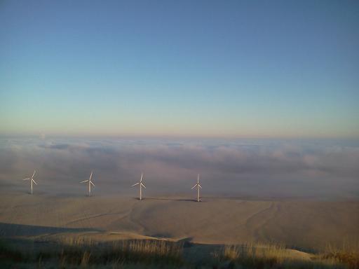
Jump off Joe is a butte in the Horse Heaven Hills south of Kennewick in the U.S. state of Washington. Jump off Joe rises above the Tri-Cities and is visible throughout much of the region, including in parts of Umatilla and Morrow Counties in Oregon to the south. A gravel road approaches the summit from the south up a steep incline. On a clear day, visitors to the summit can see Mount Hood, Mount Adams and Mount Rainier. Jump off Joe's high elevation compared to the surrounding area makes it an ideal location to place towers for radio and television communications. Among these is an amateur radio repeater that provides coverage to much of the Columbia Basin. Two major local television stations, NBC affiliate KNDU and ABC affiliate KVEW have their towers atop the butte. FM radio stations with transmitters on top of the butte include KUJ-FM and KORD-FM. Geology Jump off Joe and the greater Horse Heaven Hills are anticlines within the Yakima Fold Belt. The belt is a series ... [...More Info...] [...Related Items...] OR: [Wikipedia] [Google] [Baidu] [Amazon] |
Kennewick, Washington
Kennewick () is a city in Benton County, Washington, Benton County in the U.S. state of Washington (state), Washington. It is located along the southwest bank of the Columbia River, just southeast of the confluence of the Columbia and Yakima River, Yakima rivers and across from the confluence of the Columbia and Snake River, Snake rivers. It is the most populous of the three cities collectively referred to as the Tri-Cities, Washington, Tri-Cities (the others being Pasco, Washington, Pasco and Richland, Washington, Richland). The United States Census Bureau estimated the population to be 85,158 as of 2023, up from 83,921 at the 2020 United States census. The discovery of Kennewick Man along the banks of the Columbia River provides evidence of Native Americans in the United States, Native Americans' settlement of the area for at least 9,000 years. American settlers began moving into the region in the late 19th century as transportation infrastructure was built to connect Kennew ... [...More Info...] [...Related Items...] OR: [Wikipedia] [Google] [Baidu] [Amazon] |
Federal Communications Commission
The Federal Communications Commission (FCC) is an independent agency of the United States government that regulates communications by radio, television, wire, internet, wi-fi, satellite, and cable across the United States. The FCC maintains jurisdiction over the areas of broadband access, fair competition, radio frequency use, media responsibility, public safety, and homeland security. The FCC was established pursuant to the Communications Act of 1934 to replace the radio regulation functions of the previous Federal Radio Commission. The FCC took over wire communication regulation from the Interstate Commerce Commission. The FCC's mandated jurisdiction covers the 50 states, the District of Columbia, and the territories of the United States. The FCC also provides varied degrees of cooperation, oversight, and leadership for similar communications bodies in other countries in North America. The FCC is funded entirely by regulatory fees. It has an estimated fiscal-2022 budg ... [...More Info...] [...Related Items...] OR: [Wikipedia] [Google] [Baidu] [Amazon] |
Clark Fork River
The Clark Fork, or the Clark Fork of the Columbia River, is a river in the U.S. states of Montana and Idaho, approximately long. It is named after William Clark of the 1806 Lewis and Clark Expedition. The largest river by volume in Montana, it drains an extensive region of the Rocky Mountains in western Montana and northern Idaho in the watershed of the Columbia River. The river flows northwest through a long valley at the base of the Cabinet Mountains and empties into Lake Pend Oreille in the Idaho Panhandle. The Pend Oreille River in Idaho, Washington, and British Columbia, Canada which drains the lake to the Columbia in Washington, is sometimes included as part of the Clark Fork, giving it a total length of , with a drainage area of . In its upper in Montana near Butte, it is known as Silver Bow Creek. Interstate 90 follows much of the upper course of the river from Butte to Saint Regis. The highest point within the river's watershed is Mount Evans at in Deer Lodge Co ... [...More Info...] [...Related Items...] OR: [Wikipedia] [Google] [Baidu] [Amazon] |
Idaho Panhandle
The Idaho panhandle—locally known as North Idaho, Northern Idaho, or simply the Panhandle—is a salient region of the U.S. state of Idaho encompassing the state's 10 northernmost counties: Benewah, Bonner, Boundary, Clearwater, Idaho, Kootenai, Latah, Lewis, Nez Perce, and Shoshone (though the southern part of the region is sometimes referred to as North Central Idaho). The panhandle is bordered by the state of Washington to the west, Montana to the east, and the Canadian province of British Columbia to the north. The Idaho panhandle, along with Eastern Washington, makes up the region known as the Inland Northwest, headed by its largest city, Spokane, Washington. Coeur d'Alene is the largest city within the Idaho panhandle. Spokane is around west of Coeur d'Alene, and its Spokane International Airport is the region's main air hub. Other important cities in the region include Lewiston, Moscow, Post Falls, Hayden, Sandpoint, and the smaller towns of St ... [...More Info...] [...Related Items...] OR: [Wikipedia] [Google] [Baidu] [Amazon] |


