|
Interstate 69W
Interstate 69W (I-69W) is a relatively short north–south Interstate Highway running through South Texas in the United States. The freeway begins northeast of the middle of World Trade International Bridge in Laredo and ends at I-35. In the future, I-69W will head northeast for before terminating near Victoria as both I-69E and I-69W merge to form I-69. For its entire length, I-69W runs concurrently with US Highway 59 (US 59). Route description The Federal Highway Administration (FHWA) approved the designation of a section of freeway in Laredo as part of I-69W. The congressionally designated I-69W corridor begins at the Mexican border on the World Trade International Bridge, which connects to Mexican Federal Highway 85D, at the border in Laredo. It is cosigned with both US 59 and State Highway Loop 20 (Loop 20; Bob Bullock Loop) and extends to I-35 (which connects to Mexican Federal Highway 85 south of the border). In the future, I-6 ... [...More Info...] [...Related Items...] OR: [Wikipedia] [Google] [Baidu] |
Laredo World Trade Port Of Entry
The Laredo World Trade Port of Entry is located at the World Trade International Bridge (sometimes referred to as "Bridge IV"). It was built in 2000 in an effort to relieve traffic from the congested downtown Laredo bridges. All of Laredo's cross-border commercial vehicle traffic uses this Port of Entry, as the other Laredo bridges prohibit trucks. Passenger vehicles and pedestrians are not permitted to use this crossing. References See also * List of Mexico–United States border crossings * List of Canada–United States border crossings This article includes lists of border crossings, ordered from west to east (north to south for Alaska crossings), along the International Boundary between Canada and the United States. Each port of entry (POE) in the tables below links to an art ... Mexico–United States border crossings 2000 establishments in Texas Buildings and structures in Laredo, Texas Buildings and structures completed in 2000 Road bridges in Texas ... [...More Info...] [...Related Items...] OR: [Wikipedia] [Google] [Baidu] |
Mexico–United States Border
The Mexico–United States border ( es, frontera Estados Unidos–México) is an international border separating Mexico and the United States, extending from the Pacific Ocean in the west to the Gulf of Mexico in the east. The border traverses a variety of terrains, ranging from urban areas to deserts. The Mexico–United States border is the most frequently crossed border in the world, with approximately 350 million documented crossings annually. It is the tenth-longest border between two countries in the world. The total length of the continental border is . From the Gulf of Mexico, it follows the course of the Rio Grande (Río Bravo del Norte) to the border crossing at Ciudad Juárez, Chihuahua, and El Paso, Texas. Westward from El Paso–Juárez, it crosses vast tracts of the Chihuahuan and Sonoran deserts to the Colorado River Delta and San Diego–Tijuana, before reaching the Pacific Ocean. Four American states border Mexico: California, Arizona, New Mexico, an ... [...More Info...] [...Related Items...] OR: [Wikipedia] [Google] [Baidu] |
High Priority Corridor
The Intermodal Surface Transportation Efficiency Act of 1991 (ISTEA, pronounced ''Ice-Tea'') is a United States federal law that posed a major change to transportation planning and policy, as the first U.S. federal legislation on the subject in the post-Interstate Highway System era. Objective The act presented an overall intermodal approach to highway and transit funding with collaborative planning requirements, giving significant additional powers to metropolitan planning organizations (MPOs). The act was signed into law on December 18, 1991, by President George H. W. Bush and codified as and . The bill was preceded by the Surface Transportation and Uniform Relocation Assistance Act in 1987 and followed by the Transportation Equity Act for the 21st Century (TEA-21) in 1998, the Safe, Accountable, Flexible, Efficient Transportation Equity Act: A Legacy for Users (SAFETEA-LU) in 2005, the Moving Ahead for Progress in the 21st Century Act (MAP-21) in 2012, the FIxing America's ... [...More Info...] [...Related Items...] OR: [Wikipedia] [Google] [Baidu] |
Intermodal Surface Transportation Efficiency Act Of 1991
The Intermodal Surface Transportation Efficiency Act of 1991 (ISTEA, pronounced ''Ice-Tea'') is a United States federal law that posed a major change to transportation planning and policy, as the first U.S. federal legislation on the subject in the post-Interstate Highway System era. Objective The act presented an overall intermodal approach to highway and transit funding with collaborative planning requirements, giving significant additional powers to metropolitan planning organizations (MPOs). The act was signed into law on December 18, 1991, by President George H. W. Bush and codified as and . The bill was preceded by the Surface Transportation and Uniform Relocation Assistance Act in 1987 and followed by the Transportation Equity Act for the 21st Century (TEA-21) in 1998, the Safe, Accountable, Flexible, Efficient Transportation Equity Act: A Legacy for Users (SAFETEA-LU) in 2005, the Moving Ahead for Progress in the 21st Century Act (MAP-21) in 2012, the FIxing Ameri ... [...More Info...] [...Related Items...] OR: [Wikipedia] [Google] [Baidu] |
Corpus Christi, Texas
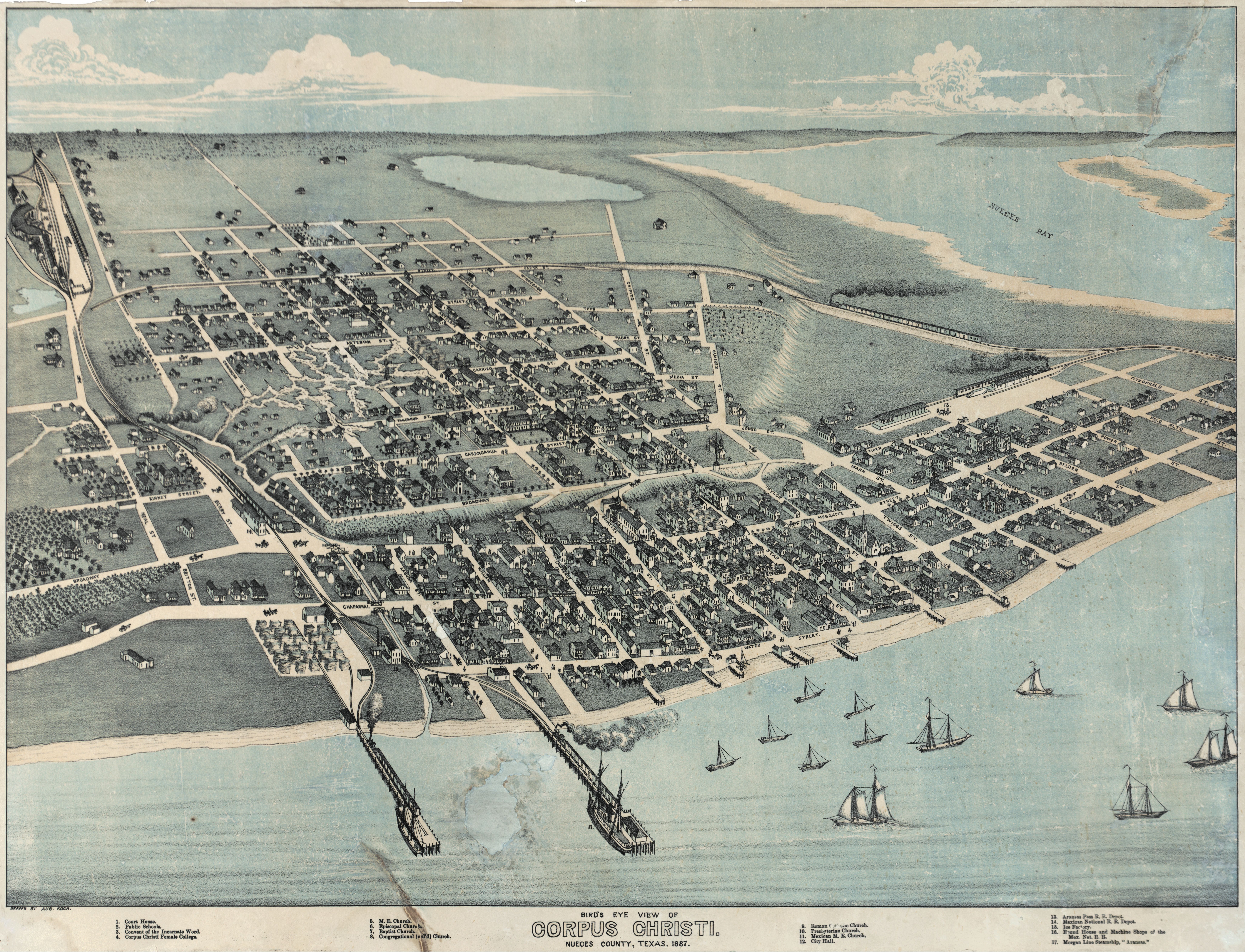
Corpus Christi (; Ecclesiastical Latin: "''Body of Christ"'') is a coastal city in the South Texas region of the U.S. state of Texas and the county seat and largest city of Nueces County, it also extends into Aransas, Kleberg, and San Patricio Counties. It is southeast of San Antonio. Its political boundaries encompass Nueces Bay and Corpus Christi Bay. Its zoned boundaries include small land parcels or water inlets of three neighboring counties. The city's population was 317,863 in 2020, making it the eighth-most populous city in Texas. The Corpus Christi metropolitan area had an estimated population of 442,600. It is also the hub of the six-county Corpus Christi-Kingsville Combined Statistical Area, with a 2013 estimated population of 516,793. The Port of Corpus Christi is the fifth-largest in the United States. The region is served by the Corpus Christi International Airport. The city's name means body of Christ in Ecclesiastical Latin, in reference to the Christian sac ... [...More Info...] [...Related Items...] OR: [Wikipedia] [Google] [Baidu] |
Freer, Texas
Freer is a city in Duval County, Texas, Duval County, Texas, United States. The population was 2,818 at the 2010 United States Census, 2010 census, down from 3,241 at the 2000 United States Census, 2000 census. Like Sweetwater, Texas, Sweetwater, the seat of Nolan County, Texas, Nolan County in West Texas, Freer holds an annual rattlesnake roundup in March. The first oil well in Texas was drilled in Freer in 1860, a year after the discovery in Titusville, Pennsylvania, but it was unproductive. In 1907, oil was again discovered in Duval County, six years after Spindletop near Beaumont, Texas, Beaumont. Geography Freer is located in northwestern Duval County at (27.879156, –98.616237). U.S. Route 59 passes east–west through the city as Riley Street. Once outside the city limits, US 59 leads northeast to Beeville, Texas, Beeville and southwest to Laredo, Texas, Laredo. Texas State Highway 16 (Norton Avenue) crosses US 59 in the center of town and leads north to San Anto ... [...More Info...] [...Related Items...] OR: [Wikipedia] [Google] [Baidu] |
Texas State Highway 44
State Highway 44 (SH 44) is a Texas state highway that runs from west of Encinal to Corpus Christi, Texas. This highway is also known as the Cesar Chavez Memorial Highway outside the city limits of Robstown, Banquete, Agua Dulce, Alice, and Corpus Christi in Nueces and Jim Hogg counties. History SH 44 was originally proposed on April 24, 1919 as a connector route between Waco and Giddings. On July 16, 1923, the southern terminus extended south to LaGrange. By 1926, construction was continuing on the highway, and SH 44 was concurrent with U.S. Highway 77 (US 77). On July 15, 1935, SH 21 was rerouted concurrent with SH 44 from north of Giddings to Giddings. On November 24, 1936, this route had extended south to Hallettsville and another section from Victoria south via Sinton and Robstown to Alice was designated, creating a gap and replacing part of SH 72 and all of SH 128 (which was reassigned to the portion of SH 72 that was disc ... [...More Info...] [...Related Items...] OR: [Wikipedia] [Google] [Baidu] |
Houston, Texas
Houston (; ) is the most populous city in Texas, the most populous city in the Southern United States, the fourth-most populous city in the United States, and the sixth-most populous city in North America, with a population of 2,304,580 in 2020. Located in Southeast Texas near Galveston Bay and the Gulf of Mexico, it is the seat and largest city of Harris County and the principal city of the Greater Houston metropolitan area, which is the fifth-most populous metropolitan statistical area in the United States and the second-most populous in Texas after Dallas–Fort Worth. Houston is the southeast anchor of the greater megaregion known as the Texas Triangle. Comprising a land area of , Houston is the ninth-most expansive city in the United States (including consolidated city-counties). It is the largest city in the United States by total area whose government is not consolidated with a county, parish, or borough. Though primarily in Harris County, small portions of ... [...More Info...] [...Related Items...] OR: [Wikipedia] [Google] [Baidu] |
Interstate 37 (Texas)
Interstate 37 (I-37) is a Interstate Highway located within the southern portion of the US state of Texas. The highway was first designated in 1959 as a route between Corpus Christi and San Antonio. Construction in the urban areas of Corpus Christi and San Antonio began in the 1960s, and the segments of the Interstate Highway in rural areas were completed by the 1980s. Prior to I-37, the route between Corpus Christi and San Antonio was served by a combination of State Highway 9 (SH 9) from Corpus Christi to Three Rivers and U.S. Highway 281 (US 281) from Three Rivers to San Antonio. As a result of the construction of I-37, SH 9 was removed from the State Highway System. The highway begins in Corpus Christi at US 181 and SH 35 and heads north to San Antonio, where it ends at I-35. Beyond I-35, the freeway continues as US 281 to northern San Antonio as a major freeway. In Corpus Christi, the highway provides access to the do ... [...More Info...] [...Related Items...] OR: [Wikipedia] [Google] [Baidu] |
Interstate 69C
Interstate 69C (I-69C) is a north–south freeway running through South Texas. Once complete, the freeway (with connections to Mexican Federal Highway 97) will begin at I-2/ U.S. Highway 83 (US 83) in Pharr and head northward before terminating at I-69W/ US 59 in George West near I-37. For its entire length, I-69C shares its alignment with US 281. , only an segment has been completed at the route's southern terminus in Pharr. Route description History The Federal Highway Administration (FHWA) approved the designation for the South Rio Grande Valley Segment on May 24, 2013, and the Texas Transportation Commission followed suit on May 30, 2013. This action finalized the designations of not only I-69C but also of the sections of I-69E from Brownsville north to north of Raymondville and also I-2 which is a freeway connecting with I-69C and I-69E in Pharr and Harlingen. These approvals added over to the Interstate Highway System in ... [...More Info...] [...Related Items...] OR: [Wikipedia] [Google] [Baidu] |
George West, Texas
George West is a city in Live Oak County, Texas, United States, and named for cattle rancher George Washington West. The population was 2,445 at the 2010 census. It is the county seat of Live Oak County. George West was named the "storytelling capital of Texas" in 2005 by the Texas Senate; and it hosts the ''George West Storyfest'', a festival that features storytelling, cowboy poetry, and music. Numerous ranches surround George West. The Texas author and folklorist J. Frank Dobie was born in Live Oak County near George West in 1888. Former State Senator Cyndi Taylor Krier, also the administrative judge of Bexar County, was reared near George West in the unincorporated community of Dinero. History George West was a land venture and ranching enterprise of George Washington West and Kittie West. Originally from Shannonville Tennessee, West began to build his town in 1913, after ranching from 1880 to 1912 in the area between Pleasanton and Corpus Christi. He sold his cattle ... [...More Info...] [...Related Items...] OR: [Wikipedia] [Google] [Baidu] |
Mexican Federal Highway 85
Federal Highway 85 (''Carretera Federal 85'') connects Mexico City with the Mexico–United States border at Nuevo Laredo, Tamaulipas. Highway 85 runs through Monterrey, Nuevo León; Ciudad Victoria, Tamaulipas; Ciudad Valles, San Luis Potosí; and Pachuca, Hidalgo. It ends at the intersection of Highway 95 in the San Pedro area of Mexico City. Highway 85 is the original route of the Pan-American Highway from the border to the capital as well as the Inter-American Highway. Through most of Tamaulipas and Nuevo León, it is a freeway and is essentially a southern continuation of U.S. Interstate 35. Highway 85 has two alternate toll routes ( Autopistas); both are named Carretera Federal 85D; one is from Nuevo Laredo to Monterrey (123.1 kilometers MXN$177) and Pachuca to Mexico City (45.8 kilometers MXN$33). Highway 85D has wider lanes, offers a more direct route, and is continuously being repaired and repaved. Major highway intersections Description Nuevo Laredo, Tamaul ... [...More Info...] [...Related Items...] OR: [Wikipedia] [Google] [Baidu] |


