|
Interstate 15 In Montana
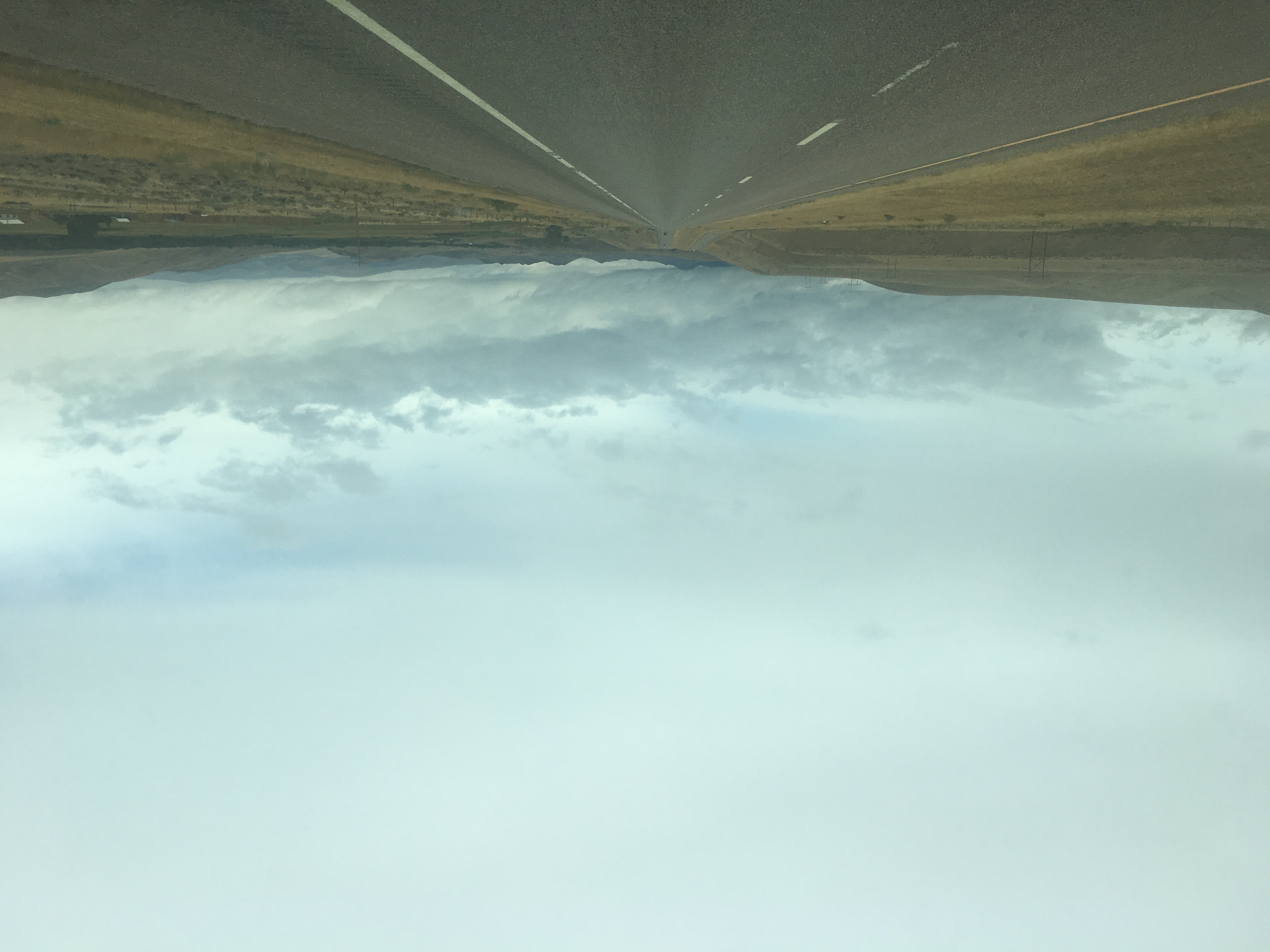
In the U.S. state of Montana, Interstate 15 (I-15) continues onward from Idaho for nearly through the cities of Butte, Helena, and Great Falls, intersecting with I-90, I-115, and I-315. I-15 reaches its northern terminus at the international border with Alberta, Canada. I-15 is additionally named as the First Special Service Force Memorial Highway from Helena to the Alberta border, where Alberta Highway 4 continues into Canada retaining that designation. I-15 joins with I-90 and makes a junction with a short, spur route I-115 in Butte. Route description I-15 crosses into Montana from Idaho just south of Lima Reservoir over Monida Pass, at , the highest elevation on the entire route of I-15. The route continues northwest through farmland and desert. The freeway turns north at Clark Canyon Reservoir, before turning northeast. In the town of Dillon, I-15 passes near Clark's Lookout State Park before beginning to parallel the Big Hole River. The freeway then ... [...More Info...] [...Related Items...] OR: [Wikipedia] [Google] [Baidu] |
Idaho
Idaho ( ) is a landlocked U.S. state, state in the Pacific Northwest and Mountain states, Mountain West subregions of the Western United States. It borders Montana and Wyoming to the east, Nevada and Utah to the south, and Washington (state), Washington and Oregon to the west; the state shares a small portion of the Canada–United States border to the north with the Canadian province of British Columbia. Idaho's State capital (United States), state capital and largest city is Boise, Idaho, Boise. With an area of , Idaho is the List of U.S. states and territories by area, 14th-largest state by land area. The state has a population of approximately two million people; it ranks as the List of U.S. states and territories by population, 13th-least populous and the List of U.S. states by population density, seventh-least densely populated of the List of US states, 50 U.S. states. For thousands of years, and prior to European colonization, Idaho had been inhabited by Native American ... [...More Info...] [...Related Items...] OR: [Wikipedia] [Google] [Baidu] |
Interstate 90
Interstate 90 (I-90) is an east–west transcontinental freeway and the longest Interstate Highway in the United States at . It begins in Seattle, Washington, Seattle, Washington, and travels through the Pacific Northwest, Mountain states, Mountain West, Great Plains, Midwestern United States, Midwest, and the Northeastern United States, Northeast, ending in Boston, Massachusetts. The highway serves 13 states and has 15 List of auxiliary Interstate Highways, auxiliary routes, primarily in major cities such as Chicago, Cleveland, Buffalo, New York, Buffalo, and Rochester, New York, Rochester. I-90 begins at Washington State Route 519 in Seattle and crosses the Cascade Range in Washington and the Rocky Mountains in Montana. It then traverses the northern Great Plains and travels southeast through Wisconsin and the Chicago area by following the southern shore of Lake Michigan. The freeway continues across Indiana and follows the shore of Lake Erie through Ohio and Pennsylvania to ... [...More Info...] [...Related Items...] OR: [Wikipedia] [Google] [Baidu] |
Clark's Lookout State Park
Clark's Lookout State Park is a Montana state park located one mile north of the community of Dillon. The park encompasses the hill overlooking the Beaverhead River that William Clark climbed on August 13, 1805, during the Lewis and Clark Expedition The Lewis and Clark Expedition, also known as the Corps of Discovery Expedition, was the United States expedition to cross the newly acquired western portion of the country after the Louisiana Purchase. The Corps of Discovery was a select gro .... From the vantage point, Clark took various compass readings and sketched a map of the Beaverhead Valley. The park offers picnicking, interpretive signage, and a chance to make the climb that Clark made and stand where he stood. References External linksClark's Lookout State ParkMontana Fish, Wildlife & ParksClark's Lookout State Park Trail MapMontana Fish, Wildlife & Parks {{authority control State parks of Montana Protected areas of Beaverhead County, Montana Protected ar ... [...More Info...] [...Related Items...] OR: [Wikipedia] [Google] [Baidu] |
Dillon, Montana
Dillon is a city in and the county seat of Beaverhead County, Montana, Beaverhead County, Montana, United States. The population was 3,880 at the 2020 United States census, 2020 census. The city was named for Sidney Dillon (1812–1892), president of Union Pacific Railroad. History Dillon was founded in the Beaverhead River, Beaverhead Valley as a railroad town in 1880. Originally named “Terminus” as it was temporarily the northernmost stop on the Utah and Northern Railway while it was under construction, in 1881, the community was renamed for Union Pacific Railroad President Sidney Dillon, who had directed the project of bringing the railroad through to Butte, Montana. The town's location was selected by the railroad in part because of its proximity to gold mining, gold mines in the area. The first ore discovered in the Dillon area was silver. Gold was first discovered at Grasshopper Creek in 1862, precipitating a flood of immigration to the area. The last real gold rush ... [...More Info...] [...Related Items...] OR: [Wikipedia] [Google] [Baidu] |
Clark Canyon Dam
Clark Canyon Dam is an earthfill dam located in Beaverhead County, Montana, about south of the county seat of Dillon. The dam impounds the waters of the Beaverhead River, creating a body of water known as Clark Canyon Reservoir. The structure was constructed in 1961-1964 by the United States Bureau of Reclamation, to hold water for downstream irrigation and for flood control purposes. Clark Canyon Dam has a crest length of , and a maximum height of . The dam contains 1,970,000 cubic yards (1,510,000 m³) of material. The elevation of the dam crest is . The reservoir has a total capacity of , and when full has a surface area of . Construction of the dam and reservoir required the relocation of U.S. Route 91 (rebuilt as Interstate 15) and a main line of the Union Pacific Railroad. The reservoir inundated the former site of the small community of Armstead, Montana, and the site of Camp Fortunate, where the Lewis and Clark Expedition camped from August 17 to 22, 1805 and held neg ... [...More Info...] [...Related Items...] OR: [Wikipedia] [Google] [Baidu] |
Monida Pass
Monida Pass is a high mountain pass in the northern Rocky Mountains of the western United States, at an elevation of above sea level on Interstate 15, and on the Union Pacific Railroad. On the Continental Divide in the Bitterroot Range, it marks the transition between the Beaverhead Mountains and the Centennial Mountains. Its name is derived from the states that it separates, "Mon" from Montana and "-ida" from Idaho. The pass forms part of the border between eastern Idaho and southwestern Montana, and is between the towns of Spencer in Clark County and Lima in Beaverhead County. On the Idaho side is Beaver Creek running through Beaver Canyon, which was the route of the Utah and Northern Railway in 1880 and is still used by Union Pacific. Union Pacific once had an icemaking plant at Humphrey, Idaho, which is now a ghost town; Monida, Montana, which is near the top of the pass, is also almost a ghost town, as only seven people now live there at , below the pass ... [...More Info...] [...Related Items...] OR: [Wikipedia] [Google] [Baidu] |
Lima Reservoir
Lima ( ; ), founded in 1535 as the Ciudad de los Reyes (, Spanish for "City of Biblical Magi, Kings"), is the capital and largest city of Peru. It is located in the valleys of the Chillón River, Chillón, Rímac River, Rímac and Lurín Rivers, in the desert zone of the central coastal part of the country, overlooking the Pacific Ocean. The city is considered the political, cultural, financial and commercial center of Peru. Due to its geostrategic importance, the Globalization and World Cities Research Network has categorized it as a "beta" tier city. Jurisdictionally, the metropolis extends mainly within the province of Lima and in a smaller portion, to the west, within the Constitutional Province of Callao, where the seaport and the Jorge Chávez Airport are located. Both provinces have regional autonomy since 2002. The 2023 census projection indicates that the city of Lima has an estimated population of 10,092,000 inhabitants, making it the List of cities in the Americas b ... [...More Info...] [...Related Items...] OR: [Wikipedia] [Google] [Baidu] |
Interstate 115
Interstate 115 (I-115) is a auxiliary Interstate Highway which connects I-15/I-90 to Butte in the U.S. state of Montana. The highway is concurrent with I-15 Bus./ I-90 Bus. for its entire length. The highway travels from an incomplete interchange with I-15/I-90 through generally rural areas in western Butte. It also has an interchange with Excelsior Avenue before terminating. The entire route was built to Interstate standards during the 1960s, and was further changed in 2005. Route description I-115 begins at an interchange with I-15/I-90. As a four-lane highway with two lanes in each direction, I-115 heads east into downtown Butte. Before reaching exit 1, eastbound traffic makes a curve while westbound traffic goes to I-15/I-90 without making such a curve, therefore, that portion of I-115 contains a large median. The other portion at exit 1, however, is separated only by a curbed street median and does not have a Jersey barrier separating the two halves. Approximat ... [...More Info...] [...Related Items...] OR: [Wikipedia] [Google] [Baidu] |
Interstate 90 In Montana
Interstate 90 (I-90) is an east–west transcontinental Interstate Highway across the northern United States, linking Seattle to Boston. The portion in the state of Montana is in length, passing through 14 counties in central and southern Montana. It is the longest segment of I-90 within a single state. Route description Mineral County I-90 enters Montana and Mineral County, Montana, Mineral County from Shoshone County, Idaho, Shoshone County, Idaho over the high Lookout Pass, which traverses the Coeur d'Alene Mountains of the Bitterroot Range, and immediately has its first interchange (road), interchange, a partial cloverleaf interchange serving extreme northwest Mineral County and access to Lookout Pass Ski and Recreation Area. The highway continues southeasterly through woodlands, paralleling the St. Regis River (Montana), St. Regis River, before meeting the Dena Mora (Lookout Pass) rest area east of the Idaho–Montana border. About from the rest stop is a diamo ... [...More Info...] [...Related Items...] OR: [Wikipedia] [Google] [Baidu] |
Alberta Highway 4
Highway 4 is a highway in southern Alberta, Canada, that connects Highway 3 in Lethbridge to Interstate 15 in Montana, United States. The highway was designated in 1999 as the First Special Service Force Memorial Highway in honour of elite soldiers who travelled to Helena, Montana, for training before World War II. The highway continues into the United States retaining that name. It begins in Coutts at Alberta's busiest border crossing, winding north through gentle rolling hills and farmlands in the south of the province. It bypasses Milk River, Warner and Stirling before reaching Lethbridge where it becomes 43 Street and ends at Crowsnest Trail on the east side of the city. In 1995, it was designated as part of the CANAMEX Corridor that links Canada to Mexico and the United States, including the major cities of Salt Lake City, Las Vegas, Los Angeles, and San Diego, which lie on Interstate 15. Between Lethbridge and Highway 61 near Stirling, Highway 4 is signed as part ... [...More Info...] [...Related Items...] OR: [Wikipedia] [Google] [Baidu] |


