|
Improved Crystal
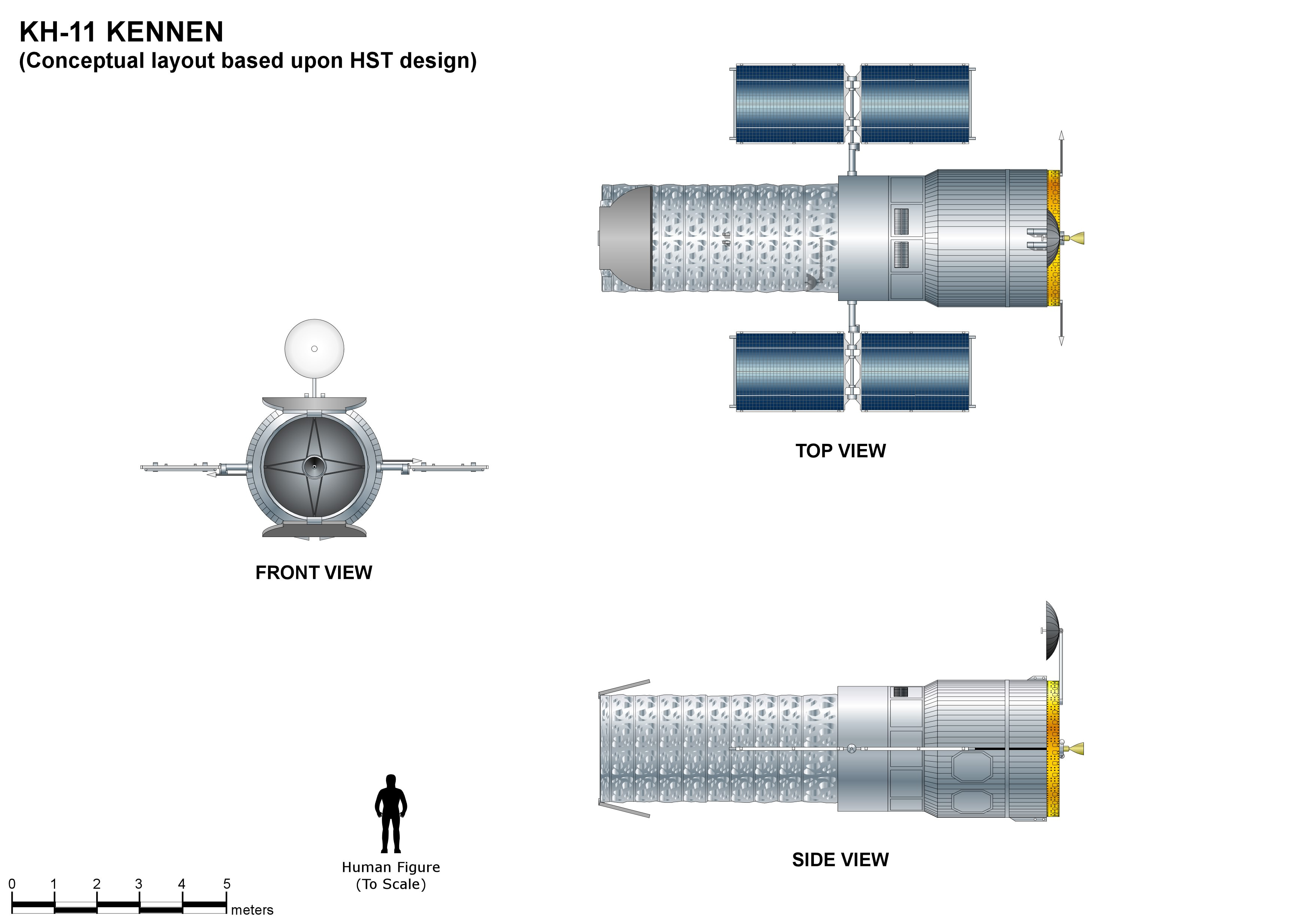
The KH-11 KENNEN (later renamed CRYSTAL,p.199-200 then Evolved Enhanced CRYSTAL System, and codenamed 1010 and Key Hole) is a type of reconnaissance satellite first launched by the American National Reconnaissance Office (NRO) in December 1976. Manufactured by Lockheed in Sunnyvale, California, the KH-11 was the first American spy satellite to use electro-optical digital imaging, and to offer real-time optical observations. Later KH-11 satellites have been referred to by outside observers as KH-11B or KH-12, and by the names "Advanced KENNEN", "Improved Crystal" and "Ikon". Official budget documents refer to the latest generation of electro-optical satellites as ''Evolved Enhanced CRYSTAL System''. The Key Hole series was officially discontinued in favor of a random numbering scheme after repeated public references to KH-7 GAMBIT, KH-8 GAMBIT 3, KH-9 HEXAGON, and KH-11 KENNEN satellites. The capabilities of the KH-11 are highly classified, as are the images they produce. ... [...More Info...] [...Related Items...] OR: [Wikipedia] [Google] [Baidu] |
Safir (rocket)
The Safir (, meaning "ambassador") was the first Iranian expendable launch vehicle able to place a satellite in orbit. The first successful orbital launch using the Safir launch system took place on 2 February 2009 when a Safir carrier rocket placed the Omid satellite into an orbit with a apogee. This made Iran the ninth nation capable of producing and launching a satellite. The Simorgh is a larger orbital launcher based on Safir technology which has since replaced the Safir, and is sometimes called the Safir-2. Design and specifications The Safir measures 1.25 meters in diameter, 22 meters in height and has a launching mass of 26 tons. The rocket consists of two stages; The first stage utilizes an upgraded Nodong/ Shahab-3 type engine which burns a hypergolic combination of UDMH as fuel and nitrogen tetroxide as oxidant, producing 37 tons (363 kN; 82,500 lbf) of thrust. The second stage utilizes a pair of smaller gimballed engines called LRE-4, fed by a ... [...More Info...] [...Related Items...] OR: [Wikipedia] [Google] [Baidu] |
HST Lockheed Integration
HST may refer to: People * Harry S. Truman (1884–1972), 33rd president of the US * Hunter S. Thompson (1937–2005), American journalist and author Science and technology * Hubble Space Telescope * Harvard–MIT Program in Health Sciences and Technology * History of science and technology * High-speed telegraphy, a radiosport * High-Speed Transfer, a USRobotics modem protocol * Highstand systems tract, in the sequence stratigraphy branch of geology Transportation and military * Hastings railway station, Melbourne (Station code), Australia * Helicopter support team, in the US Marine Corps * Helsinki City Transport (Swedish: ') * Heritage Shunters Trust, an English rail preservation society * High-speed train, a type of rail transport ** InterCity 125 or High Speed Train, UK * High Street (Glasgow) railway station (station code), Scotland * High Sierra Trail, in California, US * Homestead Air Reserve Base (IATA code), Florida, US * USS ''Harry S. Truman'' (nickname: HST), ... [...More Info...] [...Related Items...] OR: [Wikipedia] [Google] [Baidu] |
USA-224
__NOTOC__ USA-224, also known as NROL-49, is an American reconnaissance satellite. Launched in 2011 to replace the decade-old USA-161 satellite, it is the fifteenth KH-11 optical imaging satellite to reach orbit. Project history and cost After the Boeing-led Future Imagery Architecture program failed in 2005, the National Reconnaissance Office ordered two more KH-11s. Critics worried that each of these "exquisite-class" satellites would cost more than the Navy's latest aircraft carrier ( in 2005, or about $ today). Instead, USA-224–the first of these two–was completed by Lockheed under the initial budget estimate and two years ahead of schedule. Launch USA-224 was launched atop a Delta IV Heavy rocket from Vandenberg AFB Space Launch Complex 6 in California. The launch was conducted by United Launch Alliance, and was the first flight of a Delta IV Heavy from Vandenberg. Liftoff occurred on 20 January 2011 at 21:10:30 UTC. Upon reaching orbit, the satellite received th ... [...More Info...] [...Related Items...] OR: [Wikipedia] [Google] [Baidu] |
Future Imagery Architecture
Future Imagery Architecture (FIA) was a program awarded to Boeing to design a new generation of optical and radar imaging US reconnaissance satellites for the National Reconnaissance Office (NRO). In 2005 NRO director Donald Kerr recommended the project's termination, and the optical component of the program was finally cancelled in September 2005 by Director of National Intelligence John Negroponte. FIA has been called by ''The New York Times'' "perhaps the most spectacular and expensive failure in the 50-year history of American spy satellite projects." Despite the optical component's cancellation, the radar component, known as Topaz, has continued, with four satellites in orbit . History Contractors In May 1999 Raytheon was awarded the contract for the deployment and integration of the ground infrastructure portion of FIA, the Mission Integration and Development (MIND) Program. In September 1999 the contract for the development, launch integration, and operations of FIA w ... [...More Info...] [...Related Items...] OR: [Wikipedia] [Google] [Baidu] |
Boeing
The Boeing Company, or simply Boeing (), is an American multinational corporation that designs, manufactures, and sells airplanes, rotorcraft, rockets, satellites, and missiles worldwide. The company also provides leasing and product support services. Boeing is among the largest global aerospace manufacturers; it is the fourth-largest defense contractor in the world based on 2022 revenue and is the largest exporter in the United States by dollar value. Boeing was founded by William E. Boeing in Seattle, Washington, on July 15, 1916. The present corporation is the result of the merger of Boeing with McDonnell Douglas on August 1, 1997. As of 2023, the Boeing Company's corporate headquarters is located in the Crystal City neighborhood of Arlington County, Virginia. The company is organized into three primary divisions: Boeing Commercial Airplanes (BCA), Boeing Defense, Space & Security (BDS), and Boeing Global Services (BGS). In 2021, Boeing recorded $62.3billion in sales. ... [...More Info...] [...Related Items...] OR: [Wikipedia] [Google] [Baidu] |
Virginia
Virginia, officially the Commonwealth of Virginia, is a U.S. state, state in the Southeastern United States, Southeastern and Mid-Atlantic (United States), Mid-Atlantic regions of the United States between the East Coast of the United States, Atlantic Coast and the Appalachian Mountains. The state's List of capitals in the United States, capital is Richmond, Virginia, Richmond and its most populous city is Virginia Beach, Virginia, Virginia Beach. Its most populous subdivision is Fairfax County, Virginia, Fairfax County, part of Northern Virginia, where slightly over a third of Virginia's population of more than 8.8million live. Eastern Virginia is part of the Atlantic Plain, and the Middle Peninsula forms the mouth of the Chesapeake Bay. Central Virginia lies predominantly in the Piedmont (United States), Piedmont, the foothill region of the Blue Ridge Mountains, which cross the western and southwestern parts of the state. The fertile Shenandoah Valley fosters the state's mo ... [...More Info...] [...Related Items...] OR: [Wikipedia] [Google] [Baidu] |
Fort Belvoir
Fort Belvoir ( ) is a United States Army installation and a census-designated place (CDP) in Fairfax County, Virginia, United States. It was developed on the site of the former Belvoir (plantation), Belvoir plantation, seat of the prominent Lord Fairfax of Cameron, Fairfax family for whom Fairfax County was named. It was known as Camp A. A. Humphreys from 1917 to 1935 and Fort Belvoir afterward. Fort Belvoir is home to a number of significant United States military organizations. With nearly twice as many workers as The Pentagon, Fort Belvoir is the largest employer in Fairfax County. Fort Belvoir comprises three geographically distinct areas: main base, Davison Army Airfield, and Fort Belvoir North. History Plantation The Fort Belvoir site was originally the home of William Fairfax, the cousin and land agent of Thomas Fairfax, 6th Lord Fairfax of Cameron the proprietary colony, proprietor of the Northern Neck, which stood on land now part of the base. William Fairfax pur ... [...More Info...] [...Related Items...] OR: [Wikipedia] [Google] [Baidu] |
Area 58
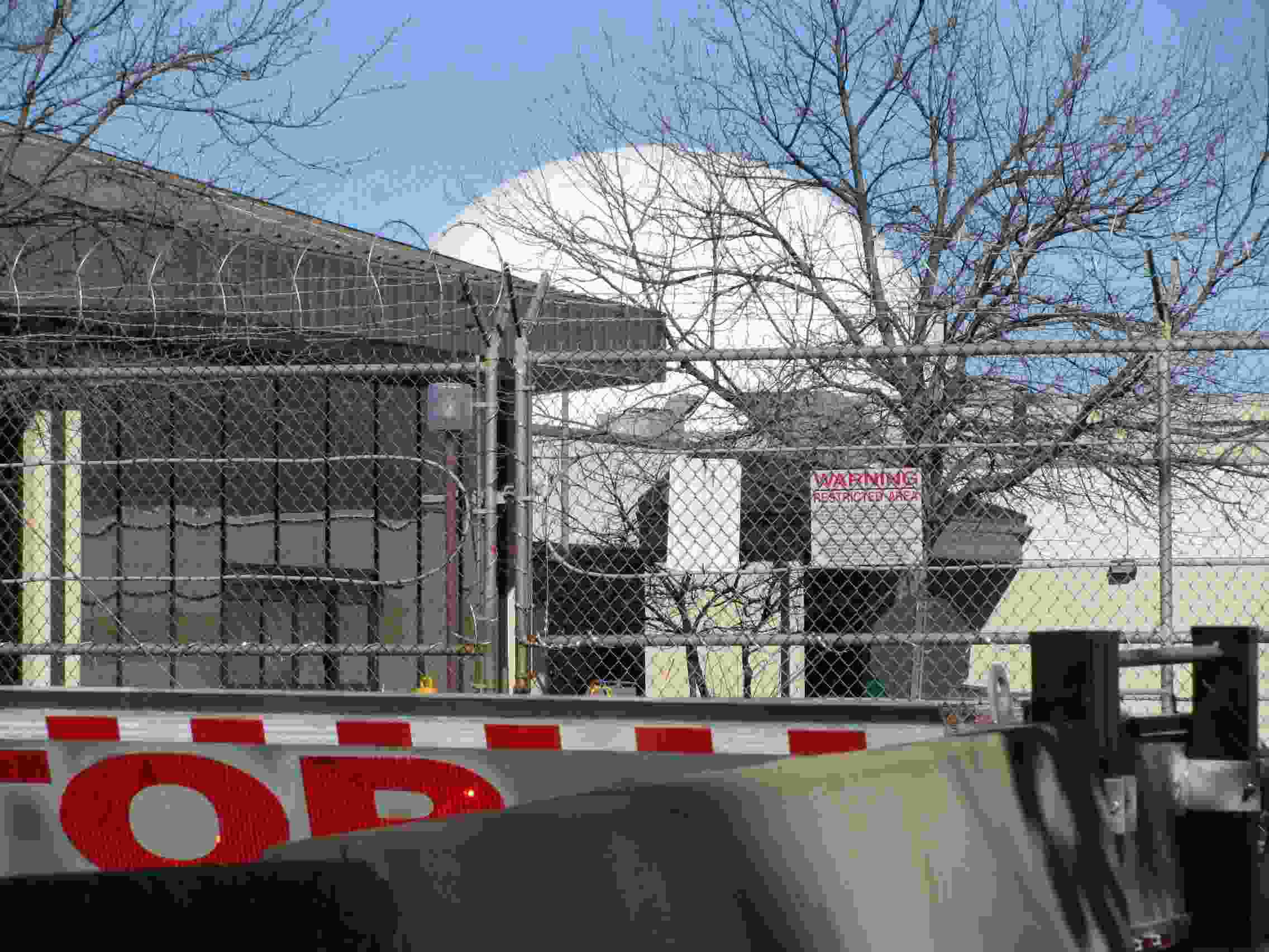
Aerospace Data Facility-East (ADF-E), also known as Area 58 and formerly known as Defense Communications Electronics Evaluation and Testing Activity (DCEETA), is one of three satellite ground stations operated by the National Reconnaissance Office (NRO) in the continental United States. Located within Fort Belvoir, Virginia, the facility is responsible for the command and control of reconnaissance satellites involved in the collection of intelligence information and for the dissemination of that intelligence to other U.S. government agencies. Function ADF East is co-located with elements of the National Geospatial-Intelligence Agency, the agency responsible for the operation of the U.S. space-based imagery constellation. Authors James Bamford and Jeffrey Richelson report that the site manages the KH-11 imagery spacecraft and the Lacrosse radar imaging spacecraft. NASA engineer Ken Young, who visited the site as part of a plan for KH-11 to photograph STS-1, described its equipmen ... [...More Info...] [...Related Items...] OR: [Wikipedia] [Google] [Baidu] |
Satellite Data System
The Satellite Data System (SDS) is a system of United States military communications satellites. At least three generations have been used: SDS-1 from 1976 to 1987; SDS-2 from 1989 to 1996; SDS-3 from 1998 to the present. It is believed that these satellites were known by the code name ''Quasar''. The first generation was named simply 'SDS', the second generation was named 'Quasar' and the third generation each had their own designations. Orbital characteristics SDS satellites have a highly elliptical orbit, going from about 300 kilometers at perigee to roughly 39,000 km at apogee in order to allow communications with polar stations that cannot contact geosynchronous satellites. The high apogee meant that the polar regions were visible for long amounts of time, and only two satellites were required in order to achieve constant communications ability. In addition, two geostationary satellites appear to be part of the system. The SDS satellites were constructed by Hughe ... [...More Info...] [...Related Items...] OR: [Wikipedia] [Google] [Baidu] |
Communications Satellite
A communications satellite is an artificial satellite that relays and amplifies radio telecommunication signals via a Transponder (satellite communications), transponder; it creates a communication channel between a source transmitter and a Radio receiver, receiver at different locations on Earth. Communications satellites are used for television, telephone, radio, internet, and military applications. Many communications satellites are in geostationary orbit above the equator, so that the satellite appears stationary at the same point in the sky; therefore the satellite dish antennas of ground stations can be aimed permanently at that spot and do not have to move to track the satellite. Others form satellite constellations in low Earth orbit, where antennas on the ground have to follow the position of the satellites and switch between satellites frequently. The radio waves used for telecommunications links travel by Line-of-sight propagation, line of sight and so are obstructe ... [...More Info...] [...Related Items...] OR: [Wikipedia] [Google] [Baidu] |


