|
Ibirapitanga
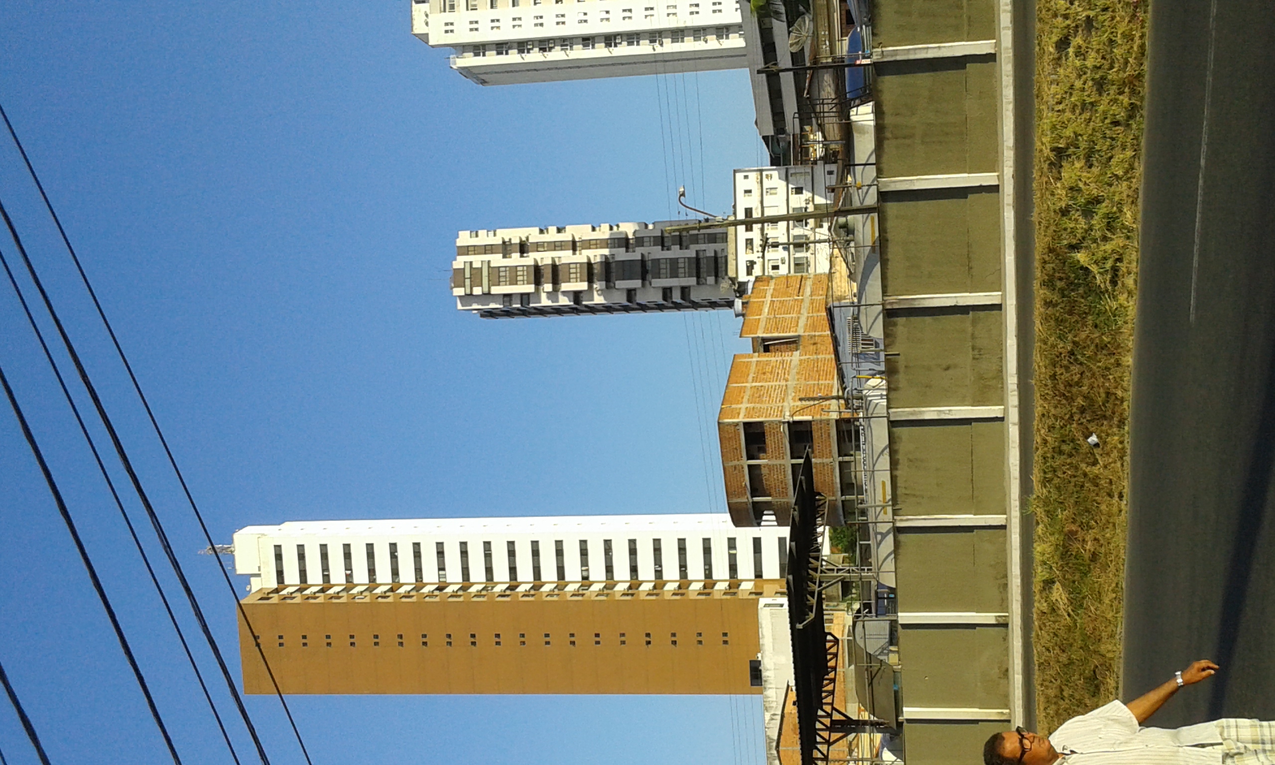
Ibirapitanga is a municipality and a town in the State of Bahia, Brazil, located inland from the coast about 45 km., United States National Geospatial-Intelligence Agency In 2020 the estimated population of the municipality was 23,404 inhabitants. History The town was founded in 1915 when José Meneses de Oliveira built his home on the banks of the Cachoeira River, and it came to be known as Cachoeira do Pau. Later the name was changed to Ibirapitanga, a word in the Tupi language for "red wood" that is, Brazilwood. The municipality was officially created in 1961, carved out of the interior portion of Camamu municipality, but came into effect in 1963. Administrative divisions Ibirapitanga municipality is divided into four parts, the headquarters town of Ibirapitanga, and the rural divisions: Itamarati, Camamuzinho and Novo Horizonte. Geography Ibirapitanga is bounded by the municipalities of Camamu to the east, Maraú to the southeast, Ubaitaba to the south, Ubatã to ... [...More Info...] [...Related Items...] OR: [Wikipedia] [Google] [Baidu] |
Camamu
Camamu is a municipality in the state of Bahia Bahia ( , , ; meaning "bay") is one of the 26 states of Brazil, located in the Northeast Region of the country. It is the fourth-largest Brazilian state by population (after São Paulo, Minas Gerais, and Rio de Janeiro) and the 5th-largest ..., Brazil. Politically, it is in the Valença subregion of the Sul Baiano region. It is located on the southern coast of Bahia state, the Costa do Dendê (Palm Coast), along the BA-001 highway. The municipality covers an area of 885.20 km², and, in a 2020 estimate, it had 35,382 inhabitants. History The region was originally inhabited by native Macamamus Indians. The name Camamu was the name of the Indians' village. In 1560 the Jesuits established a mission, that the next in year, upon completion of the chapel, was converted into a parish with the name "Aldeia de Nossa Senhora da Assunção de Macamamu". On 22 May 1693 the village was elevated to town status with the name of Camamu. ... [...More Info...] [...Related Items...] OR: [Wikipedia] [Google] [Baidu] |
Paubrasilia
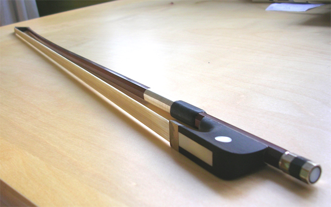
''Paubrasilia echinata'' is a species of flowering plant in the legume family, Fabaceae, that is endemic to the Atlantic Forest of Brazil. It is a Brazilian timber tree commonly known as Pernambuco wood or brazilwood ( pt, pau-de-pernambuco, ; Tupi: ) and is the national tree of Brazil. This plant has a dense, orange-red heartwood that takes a high shine, and it is the premier wood used for making bows for stringed instruments. The wood also yields a historically important red dye called brazilin, which oxidizes to brazilein. The name ''pau-brasil'' was applied to certain species of the genus '' Caesalpinia'' in the medieval period, and was given its original scientific name ''Caesalpinia echinata'' in 1785 by Jean-Baptiste Lamarck. More recent taxonomic studies have suggested that it merits recognition as a separate genus, and it was thus renamed ''Paubrasilia echinata'' in 2016. The Latin specific epithet of ''echinata'' refers to hedgehog, from ''echinus'', and describes ... [...More Info...] [...Related Items...] OR: [Wikipedia] [Google] [Baidu] |
Piraí Do Norte
Piraí do Norte is a municipality in the state of Bahia in the North-East region of Brazil. Its estimated population in 2020 was 10,036 inhabitants and is located 320 km away from the state capital. It has an area of 193.4 km². Its main source of income is cocoa culture. Etymology The term "Piraí" comes from the Tupi language, meaning "fish river", through the junction of ''pirá'' (fish) and '''y'' (river) . The expression "from the North" was added to differentiate the municipality of the municipality of Piraí, in the state of Rio de Janeiro . Origin Old Piraí do Norte Chapel, the municipality of Piraí do Norte owes its appearance to the choice of its area as a stopping point for troops transporting various items from the cities located on the coast, especially Santarém and Valença. Because of the dangers of traveling at night, it was more prudent to stay overnight in the ranch and continue the following day's trip. The adoption of this village as ... [...More Info...] [...Related Items...] OR: [Wikipedia] [Google] [Baidu] |
Maraú
Maraú is a municipality in the state of Bahia in the North-East region of Brazil. . The municipality is located in a peninsula called "Península de Maraú", physiographic area called "Região Cacaueira" (cocoa region). The city is rich in minerals, especially oil shale gypsum and oil. History The town originally called "''Mayrahú''" was an Indian village called "''Mayra''". No one knows about the disappearance of the Indian tribe, nor to which branch it belonged. The area was discovered in 1705 by Italian Capuchin friars who named it "''São Sebastião de Mayrahú''" (St. Sebastian of Mayrahú). In 1938 it became a city. Maraú has beautiful beaches of rare beauty and clear water surrounds most of its villages. It also has dozens of islands, waterfalls, mangroves ... Its best-known villages are: Barra Grande, Saquaíra, Taipus de Fora and Algodões Geography The municipality contains 49.32% of the Baía de Camamu Environmental Protection Area, created in 2002. Beaches ... [...More Info...] [...Related Items...] OR: [Wikipedia] [Google] [Baidu] |
Itabuna
Itabuna is a municipality in Bahia, Brazil. It is the 6th largest city in Bahia by population after Salvador, Feira de Santana, Camaçari, Vitória da Conquista, and Juazeiro. It had an estimated 214,123 residents in 2021. Itabuna covers a total area of and has a population density of 550 residents per square kilometer. Etymology The name "Itabuna" derives from Tupiniquim ''itáabuna'', meaning ''father of stone'' (''itá'', stone + ''abuna'', father). This name refers to a rock the Tupiniquim thought reminded them of a father and was bigger than the other stones around. History The Portuguese arrived in the 16th century. The region was inhabited by the Tupiniquim, an indigenous group of the larger Tupi people. The Portuguese established the Captaincy of Ilhéus in the region, but it failed due to attacks by the nomadic Aimoré people, who emerged from the interior of Brazil in the 1550s. Settlement began when the region served as the main crossing point for drovers head ... [...More Info...] [...Related Items...] OR: [Wikipedia] [Google] [Baidu] |
Ipiaú
Ipiaú is a city in Bahia, Brazil. It is located at around . The city is located at the confluence of the ''Contas River'' and the ''Água-Branca River'' (White-water River). Ipiaú is bordered, in counterclockwise fashion, by ''Ibirataia'' and ''Jequié Jequié is a city in the state of Bahia, Brazil. Jequié is 365 km away from Salvador Salvador, meaning "salvation" (or "saviour") in Catalan, Spanish, and Portuguese may refer to: * Salvador (name) Arts, entertainment, and media Musi ...'' to the north, ''Aiquara'' and ''Jitaúna'' to the west, ''Ibirataia'' and ''Barra do Rocha'' to the east and ''Itagibá'' to the south. The city is an important producer and exporter of Cocoa bean, cacao in Brazil. Is the birthplace of many noted Brazilian, writers and musicians, including Euclides Neto and Luiz Caldas. References Municipalities in Bahia {{bahia-geo-stub ... [...More Info...] [...Related Items...] OR: [Wikipedia] [Google] [Baidu] |
Igrapiúna
Igrapiúna is a municipality in the state of Bahia in the North-East region of Brazil. The municipality contains 2.52% of the Baía de Camamu Environmental Protection Area, created in 2002. See also *List of municipalities in Bahia This is a list of the municipalities in the state of Bahia (BA), located in the Northeast Region of Brazil. Bahia is divided into 417 municipalities, which are grouped into 32 microregions, which are grouped into 7 mesoregions. See also * ... References Populated coastal places in Bahia Municipalities in Bahia {{Bahia-geo-stub ... [...More Info...] [...Related Items...] OR: [Wikipedia] [Google] [Baidu] |
Gandu
Gandu is a municipality in the state of Bahia in the North-East region of Brazil. Gandu covers , and has a population of 32,596 with a population density of 125 inhabitants per square kilometer. Gandu has its origin as Fazenda Corujão, a farm purchased in 1912 by José Amado Costa for the cultivation of cocoa Cocoa may refer to: Chocolate * Chocolate * ''Theobroma cacao'', the cocoa tree * Cocoa bean, seed of ''Theobroma cacao'' * Chocolate liquor, or cocoa liquor, pure, liquid chocolate extracted from the cocoa bean, including both cocoa butter and .... Corujão became a district of the municipality of Ituberá in 1958, and an independent municipality on July 18, 1962. Notable people * Alejandro Aragao Da Cruz References Municipalities in Bahia {{Bahia-geo-stub ... [...More Info...] [...Related Items...] OR: [Wikipedia] [Google] [Baidu] |
Ubatã
Ubatã is a Municipalities of Brazil, municipality in the states of Brazil, state of Bahia in the Nordeste, North-East region of Brazil. See also *List of municipalities in Bahia References Municipalities in Bahia {{Bahia-geo-stub ... [...More Info...] [...Related Items...] OR: [Wikipedia] [Google] [Baidu] |
Ubaitaba
Ubaitaba is a municipality in the state of Bahia in the North-East region of Brazil. See also *List of municipalities in Bahia This is a list of the municipalities in the state of Bahia (BA), located in the Northeast Region of Brazil. Bahia is divided into 417 municipalities, which are grouped into 32 microregions, which are grouped into 7 mesoregions. See also * ... References Municipalities in Bahia {{Bahia-geo-stub ... [...More Info...] [...Related Items...] OR: [Wikipedia] [Google] [Baidu] |
Regions Of Brazil
Brazil is geopolitics, geopolitically divided into five regions (also called macroregions), by the Brazilian Institute of Geography and Statistics, which are formed by the federative units of Brazil. Although officially recognized, the division is merely academic, considering geographic, social and economic factors, among others, and has no political effects other than orientating Federal-level government programs. Under the state level, there are also mesoregions of Brazil, mesoregions and microregions of Brazil, microregions. The five regions North Region *Area: 3,689,637.9 km2 (45.27%) *Population: 17,707,783 (4,6 people/km2; 6.2%; 2016) *Gross domestic product, GDP: Brazilian real, R$ 308 billion / United States dollar, US$94,8 billion (2016; 4.7%) (Economy of Brazil, 5th) *Climate: Equatorial *States: Acre (state), Acre, Amapá, Amazonas (Brazilian state), Amazonas, Pará, Rondônia, Roraima, Tocantins (state), Tocantins *Largest Cities: Manaus (2,094,391); Bel ... [...More Info...] [...Related Items...] OR: [Wikipedia] [Google] [Baidu] |
States Of Brazil
The federative units of Brazil ( pt, unidades federativas do Brasil) are subnational entities with a certain degree of autonomy (self-government, self-regulation and self-collection) and endowed with their own government and constitution, which together form the Federative Republic of Brazil. There are 26 states (') and one federal district ('). The states are generally based on historical, conventional borders which have developed over time. The states are divided into municipalities, while the Federal District assumes the competences of both a state and a municipality. Government The government of each state of Brazil is divided into executive, legislative and judiciary branches. The state executive branch is headed by a state governor and includes a vice governor, both elected by the citizens of the state. The governor appoints several secretaries of state (each one in charge of a given portfolio) and the state attorney-general. The state legislative branch is the legi ... [...More Info...] [...Related Items...] OR: [Wikipedia] [Google] [Baidu] |


