|
I-69C (TX)
Interstate 69C (I-69C) is a north–south Interstate Highway running through South Texas. Once complete, the freeway (with connections to both Mexican Federal Highway 40, Federal Highway 40 and Mexican Federal Highway 97, Federal Highway 97) will begin at Interstate 2, I-2/U.S. Route 83 in Texas, U.S. Highway 83 (US 83) in Pharr, Texas, Pharr and head northward before terminating at Interstate 69W, I-69W/U.S. Route 59 in Texas, US 59 in George West, Texas, George West near Interstate 37, I-37. For its entire length, I-69C is concurrency (road), concurrent with U.S. Route 281 in Texas, US 281. , only an segment has been completed at the route's southern terminus in Pharr. Route description I-69C begins at a partially-completed stack interchange with Interstate 2, I-2/U.S. Route 83 in Texas, US 83 and North Cage Boulevard (U.S. Route 281 in Texas, US 281) in the northern part of Pharr, Texas, Pharr. , I-69C only has direct connections ... [...More Info...] [...Related Items...] OR: [Wikipedia] [Google] [Baidu] |
Pharr, Texas
Pharr is a city in Hidalgo County, Texas, United States. As of the 2020 census, the city population was 79,715, and in 2022, the estimated population was 80,187. Pharr is connected by bridge to the Mexican city of Reynosa, Tamaulipas. Pharr is part of the McAllen–Edinburg–Mission and Reynosa–McAllen metropolitan areas. Geography Pharr is located in southern Hidalgo County at (26.206334, –98.185174). It is bordered to the west by the city of McAllen, to the north by Edinburg, the county seat, to the east by San Juan, and to the southwest by Hidalgo. The Pharr city limits extend south in a narrow band to the Rio Grande and the Pharr–Reynosa International Bridge into Mexico. According to the United States Census Bureau, Pharr has a total area of , of which , or 0.12%, is covered by water. Communities: * Las Milpas (annexed in 1987) History The community was named after sugar planter Henry Newton Pharr (1872-1966). For a number of years, centering around ear ... [...More Info...] [...Related Items...] OR: [Wikipedia] [Google] [Baidu] |
One-way Couplet
A one-way pair, one-way couple, or couplet refers to that portion of a bi-directional traffic facilitysuch as a road, bus, streetcar, or light rail linewhere its opposing flows exist as two independent and roughly parallel facilities. Description In the context of roads, a one-way pair consists of two one-way streets whose flows combine on one or both ends into a single two-way street. The one-way streets may be separated by just a single block, such as in a grid network, or may be spaced further apart with intermediate parallel roads. One use of a one-way pair is to increase the vehicular capacity of a major route through a developed area such as a central business district. If not carefully treated with other traffic calming features, the benefit in vehicular capacity is offset by a potential for increased road user deaths, in particular people walking and biking. A one-way pair can be created by converting segments of two-way streets into one-way streets, which allows lane ... [...More Info...] [...Related Items...] OR: [Wikipedia] [Google] [Baidu] |
Brownsville, Texas
Brownsville ( ) is a city in the U.S. state of Texas and the county seat of Cameron County, Texas, Cameron County, located on the western Gulf Coast in South Texas, adjacent to the Mexico–United States border, border with Matamoros, Tamaulipas, Mexico. The city covers , and had a population of 186,738 at the 2020 United States Census, 2020 census. As of the 2020 U.S. Census, it is the List of United States cities by population, 136th-most populous city in the United States and List of cities in Texas by population, 18th-most populous in Texas. It is part of the Matamoros–Brownsville metropolitan area. The city is known for its year-round subtropical climate, deep-water seaport, and Hispanic culture. The city was founded in 1848 by American entrepreneur Charles Stillman after he developed a successful river-boat company nearby. It was named for Fort Brown, itself named after Major Jacob Brown (Texas soldier), Jacob Brown, who fought and died while serving as a United States Ar ... [...More Info...] [...Related Items...] OR: [Wikipedia] [Google] [Baidu] |
Interstate 69E
Interstate 69E (I-69E) is a north–south Interstate Highway running through South Texas. Once complete, the freeway will begin in Brownsville and head northward before terminating near Victoria as both I-69W and I-69E merge into I-69 toward Houston. For its entire length, I-69E runs concurrently with U.S. Highway 77 (US 77). The route currently exists in two segments: a segment from its southern terminus in Brownsville to the Willacy– Kenedy county line and a shorter segment south of Corpus Christi. The route has one auxiliary Interstate route, I-169 in Brownsville. Route description I-69E begins at an at-grade intersection just north of the Veterans International Bridge at Los Tomates in Brownsville. I-69E has a concurrency with US 77. I-69E intersects the eastern terminus of I-2 in Harlingen. After leaving Brownsville–Matamoros, I-69E temporarily ends and becomes US 77, a four-lane expressway. Another piece of I-69E picks up in Kin ... [...More Info...] [...Related Items...] OR: [Wikipedia] [Google] [Baidu] |
KVEO-TV
KVEO-TV (channel 23) is a television station licensed to Brownsville, Texas, United States, serving the Lower Rio Grande Valley as an affiliate of NBC and CBS. It is owned by Nexstar Media Group alongside Harlingen-licensed KGBT-TV (channel 4), which airs Antenna TV and MyNetworkTV. The two stations share studios on West Expressway ( I-2/ US 83) in Harlingen; KVEO-TV's transmitter is located in Santa Maria, Texas. KVEO-TV was the third major commercial station to start in the Rio Grande Valley, beginning broadcasting on December 19, 1981. It immediately became the full-time NBC affiliate in the market. Its original ownership was rocked by financial problems and connections to a failed bank; it emerged from bankruptcy in 1984. Two attempts at local newscasts (1981–1982 and 1985–1986) lasted less than two years each. The station was sold to what became Communications Corporation of America (ComCorp) in 1990. ComCorp began airing local news programming on the station aga ... [...More Info...] [...Related Items...] OR: [Wikipedia] [Google] [Baidu] |
Lower Rio Grande Valley
Lower Rio Grande Valley (), often referred to as the Rio Grande Valley (RGV) of South Texas, is a region located in the southernmost part of Texas, along the northern bank of the Rio Grande. It is also known locally as the Valley or the 956 (the area code for the region). It is a region spanning the border of Texas and Mexico located in a floodplain of the Rio Grande near its mouth. The region includes the southernmost tip of South Texas and a portion of northern Tamaulipas, Mexico. In the United States, it consists of the Brownsville-Harlingen and McAllen-Edinburg-Mission metropolitan areas, and the Rio Grande City-Roma and Raymondville micropolitan areas. In Mexico, it consists of the Matamoros, Río Bravo, and Reynosa metropolitan areas. The area is generally bilingual in English and Spanish, with a fair amount of Spanglish due to the region's diverse history and transborder agglomerations. It is home to some of the poorest cities in the nation, as well as many unincorpo ... [...More Info...] [...Related Items...] OR: [Wikipedia] [Google] [Baidu] |
Federal Highway Administration
The Federal Highway Administration (FHWA) is a division of the United States Department of Transportation that specializes in highway transportation. The agency's major activities are grouped into two programs, the Federal-aid Highway Program and the Federal Lands Highway Program. Its role had previously been performed by the Office of Road Inquiry, Office of Public Roads and the Bureau of Public Roads. History Background With the coming of the bicycle in the 1890s, interest grew regarding the improvement of streets and roads in America. The traditional method of putting the burden on maintaining roads on local landowners was increasingly inadequate. In 1893, the federal Office of Road Inquiry (ORI) was founded; in 1905, it was renamed the Office of Public Roads (OPR) and made a division of the United States Department of Agriculture. Demands grew for local and state government to take charge. With the coming of the automobile, urgent efforts were made to upgrade and moderniz ... [...More Info...] [...Related Items...] OR: [Wikipedia] [Google] [Baidu] |
Live Oak Courthouse
Live may refer to: Arts, entertainment, and media Films * ''Live!'' (2007 film), 2007 American film * ''Live'' (2014 film), a 2014 Japanese film * ''Live'' (2023 film), a Malayalam-language film *'' Live: Phát Trực Tiếp'', a Vietnamese-language film * ''Live'' (Apocalyptica DVD) Music *Live (band), American alternative rock band * List of albums titled ''Live'' Extended plays * ''Live EP'' (Anal Cunt album) * ''Live EP'' (Breaking Benjamin EP) * ''Live'' (Roxus EP) * ''Live'' (The Smithereens EP) *''CeCe Peniston (EP Live)'' *'' Ozzy Osbourne Live E.P.'', 1980 *''Live EP (Live at Fashion Rocks)'', by David Bowie * ''Live EP'' (The Jam EP) Songs * "Live" (Russian song) * "Live" (Superfly song) * "Live" (The Merry-Go-Round song) *"Live", by B'z from ''Highway X'', 2022 Radio *BBC Radio 5 Live *CILV-FM, branded LiVE 88.5, a radio station in Ottawa, Canada Television * ''Live'' (South Korean TV series), a 2018 South Korean television series *''Live'' (Danish TV series) *Live! ... [...More Info...] [...Related Items...] OR: [Wikipedia] [Google] [Baidu] |
Hidalgo County Courthouse
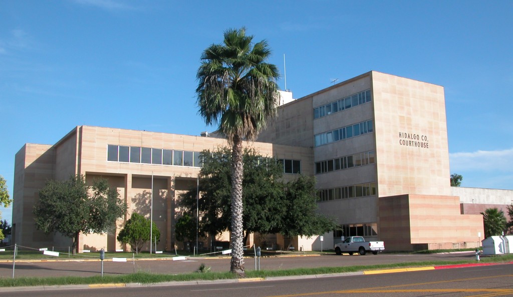
The Hidalgo County Courthouse, located at 300 S. Shakespeare St. in Lordsburg, is the county courthouse serving Hidalgo County, New Mexico. The two-story Neoclassical building, designed by architects Thorman & Frazier, was constructed in 1926. The red brick building features concrete spandrels between the first- and second-story windows and a concrete band at the top of the second-story windows. The entrance is topped by a classical pediment and flanked by pilasters with floral medallions. A metal cornice and crested parapet wrap around the building's roof line. . The courthouse was added to the National Register of Historic Places The National Register of Historic Places (NRHP) is the Federal government of the United States, United States federal government's official United States National Register of Historic Places listings, list of sites, buildings, structures, Hist ... on December 7, 1987. See also * National Register of Historic Places listings in Hidalgo County, ... [...More Info...] [...Related Items...] OR: [Wikipedia] [Google] [Baidu] |
Limited-access Road
A limited-access road, known by various terms worldwide, including limited-access highway, partial controlled-access highway, and expressway, is a highway or arterial road for high-speed traffic which has many or most characteristics of a controlled-access highway (also known as a ''freeway'' or ''motorway''), including limited or no access to adjacent property; some degree of separation of opposing traffic flow (often being dual carriageways); use of grade separated Interchange (road), interchanges to some extent; prohibition of slow modes of transport, such as bicycles, horse-drawn vehicles or ridden horses, or self-propelled agricultural machines; and very few or no intersection (road), intersecting cross-streets or level crossings. The degree of isolation from local traffic allowed varies between countries and regions. The precise definition of these terms varies by jurisdiction.''Manual on Uniform Traffic Control Devices''Section 1A.13 Definitions of Words and Phrases in This ... [...More Info...] [...Related Items...] OR: [Wikipedia] [Google] [Baidu] |
Farm To Market Road 490
A farm (also called an agricultural holding) is an area of land that is devoted primarily to agricultural processes with the primary objective of producing food and other crops; it is the basic facility in food production. The name is used for specialized units such as arable farms, vegetable farms, fruit farms, dairy, pig and poultry farms, and land used for the production of natural fiber, biofuel, and other biobased products. It includes ranches, feedlots, orchards, plantations and estates, smallholdings, and hobby farms, and includes the farmhouse and agricultural buildings as well as the land. In modern times, the term has been extended to include such industrial operations as wind farms and fish farms, both of which can operate on land or at sea. There are about 570 million farms in the world, most of which are small and family-operated. Small farms with a land area of fewer than 2 hectares operate on about 12% of the world's agricultural land, and family farms compris ... [...More Info...] [...Related Items...] OR: [Wikipedia] [Google] [Baidu] |
Faysville, Texas
Faysville is a former census-designated place (CDP) in Hidalgo County, Texas. It was annexed into the city of Edinburg in 2015. The population was 439 at the 2010 United States Census. It is part of the McAllen– Edinburg– Mission Metropolitan Statistical Area. Geography Faysville is located at (26.408564, -98.137947). According to the United States Census Bureau, the CDP has a total area of , all land. Demographics Faysville first appeared as a census designated place in the 2000 U.S. Census. It was absorbed by the city of Edinburg prior to the 2020 U.S. Census. 2010 census 2000 census As of the census of 2000, there were 348 people, 95 households, and 81 families residing in the CDP. The population density was . There were 108 housing units at an average density of . The racial makeup of the CDP was 63.22% White, 35.63% from other races, and 1.15% from two or more races. Hispanic or Latino of any race were 99.14% of the population. There were 95 hous ... [...More Info...] [...Related Items...] OR: [Wikipedia] [Google] [Baidu] |


