|
Hurricane Igor
Hurricane Igor was a very large Cape Verde hurricane and the most destructive tropical cyclone on record to strike the Canadian island of Newfoundland. It originated from a broad area of low pressure that moved off the western coast of Africa on September 6, 2010. Tracking slowly westward, it developed into a tropical depression on September 8 and strengthened into a tropical storm shortly thereafter. Higher wind shear temporarily halted intensification over the following days. On September 12, however, explosive intensification took place, and Igor reached Category 4 status on the Saffir–Simpson hurricane wind scale. By this time, Igor had already begun a prolonged turn around the western periphery of the subtropical ridge. After becoming the strongest cyclone of the season, with maximum sustained winds of 155 mph (250 km/h), it began to enter an area for continued strengthening. Igor gradually weakened before brushing Bermuda as a minimal hurrica ... [...More Info...] [...Related Items...] OR: [Wikipedia] [Google] [Baidu] |
Lesser Antilles
The Lesser Antilles ( es, link=no, Antillas Menores; french: link=no, Petites Antilles; pap, Antias Menor; nl, Kleine Antillen) are a group of islands in the Caribbean Sea. Most of them are part of a long, partially volcanic island arc between the Greater Antilles to the north-west and the continent of South America."West Indies." ''Merriam-Webster's Geographical Dictionary'', 3rd ed. 2001. () Springfield, MA: Merriam-Webster Inc., p. 1298. The islands of the Lesser Antilles form the eastern boundary of the Caribbean Sea where it meets the Atlantic Ocean. Together, the Lesser Antilles and the Greater Antilles make up the Antilles. (Somewhat confusingly, the word Caribbean is sometimes used to refer only to the Antilles, and sometimes used to refer to a much larger region.) The Lesser and Greater Antilles, together with the Lucayan Archipelago, are collectively known as the West Indies. History after European arrival The Spanish were the first Europeans to arrive o ... [...More Info...] [...Related Items...] OR: [Wikipedia] [Google] [Baidu] |
Swell (ocean)
A swell, also sometimes referred to as ground swell, in the context of an ocean, sea or lake, is a series of mechanical waves that propagate along the interface between water and air under the predominating influence of gravity, and thus are often referred to as surface gravity waves. These surface gravity waves have their origin as wind waves, but are the consequence of dispersion of wind waves from distant weather systems, where wind blows for a duration of time over a fetch of water, and these waves move out from the source area at speeds that are a function of wave period and length. More generally, a swell consists of wind-generated waves that are not greatly affected by the local wind at that time. Swell waves often have a relatively long wavelength, as short wavelength waves carry less energy and dissipate faster, but this varies due to the size, strength, and duration of the weather system responsible for the swell and the size of the water body, and varies from event ... [...More Info...] [...Related Items...] OR: [Wikipedia] [Google] [Baidu] |
Ridge (meteorology)
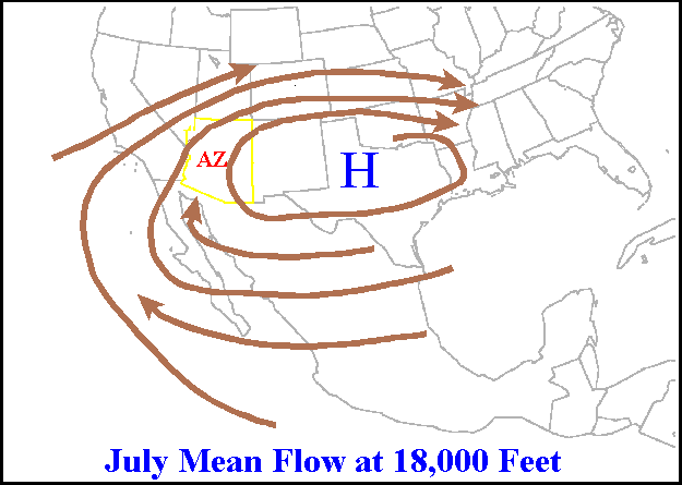
A ridge or barometric ridge is a term in meteorology describing an elongated area of relatively high atmospheric pressure compared to the surrounding environment, without being a closed circulation. It is associated with an area of maximum anticyclonic curvature of wind flow. The ridge originates in the center of an anticyclone and sandwiched between two low-pressure areas, and the locus of the maximum curvature is called the ''ridge line''. This phenomenon is the opposite of a trough. Description Ridges can be represented in two ways: * On surface weather maps, the pressure isobars form contours where the maximum pressure is found along the axis of the ridge. * In upper-air maps, geopotential height isohypses form similar contours where the maximum defines the ridge. Related weather Given the direction of the winds around an anticyclonic circulation and the fact that weather systems move from west to east: *ahead of an upper-ridge, the airflow that comes from the polar ... [...More Info...] [...Related Items...] OR: [Wikipedia] [Google] [Baidu] |
Monsoon Trough
The monsoon trough is a portion of the Intertropical Convergence Zone in the Western Pacific,Bin WangThe Asian Monsoon.Retrieved 2008-05-03. as depicted by a line on a weather map showing the locations of minimum sea level pressure, and as such, is a convergence zone between the wind patterns of the southern and northern hemispheres. Westerly monsoon winds lie in its equatorward portion while easterly trade winds exist poleward of the trough. Right along its axis, heavy rains can be found which usher in the peak of a location's respective rainy season. As it passes poleward of a location, hot and dry conditions develop. The monsoon trough plays a role in creating many of the world's rainforests. The term ''monsoon trough'' is most commonly used in monsoonal regions of the Western Pacific such as Asia and Australia. The migration of the ITCZ/monsoon trough into a landmass heralds the beginning of the annual rainy season during summer months. Depressions and tropical cyclones ofte ... [...More Info...] [...Related Items...] OR: [Wikipedia] [Google] [Baidu] |
Gale
A gale is a strong wind; the word is typically used as a descriptor in nautical contexts. The U.S. National Weather Service defines a gale as sustained surface winds moving at a speed of between 34 and 47 knots (, or ).National Weather Service Glossary s.v "gale" Forecasters typically issue s when winds of this strength are expected. In the , a gale warning is specifically a maritime warning; the land-based equivalent in ... [...More Info...] [...Related Items...] OR: [Wikipedia] [Google] [Baidu] |
Cabo Verde
, national_anthem = () , official_languages = Portuguese , national_languages = Cape Verdean Creole , capital = Praia , coordinates = , largest_city = capital , demonym = Cape Verdean or Cabo Verdean , ethnic_groups_year = 2017 , government_type = Unitary semi-presidential republic , leader_title1 = President , leader_name1 = José Maria Neves , leader_title2 = Prime Minister , leader_name2 = Ulisses Correia e Silva , legislature = National Assembly , area_rank = 166th , area_km2 = 4033 , area_sq_mi = 1,557 , percent_water = negligible , population_census = 561,901 , population_census_rank = 172nd , population_census_year = 2021 , population_density_km2 = 123.7 , population_density_sq_mi = 325.0 , population_density_rank = 89th , GDP_PPP ... [...More Info...] [...Related Items...] OR: [Wikipedia] [Google] [Baidu] |
Coordinated Universal Time
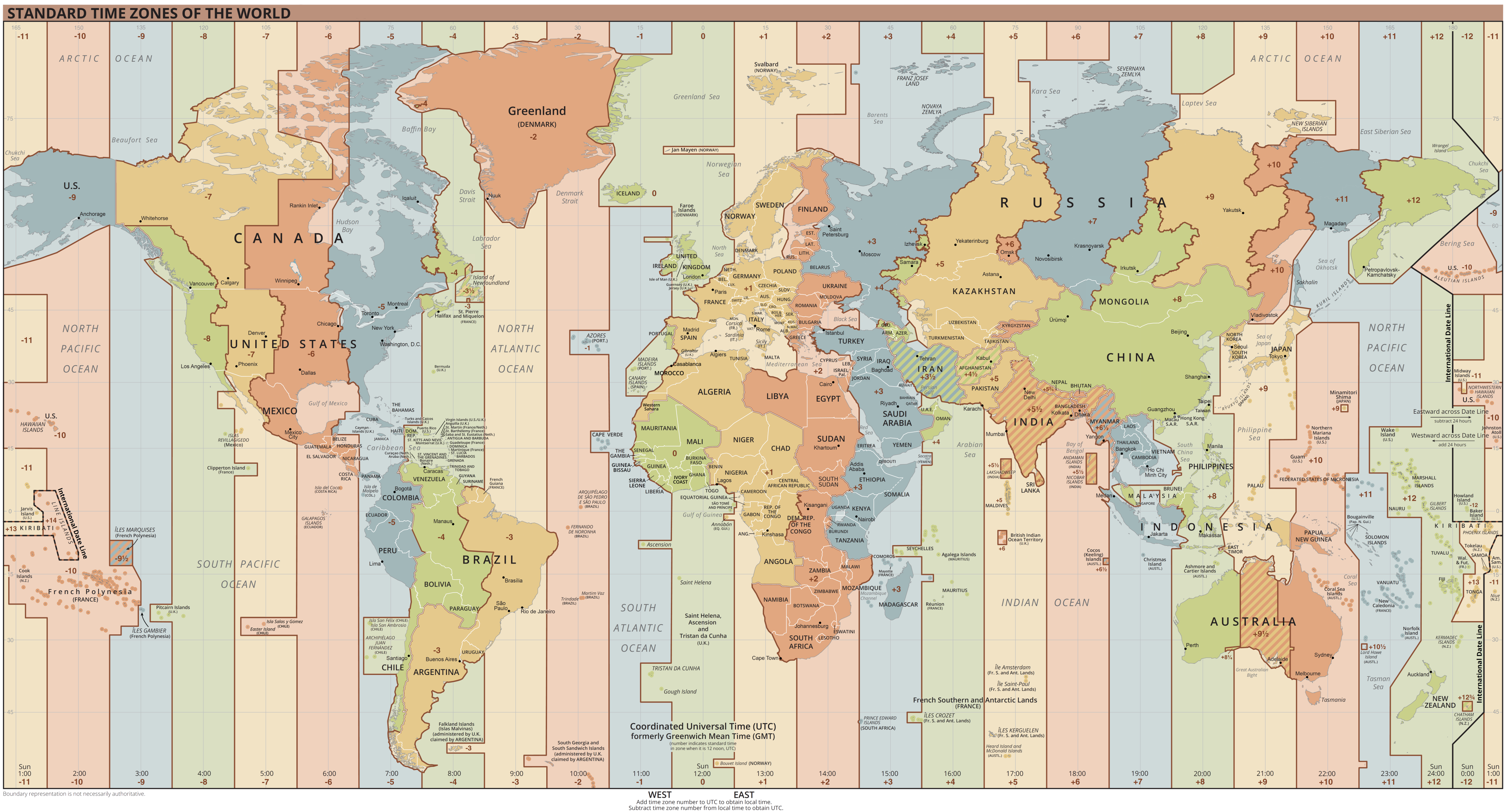
Coordinated Universal Time or UTC is the primary time standard by which the world regulates clocks and time. It is within about one second of mean solar time (such as UT1) at 0° longitude (at the IERS Reference Meridian as the currently used prime meridian) and is not adjusted for daylight saving time. It is effectively a successor to Greenwich Mean Time (GMT). The coordination of time and frequency transmissions around the world began on 1 January 1960. UTC was first officially adopted as CCIR Recommendation 374, ''Standard-Frequency and Time-Signal Emissions'', in 1963, but the official abbreviation of UTC and the official English name of Coordinated Universal Time (along with the French equivalent) were not adopted until 1967. The system has been adjusted several times, including a brief period during which the time-coordination radio signals broadcast both UTC and "Stepped Atomic Time (SAT)" before a new UTC was adopted in 1970 and implemented in 1972. This change also ... [...More Info...] [...Related Items...] OR: [Wikipedia] [Google] [Baidu] |
Atmospheric Convection
Atmospheric convection is the result of a parcel-environment instability, or temperature difference layer in the atmosphere. Different lapse rates within dry and moist air masses lead to instability. Mixing of air during the day which expands the height of the planetary boundary layer leads to increased winds, cumulus cloud development, and decreased surface dew points. Moist convection leads to thunderstorm development, which is often responsible for severe weather throughout the world. Special threats from thunderstorms include hail, downbursts, and tornadoes. Overview There are a few general archetypes of atmospheric instability that are used to explain convection (or lack thereof). A necessary (but not sufficient) condition for convection is that the environmental lapse rate (the rate of decrease of temperature with height) is steeper than the lapse rate experienced by a rising parcel of air. When this condition is met, upward-displaced air parcels can become buoyant and ... [...More Info...] [...Related Items...] OR: [Wikipedia] [Google] [Baidu] |
Tropical Cyclogenesis
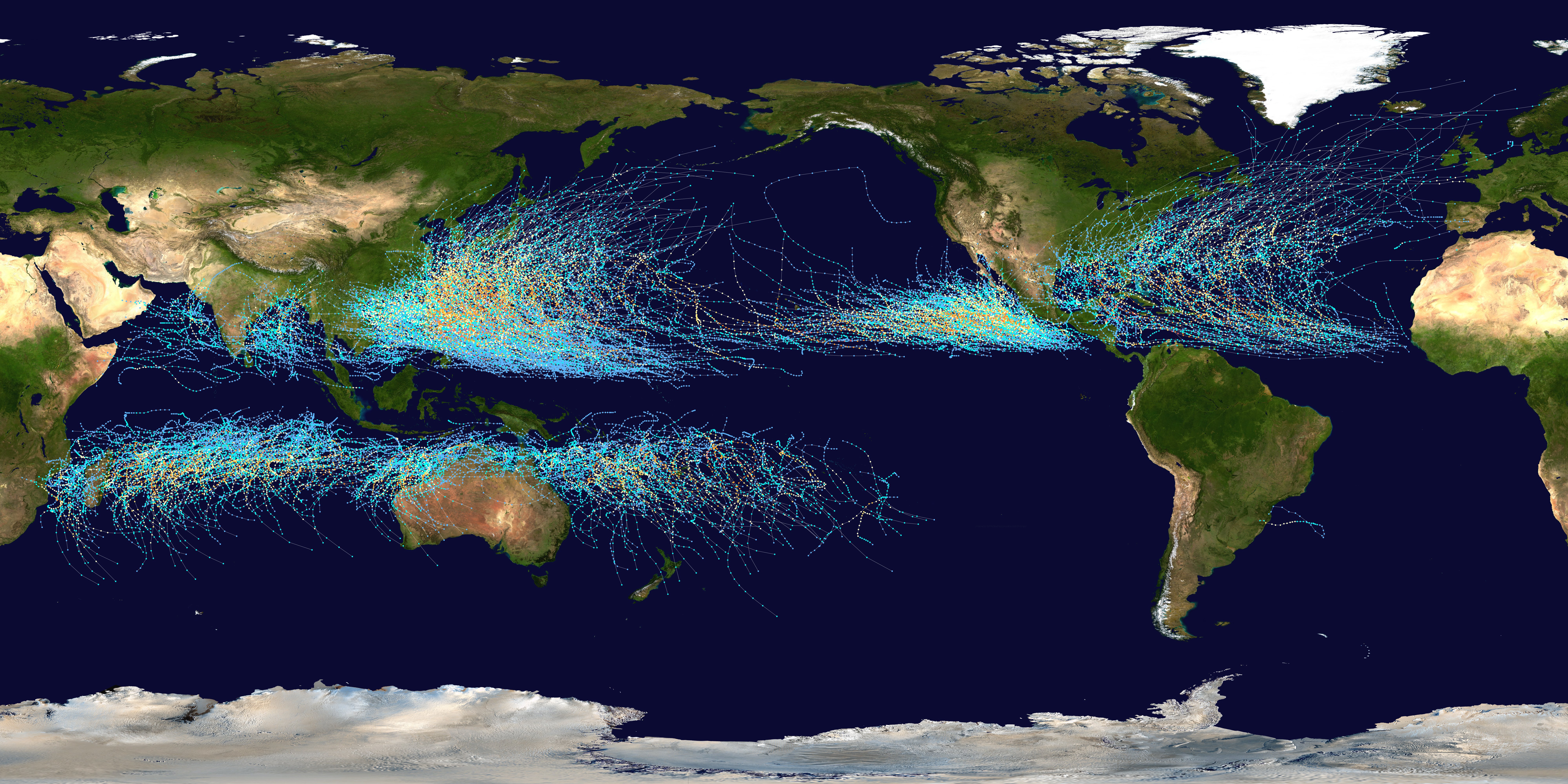
Tropical cyclogenesis is the development and strengthening of a tropical cyclone in the atmosphere. The mechanisms through which tropical cyclogenesis occurs are distinctly different from those through which temperate cyclogenesis occurs. Tropical cyclogenesis involves the development of a warm-core cyclone, due to significant convection in a favorable atmospheric environment. Tropical cyclogenesis requires six main factors: sufficiently warm sea surface temperatures (at least ), atmospheric instability, high humidity in the lower to middle levels of the troposphere, enough Coriolis force to develop a low-pressure center, a pre-existing low-level focus or disturbance, and low vertical wind shear. Tropical cyclones tend to develop during the summer, but have been noted in nearly every month in most basins. Climate cycles such as ENSO and the Madden–Julian oscillation modulate the timing and frequency of tropical cyclone development. There is a limit on tropical cyclo ... [...More Info...] [...Related Items...] OR: [Wikipedia] [Google] [Baidu] |
Tropical Wave
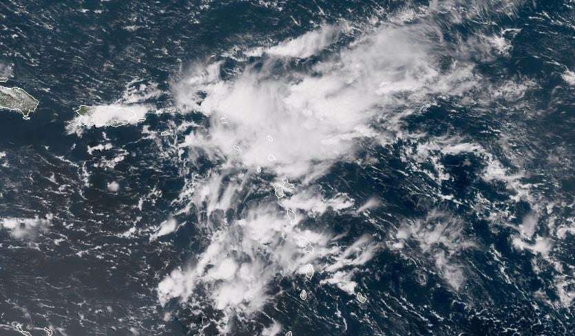
A tropical wave (also called easterly wave, tropical easterly wave, and African easterly wave), in and around the Atlantic Ocean, is a type of atmospheric trough, an elongated area of relatively low air pressure, oriented north to south, which moves from east to west across the tropics, causing areas of cloudiness and thunderstorms. Tropical waves form in the easterly flow along the equatorial side of the subtropical ridge or belt of high air pressure which lies north and south of the Intertropical Convergence Zone (ITCZ). Tropical waves are generally carried westward by the prevailing easterly winds along the tropics and subtropics near the equator. They can lead to the formation of tropical cyclones in the north Atlantic and northeastern Pacific basins. A tropical wave study is aided by Hovmöller diagrams, a graph of meteorological data. West-moving waves can also form from the tail end of frontal zones in the subtropics and tropics, and may be referred to as easterly wav ... [...More Info...] [...Related Items...] OR: [Wikipedia] [Google] [Baidu] |
Land Forces Atlantic Area
The 5th Canadian Division is a formation of the Canadian Army responsible for the command and mobilization of most army units in the provinces of New Brunswick, Nova Scotia, Prince Edward Island and Newfoundland and Labrador; as well as some units in Kingston, Ontario. The division is recognized by the distinctive maroon patch worn on the sleeve of its soldiers. It was first created as a formation of the Canadian Expeditionary Force during the First World War. It was stood down during the war only to be reactivated through the renaming from '1st Canadian Armoured Division' to the 5th Canadian (Armoured) Division during the Second World War. It was stood down following demobilization and was again reactivated in 2013 with the renaming of the former Land Force Area Atlantic. First World War The 5th Canadian Division of the Canadian Corps was formed during World War I under Major-General Garnet Burk Hughes. The 5th began assembling in Britain in February, 1917, but was broken up in ... [...More Info...] [...Related Items...] OR: [Wikipedia] [Google] [Baidu] |
National Hurricane Center
The National Hurricane Center (NHC) is the division of the United States' NOAA/National Weather Service responsible for tracking and predicting tropical weather systems between the Prime Meridian and the 140th meridian west poleward to the 30th parallel north in the northeast Pacific Ocean and the 31st parallel north in the northern Atlantic Ocean. The agency, which is co-located with the Miami branch of the National Weather Service, is situated on the campus of Florida International University in Westchester, Florida. The NHC's Tropical Analysis and Forecast Branch (TAFB) routinely issues marine forecasts, in the form of graphics and high seas forecasts year round, with the Ocean Prediction Center having backup responsibility for this unit. The Technology and Science Branch (TSB) provides technical support for the center, which includes new infusions of technology from abroad. The Chief, Aerial Reconnaissance Coordination, All Hurricanes (CARCAH) unit tasks planes, for ... [...More Info...] [...Related Items...] OR: [Wikipedia] [Google] [Baidu] |

.jpg)

