|
Hurricane Elena
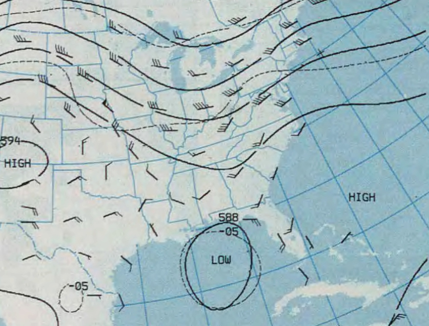
Hurricane Elena was a tropical cyclone that affected eastern and central portions of the United States Gulf Coast in late August and early September 1985. Threatening popular tourist destinations during Labor Day weekend, Elena repeatedly deviated from its forecast path, triggering evacuations of unprecedented extent. The hurricane wrought havoc to property and the environment between southwestern Florida and eastern Louisiana, though lesser effects were felt well beyond those areas. Elena developed on August 28 near Cuba, and after traveling lengthwise across the island with little impact, it entered the Gulf of Mexico and continued to strengthen. Initially projected to strike the central Gulf Coast, the hurricane unexpectedly veered toward the east on August 30, then stalled just 50 mi (80 km) west of Cedar Key, Florida. Despite predictions that Elena would continue eastward across Florida, the cyclone remained nearly stationary for about 48 hours, causing damage a ... [...More Info...] [...Related Items...] OR: [Wikipedia] [Google] [Baidu] |
1985 Atlantic Hurricane Season
The 1985 Atlantic hurricane season had six United States landfalling hurricanes, tied with 1886 and 2020 for the highest number on record. The season officially began on June 1 and lasted until November 30. It was an average season, with 11 named storms developing. This was partially attributed to a La Niña – a meteorological phenomenon that produces favorable conditions across the Atlantic basin, such as lower wind shear and higher sea surface temperatures. The first storm, Ana, developed on July 15 near Bermuda and caused minor effects in Canada while transitioning into an extratropical cyclone. Three other tropical cyclones – Claudette, Henri, and Isabel – did not significantly affect land. Claudette developed offshore of the Southeastern United States and brushed Bermuda and the Azores. Henri and Isabel were dissipating as they approached land. However, the precursor of the latter caused a severe flood in Puerto Rico that killed 180 ... [...More Info...] [...Related Items...] OR: [Wikipedia] [Google] [Baidu] |
Gulf Of Mexico
The Gulf of Mexico ( es, Golfo de México) is an ocean basin and a marginal sea of the Atlantic Ocean, largely surrounded by the North American continent. It is bounded on the northeast, north and northwest by the Gulf Coast of the United States; on the southwest and south by the Mexican states of Tamaulipas, Veracruz, Tabasco, Campeche, Yucatan, and Quintana Roo; and on the southeast by Cuba. The Southern U.S. states of Texas, Louisiana, Mississippi, Alabama, and Florida, which border the Gulf on the north, are often referred to as the " Third Coast" of the United States (in addition to its Atlantic and Pacific coasts). The Gulf of Mexico took shape approximately 300 million years ago as a result of plate tectonics.Huerta, A.D., and D.L. Harry (2012) ''Wilson cycles, tectonic inheritance, and rifting of the North American Gulf of Mexico continental margin.'' Geosphere. 8(1):GES00725.1, first published on March 6, 2012, The Gulf of Mexico basin is roughly ov ... [...More Info...] [...Related Items...] OR: [Wikipedia] [Google] [Baidu] |
Tropical Cyclone Warnings And Watches
Tropical cyclone warnings and watches are alerts issued by national weather forecasting bodies to coastal areas threatened by the imminent approach of a tropical cyclone of tropical storm or hurricane intensity. They are notices to the local population and civil authorities to make appropriate preparation for the cyclone, including evacuation of vulnerable areas where necessary. It is important that interests throughout the area of an alert make preparations to protect life and property, and do not disregard it on the strength of the detailed forecast track. Western hemisphere New tropical cyclone position and forecast information is available at least every twelve hours in the Southern Hemisphere and at least every six hours in the Northern Hemisphere from Regional Specialized Meteorological Centers and Tropical Cyclone Warning Centers. In conjunction with the National Hurricane Center, the national meteorological and hydrological services of Central America, the northern Atlan ... [...More Info...] [...Related Items...] OR: [Wikipedia] [Google] [Baidu] |
Saharan Air Layer
The Saharan Air Layer (SAL) is an extremely hot, dry and sometimes dust-laden layer of the atmosphere that often overlies the cooler, more-humid surface air of the Atlantic Ocean. It carries upwards of 60 million tonnes of dust annually over the ocean and the Americas. This annual phenomenon sometimes cools the ocean and suppresses Atlantic tropical cyclogenesis. The SAL is a subject of ongoing study and research. Its existence was first postulated in 1972. Creation The dust cloud originates in Saharan Africa and extends from the surface upwards several kilometers. As the dust drives, or is driven out over the Atlantic ocean, it is lifted above the denser marine air. This atmospheric arrangement is an inversion where the temperature actually increases with height, as the boundary between the SAL and the marine layer suppresses or "caps" any convection originating in the marine layer. Since it is dry air, the lapse rate within the SAL itself is steep, that is, the temperat ... [...More Info...] [...Related Items...] OR: [Wikipedia] [Google] [Baidu] |
Tropical Wave
A tropical wave (also called easterly wave, tropical easterly wave, and African easterly wave), in and around the Atlantic Ocean, is a type of atmospheric trough, an elongated area of relatively low air pressure, oriented north to south, which moves from east to west across the tropics, causing areas of cloudiness and thunderstorms. Tropical waves form in the easterly flow along the equatorial side of the subtropical ridge or belt of high air pressure which lies north and south of the Intertropical Convergence Zone (ITCZ). Tropical waves are generally carried westward by the prevailing easterly winds along the tropics and subtropics near the equator. They can lead to the formation of tropical cyclones in the north Atlantic and northeastern Pacific basins. A tropical wave study is aided by Hovmöller diagrams, a graph of meteorological data. West-moving waves can also form from the tail end of frontal zones in the subtropics and tropics, and may be referred to as easterly wav ... [...More Info...] [...Related Items...] OR: [Wikipedia] [Google] [Baidu] |
Ronald Reagan
Ronald Wilson Reagan ( ; February 6, 1911June 5, 2004) was an American politician, actor, and union leader who served as the 40th president of the United States from 1981 to 1989. He also served as the 33rd governor of California from 1967 to 1975, after having a career in entertainment. Reagan was born in Tampico, Illinois. He graduated from Eureka College in 1932 and began to work as a sports announcer in Iowa. In 1937, Reagan moved to California, where he found work as a film actor. From 1947 to 1952, Reagan served as the president of the Screen Actors Guild, working to root out alleged communist influence within it. In the 1950s, he moved to a career in television and became a spokesman for General Electric. From 1959 to 1960, he again served as the guild's president. In 1964, his speech "A Time for Choosing" earned him national attention as a new conservative figure. Building a network of supporters, Reagan was elected governor of California in 1966. During his go ... [...More Info...] [...Related Items...] OR: [Wikipedia] [Google] [Baidu] |
United States Dollar
The United States dollar ( symbol: $; code: USD; also abbreviated US$ or U.S. Dollar, to distinguish it from other dollar-denominated currencies; referred to as the dollar, U.S. dollar, American dollar, or colloquially buck) is the official currency of the United States and several other countries. The Coinage Act of 1792 introduced the U.S. dollar at par with the Spanish silver dollar, divided it into 100 cents, and authorized the minting of coins denominated in dollars and cents. U.S. banknotes are issued in the form of Federal Reserve Notes, popularly called greenbacks due to their predominantly green color. The monetary policy of the United States is conducted by the Federal Reserve System, which acts as the nation's central bank. The U.S. dollar was originally defined under a bimetallic standard of (0.7735 troy ounces) fine silver or, from 1837, fine gold, or $20.67 per troy ounce. The Gold Standard Act of 1900 linked the dollar solely to gold. From 1934, it ... [...More Info...] [...Related Items...] OR: [Wikipedia] [Google] [Baidu] |
Texas
Texas (, ; Spanish: ''Texas'', ''Tejas'') is a state in the South Central region of the United States. At 268,596 square miles (695,662 km2), and with more than 29.1 million residents in 2020, it is the second-largest U.S. state by both area (after Alaska) and population (after California). Texas shares borders with the states of Louisiana to the east, Arkansas to the northeast, Oklahoma to the north, New Mexico to the west, and the Mexican states of Chihuahua, Coahuila, Nuevo León, and Tamaulipas to the south and southwest; and has a coastline with the Gulf of Mexico to the southeast. Houston is the most populous city in Texas and the fourth-largest in the U.S., while San Antonio is the second most populous in the state and seventh-largest in the U.S. Dallas–Fort Worth and Greater Houston are, respectively, the fourth- and fifth-largest metropolitan statistical areas in the country. Other major cities include Austin, the second most populous s ... [...More Info...] [...Related Items...] OR: [Wikipedia] [Google] [Baidu] |
Gulfport, Mississippi
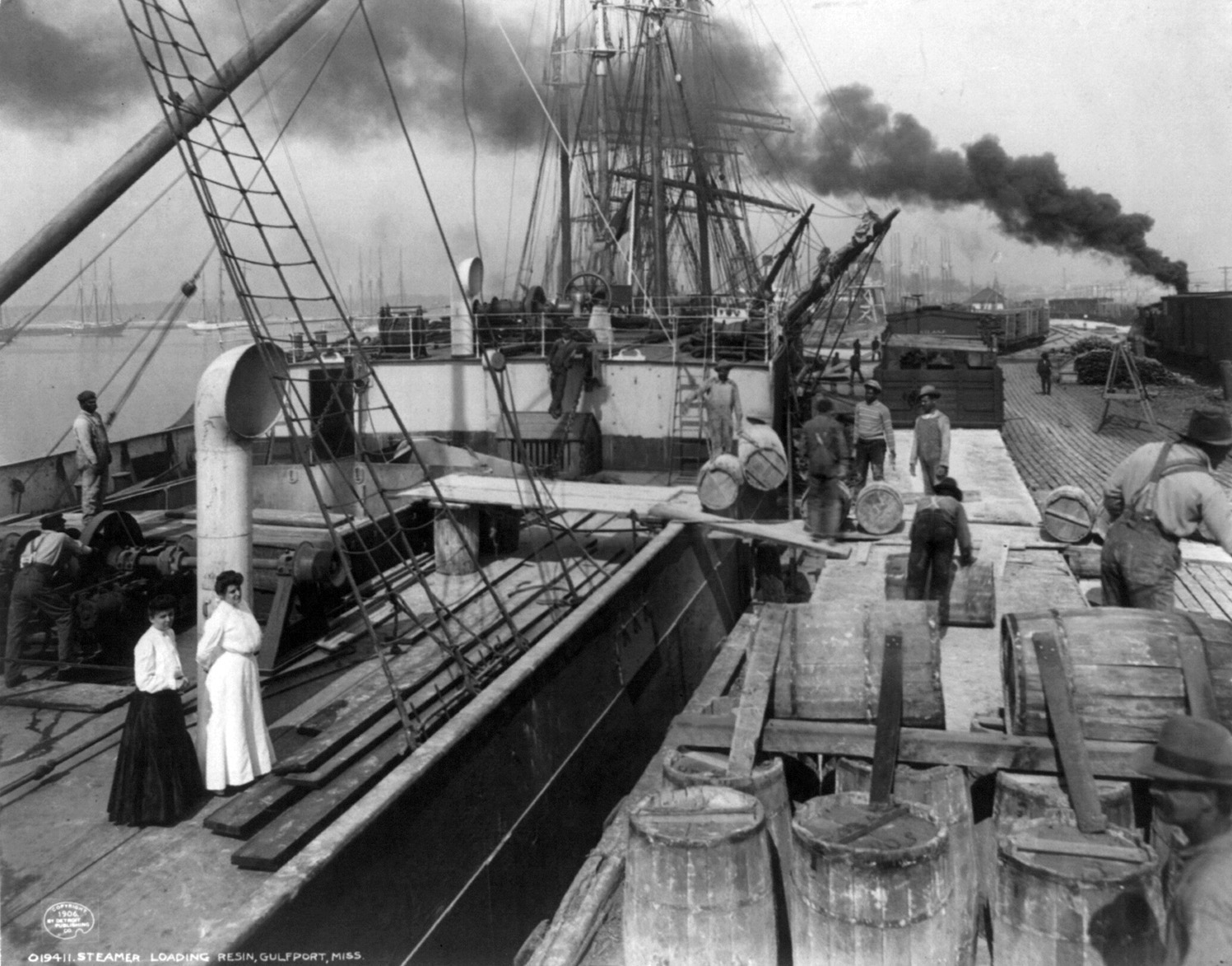
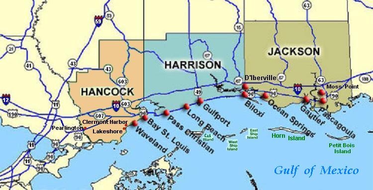
Gulfport is the second-largest city in Mississippi after the state capital, Jackson. Along with Biloxi, Gulfport is the co-county seat of Harrison County and the larger of the two principal cities of the Gulfport-Biloxi, Mississippi Metropolitan Statistical Area. As of the 2020 census, the city of Gulfport had a total population of 72,926, with 416,259 in the metro area as of 2018. It is also home to the US Navy Atlantic Fleet Seabees. History This area was occupied by indigenous cultures for thousands of years, culminating in the historic encounter between the Choctaw and the first European explorers of the area. Along the Gulf Coast, French colonists founded nearby Biloxi, and Mobile in the 18th century, well before the area was acquired from France by the United States in 1803 in the Louisiana Purchase. By the Indian Removal Act of 1830, the United States completed treaties to extinguish Choctaw and other tribal land claims and removed them to Indian Territory, now Ok ... [...More Info...] [...Related Items...] OR: [Wikipedia] [Google] [Baidu] |
Gautier, Mississippi
Gautier ( ) is a city in Jackson County, Mississippi, United States, along the Gulf of Mexico west of Pascagoula. It is part of the Pascagoula Metropolitan Statistical Area. The population was 18,572 at the 2010 census, up from 11,681 at the 2000 census. In 2002, Gautier had annexed land more than doubling its area. Gautier is a bedroom resort community surrounded by bayous and wetlands on three sides. The natural environment of Gautier offers many opportunities for recreation and eco-tourism. The Gulf Coast region, of which Gautier is a part, has been considered a relatively high growth area of the state; however, the loss of houses and jobs after Hurricane Katrina on August 29, 2005 led to outmigration in 2006. History The town takes its name from the Gautier family that originated in Lyon, France. Fernando Upton Gautier (1822–1891) was born on a cargo ship as his parents were emigrating to New Orleans. In 1867, Gautier established a spacious homestead"Ocean Springs Archiv ... [...More Info...] [...Related Items...] OR: [Wikipedia] [Google] [Baidu] |
Pascagoula, Mississippi
Pascagoula ( ) is a city in Jackson County, Mississippi, United States. It is the principal city of the Pascagoula Metropolitan Statistical Area, and is part of the Gulfport– Biloxi–Pascagoula Combined Statistical Area. The population was 22,392 at the 2010 census, down from 26,200 at the 2000 census. As of 2019 the estimated population was 21,699. It is the county seat of Jackson County. The city is served by three airports: Mobile Regional Airport, to the northeast in Alabama; Gulfport-Biloxi International Airport, about west of Pascagoula; and the Trent Lott International Airport, to the north in Jackson County. The current mayor of the city is Jay Willis. History Early history The name ''Pascagoula'', which means "bread eater", is taken from the Pascagoula, a group of Native Americans found in villages along the Pascagoula River some distance above its mouth. Hernando de Soto seems to have made the first contact with them in the 1540s, though little is kno ... [...More Info...] [...Related Items...] OR: [Wikipedia] [Google] [Baidu] |
Dauphin Island
Dauphin Island is an island town in Mobile County, Alabama, United States, on a barrier island of the same name, in the Gulf of Mexico. It incorporated in 1988. The population was 1,778 at the 2020 census, up from 1,238 at the 2010 census. The town is part of the Mobile metropolitan area. The island (originally named Massacre Island) was renamed for Louis XIV of France's great-grandson and heir, the dauphin, the future Louis XV of France. The name of the island is often mistaken as Dolphin Island; the word ''dauphin'' is French for dolphin, but historically, the term was used as the title of the heir apparent to the French monarch. The island is one of the Mississippi–Alabama barrier islands, with the Gulf of Mexico to the south, and the Mississippi Sound and Mobile Bay to the north. The island's eastern end helps define the mouth of Mobile Bay. The eastern, wider portion of the island is shaded by thick stands of pine trees and saw palmettos, but the narrow, western part of ... [...More Info...] [...Related Items...] OR: [Wikipedia] [Google] [Baidu] |


.jpg)


.jpg)


