|
Hurdlow
Hurdlow railway station was near to the hamlet of Hurdlow within Hartington Middle Quarter civil parish, to the south east of Buxton, Derbyshire on the LNWR line to Ashbourne and the south. History It opened for goods in 1833 on the Cromford and High Peak Railway from Whaley Bridge to Cromford. Passenger service began in 1856, but it closed in 1877. When it became part of the Ashbourne Line, the LNWR The London and North Western Railway (LNWR, L&NWR) was a British railway company between 1846 and 1922. In the late 19th century, the L&NWR was the largest joint stock company in the United Kingdom. In 1923, it became a constituent of the L ... opened it again in 1894. In some timetables it was listed as Hurdlow for Longnor and Monyash,; the platforms and buildings were of timber construction, as in all the stations on the line. From the summit at above sea level at Dowlow Halt the line descended at 1 in 60 to Hurdlow. From here to Ashbourne, the gradients would becom ... [...More Info...] [...Related Items...] OR: [Wikipedia] [Google] [Baidu] |
Hartington Middle Quarter
Hartington Middle Quarter is a civil parish within the Derbyshire Dales district, which is in the county of Derbyshire, England. Formerly a part of Hartington parish, for which it is named, it has a mix of a number of villages and hamlets amongst a mainly rural and undulating landscape, and is wholly within the Peak District National Park. It had a population of 379 residents in 2011. The parish is north west of London, north west of the county city of Derby, and south east of the nearest market town of Buxton. Being on the edge of the county border, it shares a boundary with the parishes of Chelmorton, Flagg, Hartington Town Quarter, Hartington Upper Quarter, Middleton and Smerrill, Monyash in Derbyshire, as well as Hollinsclough, Longnor and Sheen in Staffordshire. Geography Location Hartington Middle Quarter parish is surrounded by the following local locations: * Buxton, Chelmorton and Sterndale Moor to the north * Hartington and Pilsbury to the south * Fl ... [...More Info...] [...Related Items...] OR: [Wikipedia] [Google] [Baidu] |
Cromford And High Peak Railway
The Cromford and High Peak Railway (C&HPR) was a standard-gauge line between the Cromford Canal wharf at High Peak Junction and the Peak Forest Canal at Whaley Bridge. The railway, which was completed in 1831, was built to carry minerals and goods through the hilly rural terrain of the Peak District within Derbyshire, England. The route was marked by a number of roped worked inclines. Due to falling traffic, the entire railway was closed by 1967. The remains of the line, between Dowlow and Cromford, has now become the High Peak Trail, a route on the National Cycle Network. Background The Peak District of Derbyshire has always posed problems for travel, but from 1800 when the Peak Forest Canal was built, an alternative to the long route through the Trent and Mersey Canal was sought, not only for minerals and finished goods to Manchester, but raw cotton for the East Midlands textile industry. One scheme that had been suggested would pass via Tansley, Matlock and Bakewe ... [...More Info...] [...Related Items...] OR: [Wikipedia] [Google] [Baidu] |
Dowlow Halt Railway Station
Dowlow Halt was opened in 1920 between Dowlow (hill now largely quarried away) and Greatlow to the south east of Buxton, Derbyshire on the London and North Western Railway line to Ashbourne and the south. History The line utilised part of the Cromford and High Peak Railway (which ran from Whaley Bridge to Cromford) joining it near Hindlow and proceeding to a branch to Ashbourne at Parsley Hay. After leaving Hindlow the line began to climb at 1 in 60 through Hindlow Tunnel to Brigg's Sidings and its summit at Dowlow Halt. at the summit, this was the highest main line in England at the time. From Dowlow Halt the line travelled downhill at a gradient of 1 in 60 to Hurdlow. Brigg's Sidings served Messrs. Briggs and the Dowlow Lime and Stone Company (later Steetley, then Redland Aggregates). The halt itself was unstaffed with two short stone platforms and without buildings, since it was initially used by workmen's trains for the nearby works. It was opened for public servic ... [...More Info...] [...Related Items...] OR: [Wikipedia] [Google] [Baidu] |
High Peak Trail
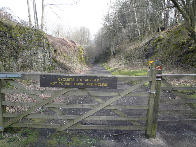
The High Peak Trail is a trail for walkers, cyclists and horse riders in the Peak District of England. Running from Dowlow , near Buxton, to High Peak Junction, Cromford , it follows the trackbed of the former Cromford and High Peak Railway, which was completed in 1831 to carry minerals and goods between the Cromford Canal wharf at High Peak Junction and the Peak Forest Canal at Whaley Bridge. Closure of the line occurred during the Beeching era, with the first section of the line closing in 1963 (i.e. the Middleton Incline) followed by full closure in 1967. In 1971 the Peak Park Planning Board and Derbyshire County Council bought the largest part of the trackbed and, in partnership with the Countryside Commission, adapted it for its current leisure use. The trail has a crushed limestone surface which makes it ideal for all users, including wheelchair use, assisted by level access onto the trail at various points along its route. The High Peak Trail is now a national ... [...More Info...] [...Related Items...] OR: [Wikipedia] [Google] [Baidu] |
Ashbourne Line
The Ashbourne line was a railway from Buxton via Ashbourne to Uttoxeter. It was built by the London and North Western Railway using a section of the Cromford and High Peak Railway (C&HPR) and it joined the North Staffordshire Railway at Ashbourne, proceeding to Uttoxeter with a junction onto the main line at Rocester. Origins Although the country between Buxton and Ashbourne was sparsely populated, and the terrain immensely difficult, there were a number of motivations for its construction. Ashbourne was one of the few large settlements in the area without a railway connection until the North Staffordshire Railway built its branch from the Churnet Valley line in 1852. Meanwhile, a lucrative trade in limestone was building up and the LNWR's only route southwards was through the Manchester area. Finally, and not least, the Midland Railway was threatening to take over the Derbyshire business through its attempts to reach Manchester from Derby via Buxton. The LNWR sought to con ... [...More Info...] [...Related Items...] OR: [Wikipedia] [Google] [Baidu] |
Cromford
Cromford is a village and civil parish in Derbyshire, England, in the valley of the River Derwent between Wirksworth and Matlock. It is north of Derby, south of Matlock and south of Matlock Bath. It is first mentioned in the 11th-century Domesday Book as ''Crumforde'', a berewick (supporting farm) of Wirksworth, and this remained the case throughout the Middle Ages. The population at the 2011 Census was 1,433. It is principally known for its historical connection with Richard Arkwright and the nearby Cromford Mill, which he built outside the village in 1771. Cromford is in the Derwent Valley Mills World Heritage Site. The Cromford mill complex, owned and being restored by the Arkwright Society, was declared by Historic England as "one of the country’s 100 irreplaceable sites". It is also the centrepiece of the Derwent Valley Mills UNESCO World Heritage Site. In 2018, the ''Cromford Mills Creative Cluster and World Heritage Site Gateway Project'' was listed as a fina ... [...More Info...] [...Related Items...] OR: [Wikipedia] [Google] [Baidu] |
Railway Stations In Great Britain Opened In 1856
Rail transport (also known as train transport) is a means of transport that transfers passengers and goods on wheeled vehicles running on rails, which are incorporated in tracks. In contrast to road transport, where the vehicles run on a prepared flat surface, rail vehicles (rolling stock) are directionally guided by the tracks on which they run. Tracks usually consist of steel rails, installed on sleepers (ties) set in ballast, on which the rolling stock, usually fitted with metal wheels, moves. Other variations are also possible, such as "slab track", in which the rails are fastened to a concrete foundation resting on a prepared subsurface. Rolling stock in a rail transport system generally encounters lower frictional resistance than rubber-tyred road vehicles, so passenger and freight cars (carriages and wagons) can be coupled into longer trains. The operation is carried out by a railway company, providing transport between train stations or freight customer facil ... [...More Info...] [...Related Items...] OR: [Wikipedia] [Google] [Baidu] |
Rth Rly Hurdlow Station Site 2015
Rth or RTH may refer to: Business * Regular trading hours * ICAO symbol for Artis (airline) * Exchange symbol for VanEck Vectors Retail, an exchange-traded fund Media * Radio y Televisión de Hidalgo, Mexico Other uses * Equivalent resistance (Rth) in Thévenin's theorem * Resistance to Thyroid Hormone * Book of Ruth * Rotterdam The Hague Airport Rotterdam The Hague Airport (formerly ''Rotterdam Airport'', ''Vliegveld Zestienhoven'' in Dutch), is a minor international airport serving Rotterdam, the Netherlands' second largest city, and The Hague, its administrative and royal capital. I ... * '' Rhyncattleanthe'' (''Rth.''), an orchid nothogenus {{disambiguation ... [...More Info...] [...Related Items...] OR: [Wikipedia] [Google] [Baidu] |
Ashbourne, Derbyshire
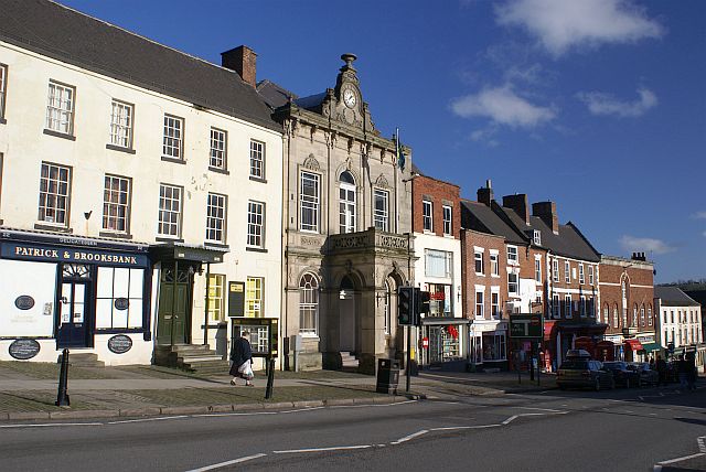
Ashbourne is a market town in the Derbyshire Dales district in Derbyshire, England. Its population was measured at 8,377 in the 2011 census and was estimated to have grown to 9,163 by 2019. It has many historical buildings and independent shops. The town offers a historic annual Shrovetide football match. Its position near the southern edge of the Peak District makes it the closest town to Dovedale, to which Ashbourne is sometimes referred to as the gateway. The town is west of Derby, south-east of Buxton, east of Stoke-on-Trent, south-south-east of Manchester, south-west of Sheffield and north of Lichfield. Nearby towns include Matlock, Uttoxeter, Leek, Cheadle and Bakewell. History The town's name derives from the Old English ''æsc-burna'' meaning "stream with ash trees". Ashbourne was granted a market charter in 1257. In medieval times it was a frequent rest stop for pilgrims walking "St Non's Way" to the shrine of Saint Fremund at Dunstable in Bedfordshire. ... [...More Info...] [...Related Items...] OR: [Wikipedia] [Google] [Baidu] |
Whaley Bridge
Whaley Bridge () is a town and civil parish in the High Peak district of Derbyshire, England. It is situated on the River Goyt, south-east of Manchester, north of Buxton, north-east of Macclesfield and west of Sheffield. It had a population of 6,455 at the 2011 census, including Furness Vale, Horwich End, Bridgemont, Fernilee, Stoneheads and Taxal. History There is evidence of prehistoric activity in the area, including early Bronze Age standing stones, burial sites and the remains of a stone circle. A bronze-age axe head was discovered in 2005. There has long been speculation that the 'Roosdyche', a complex of banks and ditches on the eastern side of the town, is of prehistoric human origin, but investigations in 1962 concluded that it was formed by glacial meltwater. The name of ''Weyley'' or ''Weylegh'' appears in many 13th-century documents and is derived from the Anglo Saxon ''weg lēah'', meaning 'a clearing by the road'. In 1351, the lands of Weyley and Yeardsley wer ... [...More Info...] [...Related Items...] OR: [Wikipedia] [Google] [Baidu] |
Derbyshire Dales
Derbyshire Dales ( ) is a local government district in Derbyshire, England. The population at the 2011 Census was 71,116. Much of it is in the Peak District, although most of its population lies along the River Derwent. The borough borders the districts of High Peak, Amber Valley, North East Derbyshire and South Derbyshire in Derbyshire, Staffordshire Moorlands and East Staffordshire in Staffordshire and Sheffield in South Yorkshire. The district also lies within the Sheffield City Region, and the district council is a non-constituent partner member of the Sheffield City Region Combined Authority. A significant amount of the working population is employed in Sheffield and Chesterfield. The district offices are at Matlock Town Hall in Matlock. It was formed on 1 April 1974, originally under the name of West Derbyshire. The district adopted its current name on 1 January 1987. The district was a merger of Ashbourne, Bakewell, Matlock and Wirksworth urban districts ... [...More Info...] [...Related Items...] OR: [Wikipedia] [Google] [Baidu] |


