|
Hulu Perak
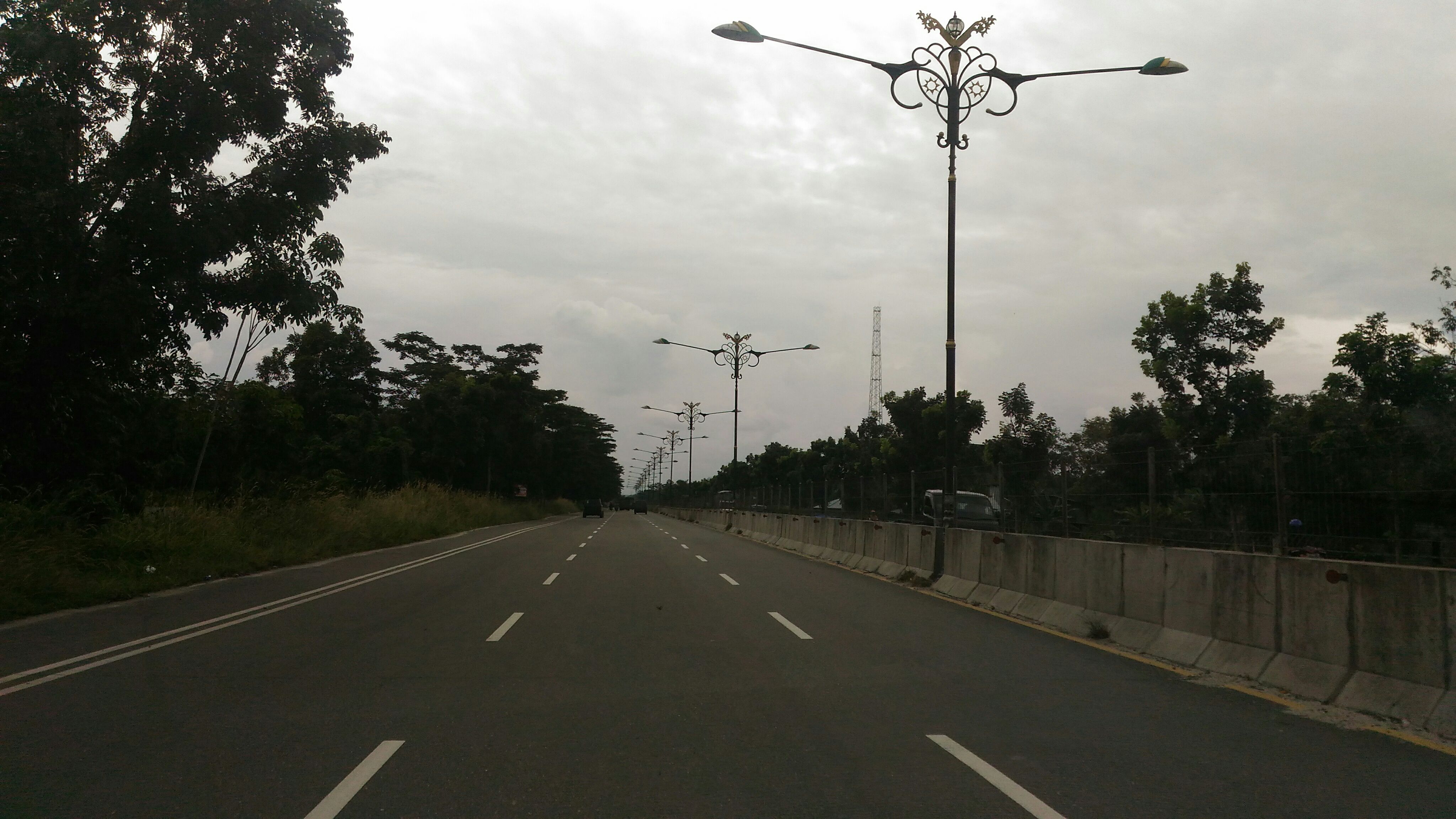
Hulu Perak District (Upper Perak) is a district in Perak, Malaysia. As the largest district in Perak, there are border to the east of the district is the state of Kelantan, to the west is Kedah, to the south is the district of Kuala Kangsar while to the south-west is the district of Larut, Matang and Selama. Hulu Perak also shares a border with Betong District of Thailand. The seat of the district is Gerik, which is also the largest town of the district. The highest point of the district is located at Titiwangsa Mountains, with 1,533 m high Ulu Titi Basah peak near the Thai/Malaysian border, and Temenggor Lake. History In 1511, after the fall of the Malacca Sultanate to the Portuguese, Sultan Mahmud Shah retreated and established his government in Bentan. In 1526 the Portuguese attacked his domain again and forced him to retreat to Kampar and to establish his rule there. At that time, Tun Saban had moved to Upper Patani and stayed at Beredung Budi. He then moved to Belum ... [...More Info...] [...Related Items...] OR: [Wikipedia] [Google] [Baidu] |
Temenggor Lake
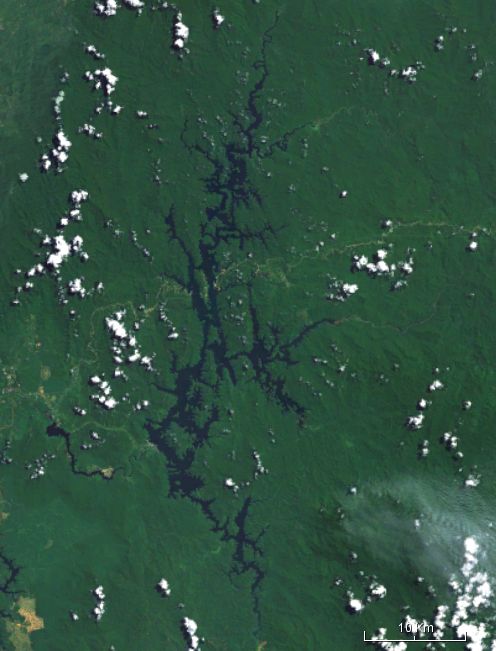
Temenggor Lake ( ms, Tasik Temenggor) is a lake in Hulu Perak District, Perak, Malaysia. It is the second largest lake in Peninsular Malaysia after Kenyir Lake in Hulu Terengganu District, Terengganu. This man-made lake is located south of 1,533 m high Ulu Titi Basah peak. It was created after the construction of Temenggor Dam to generate electric power. The lake is located about 45 km from the Hulu Perak district capital, Gerik. There is a man-made island, Banding Island (Pulau Banding) and Lake Temenggor Bridge on the East-West Highway which crosses the lake. Recreational activity The Perak Fisheries Department is tasked with implementing the Temenggor Lake Management Plan. Lake Temenggor is divided into Conservation Zones, Recreational Fishing Zones and Commercial Zones. The Conservation Zone covers the northern part of Temenggor Lake as the Sungai Kejar, Sungai Tiang and Sungai Gadong. Freshwater fishing culture Lake Temenggor was developed as a freshwater fis ... [...More Info...] [...Related Items...] OR: [Wikipedia] [Google] [Baidu] |
Jawi Alphabet
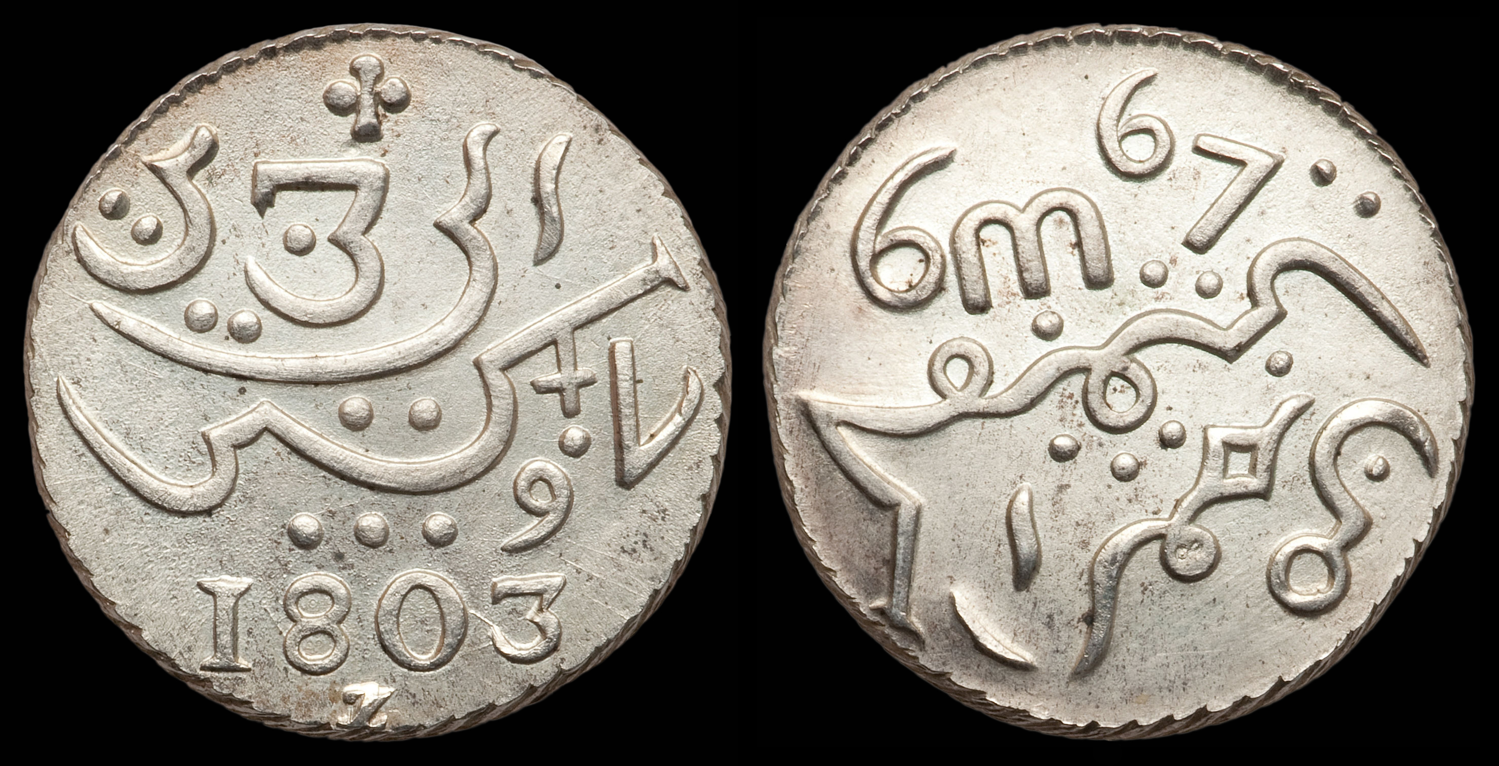
Jawi (; ace, Jawoë; Kelantan-Pattani: ''Yawi''; ) is a writing system used for writing several languages of Southeast Asia, such as Acehnese, Banjarese, Kerinci, Maguindanaon, Malay, Minangkabau, Tausūg, and Ternate. Jawi is based on the Arabic script, consisting of all of the original 31 Arabic letters, and six additional letters constructed to fit the phonemes native to Malay, and an additional phoneme used in foreign loanwords, but not found in Classical Arabic, which are ''ca'' ( ), ''nga'' ( ), ''pa'' ( ), ''ga'' ( ), ''va'' ( ), and ''nya'' ( ). Jawi was developed from the advent of Islam in the Maritime Southeast Asia, supplanting the earlier Brahmic scripts used during Hindu-Buddhist era. The oldest evidence of Jawi writing can be found on the 14th century Terengganu Inscription Stone, recorded in Classical Malay language that contains a mixture of Malay, Sanskrit and Arabic vocabularies. There are two competing theories on the origin of the Jawi alphabet ... [...More Info...] [...Related Items...] OR: [Wikipedia] [Google] [Baidu] |
Larut, Matang And Selama
The Larut, Matang and Selama District is a district of Perak, Malaysia. Taiping is the capital town of this district. Larut, Matang and Selama used to be three small different districts and they merged into one larger district later. Larut, Matang and Selama houses Taiping, Perak's second largest city and former state capital. Other towns in the region include Matang, Kuala Sepetang (Port Weld) and Selama. The region borders the state of Kedah on the north, the Kerian District on the northwest, the Hulu Perak and Kuala Kangsar District on the east, and the Manjung District on the south. History The area has a long history dating back to the mid-1850s. The Larut War occurred around Taiping and Matang. The first railway in the Malay states was constructed here, connecting Taiping with Kuala Sepetang, formerly Port Weld. Larut, Matang and Selama is also the place where the first modern town, museum and hill station were built in Perak as Taiping was the capital of the Federat ... [...More Info...] [...Related Items...] OR: [Wikipedia] [Google] [Baidu] |
Federated Malay States
)Under God's Protection , capital = Kuala Lumpur1 , religion = Islam , legislature = Federal Legislative Council , type_house1 = State level , common_languages = , title_leader = Monarch , leader1 = Victoria , year_leader1 = 1895–1901 (first) , leader2 = George VI , year_leader2 = 1936–1946 (last) , title_deputy = Resident General , deputy1 = Sir Frank Swettenham , year_deputy1 = 1896–1901 (first) , deputy2 =Hugh Fraser , year_deputy2 = 1939-1942 (last) , stat_pop2 = 1,597,700 , stat_year2 = 1933 , currency = Straits dollar until 1939Malayan dollar until 1953 , today = Malaysia *Perak *Selangor *Kuala Lumpur *Putrajaya * Negeri Sembilan *Pahang , footnotes = 1 Also the state capital of Selangor ² Malay using Jawi (Arabic) script ³ Later Chief Secretaries to the Government and Federal Secretaries The Federated Malay State ... [...More Info...] [...Related Items...] OR: [Wikipedia] [Google] [Baidu] |
Protectorate
A protectorate, in the context of international relations, is a state that is under protection by another state for defence against aggression and other violations of law. It is a dependent territory that enjoys autonomy over most of its internal affairs, while still recognizing the suzerainty of a more powerful sovereign state without being a possession. In exchange, the protectorate usually accepts specified obligations depending on the terms of their arrangement. Usually protectorates are established de jure by a treaty. Under certain conditions—as with Egypt under British rule (1882–1914)—a state can also be labelled as a de facto protectorate or a veiled protectorate. A protectorate is different from a colony as it has local rulers, is not directly possessed, and rarely experiences colonization by the suzerain state. A state that is under the protection of another state while retaining its "international personality" is called a "protected state", not a protec ... [...More Info...] [...Related Items...] OR: [Wikipedia] [Google] [Baidu] |
Belum-Temengor
Belum-Temengor is the largest continuous forest complex in Peninsular Malaysia. Specifically, it is located in the Malaysian state of Perak ( Hulu Perak) and crosses into Southern Thailand. Belum-Temenggor is divided into two sections. Belum is located up north right by the Malaysia-Thailand border while Temenggor is south of Belum. The Royal Belum State Park is entirely contained within the forest complex. Bang Lang National Park is on the Thailand side of the border. Description Belum-Temenggor is believed to have been in existence for over 130 million years, making it one of the world's oldest rainforests, older than both the Amazon and the Congo. In the heart of the forest lies the manmade lake of Tasik Temenggor, covering 15,200 Hectares which is dotted with hundreds of islands. The area has been identified as an Environmentally Sensitive Area (ESA) Rank 1 under the Malaysian National Physical Plan and recognized by Birdlife International as an Important Bird Area. The Ma ... [...More Info...] [...Related Items...] OR: [Wikipedia] [Google] [Baidu] |
Kingdom Of Reman
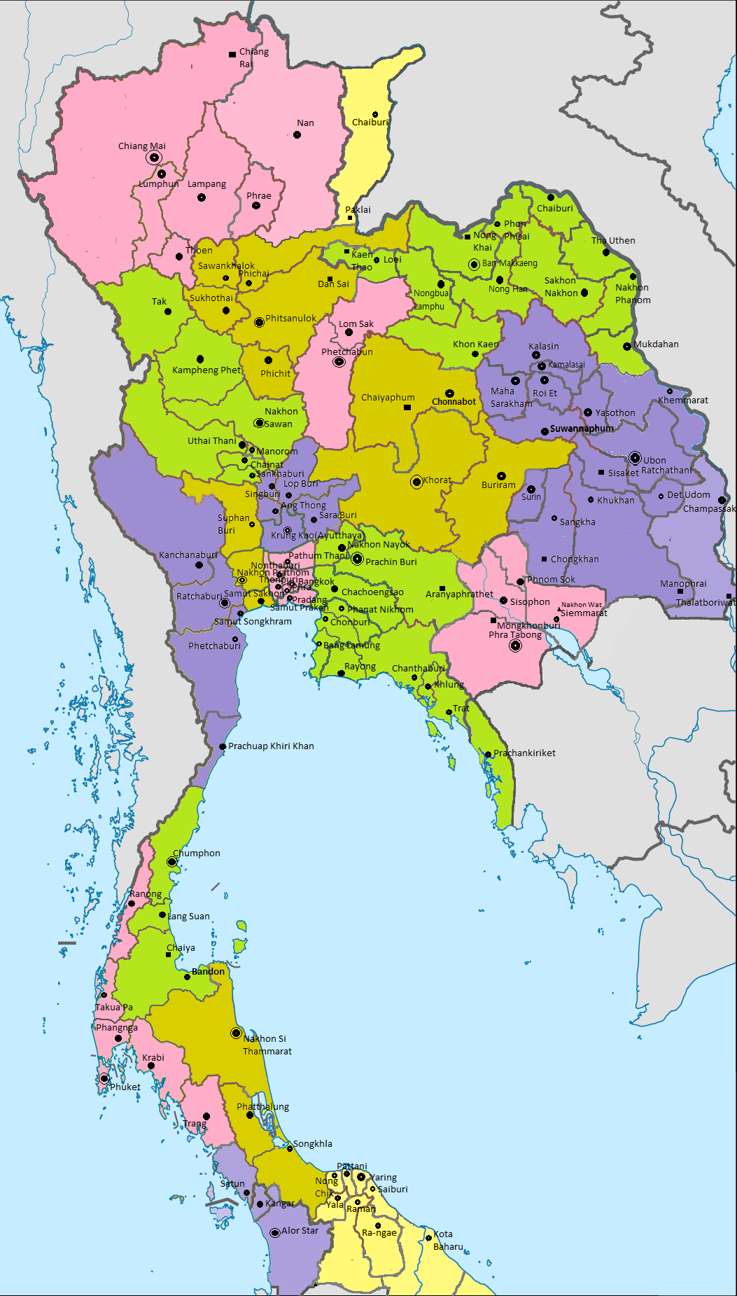
The Kingdom of Reman or Kingdom of Rahman ( ms, Kerajaan Reman; Jawi: كراجأن رمان; ; ) was a landlocked semi-independent Malay kingdom established in northern Malay Peninsula. It was one of seven regions of Pattani Kingdom, an autonomous tributary state of Siam, between 1810 and 1902. Tuan Mansor, a member of the Patani aristocracy, ascended to the throne in 1810. The state's territory straddles the present-day Malaysia-Thailand border, covering Amphoe Raman in Yala province in Thailand, as well as Upper Perak region and parts of Jeli and Upper Kelantan regions in Malaysia. Etymology The name of the state may be derived from a Patani Malay word ''rama' '', cognate to standard Malay ''ramai'', meaning "a large assembly". It is likely named after a growing settlement founded in the area around the late 18th century. The earliest English-language reference of the state was made in 1818, between an agreement by the Governor of Prince of Wales' Island (Penang) ... [...More Info...] [...Related Items...] OR: [Wikipedia] [Google] [Baidu] |
Kampar Regency
Kampar is a regency (''kabupaten'') of Riau, Indonesia. It has an area of 11,289.28 km2 and had a population of 686,204 at the 2010 Census, 793,005 at the 2015 Intermediate Census and 841,332 at the 2020 Census. The administrative centre of the regency is located at Bangkinang town. Bordered by: Geography The Kampar Regency covers an area of 11,289.28 km2, and is an area that lies between 1 ° 00'40 "north latitude to 0 ° 27'00" south latitude and 100 ° 28'30 "- 101 ° 14'30" east longitude. 6The boundaries of Kampar Regency are as follows: North Rokan Hulu and Bengkalis Southern Regency Kuantan Singingi Fifty-City West District (West Sumatra Province) East Pekanbaru, Siak and Pelalawan. The Kampar Regency is traversed by two major rivers and several small rivers, including Sungai Kampar about 413.5 km long with an average depth of 7.7 m and an average width of 143 metres. All parts of the river are included in Kampar Regency, which includes the districts ... [...More Info...] [...Related Items...] OR: [Wikipedia] [Google] [Baidu] |
Bintan Island
Bintan Island or ''Negeri Segantang Lada'' is an island in the Riau archipelago of Indonesia. It is part of the Riau Islands province, the capital of which, Tanjung Pinang, lies in the island's south and is the island's main community. Bintan's land area is (total area is including 96% sea area). Its administrative region is designated the Bintan Regency, one of the six administrative regencies of the Riau Islands province. The city of Tanjung Pinang is an autonomous area geographically within Bintan Island but not included in the Regency. Bintan's history is traced to the early 3rd century. The island flourished as a trading post on the route between China and India, and over the centuries it came under the control of the Chinese, the British, and then the Dutch when it was declared part of the Dutch East Indies through the Anglo-Dutch Treaty of 1824. In the 12th century, the Bintan island in the Strait of Malacca was known as the "Pirate Island" since the Malay pirates used ... [...More Info...] [...Related Items...] OR: [Wikipedia] [Google] [Baidu] |
Mahmud Shah Of Malacca
Sultan Mahmud Shah ibni Almarhum Sultan Alauddin Riayat Shah (died 1528) ruled the Sultanate of Malacca from 1488 to 1511, and again as pretender to the throne from 1513 to 1528. He was son to Sultan Alauddin Riayat Shah. As a monarch, he was known to be ruthless ruler. After the capture of Malacca and the downfall of the century long sultanate; Mahmud left for Bintan and became a leader of a small confederacy which led attacks against Portuguese-occupied Malacca in the late 1510s. After retaliation from the Portuguese in 1526, he fled to Riau and died there in 1528. He had several wives, the most notable being Tun Teja. The sultan was surrounded by able men and warriors such as Hang Tuah, Khoja Hassan and Hang Nadim. He had three sons; Ahmad Shah, Muzaffar and Alauddin Riayat Shah II. Muzaffar and Alauddin Riayat would later form the Perak and Johor Sultanate respectively. Sultan Mahmud is associated with the Malay legend of Puteri Gunung Ledang which is about his failed co ... [...More Info...] [...Related Items...] OR: [Wikipedia] [Google] [Baidu] |
Malacca Sultanate
The Malacca Sultanate ( ms, Kesultanan Melaka; Jawi script: ) was a Malay sultanate based in the modern-day state of Malacca, Malaysia. Conventional historical thesis marks as the founding year of the sultanate by King of Singapura, Parameswara, also known as Iskandar Shah, although earlier dates for its founding have been proposed. At the height of the sultanate's power in the 15th century, its capital grew into one of the most important transshipment ports of its time, with territory covering much of the Malay Peninsula, the Riau Islands and a significant portion of the northern coast of Sumatra in present-day Indonesia. As a bustling international trading port, Malacca emerged as a centre for Islamic learning and dissemination, and encouraged the development of the Malay language, literature and arts. It heralded the golden age of Malay sultanates in the archipelago, in which Classical Malay became the ''lingua franca'' of Maritime Southeast Asia and Jawi script became ... [...More Info...] [...Related Items...] OR: [Wikipedia] [Google] [Baidu] |
Ulu Titi Basah
Ulu Titi Basah ( th, เขาฮูลูติติปาซา; ms, Gunung Ulu Titi Basah) is the southernmost high peak of Thailand. This 1,533 m high peak is located on the Malaysia-Thailand border between Betong District of Yala Province and Hulu Perak in the state of Perak. Geography Ulu Titi Basah is the highest summit of the Sankalakhiri Range ( th, ทิวเขาสันกาลาคีรี), the northern section of the Titiwangsa Mountains The Titiwangsa Mountains ( Malay: ''Banjaran Titiwangsa,'' بنجرن تيتيوڠسا, ), also known as ''"Banjaran Besar"'' (Big Range) by locals, is the chain of mountains that forms the backbone of the Malay Peninsula. The northern section ..., a sub-range of the Tenasserim Hills. See also * List of mountains in Thailand * Temenggor Lake References {{Reflist External links Gunong Ulu Titi Basah, Thailand [...More Info...] [...Related Items...] OR: [Wikipedia] [Google] [Baidu] |


