|
Honghe Hani And Yi Autonomous Prefecture
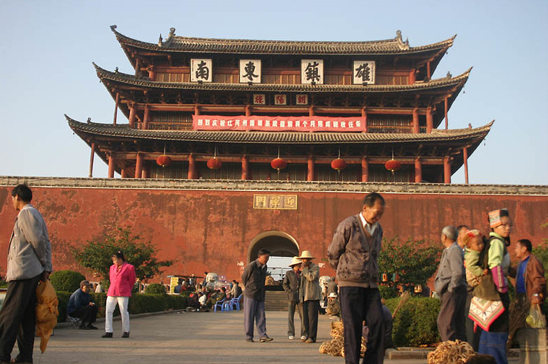
Honghe Hani and Yi Autonomous Prefecture (; Hani: ; Yi: ꉼꉸꉳꆃꁈꆃꁈꊨꏦꍓ) is an autonomous prefecture in Southeast-Central Yunnan Province, China, bordering Vietnam's Lào Cai and Lai Châu provinces to the south. Its name is derived from the Hong (Red) River and the two major ethnic minority groups who live there: the Yi and the Hani. Honghe has an area of and its seat is Mengzi. The total population is 4.8 million, of which 61.3% belong to ethnic minorities. In 2008, the ''State Administration of Cultural Heritage'' of the People's Republic of China nominated the Honghe Hani Terraced Fields of Yuanyang County for World Heritage Site status. It was added to the list on 22 June 2013, bringing the total number of World Heritage Sites in China to 45. Subdivisions The prefecture is subdivided into 13 county-level divisions: 4 county-level cities, 6 counties, and 3 autonomous counties: Demographics At the end of 2019, Honghe Prefecture had 4.775 mil ... [...More Info...] [...Related Items...] OR: [Wikipedia] [Google] [Baidu] |
Autonomous Prefecture
Autonomous prefectures () are one type of autonomous administrative divisions of China, existing at the prefectural level, with either ethnic minorities forming over 50% of the population or being the historic home of significant minorities. All autonomous prefectures are mostly dominated, in population, by the Han Chinese. The official name of an autonomous prefecture includes the most dominant minority in that region, sometimes two, rarely three. For example, a Kazakh (''Kazak'' in official naming system) prefecture may be called ''Kazak Zizhizhou''. Like all other prefectural level divisions, autonomous prefectures are divided into county level divisions. There is one exception: Ili Kazak Autonomous Prefecture contains two prefectures of its own. Under the Constitution of the People's Republic of China, autonomous prefectures cannot be abolished. Autonomous administrative divisions The PRC's autonomous administrative divisions may be found in the first (or top) to thi ... [...More Info...] [...Related Items...] OR: [Wikipedia] [Google] [Baidu] |
China–Vietnam Border
The China–Vietnam border is the international boundary between China and Vietnam, consisting of a 1,297 km (806 mi) terrestrial border stretching from the tripoint with Laos in the west to the Gulf of Tonkin coast in the east, and a maritime border in the Gulf of Tonkin and South China Sea. While disputes over the terrestrial border have been settled with the signing of a land boundary treaty between the two countries, the maritime border is currently undefined due to disputes over the ownership of territorial waters and islands, including the Spratly and Paracel Islands. Description The terrestrial border begins in the west at the China-Laos-Vietnam tripoint at the Shiceng Dashan peak. It then proceeds overland in a broadly eastwards direction, albeit in a highly irregular zig-zag pattern, predominantly through isolated mountainous areas inhabited by ethnic minorities. In places, rivers are utilised for short sections, such as the Lixian River, Red River, Nanx ... [...More Info...] [...Related Items...] OR: [Wikipedia] [Google] [Baidu] |
Kaiyuan, Yunnan
Kaiyuan () is a county-level city within the jurisdiction of Honghe Hani and Yi Autonomous Prefecture in the southeast of Yunnan province, China. Geography The maximum sea level of Kaiyuan is 2,775.6 meters and the minimum is 950 meters. The annual average temperature is 19.9 degrees Celsius. Administrative divisions At present, Kaiyuan City has 2 subdistricts, 2 towns, 2 townships and 1 ethnic township. ;2 subdistricts * Lebaidao () * Lingquan () ;2 towns * Zhongheying () * Xiaolongtan () ;2 townships * Yangjie () * Beige () ;1 ethnic township * Dazhuang Hui () Demography It has a population of 299,000, of whom 156,000 belong to ethnic minorities, including Yi, Zhuang, Miao, and Hui. Ethnic groups The ''Kaiyuan City Almanac '' (1996:618) lists the following ethnic Yi subgroups. *Gaisu 改苏 (autonyms: Gaisupo 改苏泼, Luoluopo 倮倮泼; exonyms: Luoluo 倮倮); ancestors migrated from Luxi 泸西 and Mile 弥勒 **Mazheshao Township 马者哨: Sanjia 三家 ... [...More Info...] [...Related Items...] OR: [Wikipedia] [Google] [Baidu] |
Gejiu
(, ; Hani: ''Goqjef''; formerly known as Kochiu) is a county-level city and the former capital of Honghe prefecture, Yunnan Province, China, and has 202,000 urban inhabitants (ranked 14th largest city in Yunnan). It is the site of the country's largest tin deposits and its main industry is mining. Location Gejiu is located on top of a mountain to the north of the Red River (pinyin ''Hong He'') valley, which flows from Yunnan, Dali prefecture to Vietnam. To the south-west in this valley is Nansha, which lies directly below the town of Yuanyang. To the north-west lies Jianshui, and to the north Jijie. Mengzi lies 12 miles to the East. Layout The town is located in a crater-like depression around a lake on top of a mountain. The main road enters the town from the north through a thin pass. To the east and west are steep cliffs. Those to the west are too steep to inhabit, however extensive new construction along the eastern side has created many new districts. Adminis ... [...More Info...] [...Related Items...] OR: [Wikipedia] [Google] [Baidu] |
Autonomous Counties
Autonomous counties () and autonomous banners () are county-level autonomous administrative divisions of China. The two are essentially identical except in name. There are 117 autonomous counties and three autonomous banners. The latter are found in Inner Mongolia Autonomous Region Inner Mongolia, officially the Inner Mongolia Autonomous Region, is an autonomous region of the People's Republic of China. Its border includes most of the length of China's border with the country of Mongolia. Inner Mongolia also accounts for a ... and the former are found everywhere else. Maps List History Former autonomous counties of China See also * External links ChinaDataOnline.org website {{authority control C * Counties of China China, PRC Autonomous ... [...More Info...] [...Related Items...] OR: [Wikipedia] [Google] [Baidu] |
County (People's Republic Of China)
Counties ( zh, t=縣, s=县, hp=Xiàn), formally county-level divisions, are found in the third level of the administrative hierarchy in Provinces and Autonomous regions and the second level in municipalities and Hainan, a level that is known as "county level" and also contains autonomous counties, county-level cities, banners, autonomous banners and City districts. There are 1,355 counties in Mainland China out of a total of 2,851 county-level divisions. The term ''xian'' is sometimes translated as "district" or "prefecture" when put in the context of Chinese history. History ''Xian'' have existed since the Warring States period and were set up nationwide by the Qin Dynasty. The number of counties in China proper gradually increased from dynasty to dynasty. As Qin Shi Huang reorganized the counties after his unification, there were about 1,000. Under the Eastern Han Dynasty, the number of counties increased to above 1,000. About 1400 existed when the Sui dyn ... [...More Info...] [...Related Items...] OR: [Wikipedia] [Google] [Baidu] |
County-level Cities
A county-level municipality (), county-level city or county city, formerly known as prefecture-controlled city (1949–1970: ; 1970–1983: ), is a county-level administrative division of the People's Republic of China. County-level cities have judicial but no legislative rights over their own local law and are usually governed by prefecture-level divisions, but a few are governed directly by province-level divisions. A county-level city is a "city" () and "county" () that have been merged into one unified jurisdiction. As such it is simultaneously a city, which is a municipal entity and a county which is an administrative division of a prefecture. Most county-level cities were created in the 1980s and 1990s by replacing denser populated counties. County-level cities are not "cities" in the strictest sense of the word, since they usually contain rural areas many times the size of their urban, built-up area. This is because the counties that county-level cities ... [...More Info...] [...Related Items...] OR: [Wikipedia] [Google] [Baidu] |
Administrative Divisions Of The People's Republic Of China
The administrative divisions of China have consisted of several levels since ancient times, due to China's large population and geographical area. The constitution of China provides for three levels of government. However in practice, there are five levels of local government; the provincial (province, autonomous region, municipality, and special administrative region), prefecture, county, township, and village. Since the 17th century, provincial boundaries in China have remained largely static. Major changes since then have been the reorganisation of provinces in the northeast after the establishment of the People's Republic of China and the formation of autonomous regions, based on Soviet ethnic policies. The provinces serve an important cultural role in China, as people tend to identify with their native province. Levels The Constitution of China provides for three levels: the provincial, the county level, and the township level. However, in practice, there are four leve ... [...More Info...] [...Related Items...] OR: [Wikipedia] [Google] [Baidu] |
World Heritage Site
A World Heritage Site is a landmark or area with legal protection by an international convention administered by the United Nations Educational, Scientific and Cultural Organization (UNESCO). World Heritage Sites are designated by UNESCO for having cultural, historical, scientific or other form of significance. The sites are judged to contain " cultural and natural heritage around the world considered to be of outstanding value to humanity". To be selected, a World Heritage Site must be a somehow unique landmark which is geographically and historically identifiable and has special cultural or physical significance. For example, World Heritage Sites might be ancient ruins or historical structures, buildings, cities, deserts, forests, islands, lakes, monuments, mountains, or wilderness areas. A World Heritage Site may signify a remarkable accomplishment of humanity, and serve as evidence of our intellectual history on the planet, or it might be a place of great natural beauty. A ... [...More Info...] [...Related Items...] OR: [Wikipedia] [Google] [Baidu] |
Yuanyang County, Yunnan
Yuanyang County (; Hani: ''Yeiqyaq'') is located in Honghe Prefecture in southeastern Yunnan province, China, along the Red River. It is well known for its spectacular rice-paddy terracing. In 2013, part of the county formed the Honghe Hani Rice Terraces World Heritage Site, the 45th World Heritage Site in China. Overview It covers an area of and has a population of approximately 365,000 (2002), of which 88% belong to ethnic minorities and 95% is associated with agriculture. The majority of the inhabitants of the county are from the Hani ethnic group. The GDP of Yuanyang county in 2002 was 630 million Yuan. The administrative seat of the county is the town of ''Nansha'' (a.k.a. New Yuanyang) down in the Red River valley at an elevation of 240 meters. It is situated towards the north-east of the former administrative seat ''Xinjie'' (a.k.a. Old Yuanyang or just Yuanyang) to which it is connected by a long twisting mountain road. To the south of Old Yuanyang, the town of ... [...More Info...] [...Related Items...] OR: [Wikipedia] [Google] [Baidu] |
Ethnic Minorities In China
Ethnic minorities in China are the non- Han population in the People's Republic of China (PRC). The PRC officially recognizes 55 ethnic minority groups within China in addition to the Han majority. As of 2010, the combined population of officially-recognized minority groups comprised 8.49% of the population of mainland China. In addition to these officially-recognized ethnic minority groups, there are Chinese nationals who privately classify themselves as members of unrecognized ethnic groups, such as the very small Chinese Jewish, Tuvan, and Ili Turk communities, as well as the much larger Oirat and Japanese communities. In Chinese, 'ethnic minority' has translated to (), wherein () means ' nationality' or ' nation' (as in ethnic group)—in line with the Soviet concept of ethnicity—and () means ' minority'.Binggao, Jin. 9871988.When Does The Word 'Minority Nationality' [Shaoshu Minzu[First">haoshu Minzu">When Does The Word 'Minority Nationality' [Shaoshu Minzu ... [...More Info...] [...Related Items...] OR: [Wikipedia] [Google] [Baidu] |
Hani People
The Hani or Ho people (Hani: ''Haqniq''; zh, c=哈尼族, p=Hānízú; vi, Người Hà Nhì / 𠊛何贰) are a Lolo-speaking ethnic group in Southern China and Northern Laos and Vietnam. They form one of the 56 officially recognized nationalities of the People's Republic of China and one of the 54 officially recognized ethnic groups of Vietnam. In Laos, the Hani are more commonly known as ''Ho''. Distribution There are 12,500 Hani living in Lai Châu Province and Lào Cai Province of Vietnam. The Ho reside in the mountainous northern regions of Phongsaly Province in Laos, near the Chinese and Vietnamese borders. China Over ninety percent of present-day Hani peoples live in the Province of Yunnan in Southern China, located across the Ailao Mountains, between the Mekong River and the Red River (''Yuanjiang'' river). Subdivisions of Hani autonomous counties within prefecture-level cities and a prefecture, within Yunnan are: * Mojiang Hani Autonomous County — P ... [...More Info...] [...Related Items...] OR: [Wikipedia] [Google] [Baidu] |


