|
High Alps
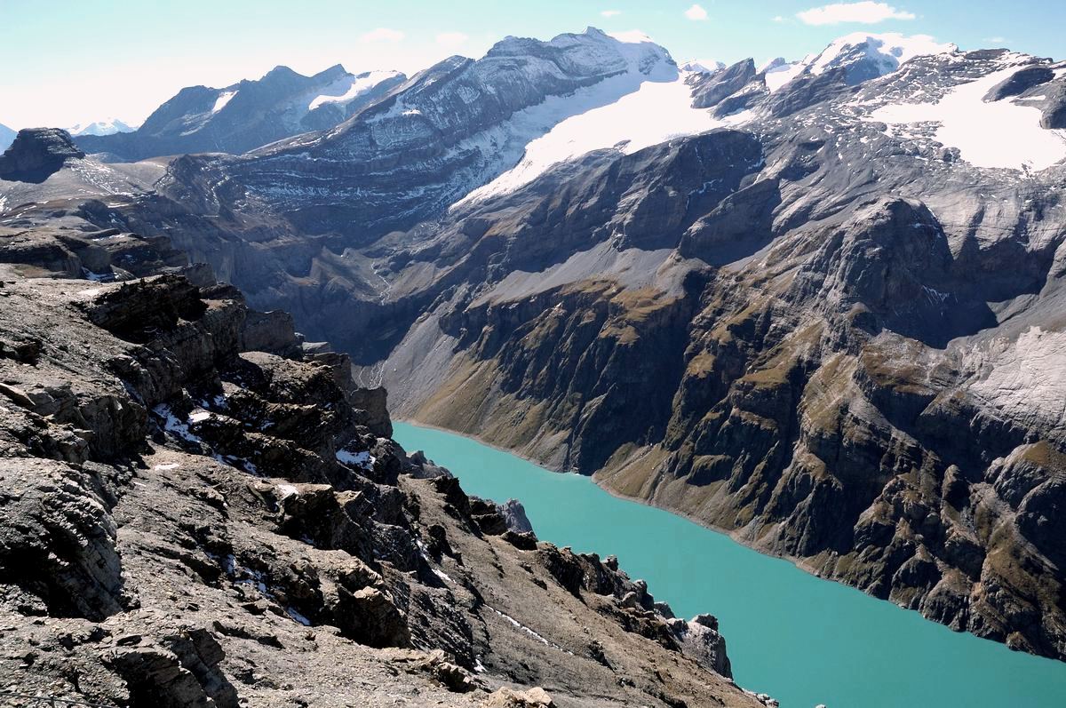
The High Alps are the parts of the Alps unsuitable for habitation or seasonal transhumance. This includes all regions higher than 3,000 m above sea level, as well as most regions between 2,500 m and 3,000 m (Juf at 2,126 m is the highest permanently inhabited village in the Alps). Alpine pastures are typically below 2,400 m but may exceptionally be located as high as 2,800 m.The alp of Bréona (Valais) is among the highest, with buildings at 2,435 m and pastures reaching as high as 2,800 /ref> The High Alps have Tundra climate, tundra or ice cap climate rather than the Alpine climate eponymous of the Alpine region at 1,800-2,500 m, above the tree-line but still amenable to transhumance economy. Exploration of the High Alps began in the 18th century, with Horace-Bénédict de Saussure. The first ascent of the highest peak of the Alps, Mont Blanc, dates to 1786. All important mountain passes in Switzerland are below 2,500 m (with Nufenen Pass as high as 2,478 m) but there ar ... [...More Info...] [...Related Items...] OR: [Wikipedia] [Google] [Baidu] |
Zwischbergen Pass
The Zwischbergen Pass (el. 3268 m.) (german: Zwischbergenpass) is a high mountain pass across the eastern Pennine Alps, connecting Saas Almagell and Zwischbergen in the canton of Valais Valais ( , , ; frp, Valês; german: Wallis ), more formally the Canton of Valais,; german: Kanton Wallis; in other official Swiss languages outside Valais: it, (Canton) Vallese ; rm, (Chantun) Vallais. is one of the 26 cantons forming the S ... in Switzerland. The pass lies between the Weissmies on the north and Portjengrat on the South. See also * List of mountain passes in Switzerland External links Information on itinerary (German) Mountain passes of Valais Mountain passes of the Alps {{Valais-geo-stub ... [...More Info...] [...Related Items...] OR: [Wikipedia] [Google] [Baidu] |
Pennine Alps
The Pennine Alps (german: Walliser Alpen, french: Alpes valaisannes, it, Alpi Pennine, la, Alpes Poeninae), also known as the Valais Alps, are a mountain range in the western part of the Alps. They are located in Switzerland (Valais) and Italy (Piedmont and the Aosta Valley). The Pennine Alps are amongst the three highest major subranges of the Alps, together with the Bernese Alps and the Mont Blanc massif. Geography The Italian side is drained by the rivers Dora Baltea, Sesia and Toce, tributaries of the Po. The Swiss side is drained by the Rhône. The Great St Bernard Tunnel, under the Great St Bernard Pass, leads from Martigny, Switzerland to Aosta. Morphology The main chain ( watershed between the Mediterranean Sea and the Adriatic Sea) runs from west to east on the border between Italy (south) and Switzerland (north). From Mont Vélan, the first high summit east of St Bernard Pass, the chain rarely goes below 3000 metres and contains many four-thousanders such ... [...More Info...] [...Related Items...] OR: [Wikipedia] [Google] [Baidu] |
Glarus Alps
The Glarus Alps (german: Glarner Alpen) are a mountain range in central Switzerland. They are bordered by the Uri Alps and the Schwyz Alps to the west, the Lepontine Alps to the south, the Appenzell Alps to the northeast. The eastern part of the Glarus Alps contains a major thrust fault that was declared a geologic UNESCO World Heritage Site (the Swiss Tectonic Arena Sardona). The Glarus Alps extend well beyond the canton of Glarus, including parts of the cantons of Uri, Graubünden, and St Gallen. Conversely, not all the mountains in the canton of Glarus are part of the Glarus Alps, with those to the north of the Urner Boden and to the west of the valley of the river Linth considered to be part of the Schwyz Alps. Geography The main chain of the Glarus Alps can be divided into six minor groups, separated from each other by passes, the lowest of which exceeds 7,500 ft. The westernmost of these is the Crispalt, a rugged range including many peaks of nearly equal he ... [...More Info...] [...Related Items...] OR: [Wikipedia] [Google] [Baidu] |
Dauphiné Alps
The Dauphiné Alps (french: Alpes du Dauphiné) are a group of mountain ranges in Southeastern France, west of the main chain of the Alps. Mountain ranges within the Dauphiné Alps include the Massif des Écrins in Écrins National Park, Belledonne, Le Taillefer range and the mountains of Matheysine. Etymology The ''Dauphiné'' () is a former French province whose area roughly corresponded to that of the present departments of :Isère, :Drôme, and :Hautes-Alpes. Geography They are separated from the Cottian Alps in the east by the Col du Galibier and the upper Durance valley; from the western Graian Alps ( Vanoise Massif) in the north-east by the river Arc; from the lower ranges Vercors Plateau and Chartreuse Mountains in the west by the rivers Drac and Isère. Many peaks rise to more than 10,000 feet (3,050 m), with Barre des Écrins (4,102 m) the highest. Administratively the French part of the range belongs to the French departments of Isère, Hautes-Alpes ... [...More Info...] [...Related Items...] OR: [Wikipedia] [Google] [Baidu] |
Graian Alps
, it, Alpi Graie , photo = , photo_caption = , country_type = Countries , country = , subdivision1_type = Provinces/Regions , subdivision1 = , parent = Alps , borders_on = , length_km = , length_orientation = , width_km = , width_orientation = , highest = Mont Blanc , elevation_m = 4810.45 , coordinates = , range_coordinates = , map_image = Alps location map (Alpi Graie, SOIUSA).png , map_caption = Graian Alps (in red) within the Alps.The borders of the range according toPartizione delle Alpi & SOIUSA , orogeny = Alpine orogeny The Graian Alps (french: Alpes grées ; it, Alpi Graie ) are a mountain range in the western part of the Alps. Etymology The name ''Graie'' comes from the ''Graioceli'' Celtic tribe, which dwelled in the area surrounding the Mont Cenis pass and the Viù valley. Other sources claim that the na ... [...More Info...] [...Related Items...] OR: [Wikipedia] [Google] [Baidu] |
Central Eastern Alps
The Central Eastern Alps (german: Zentralalpen or Zentrale Ostalpen), also referred to as Austrian Central Alps (german: Österreichische Zentralalpen) or just Central Alps, comprise the main chain of the Eastern Alps in Austria and the adjacent regions of Switzerland, Liechtenstein, Italy and Slovenia. South them is the Southern Limestone Alps. The term "Central Alps" is very common in the Geography of Austria as one of the seven major landscape regions of the country. "Central Eastern Alps" is usually used in connection with the Alpine Club classification of the Eastern Alps (''Alpenvereinseinteilung'', AVE). The Central Alps form the eastern part of the Alpine divide, its central chain of mountains, as well as those ranges that extend or accompany it to the north and south. The highest mountain in the Austrian Central Alps is Grossglockner at . Location The Central Alps have the highest peaks of the Eastern Alps, and are located between the Northern Limestone Alps and t ... [...More Info...] [...Related Items...] OR: [Wikipedia] [Google] [Baidu] |
Cottian Alps
The Cottian Alps (; french: Alpes Cottiennes ; it, Alpi Cozie ) are a mountain range in the southwestern part of the Alps. They form the border between France (Hautes-Alpes and Savoie) and Italy (Piedmont). The Fréjus Road Tunnel and Fréjus Rail Tunnel between Modane and Susa are important transportation arteries between France (Lyon, Grenoble) and Italy (Turin). Etymology The name ''Cottian'' comes from '' Marcus Julius Cottius'', a king of the tribes inhabiting that mountainous region in the 1st century BC. Under his father Donnus, these tribes had previously opposed but later made peace with Julius Caesar. Cottius was succeeded by his son Gaius Julius Donnus II (reigned 3 BC-4 AD), and his grandson Marcus Julius Cottius II (reigned 5-63 AD), who was granted the title of king by the emperor Claudius. On his death, Nero annexed his kingdom as the province of Alpes Cottiae. History For a long part of the Middle Ages the Cottian Alps were divided between the Duchy of Savo ... [...More Info...] [...Related Items...] OR: [Wikipedia] [Google] [Baidu] |
Bernese Alps
, topo_map= Swiss Federal Office of Topography swisstopo , photo=BerneseAlps.jpg , photo_caption=The Eiger, Mönch, and Jungfrau , country= Switzerland , subdivision1_type= Cantons , subdivision1= , parent= Western Alps , borders_on= , length_mi= , length_orientation= , width_mi= , width_orientation= , geology= , orogeny= , highest= Finsteraarhorn , elevation_m=4274 , range_coordinates= , coordinates= , map_image=Berner Alpen.png , map_caption=Map of Bernese Alps and their location in Switzerland (red) The Bernese Alps (german: Berner Alpen, french: Alpes bernoises, it, Alpi bernesi) are a mountain range of the Alps, located in western Switzerland. Although the name suggests that they are located in the Berner Oberland region of the canton of Bern, portions of the Bernese Alps are in the adjacent cantons of Valais, Fribourg and Vaud, the latter being usually named ''Fribourg Alps'' and ''Vaud Alps'' respectively. The highest mountain in the range, the ... [...More Info...] [...Related Items...] OR: [Wikipedia] [Google] [Baidu] |
Polar Region
The polar regions, also called the frigid zones or polar zones, of Earth are the regions of the planet that surround its geographical poles (the North and South Poles), lying within the polar circles. These high latitudes are dominated by floating sea ice covering much of the Arctic Ocean in the north, and by the Antarctic ice sheet on the continent of Antarctica and the Southern Ocean in the south. Definitions The Arctic has various definitions, including the region north of the Arctic Circle (currently Epoch 2010 at 66°33'44" N), or just the region north of 60° north latitude, or the region from the North Pole north to the timberline. The Antarctic is usually defined simply as south of 60° south latitude, or the continent of Antarctica. The 1959 Antarctic Treaty uses the former definition. The two polar regions are distinguished from the other two climatic and biometric belts of Earth, a tropics belt near the equator, and two middle latitude regions located betwe ... [...More Info...] [...Related Items...] OR: [Wikipedia] [Google] [Baidu] |
Snow Line
The climatic snow line is the boundary between a snow-covered and snow-free surface. The actual snow line may adjust seasonally, and be either significantly higher in elevation, or lower. The permanent snow line is the level above which snow will lie all year. Background Snow line is an umbrella term for different interpretations of the boundary between snow-covered surface and snow-free surface. The definitions of the snow line may have different temporal and spatial focus. In many regions the changing snow line reflect seasonal dynamics. The final height of the snow line in a mountain environment at the end of the melting season is subject to climatic variability, and therefore may be different from year to year. The snow line is measured using automatic cameras, aerial photographs, or satellite images. Because the snow line can be established without on-the-ground measurements, it can be measured in remote and difficult to access areas. Therefore, the snow line has become an ... [...More Info...] [...Related Items...] OR: [Wikipedia] [Google] [Baidu] |
Stelvio Pass
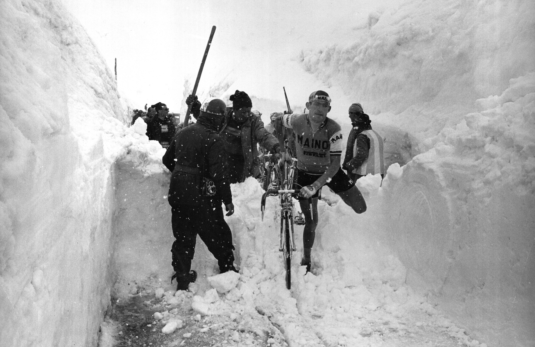
The Stelvio Pass ( it, Passo dello Stelvio , ''Giogo dello Stelvio'' ; german: Stilfser Joch; ) is a mountain pass in Northern Italy, northern Italy bordering Switzerland at an elevation of Height above mean sea level, above sea level. It is the List of highest paved roads in the Alps, highest paved mountain pass in the Eastern Alps, and the second highest in the Alps, below France's Col de l'Iseran (). Location The pass is located in the Ortler Alps in Italy between Stilfs ("Stelvio" in Italian) in South Tyrol and Bormio in the Provinces of Italy, province of Province of Sondrio, Sondrio. It is about from Bolzano and 200 m from the Switzerland, Swiss border. The Umbrail Pass runs northwards from the Stelvio's western ramp, and the "Three Languages Peak" ''(Dreisprachenspitze)'' above the pass is so named because this is where the Italian (language), Italian, German (language), German, and Romansh language, Romansh language-speaking areas meet. The road connects the Valtellina w ... [...More Info...] [...Related Items...] OR: [Wikipedia] [Google] [Baidu] |


