|
Holme Moss
Holme Moss ( Above mean sea level, a.s.l.) is high moorland on the border between the Holme Valley district of Kirklees in West Yorkshire and the High Peak, Derbyshire, High Peak district of Derbyshire in England. Historically on the boundary between the West Riding of Yorkshire and Cheshire, it is just inside the boundary of the Peak District, Peak District National Park. The A6024 road between Holmfirth and Longdendale crosses the moor near its highest point close to Holme Moss transmitting station's prominent mast. Watershed Water seeping from the surrounding moorland into Rake Dike is the source of the River Holme. Rake Dike rising from Kay Edge on the moor flows through the village of Holme, West Yorkshire, Holme into Brownhill Reservoir, about a mile below the moor, and passes down through the Holme Valley to Huddersfield, where it flows into the River Colne, West Yorkshire, River Colne. The upper part of the moor continues into Black Hill (Peak District), Black Hill whic ... [...More Info...] [...Related Items...] OR: [Wikipedia] [Google] [Baidu] |
Holme Moss Transmitting Station
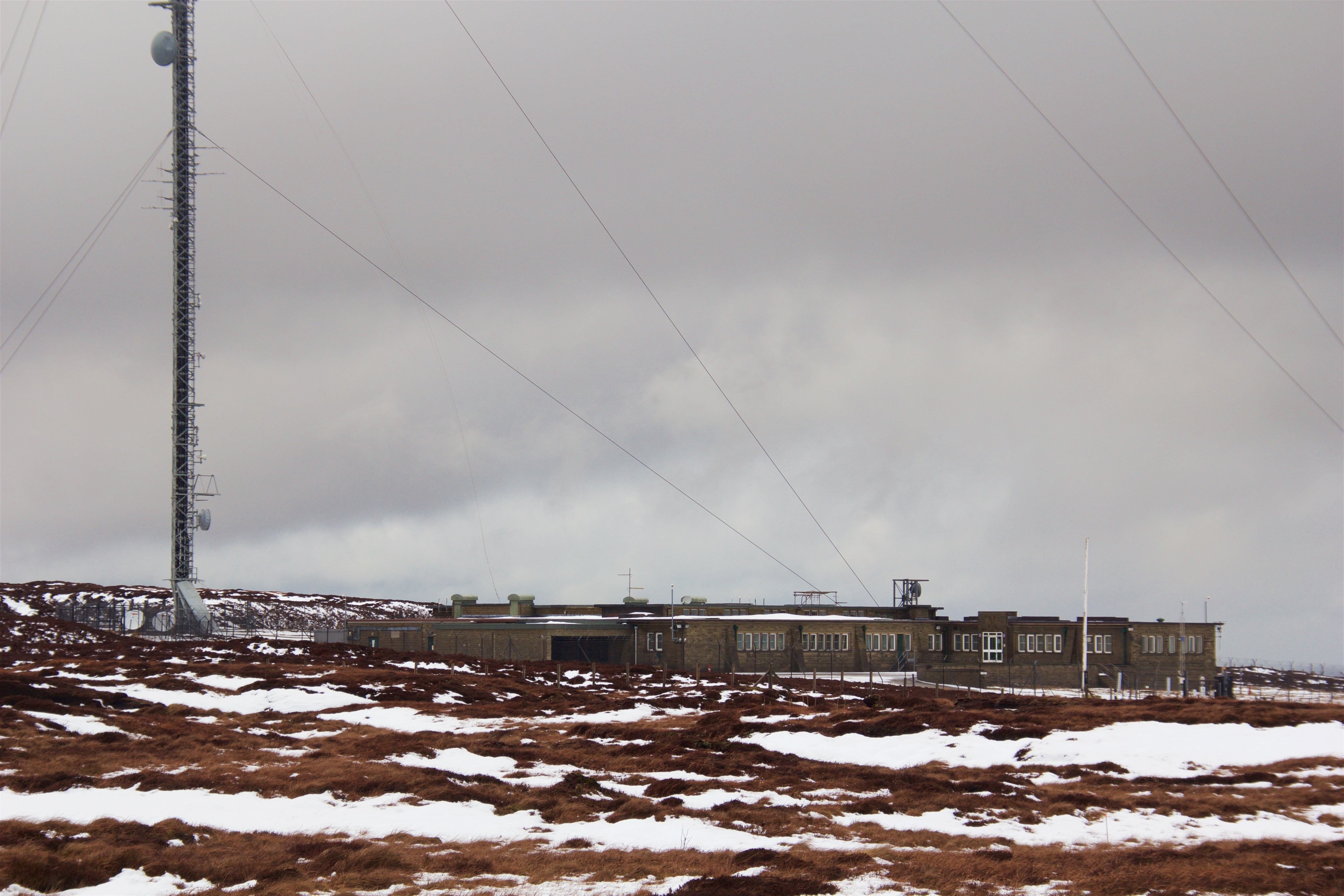
The Holme Moss transmitting station is a radio transmitting station at Holme Moss in West Yorkshire, England. The mast provides VHF coverage of both FM and DAB to a wide area around the mast including Derbyshire, Greater Manchester, South Yorkshire and West Yorkshire. History Holme Moss transmitting station was built by British Insulated Callender's Cables with John Laing & Son acting as sub-contractors for the foundations. It became the BBC's third public television transmitter, launched on 12 October 1951. Of historic and technical interest, this operated on the 405 line VHF system, with black and white transmissions originally on British System A, Channel 2, with vision 51.75 MHz, 45 kW and sound 48.25 MHz, 12 kW. The mast survived until the end of the Band I TV broadcasts in 1985, with a replacement mast being constructed, adjacent, in 1984. In early 1986, there was concern that heavy blocks of ice could bring down the old mast: February 1986 had ... [...More Info...] [...Related Items...] OR: [Wikipedia] [Google] [Baidu] |
River Colne, West Yorkshire
The River Colne in West Yorkshire is formed at the confluence of two brooks that originate in the Pennines close to Marsden. It flows in an easterly direction through the Colne Valley and Huddersfield towards Cooper Bridge where it flows into the River Calder. Course Brooks formed by rainwater high (between 300 and 480 metres AMSL) in the Pennines of West Yorkshire, flow down the hillsides through the small valleys known locally as ''cloughs'' to fill March Haigh and Redbrook Reservoirs. The Haigh Brook and Redbrook continue down the valley fed by more tributaries, until they converge at a scenic spot called Close Gate or Eastergate Bridge where the River Colne is formed. The river flows from west to east through the Colne Valley passing through Marsden, Slaithwaite and Milnsbridge to Huddersfield and then on to Cooper Bridge where it feeds the larger River Calder. Its tributaries include Wessenden Brook, Bradley Brook, Crimble Brook, Mag Brook, Fenay Brook, New Mi ... [...More Info...] [...Related Items...] OR: [Wikipedia] [Google] [Baidu] |
Holme Moss And Black Hill(RLH)
Holme may refer to: * Holme (surname) Music * Holme (band) Places Antarctica * Holme Bay Denmark * Holme, Aarhus England * Holme, Bedfordshire * Holme, Cambridgeshire * Holme, Cumbria * Holme, North Lincolnshire, Lincolnshire * Holme, North Yorkshire * Holme, Nottinghamshire * Holme, West Lindsey, Lincolnshire * Holme, West Yorkshire * Holme Fell, Cumbria * Holme Island, a small tidal island off Grange-over-Sands, Cumbria * Holme Valley, West Yorkshire * Holme-next-the-Sea * Holme-on-Spalding-Moor * Holme on the Wolds * Holme Moss * The Holme, one of the villas in Regent's Park, London * River Holme Latvia * Holme, former German name of Mārtiņsala Norway * Holme, Vestland, a village in Alver municipality, Vestland county * Holme, old name of Holum See also * East Holme * West Holme * Holm (other) * Holmes (other) Holmes may refer to: People and fictional characters * Holmes (surname), a list of people and fictional characters ** Sherlock Holmes, ... [...More Info...] [...Related Items...] OR: [Wikipedia] [Google] [Baidu] |
Crowden, Derbyshire
Crowden (also known as Crowden-in-Longdendale) is a hamlet in the High Peak borough of Derbyshire, England. Historically a part of Cheshire, Crowden was incorporated into Derbyshire for administrative and ceremonial purposes in 1974 and is now Derbyshire's most northerly settlement. It lies in the Longdendale valley, north-east of Glossop and south-west of Holme in West Yorkshire. It lies on the trans- Pennine A628 road connecting Greater Manchester and South Yorkshire. It also lies very close to the Pennine Way long distance footpath, on which it is traditionally the first-night stop after Edale. A youth hostel, previously operated under a joint management agreement by the Youth Hostels Association (England & Wales) and Rotherham Metropolitan Borough Council, was transferred to the sole management of Rotherham Metropolitan Borough Council and closed (except for use by large groups) in 2014. The Torside Reservoir is to the south of Crowden. An army rifle range was sit ... [...More Info...] [...Related Items...] OR: [Wikipedia] [Google] [Baidu] |
View From Holme Moss(RLH)
Acornsoft was the software arm of Acorn Computers, and a major publisher of software for the BBC Micro and Acorn Electron. As well as games, it also produced a large number of educational titles, extra computer languages and business and utility packages – these included word processor ''VIEW'' and the spreadsheet ''ViewSheet'' supplied on ROM and cartridge for the BBC Micro/Acorn Electron and included as standard in the BBC Master and Acorn Business Computer. History Acornsoft was formed in late 1980 by Acorn Computers directors Hermann Hauser and Chris Curry, and David Johnson-Davies, author of the first game for a UK personal computer and of the official Acorn Atom manual "Atomic Theory and Practice". David Johnson-Davies was managing director and in early 1981 was joined by Tim Dobson, Programmer and Chris Jordan, Publications Editor. While some of their games were clones or remakes of popular arcade games (e.g. ''Hopper'' is a clone of Sega's ''Frogger'', '' Snapper' ... [...More Info...] [...Related Items...] OR: [Wikipedia] [Google] [Baidu] |
Moorside Edge Transmitting Station
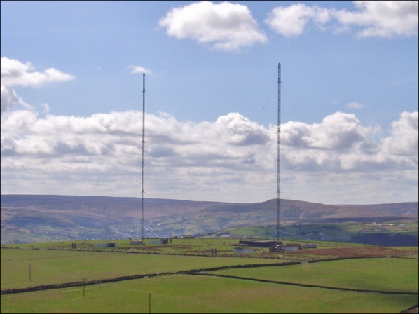
Moorside Edge transmitting station, opened in 1931, was originally constructed to radiate the BBC's North Regional (from 17 May on 626 kHz) and National Programmes (from 12 July on 995 kHz). It is – at 400 kW – one of the most powerful mediumwave radio transmitters in Britain. Formed of two 158-metre-high steel lattice towers, it is located just above Moorside Edge (). Other nearby transmitting stations are Holme Moss (11.56 km, bearing 168.17°) and Emley Moor (15.4 km, bearing 99.41°). As with most mediumwave transmitters, a good "signal earth" is important and this is assured by the waterlogged nature of the ground on which it is built. The site's location on the Pennine Hills means that signals from Moorside Edge can be received at very long distances: as far north as Scotland, as far south as the Midlands, as far west as Dublin, and well beyond the country's eastern (North Sea) coast. The station is now owned and operated by Arqiva and br ... [...More Info...] [...Related Items...] OR: [Wikipedia] [Google] [Baidu] |
Emley Moor Transmitting Station
The Emley Moor transmitting station is a telecommunications and broadcasting facility on Emley Moor, west of the village centre of Emley, in Huddersfield, West Yorkshire, England. It is made up of a concrete tower and apparatus that began to transmit in 1971. It is protected under UK law as a Grade II listed building. It is the tallest freestanding structure in the United Kingdom, and 25th tallest tower in the world. It was the seventh tallest freestanding structure and was fourth tallest tower in the European Union before Brexit. When built it was the sixth tallest freestanding structure in the world after the Ostankino Tower, the Empire State Building, 875 North Michigan Avenue (known as The John Hancock Center), the Berliner Fernsehturm and Tokyo Tower. The tower's current official name, The Arqiva Tower, is shown on a sign beside the offices at the base of the tower, but it is commonly known just as "Emley Moor Mast". In 2021, the antenna was replaced, to accommodat ... [...More Info...] [...Related Items...] OR: [Wikipedia] [Google] [Baidu] |
Nottinghamshire
Nottinghamshire (; abbreviated ''Notts.'') is a ceremonial county in the East Midlands of England. The county is bordered by South Yorkshire to the north-west, Lincolnshire to the east, Leicestershire to the south, and Derbyshire to the west. The largest settlement is the city of Nottingham (323,632), which is also the county town. The county has an area of and a population of 1,154,195. The latter is concentrated in the Nottingham Urban Area, Nottingham built-up area in the south-west, which extends into Derbyshire and has a population of 729,997. The north-east of the county is more rural, and contains the towns of Worksop (44,733) and Newark-on-Trent (27,700). For Local government in England, local government purposes Nottinghamshire comprises a non-metropolitan county, with seven districts, and the Nottingham Unitary authorities of England, unitary authority area. The East Midlands Combined County Authority includes Nottinghamshire County Council and Nottingham City Council. ... [...More Info...] [...Related Items...] OR: [Wikipedia] [Google] [Baidu] |
Greater Manchester
Greater Manchester is a ceremonial county in North West England. It borders Lancashire to the north, Derbyshire and West Yorkshire to the east, Cheshire to the south, and Merseyside to the west. Its largest settlement is the city of Manchester. The county has an area of and is highly urbanised, with a population of 2.9 million. The majority of the county's settlements are part of the Greater Manchester Built-up Area, which extends into Cheshire and Merseyside and is the List of urban areas in the United Kingdom, second most populous urban area in the UK. The city of Manchester is the largest settlement. Other large settlements are Altrincham, Bolton, Rochdale, Sale, Greater Manchester, Sale, Salford, Stockport and Wigan. Greater Manchester contains ten metropolitan boroughs: Manchester, City of Salford, Salford, Metropolitan Borough of Bolton, Bolton, Metropolitan Borough of Bury, Bury, Metropolitan Borough of Oldham, Oldham, Metropolitan Borough of Rochdale, Rochdale, Metropol ... [...More Info...] [...Related Items...] OR: [Wikipedia] [Google] [Baidu] |
South Yorkshire
South Yorkshire is a Ceremonial counties of England, ceremonial county in the Yorkshire and the Humber region of England. It borders North Yorkshire and West Yorkshire to the north, the East Riding of Yorkshire to the north-east, Lincolnshire to the east, Nottinghamshire to the south-east, and Derbyshire to the south and west. The largest settlement is the city of Sheffield. The county is largely urban, with an area of and a population of 1,402,918. The largest settlements after Sheffield (556,500) are the city of Doncaster (113,566), Rotherham (109,697), and Barnsley (96,888). The east and west of the county are more rural. The county is governed by four metropolitan boroughs: Metropolitan Borough of Barnsley, Barnsley, City of Doncaster, Metropolitan Borough of Rotherham, Rotherham, and City of Sheffield. They collaborate through South Yorkshire Mayoral Combined Authority. South Yorkshire lies on the edge of the Pennines, and the west of the county contains part of the Peak ... [...More Info...] [...Related Items...] OR: [Wikipedia] [Google] [Baidu] |
Digital Audio Broadcasting
Digital Audio Broadcasting (DAB) is a digital radio international standard, standard for broadcasting digital audio radio services in many countries around the world, defined, supported, marketed and promoted by the WorldDAB organisation. The standard is dominant in Europe and is also used in Australia, and in parts of Africa and as of 2025, countries using DAB/DMB, 55 countries are actively running DAB broadcasts as an alternative platform to analogue FM. DAB was the result of a European research project and first publicly rolled out in 1995, with consumer-grade DAB Radio receiver, receivers appearing at the start of this millennium. Initially it was expected in many countries that existing FM broadcasting, FM services would switch over to DAB, although the take-up of DAB has been much slower than expected. In 2023, Norway became the first country to have implemented a national FM radio switch-off, with others to follow in the next years, Switzerland and the United Kingdom ... [...More Info...] [...Related Items...] OR: [Wikipedia] [Google] [Baidu] |
FM Broadcasting
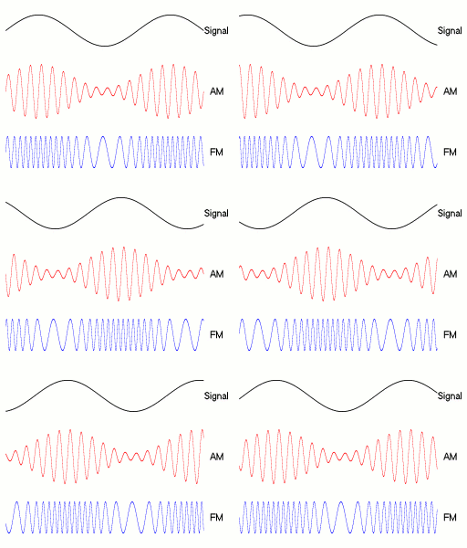
FM broadcasting is a method of radio broadcasting that uses frequency modulation (FM) of the radio broadcast carrier wave. Invented in 1933 by American engineer Edwin Armstrong, wide-band FM is used worldwide to transmit high fidelity, high-fidelity sound over broadcast radio. FM broadcasting offers higher fidelity—more accurate reproduction of the original program sound—than other broadcasting techniques, such as AM broadcasting. It is also less susceptible to Electromagnetic interference, common forms of interference, having less static and popping sounds than are often heard on AM. Therefore, FM is used for most broadcasts of music and general audio (in the audio spectrum). FM radio stations use the very high frequency range of radio frequency, radio frequencies. Broadcast bands Throughout the world, the FM broadcast band falls within the VHF part of the radio spectrum. Usually 87.5 to 108.0 MHz is used, or some portion of it, with few exceptions: * In the Commo ... [...More Info...] [...Related Items...] OR: [Wikipedia] [Google] [Baidu] |


