|
Hochrhein
High Rhine (, ; kilometres 0 to 167 of the Rhine) is the section of the Rhine between Lake Constance () and the city of Basel, flowing in a general east-to-west direction and forming mostly the Germany–Switzerland border. It is the first of four named sections of the Rhine (High Rhine, Upper Rhine, Middle Rhine, Lower Rhine) between Lake Constance and the river delta at the North Sea. Name The term ''High Rhine'' was introduced by scientists in the 19th century. Above all geologists tried to differentiate the High Rhine () linguistically from the Upper Rhine (, ). Until the 19th century, it was also known as the 'Badisch-Swiss Rhine'. It lends its name to the High Rhine Railway line, which to a great extend follows the river to the north of it. Geography Course The High Rhine begins at the outflow of the Rhine from the '' Untersee'' (Lower Lake Constance) in Stein am Rhein and turns into the Upper Rhine at the Rhine knee () in Basel (more precisely at the Middle Bridge). It ... [...More Info...] [...Related Items...] OR: [Wikipedia] [Google] [Baidu] |
Konstanz (district)
Konstanz (or ''Constance'') is a ''Landkreis'' (district) in the south of Baden-Württemberg on the German-Swiss border, situated along the shores of Lake Constance. Neighboring districts are (from west clockwise) Schwarzwald-Baar, Tuttlingen, Sigmaringen and Bodenseekreis. To the south it borders the Swiss cantons of Zurich, Thurgau and Schaffhausen. The municipality of Büsingen am Hochrhein is an exclave of Germany surrounded by Swiss territory. History The district dates back to the ''Bezirksamt Konstanz'', which was created in 1806 when the area became part of Württemberg (since 1810 Baden). After some changes in its outline it was changed into the district in 1936, including part of the dissolved ''Bezirksamt Engen''. 1939 the city Constance became district-free, but was reintegrated into the district in 1953. 1973 it was merged with the neighboring district Stockach and some municipalities from the districts Sigmaringen and Donaueschingen. Geography The district is ... [...More Info...] [...Related Items...] OR: [Wikipedia] [Google] [Baidu] |
Dörflingen
Dörflingen is a village and a Municipalities of Switzerland, municipality in the Cantons of Switzerland, canton of Schaffhausen (canton), Schaffhausen in Switzerland. It borders a short strip of the north shore of the Rhine. History Dörflingen is first mentioned in 1264 as ''Dorfelingen''. Geography Dörflingen has an area, , of . Of this area, 64.3% is used for agricultural purposes, while 26.9% is forested. Of the rest of the land, 7.5% is settled (buildings or roads) and the remainder (1.4%) is non-productive (rivers or lakes). Dörflingen is located in the Reiat district, about east of Schaffhausen and has two separate international borders with Germany, one of which being with the German exclave of Büsingen am Hochrhein. Economy Dörflingen has an unemployment rate of 1.02%. , there were 60 people employed in the Primary sector of the economy, primary economic sector and about 26 businesses involved in this sector. 68 people are employed in the Secondary sector of the ... [...More Info...] [...Related Items...] OR: [Wikipedia] [Google] [Baidu] |
Canton Of Schaffhausen
The canton of Schaffhausen, also canton of Schaffhouse (; ; ; ), is the northernmost Cantons of Switzerland, canton of Switzerland. The principal city and capital of the canton is Schaffhausen. The canton's territory is divided into three non-contiguous segments, where German territory reaches the Rhine. The large central part, which includes the capital, in turn separates the German exclave of Büsingen am Hochrhein from the rest of Germany. History Schaffhausen was a city-state in the Middle Ages; it is documented that it struck its own coins starting in 1045. It was then documented as ''Villa Scafhusun''. Around 1049, Count Eberhard von Nellenburg founded a Benedictine monastery which led to the development of a community. This community achieved independence in 1190. In 1330, the town lost not only all its lands but also its independence to the Habsburgs. In 1415, the Habsburg Duke Frederick IV, Duke of Austria, Frederick IV of Austria sided with the Antipope John XXIII at ... [...More Info...] [...Related Items...] OR: [Wikipedia] [Google] [Baidu] |
Alpine Rhine
The Alpine Rhine Valley () is a glacial alpine valley, formed by the Alpine Rhine ( ), the part of the Rhine between the confluence of the Anterior Rhine and Posterior Rhine at Reichenau and Lake Constance. It covers three countries, with sections of the river demarcating the borders between Austria and Switzerland and between Liechtenstein and Switzerland. The full length of the Alpine Rhine is 93.5 km. From Reichenau, the Alpine Rhine flows east, passing Chur and turning north, before it turns north-east at Landquart, and then roughly north, east of Sargans. From here, the Alpine Rhine forms the border between the canton of St. Gallen of Switzerland on the left, west side, and the Principality of Liechtenstein on the east side. About further down, the Rhine then meets the Austrian federal state Vorarlberg and finally flows into Lake Constance, south of Lindau (Germany), which is no longer part of the Rhine Valley. The Swiss-Austrian border follows the historical be ... [...More Info...] [...Related Items...] OR: [Wikipedia] [Google] [Baidu] |
Waldshut (district)
Waldshut () is a ''Landkreis'' (district) in the south of Baden-Württemberg, Germany. Neighbouring districts are (clockwise from the west) Lörrach, Breisgau-Hochschwarzwald and Schwarzwald-Baar; followed in the south by the Swiss cantons of Schaffhausen, Zürich and Aargau. History The district dates to the ''Oberamt Waldshut'', which was created when the area became part of the state of Baden in the beginning of the 19th century. After some changes it was converted to a district in 1938. In 1973 the districts Säckingen and Hochschwarzwald were dissolved and were partially added to the district Waldshut, which then grew to its current size. Geography The district covers the southern part of the Black Forest. The river Rhine The Rhine ( ) is one of the List of rivers of Europe, major rivers in Europe. The river begins in the Swiss canton of Graubünden in the southeastern Swiss Alps. It forms part of the Swiss-Liechtenstein border, then part of the Austria–Swit ... fo ... [...More Info...] [...Related Items...] OR: [Wikipedia] [Google] [Baidu] |
Canton Of Zürich
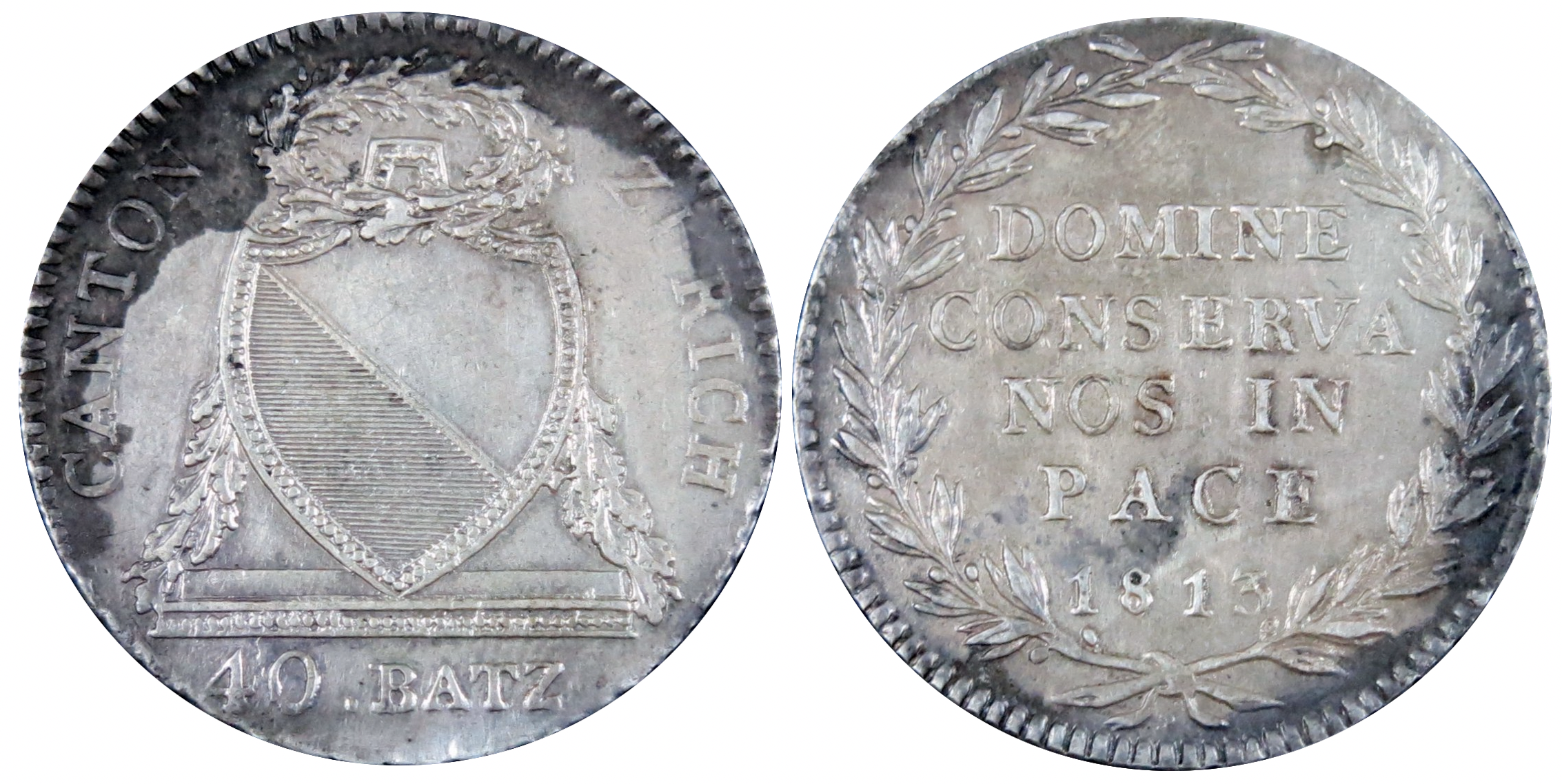
The canton of Zurich is an administrative unit (Swiss canton, canton) of Switzerland, situated in the northeastern part of the country. With a population of (as of ), it is the most populous canton of Switzerland. Zurich is the ''de facto'' Capital city, capital of the canton, but is not specifically mentioned in the constitution. The Languages of Switzerland, official language is German language, German. The local Swiss German dialect, called ''Züritüütsch'', is commonly spoken. The canton has the highest Human Development Index score (0.994) List of subnational entities with the highest and lowest Human Development Index#Regions with the highest and lowest HDI, out of 1,790 subnational regions as of 2022. It is also a global Financial centre, financial center and has the List of Swiss cantons by GRP, fourth-highest GRP in Switzerland behind Basel-Stadt, Canton of Zug, Zug and Geneva canton, Geneva by GDP per capita. History Early history The prehistoric pile dwellings ... [...More Info...] [...Related Items...] OR: [Wikipedia] [Google] [Baidu] |
Sources Of The Rhine
Lake Toma in the Swiss canton of Grisons () is generally regarded as the Source of the River Rhine. The lake's outflow, the Rein da Tuma, subsequently becomes the Anterior Rhine (Sursilvan: ''Rein Anteriur''; ), which later confluences with the Posterior Rhine (Sutsilvan: ''Ragn Posteriur''; ) to form the Rhine ( Alpine Rhine). Because the tributary systems of the Rhine differ only slightly in length, discharge and the size of their drainage areas, it is difficult to pinpoint a single source of this major European river. Criteria for distinguishing between main branches and tributaries There are different criteria for the definition of tributaries, and by some definitions, irrespective of the official name, one strand or another may be called ''the'' source. Determining the source of the Rhine is difficult, because in the river system of the Anterior and Posterior Rhine, there are many headwaters of similar size. Apart from the common criterion of the (apparent or real) la ... [...More Info...] [...Related Items...] OR: [Wikipedia] [Google] [Baidu] |
Lake Constance
Lake Constance (, ) refers to three bodies of water on the Rhine at the northern foot of the Alps: Upper Lake Constance (''Obersee''), Lower Lake Constance (''Untersee''), and a connecting stretch of the Rhine, called the Seerhein (). These waterbodies lie within the Lake Constance Basin () in the Alpine Foreland through which the Rhine flows. The nearby '' Mindelsee'' is not considered part of Lake Constance. The lake is situated where Germany, Switzerland, and Austria meet. Its shorelines lie in the German states of Baden-Württemberg and Bavaria; the Swiss cantons of St. Gallen, Thurgau, and Schaffhausen; and the Austrian state of Vorarlberg. The actual locations of the country borders within the lake are disputed. The Alpine Rhine forms, in its original course ( Alter Rhein), the Austro-Swiss border and flows into the lake from the south. The High Rhine flows westbound out of the lake and forms (with the exception of the Canton of Schaffhausen, Rafzerfeld and Bas ... [...More Info...] [...Related Items...] OR: [Wikipedia] [Google] [Baidu] |
Switzerland
Switzerland, officially the Swiss Confederation, is a landlocked country located in west-central Europe. It is bordered by Italy to the south, France to the west, Germany to the north, and Austria and Liechtenstein to the east. Switzerland is geographically divided among the Swiss Plateau, the Swiss Alps, Alps and the Jura Mountains, Jura; the Alps occupy the greater part of the territory, whereas most of the country's Demographics of Switzerland, 9 million people are concentrated on the plateau, which hosts List of cities in Switzerland, its largest cities and economic centres, including Zurich, Geneva, and Lausanne. Switzerland is a federal republic composed of Cantons of Switzerland, 26 cantons, with federal authorities based in Bern. It has four main linguistic and cultural regions: German, French, Italian and Romansh language, Romansh. Although most Swiss are German-speaking, national identity is fairly cohesive, being rooted in a common historical background, shared ... [...More Info...] [...Related Items...] OR: [Wikipedia] [Google] [Baidu] |
Cantons Of Switzerland
The 26 cantons of Switzerland are the Federated state, member states of the Switzerland, Swiss Confederation. The nucleus of the Swiss Confederacy in the form of the first three confederate allies used to be referred to as the . Two important periods in the development of the Old Swiss Confederacy are summarized by the terms ('Eight Cantons'; from 1353 to 1481) and ('Thirteen Cantons', from 1513 to 1798).rendered "the 'confederacy of eight'" and "the 'Thirteen-Canton Confederation'", respectively, in: Each canton of the Old Swiss Confederacy, formerly also ('lieu/locality', from before 1450), or ('estate', from ), was a fully sovereignty, sovereign state with its own border controls, army, and currency from at least the Treaty of Westphalia (1648) until the establishment of the Swiss federal state in 1848, with a brief period of centralised government during the Helvetic Republic (1798–1803). The term has been widely used since the 19th century. "" The number of canton ... [...More Info...] [...Related Items...] OR: [Wikipedia] [Google] [Baidu] |
Basel-Stadt
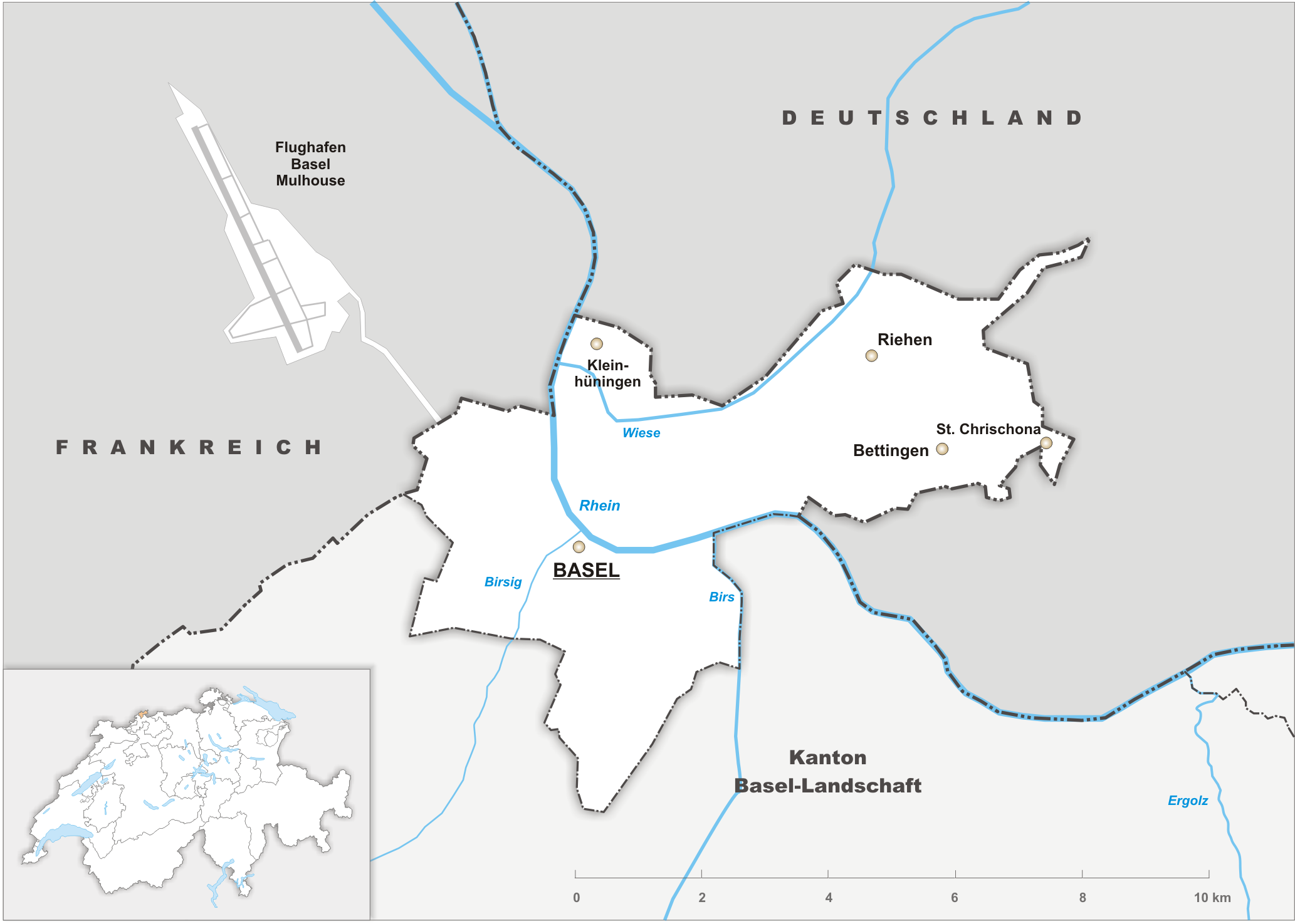
Canton of Basel-Stadt or Basel-City ( ; ; ; ) is one of the 26 cantons forming the Swiss Confederation. It is composed of three municipalities with Basel as the capital. It is traditionally considered a " half-canton", the other half being Basel-Landschaft, its rural counterpart. Basel-Stadt is one of the northernmost and lowest cantons of Switzerland, and the smallest by area. The canton lies on both sides of the Rhine and is very densely populated. The largest municipality is Basel, followed by Riehen and Bettingen. The only canton sharing borders with Basel-Stadt is Basel-Landschaft to the south. To the north of Basel-Stadt are France and Germany, with the tripoint being in the middle of the Rhine. Together with Basel-Landschaft, Basel-Stadt was part of the Canton of Basel, which joined the Old Swiss Confederacy in 1501. Political quarrels and armed conflict led to the partition of the canton in 1833. Basel-Stadt is Switzerland's seventh-largest economic centre and ha ... [...More Info...] [...Related Items...] OR: [Wikipedia] [Google] [Baidu] |
Aargau
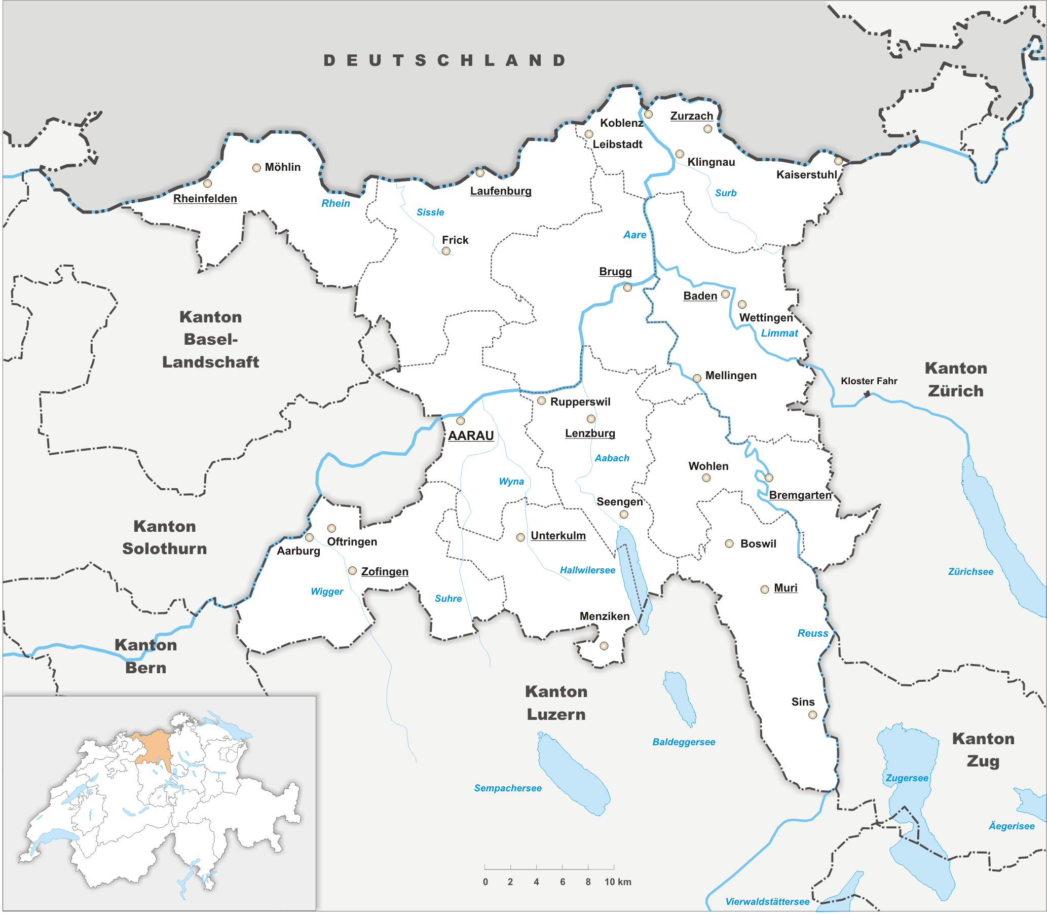
Aargau ( ; ), more formally the Canton of Aargau (; ; ; ), is one of the Canton of Switzerland, 26 cantons forming the Switzerland, Swiss Confederation. It is composed of eleven districts and its capital is Aarau. Aargau is one of the most northerly cantons of Switzerland, by the lower course of the Aare River, which is why it is called ''Aar-Gau (country subdivision), gau'' ("Aare province"). It is one of the most densely populated regions of Switzerland. History Early history The area of Aargau and the surrounding areas were controlled by the Helvetians, a tribe of Celts, as far back as 200 BC. It was eventually occupied by the Roman Empire, Romans and then by the 6th century, the Franks. The Romans built a major settlement called Vindonissa, near the present location of Brugg. Medieval Aargau The reconstructed Old High German name of Aargau is ''Argowe'', first unambiguously attested (in the spelling ''Argue'') in 795. The term described a territory only loosely eq ... [...More Info...] [...Related Items...] OR: [Wikipedia] [Google] [Baidu] |


