|
Gross Windgällen
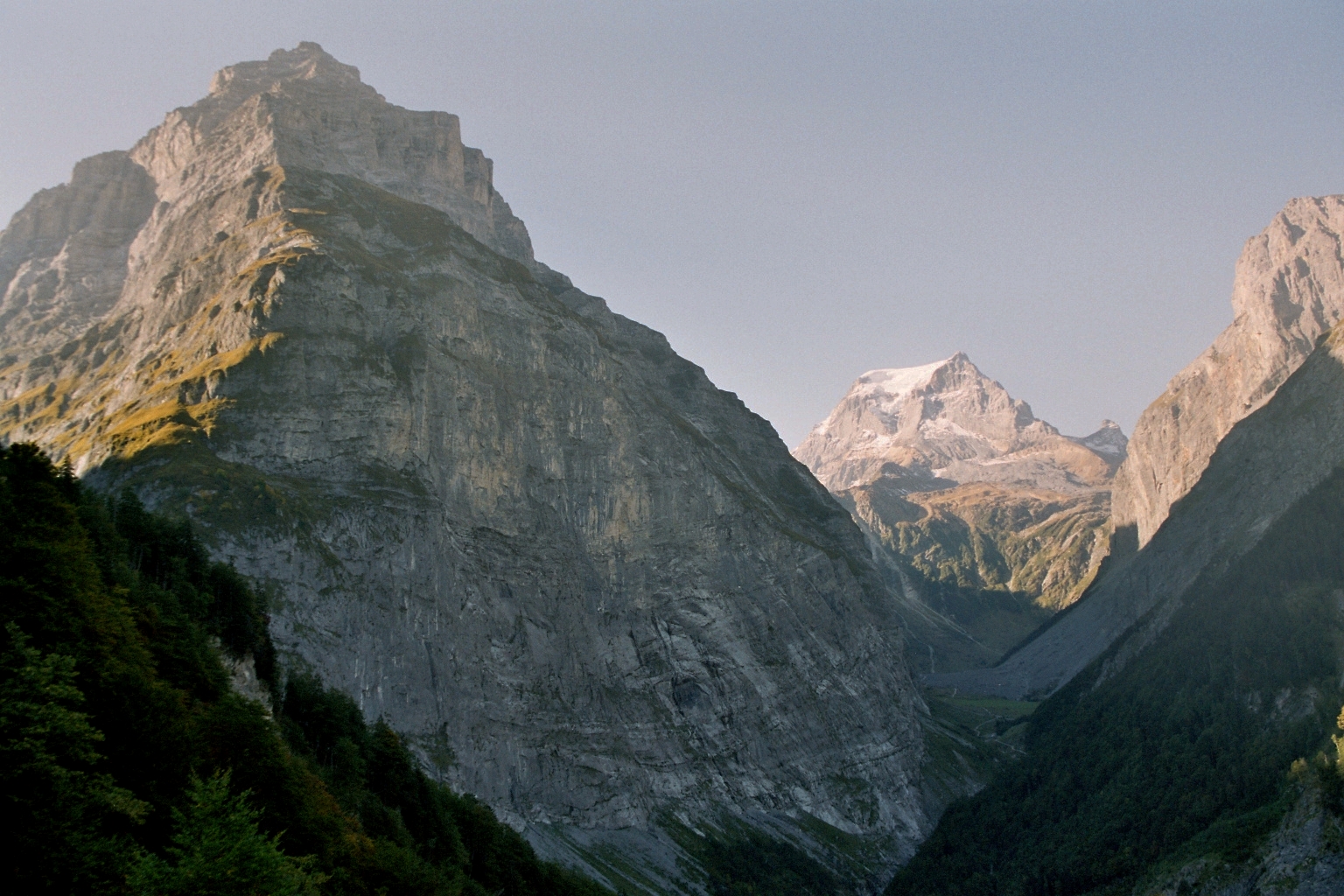
The Gross Windgällen is a 3,187 m high mountain in the Glarus Alps, overlooking the valley of the Reuss in the canton of Uri. The name Gross Windgällen derives from Gälle or gellen, meaning as much as wailing, shrilling or whistling. Geography The massif of the Gross Wingällen lies between two parallel valleys, the Schächental on the north side and the Maderanertal on the south side, both converging to the Reuss on the west at approximately 500 metres above sea level or 2,700 m below the summit. On the north side, the massif encloses a small valley, the Brunnital, which belong to the Schächental, thus forming an amphitheatre of several summits above 3,000 m, including the Gross Ruchen The Gross Ruchen is a mountain in the Glarus Alps, overlooking the Brunnital south of Unterschächen Unterschächen is a municipality in the canton of Uri in Switzerland, situated in the upper Schächental. Geography Unterschächen has an ar ... on the east; the north ... [...More Info...] [...Related Items...] OR: [Wikipedia] [Google] [Baidu] |
Chli Windgällen
The Chli Windgällen (2,986 m) is a mountain of the Glarus Alps, overlooking the valley of the Reuss in the canton of Uri. It lies west of the Gross Windgällen, on the range north of the Maderanertal The Maderanertal is an Alpine valley of the canton of Uri in Central Switzerland. It is drained by the Chärstelenbach, a stream that is a right tributary of the Reuss at Amsteg. The highest mountain in the Maderanertal is the Oberalpstock with .... References External linksChli Windgällen on Hikr Mountains of the Alps Mountains of Switzerland Mountains of the canton of Uri {{uri-mountain-stub ... [...More Info...] [...Related Items...] OR: [Wikipedia] [Google] [Baidu] |
Alpine Three-thousanders
Three-thousanders are mountains with a height of between , but less than above sea level. Similar terms are commonly used for mountains of other height brackets e. g. four-thousanders or eight-thousanders. In Britain, the term may refer to mountains above . Climatological significance In temperate latitudes three-thousanders play an important role, because even in summer they lie below the zero degree line for weeks. Thus the chains of three-thousanders always form important climatic divides and support glaciation - in the Alps the contour is roughly the general limit of the "nival step"; only a few glaciated mountains are under (the Dachstein, the easternmost glaciated mountain in the Alps, is, at , not a three-thousander). In the Mediterranean, however, the three-thousanders remain free of ice and, in the tropics, they are almost insignificant from a climatic perspective; here the snow line lies at around to , and in the dry continental areas (Trans-Himalayas, Ande ... [...More Info...] [...Related Items...] OR: [Wikipedia] [Google] [Baidu] |
Mountains Of The Alps
This page tabulates only the most prominent mountains of the Alps, selected for having a topographic prominence of ''at least'' , and all of them exceeding in height. Although the list contains 537 summits, some significant alpine mountains are necessarily excluded for failing to meet the stringent prominence criterion. The list of these most prominent mountains is continued down to 2500 m elevation at List of prominent mountains of the Alps (2500–2999 m) and down to 2000 m elevation on List of prominent mountains of the Alps (2000–2499 m). All such mountains are located in either France, Italy, Switzerland, Liechtenstein, Austria, Germany or Slovenia, even in some lower regions. Together, these three lists include all 44 ultra-prominent peaks of the Alps, with 19 ultras over 3000m on this page. For a definitive list of all 82 the highest peaks of the Alps, as identified by the International Climbing and Mountaineering Federation (UIAA), and often referred to as the 'A ... [...More Info...] [...Related Items...] OR: [Wikipedia] [Google] [Baidu] |
Seewli
__NOTOC__ Seewlisee (or ''Seewli'') is a lake in Uri, Switzerland at an elevation of 2028 m. Its surface area is . The lake lies at the foot of the Gross Windgällen. The lake can be reached by foot in 2–3 hours from the cable car Silenen-Chilcherbergen. See also *List of mountain lakes of Switzerland This is a list of high-altitude lakes in Switzerland. It includes all significant lakes, natural or artificial, with an area over 4 hectares and a height over 800 metres above sea level. This height approximately corresponds to the transiti ... External linksSeewli AlpFischerei Uri: Seewlisee profile Lakes of Switzerland Lakes of the canton of Uri {{Uri-lake-stub ... [...More Info...] [...Related Items...] OR: [Wikipedia] [Google] [Baidu] |
Gross Ruchen
The Gross Ruchen is a mountain in the Glarus Alps, overlooking the Brunnital south of Unterschächen Unterschächen is a municipality in the canton of Uri in Switzerland, situated in the upper Schächental. Geography Unterschächen has an area, , of . Of this area, 35.6% is used for agricultural purposes, while 9.4% is forested. Of the rest of ... in the canton of Uri. It is located between the higher Gross Windgallen on the west and the Chli Ruchen on the east. The north face is very steep and is linked with that of the Gross Windgällen. On the east flanks is the Ruchenfirn, a glacier lying between 2,600 and 3,100 metres. References External links Gross Ruchen on Summitpost Mountains of the Alps [...More Info...] [...Related Items...] OR: [Wikipedia] [Google] [Baidu] |
Maderanertal
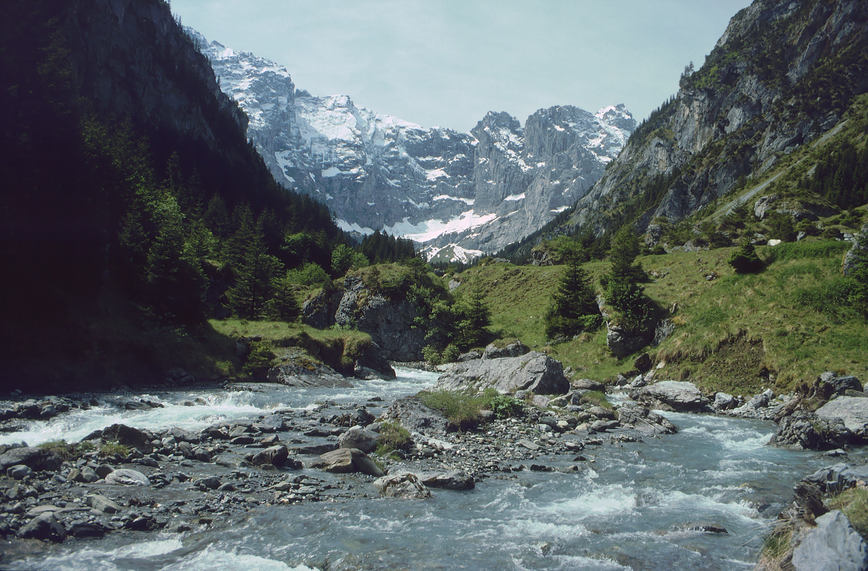
The Maderanertal is an Alpine valley of the canton of Uri in Central Switzerland. It is drained by the Chärstelenbach, a stream that is a right tributary of the Reuss at Amsteg. The highest mountain in the Maderanertal is the Oberalpstock with a height of 3,328 metres above sea level. Other important summits are the Schärhorn, the Clariden, the Düssi, the Gross Windgällen, the Gross Ruchen The Gross Ruchen is a mountain in the Glarus Alps, overlooking the Brunnital south of Unterschächen Unterschächen is a municipality in the canton of Uri in Switzerland, situated in the upper Schächental. Geography Unterschächen has an ar ..., Piz Giuv and the Bristen. The Maderanertal include two large lateral valleys: the Etzlital and the Brunnital, drained by the Etzlibach and the Brunnibach respectively (both left tributaries). The upper valley is heavily glaciated, the largest glacier being the Hüfi Glacier. The Maderanertal belongs to the municipality of Silenen. T ... [...More Info...] [...Related Items...] OR: [Wikipedia] [Google] [Baidu] |
Schächental
The Schächental (''Schächen Valley'') is an alpine valley of Uri, Switzerland, formed by the river Schächen. The valley stretches to the east of Altdorf for some 10 km. Situated in the Schächental are the municipalities of Bürglen (525 m), Spiringen (923 m) and Unterschächen (995 m). The valley terminates in the Klausenpass (1948 m), which connects to the Urner Boden, leading towards Glarus. A side valley, the Brunnital branches to the south of Unterschächen, extending for some 4 km. It terminates abruptly, in the steep northern slope of the Gross Windgällen. Upon leaving the valley, the Schächen flows past Altdorf and joins the Reuss at Attinghausen. The inhabitants of the Schächen valley figure prominently in the formative phase of the Old Swiss Confederacy in the context of the struggle against the Habsburg feudal lords. According to Aegidius Tschudi (1570), William Tell was a native of the Schächen valley. See also *Valleys of the Alps The mai ... [...More Info...] [...Related Items...] OR: [Wikipedia] [Google] [Baidu] |
Reuss (river)
The Reuss (Swiss German: ''Rüüss'') is a river in Switzerland. With a length of and a drainage basin of , it is the fourth largest river in Switzerland (after the Rhine, Aare and Rhône). The upper Reuss forms the main valley of the canton of Uri. The course of the lower Reuss runs from Lake Lucerne to the confluence with the Aare at Brugg and Windisch. The Reuss is one of the four major rivers taking their source in the Gotthard region, along with the Rhine, Ticino and Rhône. Geography Course The Gotthardreuss rises in the Gotthard massif, emerging from Lago di Lucendro (reservoir built in 1947; elevation 2,131 m) in the canton of Ticino and passing into the canton of Uri below the ''Brigghubel'' (1,898 m). The Furkareuss rises east of Furka Pass (2,429 m), early joined by the ''Blaubergbach'' (sourced by two mountain lakes on 2,649 m) and several other creeks sourced by still existing glaciers, such as ''Sidelengletscher'' (3,170&nbs ... [...More Info...] [...Related Items...] OR: [Wikipedia] [Google] [Baidu] |
Tödi
The Tödi (), is a mountain massif and with the mountain peak Piz Russein the highest mountain in the Glarus Alps and the highest summit in the canton of Glarus, Switzerland. It is located on the border between the cantons of canton of Graubünden, Graubünden, to the south, and Glarus, to the north, close to the point where those two cantons meet the canton of Uri, to the west. Although not the culminating point of Graubünden, it is its highest peak outside the Bernina range. Geography The Tödi lies in the west part of the Glarus Alps, between Linthal, Glarus, Linthal on the north and Disentis on the south. The Tödi is a vast mountain massif projecting as a promontory to the north from the range that divides the basin of the Linth from that of the Rhine. There are three principal peaks. The lowest, and northernmost, which is that seen from the Ober Sand Alp, is called ''Sandgipfel'' (). The ''Glarner Tödi'' (), long supposed to be the highest, and most conspicuous from St ... [...More Info...] [...Related Items...] OR: [Wikipedia] [Google] [Baidu] |
Mountain
A mountain is an elevated portion of the Earth's crust, generally with steep sides that show significant exposed bedrock. Although definitions vary, a mountain may differ from a plateau in having a limited summit area, and is usually higher than a hill, typically rising at least 300 metres (1,000 feet) above the surrounding land. A few mountains are isolated summits, but most occur in mountain ranges. Mountains are formed through tectonic forces, erosion, or volcanism, which act on time scales of up to tens of millions of years. Once mountain building ceases, mountains are slowly leveled through the action of weathering, through slumping and other forms of mass wasting, as well as through erosion by rivers and glaciers. High elevations on mountains produce colder climates than at sea level at similar latitude. These colder climates strongly affect the ecosystems of mountains: different elevations have different plants and animals. Because of the less hospitable ter ... [...More Info...] [...Related Items...] OR: [Wikipedia] [Google] [Baidu] |
List Of Mountains Of The Alps Above 3000 M
This page tabulates only the most prominent mountains of the Alps, selected for having a topographic prominence of ''at least'' , and all of them exceeding in height. Although the list contains 537 summits, some significant alpine mountains are necessarily excluded for failing to meet the stringent prominence criterion. The list of these most prominent mountains is continued down to 2500 m elevation at List of prominent mountains of the Alps (2500–2999 m) and down to 2000 m elevation on List of prominent mountains of the Alps (2000–2499 m). All such mountains are located in either France, Italy, Switzerland, Liechtenstein, Austria, Germany or Slovenia, even in some lower regions. Together, these three lists include all 44 ultra-prominent peaks of the Alps, with 19 ultras over 3000m on this page. For a definitive list of all 82 the highest peaks of the Alps, as identified by the International Climbing and Mountaineering Federation (UIAA), and often referred to as the 'A ... [...More Info...] [...Related Items...] OR: [Wikipedia] [Google] [Baidu] |


