|
Gia Lâm District
Gia Lâm is the easternmost rural district (''huyện'') of Hanoi, the capital city of Vietnam. Prior to 2003, the district covered the entire area of Long Biên district, which included Long Biên Bridge, Gia Lâm Airport, Gia Lâm railway station, Gia Lâm bus station and the headquarters of Vietnam Airlines Vietnam Airlines ( vi, Hãng Hàng không Quốc gia Việt Nam, lit=Vietnam National Airlines) is the flag carrier of Vietnam. The airline was founded in 1956 and later established as a state-owned enterprise in April 1989. Vietnam Airline .... Geography Gia Lâm district is bordered by Bắc Ninh province to the east and north, Đông Anh district to the northwest, Long Biên district and Hoàng Mai district to the west, Thanh Trì district and Hưng Yên province to the south. As of 2011, the district had a population of 243,957. The district covers an area of . The district capital lies at Trâu Quỳ township. Gia Lâm district is subdivided to 22 ... [...More Info...] [...Related Items...] OR: [Wikipedia] [Google] [Baidu] |
Huyện
Districts (huyện), also known as rural districts, are one of several types of second-tier administrative subdivisions of Vietnam, the other types being urban districts (''quận''), provincial cities (), municipal city (), and district-level towns (). The districts are subdivisions of the first-tier divisions, namely the provinces and municipalities. Districts are subdivided into third-tier units, namely townships and communes. History The districts existed since the 15th century. Prior to 1945 the ''huyện'' (chữ Hán: 縣) was also called district and earlier "sub-prefecture" of the prefectures, or phủ into which provinces were previously divided. The administrative reorganization by Minh Mạng Minh Mạng () or Minh Mệnh (, vi-hantu, 明 命, lit. "the bright favour of Heaven"; 25 May 1791 – 20 January 1841; born Nguyễn Phúc Đảm, also known as Nguyễn Phúc Kiểu) was the second emperor of the Nguyễn dynasty of V ... in 1832 did not subst ... [...More Info...] [...Related Items...] OR: [Wikipedia] [Google] [Baidu] |
Gia Lâm Station
Gia Lâm station is a railway station in Vietnam, in the north eastern Long Biên District of Hanoi. It serves the city of Hanoi. It is the terminus of the standard-gauge railway A standard-gauge railway is a railway with a track gauge of . The standard gauge is also called Stephenson gauge (after George Stephenson), International gauge, UIC gauge, uniform gauge, normal gauge and European gauge in Europe, and SGR in E ... linking Vietnam to China, known as the Hanoi–Đồng Đăng railway. The daily train to Nanning (610 km) departs from this station instead of the main Hanoi railway station, which is served only by metre gauge tracks, as does the Beijing–Nanning–Hanoi through train.Vietnam – Page 164 Michelin – 2010 "Départs de Hanoi (Ga Gia Lam) les mar. et vend. à 17h pour Ningming (234 km) et Nanning (610 km, 26h)." References Railway stations in Hanoi {{Vietnam-railstation-stub ... [...More Info...] [...Related Items...] OR: [Wikipedia] [Google] [Baidu] |
Commune-level Subdivisions (Vietnam)
In Vietnam, there are three kinds of third-level (commune-level) administrative subdivisions: the rural commune ( vi, xã), the commune-level town ( vi, thị trấn), and the ward ( vi, phường, literal meaning: urban subdistrict). In Vietnam a rural commune is referred to as a ''xã'' and urban communes are referred to as ''Thị trấn'', urban townships. However many communities, particularly large urban ones with provincial status, will be divided into wards which are known as ''phường''. , there were a total of 9,111 communes in Vietnam excluding townships and wards. Each commune may consist of a number of towns and villages; but often wards and commune-level towns (mostly from urban districts) are divided into residential neighborhoods or wards which differ from rural communes. , there were a total of 11,112 commune-level subdivisions in Vietnam including townships and wards. Thanh Hóa Province has the highest number of communes in any province of Vietnam with a ... [...More Info...] [...Related Items...] OR: [Wikipedia] [Google] [Baidu] |
Hoàng Mai District, Hanoi
Huang (; ) is a Chinese surname that originally means and refers to jade people were wearing and decorating in ancient times. While ''Huáng'' is the pinyin romanization of the word, it may also be romanized as Hwang, Wong, Waan, Wan, Waon, Hwong, Vong, Hung, Hong, Bong, Eng, Ng, Uy, Wee, Oi, Oei, Oey, Ooi, Ong, or Ung due to pronunciations of the word in different dialects and languages. It is the 96th name on the ''Hundred Family Surnames'' poem.K. S. Tom. 989(1989). Echoes from Old China: Life, Legends and Lore of the Middle Kingdom. University of Hawaii Press. . This surname is known as Hwang in Korean. In Vietnamese, the name is known as Hoàng or Huỳnh. Huang is the 7th most common surname in China. Huynh is the 5th most common surname in Vietnam. The population of Huangs in China and Taiwan was estimated at more than 35 million in 2020; it was also the surname of more than 2 million overseas Chinese, 5.7 million Vietnamese (6%), and an estimated 1 million Koreans ... [...More Info...] [...Related Items...] OR: [Wikipedia] [Google] [Baidu] |
Vietnam Airlines
Vietnam Airlines ( vi, Hãng Hàng không Quốc gia Việt Nam, lit=Vietnam National Airlines) is the flag carrier of Vietnam. The airline was founded in 1956 and later established as a state-owned enterprise in April 1989. Vietnam Airlines is headquartered in Long Biên District, Hanoi, with hubs at Noi Bai International Airport in Hanoi and Tan Son Nhat International Airport in Ho Chi Minh City. The airline flies to 64 destinations in 17 countries, excluding codeshared services. From its inception until the early 1990s, Vietnam Airlines was a minor carrier within the aviation industry as it was hampered by a variety of factors including the socio-economic and political situation of the country. With the government's normalization of relations with the United States, the airline was able to expand, improve its products and services, and modernize its ageing fleet. In 1996, the Vietnamese government brought together 20 service companies to form Vietnam Airlines Corpora ... [...More Info...] [...Related Items...] OR: [Wikipedia] [Google] [Baidu] |
Gia Lâm Airport
Gia Lam Airport () is an airport in Hanoi, Vietnam, located in Long Biên District, on the eastern bank of the Red River. It is primarily a military field, used by the Vietnam People's Air Force (VPAF), with MiG-21 fighters and Kamov Ka-28 helicopters stored in revetments. The airfield was inaugurated in 1936, before the Japanese occupation of French Indochina. The airport is currently used for military training activities, as well as for chartered helicopter taxi flights for tourists visiting nearby attractions such as Ha Long Bay. There are plans to convert Gia Lam to a civilian airport, serving short flights to and from locations in Northern Vietnam. History 1936–40 Gia Lam Airfield (french: Aérogare de Gia Lam, links=no) was built in , according to an urban plan laid out by French architect Ernest Hébrard over a decade earlier. Hébrard was hired by the city of Hanoi's Urban Planning and Architecture Services department in 1923 to supervise a number of urban renewal p ... [...More Info...] [...Related Items...] OR: [Wikipedia] [Google] [Baidu] |
Regions Of Vietnam
The Vietnamese government often groups the various provinces and municipalities into three regions: Northern Vietnam, Central Vietnam, and Southern Vietnam. These regions can be further subdivided into eight subregions: Northeast Vietnam, Northwest Vietnam, the Red River Delta, the North Central Coast, the South Central Coast, the Central Highlands, Southeast Vietnam, and the Mekong River Delta. These regions are not always used, and alternative classifications are possible. Other classifications used can be: Northern, Central, Southern, and Mekong. List of regions and subregions ǂ Municipality Table of provinces per region {, border="2" cellpadding="4" cellspacing="0" style="margin: 1em 1em 1em 0; background: #f9f9f9; border: 1px #aaa solid; border-collapse: collapse; font-size: 100%;" !Name !Capital !Population !Area(km2) , ---bgcolor=#CCCCCC , colspan=4, Northern Vietnam (Bắc Bộ Việt Nam) , ---bgcolor=#DDDDDD , colspan=4, ''Northeast Vietnam (Đông Bắc Vi� ... [...More Info...] [...Related Items...] OR: [Wikipedia] [Google] [Baidu] |
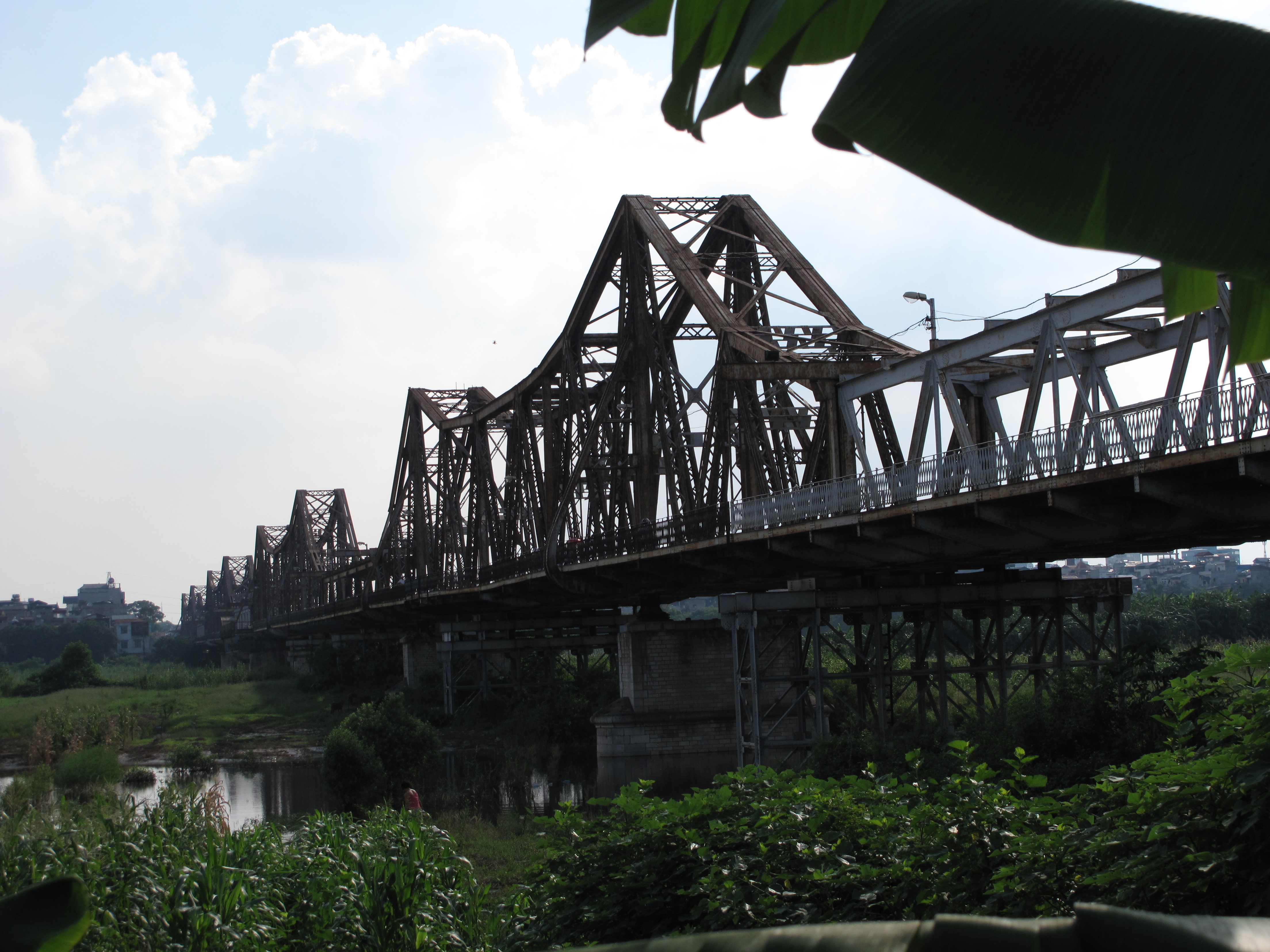
Long Biên Bridge
Long Biên Bridge ( vi, Cầu Long Biên) is a historic cantilever bridge across the Red River that connects two districts, Hoàn Kiếm and Long Biên of the city of Hanoi, Vietnam. It was originally called ''Paul Doumer Bridge''. History The bridge was built in 1899–1902 by the architects Daydé & Pillé of Paris, and opened in 1903.Long Bien: Historic Hanoi bridge with an uncertain future by Petroc Trelawny, BBC News Magazine, 18 August 2013. Retrieved 18 August 2013. Before North Vietnam's independence in 1954, it was called ''Paul-Doumer Bridge'', named after – The Governor-General of French Indochina and then French president. At in length, [...More Info...] [...Related Items...] OR: [Wikipedia] [Google] [Baidu] |

.jpg)

