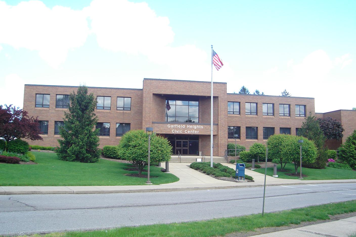
|
Garfield Heights
Garfield Heights is a city in Cuyahoga County, Ohio, United States. It is a suburb of Cleveland. The population was 28,849 at the time of the 2010 census. Geography Garfield Heights is located at (41.421423, -81.602682). According to the United States Census Bureau, the city has a total area of , of which is land and is water. The elevation of Garfield Heights is above sea level where it borders Cleveland, and its highest elevation is above sea level at the Garfield Heights Justice Center. History The area was originally part of Newburgh Township. The Village of South Newburgh was formed in 1907, and it was incorporated as Garfield Heights in 1930. The city is named after Garfield Park, which in turn was named in honor of President James A. Garfield. Economy Marymount Hospital, part of the Cleveland Clinic system, is the city's largest employer. The Ohio Department of Transportation has its District 12 headquarters in the city. In 2007, Garfield Heights and its neigh ... [...More Info...] [...Related Items...] OR: [Wikipedia] [Google] [Baidu] |
City
A city is a human settlement of notable size.Goodall, B. (1987) ''The Penguin Dictionary of Human Geography''. London: Penguin.Kuper, A. and Kuper, J., eds (1996) ''The Social Science Encyclopedia''. 2nd edition. London: Routledge. It can be defined as a permanent and densely settled place with administratively defined boundaries whose members work primarily on non-agricultural tasks. Cities generally have extensive systems for housing, transportation, sanitation, utilities, land use, production of goods, and communication. Their density facilitates interaction between people, government organisations and businesses, sometimes benefiting different parties in the process, such as improving efficiency of goods and service distribution. Historically, city-dwellers have been a small proportion of humanity overall, but following two centuries of unprecedented and rapid urbanization, more than half of the world population now lives in cities, which has had profound consequences for ... [...More Info...] [...Related Items...] OR: [Wikipedia] [Google] [Baidu] |
Geographic Names Information System
The Geographic Names Information System (GNIS) is a database of name and locative information about more than two million physical and cultural features throughout the United States and its territories, Antarctica, and the associated states of the Marshall Islands, Federated States of Micronesia, and Palau. It is a type of gazetteer. It was developed by the United States Geological Survey (USGS) in cooperation with the United States Board on Geographic Names (BGN) to promote the standardization of feature names. Data were collected in two phases. Although a third phase was considered, which would have handled name changes where local usages differed from maps, it was never begun. The database is part of a system that includes topographic map names and bibliographic references. The names of books and historic maps that confirm the feature or place name are cited. Variant names, alternatives to official federal names for a feature, are also recorded. Each feature receives ... [...More Info...] [...Related Items...] OR: [Wikipedia] [Google] [Baidu] |
Traffic Signal Preemption
Traffic signal preemption (also called traffic signal prioritisation) is a system that allows the normal operation of traffic lights to be preempted. The most common use of these systems manipulates traffic signals in the path of an emergency vehicle, halting conflicting traffic and allowing the emergency vehicle right-of-way, thereby reducing response times and enhance traffic safety. Signal preemption can also be used on tram, light-rail and bus rapid transit systems, to allow public transportation priority access through intersections, and by railroad systems at crossings to prevent collisions. Implementation Traffic preemption is implemented in a variety of ways. Traffic light activation devices can be installed on road vehicles, integrated with transport network management systems, or operated by remote control from a fixed location, such as a fire station, or by an emergency call dispatcher. Traffic lights are equipped to receive an activation signal which interrupts the n ... [...More Info...] [...Related Items...] OR: [Wikipedia] [Google] [Baidu] |
Garfield Heights City Hall
''Garfield'' is an American comic strip created by Jim Davis. Originally published locally as ''Jon'' in 1976, then in nationwide syndication from 1978 as ''Garfield'', it chronicles the life of the title character Garfield the cat, his human owner Jon Arbuckle, and Odie the dog. As of 2013, it was syndicated in roughly 2,580 newspapers and journals, and held the Guinness World Record for being the world's most widely syndicated comic strip. Though its setting is rarely mentioned in print, ''Garfield'' takes place in Jim Davis' hometown of Muncie, Indiana, according to the television special ''Happy Birthday, Garfield''. Common themes in the strip include Garfield's laziness, obsessive eating, love of coffee and lasagna, disdain of Mondays, and diets. Garfield is also shown to manipulate people to get whatever he wants. The strip's focus is mostly on the interactions among Garfield, Jon, and Odie, but other recurring characters appear as well. Originally created with the ... [...More Info...] [...Related Items...] OR: [Wikipedia] [Google] [Baidu] |
Chart Industries
A chart (sometimes known as a graph) is a graphical representation for data visualization, in which "the data is represented by symbols, such as bars in a bar chart, lines in a line chart, or slices in a pie chart". A chart can represent tabular numeric data, functions or some kinds of quality structure and provides different info. The term "chart" as a graphical representation of data has multiple meanings: * A data chart is a type of diagram or graph, that organizes and represents a set of numerical or qualitative data. * Maps that are adorned with extra information ( map surround) for a specific purpose are often known as charts, such as a nautical chart or aeronautical chart, typically spread over several map sheets. * Other domain-specific constructs are sometimes called charts, such as the chord chart in music notation or a record chart for album popularity. Charts are often used to ease understanding of large quantities of data and the relationships between parts ... [...More Info...] [...Related Items...] OR: [Wikipedia] [Google] [Baidu] |


