|
Garbh Eilean, Loch Maree
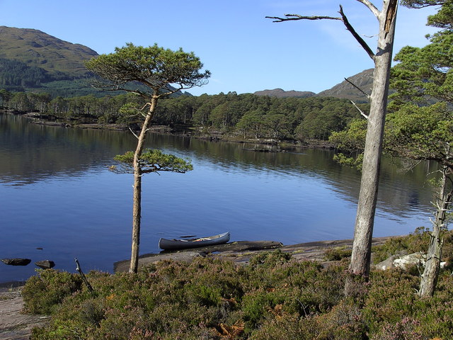
Garbh Eilean is a forested island in Loch Maree, Wester Ross, Scotland. Garbh Eilean lies between Eilean Sùbhainn and Eilean Ruairidh Mòr. The islands are among the least disturbed in Britain. They are managed as the Loch Maree National Nature Reserve by agreements between Scottish Natural Heritage NatureScot ( gd, NàdarAlba), which was formerly known as Scottish Natural Heritage, is an executive non-departmental public body of the Scottish Government responsible for the country's natural heritage, especially its natural, genetic and s ... and their owners. Footnotes Islands of Loch Maree Uninhabited islands of Highland (council area) {{highland-geo-stub ... [...More Info...] [...Related Items...] OR: [Wikipedia] [Google] [Baidu] |
Loch Maree
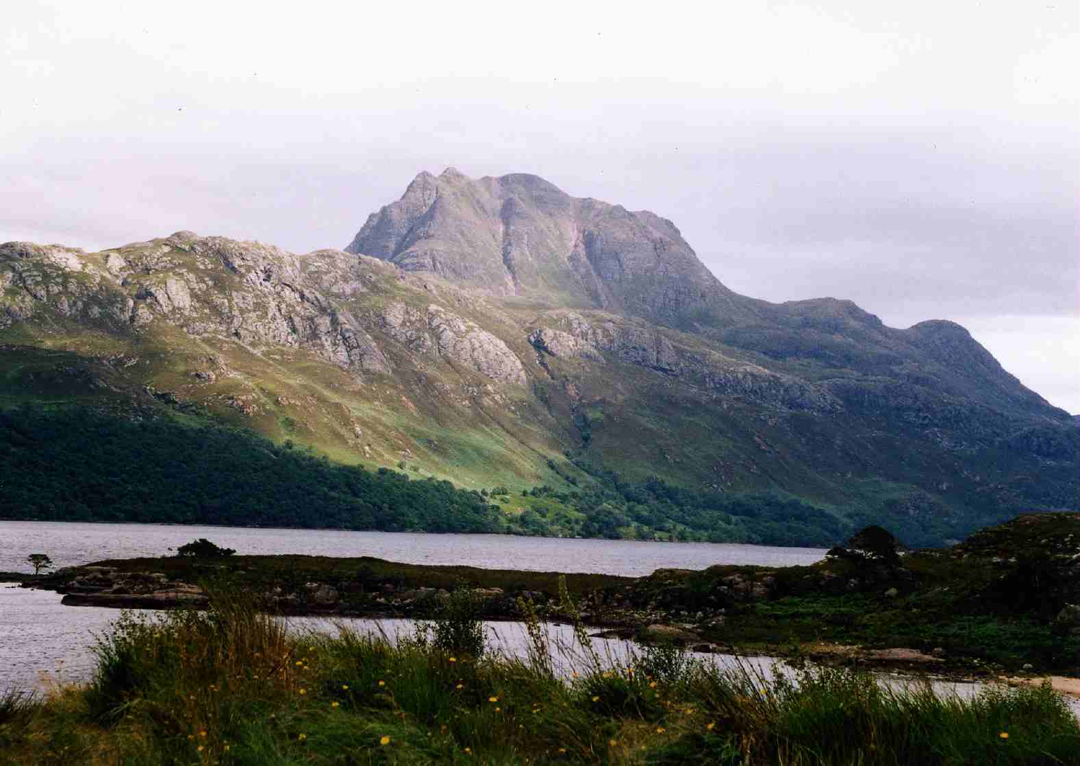
Loch Maree ( gd, Loch Ma-ruibhe) is a loch in Wester Ross in the Northwest Highlands of Scotland. At long and with a maximum width of , it is the fourth-largest freshwater loch in Scotland; it is the largest north of Loch Ness. Its surface area is . Loch Maree contains five large wooded islands and over 60 smaller ones, many of which have their own lochans. The largest island, Eilean Sùbhainn, contains a loch that itself contains an island,Ordnance Survey. 1:25000 ''Explorer'' map. Sheet 433, Torridon - Beinn Eighe & Liathach. a situation that occurs nowhere else in Great Britain. Isle Maree holds the remains of a chapel believed to be the 8th century hermitage of Saint Máel Ruba (d. 722), who founded the monastery of Applecross in 672. It is after him that Loch Maree is named; prior to the saint's arrival in the area the loch is believed to have been named Loch Ewe, as evidenced by the name of the village of Kinlochewe ( gd, Ceann Loch Iù, meaning "Head of Loch Ewe") ... [...More Info...] [...Related Items...] OR: [Wikipedia] [Google] [Baidu] |
Highland (council Area)
Highland ( gd, A' Ghàidhealtachd, ; sco, Hieland) is a council area in the Scottish Highlands and is the largest local government area in the United Kingdom. It was the 7th most populous council area in Scotland at the 2011 census. It shares borders with the council areas of Aberdeenshire, Argyll and Bute, Moray and Perth and Kinross. Their councils, and those of Angus and Stirling, also have areas of the Scottish Highlands within their administrative boundaries. The Highland area covers most of the mainland and inner-Hebridean parts of the historic counties of Inverness-shire and Ross and Cromarty, all of Caithness, Nairnshire and Sutherland and small parts of Argyll and Moray. Despite its name, the area does not cover the entire Scottish Highlands. Name Unlike the other council areas of Scotland, the name ''Highland'' is often not used as a proper noun. The council's website only sometimes refers to the area as being ''Highland'', and other times as being '' ... [...More Info...] [...Related Items...] OR: [Wikipedia] [Google] [Baidu] |
List Of Islands Of Scotland
This is a list of islands of Scotland, the mainland of which is part of the island of Great Britain. Also included are various other related tables and lists. The definition of an offshore island used in this list is "land that is surrounded by seawater on a daily basis, but not necessarily at all stages of the tide, excluding human devices such as bridges and causeways". Scotland has over 790 offshore islands, most of which are to be found in four main groups: Shetland, Orkney, and the Hebrides, sub-divided into the Inner Hebrides and Outer Hebrides. There are also clusters of islands in the Firth of Clyde, Firth of Forth, and Solway Firth, and numerous small islands within the many bodies of fresh water in Scotland including Loch Lomond and Loch Maree. The largest island is Lewis and Harris which extends to 2,179 square kilometres, and there are a further 200 islands which are greater than 40 hectares in area. Of the remainder, several such as Staffa and the Flannan Is ... [...More Info...] [...Related Items...] OR: [Wikipedia] [Google] [Baidu] |
Ordnance Survey
Ordnance Survey (OS) is the national mapping agency for Great Britain. The agency's name indicates its original military purpose (see ordnance and surveying), which was to map Scotland in the wake of the Jacobite rising of 1745. There was also a more general and nationwide need in light of the potential threat of invasion during the Napoleonic Wars. Since 1 April 2015 Ordnance Survey has operated as Ordnance Survey Ltd, a government-owned company, 100% in public ownership. The Ordnance Survey Board remains accountable to the Secretary of State for Business, Energy and Industrial Strategy. It was also a member of the Public Data Group. Paper maps for walkers represent only 5% of the company's annual revenue. It produces digital map data, online route planning and sharing services and mobile apps, plus many other location-based products for business, government and consumers. Ordnance Survey mapping is usually classified as either " large-scale" (in other words, more detaile ... [...More Info...] [...Related Items...] OR: [Wikipedia] [Google] [Baidu] |
Wester Ross
Wester Ross () is an area of the Northwest Highlands of Scotland in the council area of Highland. The area is loosely defined, and has never been used as a formal administrative region in its own right, but is generally regarded as lying to the west of the main watershed of Ross (the eastern part of Ross being Easter Ross), thus forming the western half of the county of Ross and Cromarty. The southwesternmost part of Ross and Cromarty, Lochalsh, is not considered part of Wester Ross by the local tourist organisation, ''Visit Wester Ross'', but is included within the definition used for the Wester Ross Biosphere Reserve.Wester Ross Biosphere Reserve Application. p. 2. Wester Ross has one of the lowest population densities in Europe, with just 1.6 people per km2, who live mostly in small crofting townships along the coastline of the region. The area is renowned for the scenic splendour of its mountains and coastline, and the range of wildlife that can be seen. It is a popula ... [...More Info...] [...Related Items...] OR: [Wikipedia] [Google] [Baidu] |
Scotland
Scotland (, ) is a Countries of the United Kingdom, country that is part of the United Kingdom. Covering the northern third of the island of Great Britain, mainland Scotland has a Anglo-Scottish border, border with England to the southeast and is otherwise surrounded by the Atlantic Ocean to the north and west, the North Sea to the northeast and east, and the Irish Sea to the south. It also contains more than 790 Islands of Scotland, islands, principally in the archipelagos of the Hebrides and the Northern Isles. Most of the population, including the capital Edinburgh, is concentrated in the Central Belt—the plain between the Scottish Highlands and the Southern Uplands—in the Scottish Lowlands. Scotland is divided into 32 Subdivisions of Scotland, administrative subdivisions or local authorities, known as council areas. Glasgow, Glasgow City is the largest council area in terms of population, with Highland (council area), Highland being the largest in terms of area. Limi ... [...More Info...] [...Related Items...] OR: [Wikipedia] [Google] [Baidu] |
Eilean Sùbhainn
Eilean Sùbhainn is the largest of several small islands in Loch Maree, Wester Ross, Scotland. It is the second largest freshwater island in Scotland after Inchmurrin Inchmurrin ( gd, Innis Mhearain) is an island in Loch Lomond in Scotland. It is the largest fresh water island in the British Isles. Geography and geology Inchmurrin is the largest and most southerly of the islands in Loch Lomond. It reache .... Lying northeast of Talladale, the island is partially forested and uninhabited. It rises to and extends to . The island is a nature reserve and includes several small lochans. Footnotes Islands of Loch Maree Uninhabited islands of Highland (council area) {{highland-geo-stub ... [...More Info...] [...Related Items...] OR: [Wikipedia] [Google] [Baidu] |
Eilean Ruairidh Mòr
Eilean Ruairidh Mòr is a forested island in Loch Maree, Wester Ross, Scotland. Its name was formerly anglicised as "Ellan-Rorymore".Wilson, Rev. John ''The Gazetteer of Scotland'' (Edinburgh, 1882) Published by W. & A.K. Johnstone The island is owned by Forestry and Land Scotland, as is the Slattadale Forest on the southern shore of Loch Maree.Ordnance Survey Ordnance Survey (OS) is the national mapping agency for Great Britain. The agency's name indicates its original military purpose (see ordnance and surveying), which was to map Scotland in the wake of the Jacobite rising of 1745. There was a .... ''Landranger'' (1:50000) Series. Sheet 19: Gairloch and Ullapool. The islands in Loch Maree are among the least disturbed in Britain and are managed as a national nature reserve. History Eilean Ruairidh Mòr was planted with pines in about 1815. There are remains of a subterranean circular structure, similar to a Scandinavian dùn or burgh. The ancestors of the Mackenzies ... [...More Info...] [...Related Items...] OR: [Wikipedia] [Google] [Baidu] |
National Nature Reserve (United Kingdom)
Some statutory nature reserves are designated by national bodies in the United Kingdom, and are known as national nature reserves. Great Britain In Great Britain, nature reserves designed under Part III of the National Parks and Access to the Countryside Act 1949 that are deemed to be of national importance may be designated as statutory 'national nature reserves' by the relevant national nature conservation body (Natural England, Scottish Natural Heritage, or Natural Resources Wales) using section 35(1) of the Wildlife and Countryside Act 1981. If a nature reserve is designated by a local authority in Great Britain, then the resulting statutory nature reserve will be referred to as a local nature reserve. England In England, 229 national nature reserves are designated by Natural England. Scotland In Scotland, 43 national nature reserves are designated by NatureScot. Wales In Wales, 76 national nature reserves are designated by Natural Resources Wales. Northern Irelan ... [...More Info...] [...Related Items...] OR: [Wikipedia] [Google] [Baidu] |
Scottish Natural Heritage
NatureScot ( gd, NàdarAlba), which was formerly known as Scottish Natural Heritage, is an executive non-departmental public body of the Scottish Government responsible for the country's natural heritage, especially its natural, genetic and scenic diversity. It advises the Scottish Government on nature conservation, and acts as a government agent in the delivery of conservation designations, i.e. national nature reserves, local nature reserves, national parks, Sites of Special Scientific Interest (SSSIs), Special Areas of Conservation, Special Protection Areas and the national scenic areas. It receives annual funding from the Government in the form of Grant in Aid to deliver Government priorities for the natural heritage. NatureScot is the Scottish Government's adviser on all aspects of nature, wildlife management and landscape across Scotland, and also helps the Scottish Government meet its responsibilities under European environmental laws, particularly in relation to t ... [...More Info...] [...Related Items...] OR: [Wikipedia] [Google] [Baidu] |
Islands Of Loch Maree
An island (or isle) is an isolated piece of habitat that is surrounded by a dramatically different habitat, such as water. Very small islands such as emergent land features on atolls can be called islets, skerries, cays or keys. An island in a river or a lake island may be called an eyot or ait, and a small island off the coast may be called a holm. Sedimentary islands in the Ganges delta are called chars. A grouping of geographically or geologically related islands, such as the Philippines, is referred to as an archipelago. There are two main types of islands in the sea: continental and oceanic. There are also artificial islands, which are man-made. Etymology The word ''island'' derives from Middle English ''iland'', from Old English ''igland'' (from ''ig'' or ''ieg'', similarly meaning 'island' when used independently, and -land carrying its contemporary meaning; cf. Dutch ''eiland'' ("island"), German ''Eiland'' ("small island")). However, the spelling of the word ... [...More Info...] [...Related Items...] OR: [Wikipedia] [Google] [Baidu] |


