|
Ga-Selati River
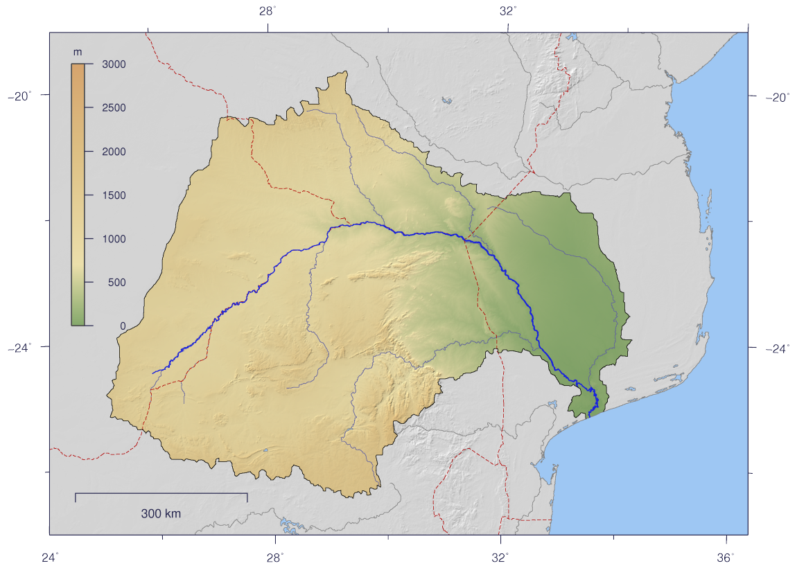
The Ga-Selati River or Selati River ( af, Selatirivier) is a river in Limpopo, South Africa. Course It rises on the rugged western slopes of the Wolkberg Mountains, part of the Drakensberg Mountain chain, about 20 km SE of Tzaneen. From its source in this high rainfall zone, the river flows roughly eastward for approximately 140 kilometres before joining the Olifants River some 7 kilometres to the south of the town of Phalaborwa. The Ga-Selati River's largest tributaries are the Ngwabitsi River and the Mulati River, both joining its right bank. In the dry season, the riverbed of the Ga-Selati is dry for most of its length. This river is heavily polluted owing to mining activity at Phalaborwa in its lower course. Dams in the basin *Tours Dam, in the Ngwabitsi River See also * List of rivers of South Africa * List of reservoirs and dams in South Africa The following is a partial list of dams in South Africa. __NOTOC__ In South African English (as well as Afrik ... [...More Info...] [...Related Items...] OR: [Wikipedia] [Google] [Baidu] |
South Africa
South Africa, officially the Republic of South Africa (RSA), is the southernmost country in Africa. It is bounded to the south by of coastline that stretch along the South Atlantic and Indian Oceans; to the north by the neighbouring countries of Namibia, Botswana, and Zimbabwe; and to the east and northeast by Mozambique and Eswatini. It also completely enclaves the country Lesotho. It is the southernmost country on the mainland of the Old World, and the second-most populous country located entirely south of the equator, after Tanzania. South Africa is a biodiversity hotspot, with unique biomes, plant and animal life. With over 60 million people, the country is the world's 24th-most populous nation and covers an area of . South Africa has three capital cities, with the executive, judicial and legislative branches of government based in Pretoria, Bloemfontein, and Cape Town respectively. The largest city is Johannesburg. About 80% of the population are Black S ... [...More Info...] [...Related Items...] OR: [Wikipedia] [Google] [Baidu] |
Limpopo
Limpopo is the northernmost province of South Africa. It is named after the Limpopo River, which forms the province's western and northern borders. The capital and largest city in the province is Polokwane, while the provincial legislature is situated in Lebowakgomo. The province is made up of 3 former homelands of Lebowa, Gazankulu and Venda and the former parts of the Transvaal province. The Limpopo province was established as one of the new nine provinces after South Africa's first democratic election on the 27th of April 1994. The province's name was first "Northern Transvaal", later changed to "Northern Province" on the 28th of June 1995, together with two other provinces. The name was later changed again in 2002 to the Limpopo province. Limpopo is made up of 3 main ethnic groups namely; Pedi people, Tsonga and Venda people. Traditional leaders and chiefs still form a strong backbone of the province's political landscape. Established in terms of the Limpopo House ... [...More Info...] [...Related Items...] OR: [Wikipedia] [Google] [Baidu] |
Wolkberg
The Wolkberg is a mountain range in Tzaneen, Limpopo Province, South Africa. It is a northern termination and a subrange of the Drakensberg mountain range which lines up from Eastern Cape, Lesotho, Kwazulu Natal and Mpumalanga. At 2200 m (7200 ft) above sea level, it is the highest mountain range in Limpopo, together with the Iron crown mountain. Its Meteorological significance is that it brings along cold fronts and is a source of cold winters throughout the Limpopo province, the cold front gets transferred from greater Drakensberg mountains in Kwazulu Natal all the way to the Wolkberg. Without the Wolkberg, Limpopo will not experience cold winters at all . The range extends for about in a NW/SE direction north of Sekhukhuneland. The nearest towns are Haenertsburg and Tzaneen. Physiography The range forms a high plateau reaching up to 2126 m in height at the Ysterkroon, its highest point. Other conspicuous peaks are 2050 m high Serala, 1838 m high M ... [...More Info...] [...Related Items...] OR: [Wikipedia] [Google] [Baidu] |
Tzaneen
Tzaneen () is a large tropical garden town situated in the Mopani District Municipality of the Limpopo province in South Africa. It is situated in a high rainfall fertile region with tropical and subtropical agriculture taking place in a region. It is Limpopo's second largest town after Polokwane. About 475,000 people reside within a radius, with the town itself holding a population of around 30,000. Tzaneen is today a proud home of both the Tsonga and Bapedi. Approximately 225,000 Bapedi Tribes of Balobedu ba ga Modjadji, BaNareng ba ga sekororo, Batlou ba ga makgoba, Bathlabine ba ga mogoboya, BaKgaga ba maake, Bakgaga ba maupa and Babirwa ba ga Raphahlelo, phooko and Bakoni ba mametja call Tzaneen their home. Equally so, approximately 220,000 Tsonga tribes of Shiluvane-Nkuna tribe Hosi Muhlaba-Shiluvane (132,000 people/subjects) and Valoyi tribe under Hosi Nwamitwa-Valoyi (91,000 people/subjects) make the same claim that Tzaneen is also their native land, thereby makin ... [...More Info...] [...Related Items...] OR: [Wikipedia] [Google] [Baidu] |
Olifants River (Limpopo)
The Olifants River, Lepelle, iBhalule or Obalule ( af, Olifantsrivier; pt, Rio dos Elefantes) is a river in South Africa and Mozambique, a tributary of the Limpopo River. It falls into the Drainage Area B of the Drainage basins of South Africa. The historical area of the Pedi people, Sekhukhuneland, is located between the Olifants River and one of its largest tributaries, the Steelpoort River. Course The Olifants River has its origin between Breyten and Bethal, Mpumalanga Province. It flows north towards Limpopo Province through Witbank Dam and then the Loskop Dam and is forced east by the Transvaal Drakensberg, cutting through at the Abel Erasmus Pass and then flowing east further across the Lowveld to join with the Letaba River. It crosses into Gaza Province, Mozambique, after cutting through the Lebombo Mountains by way of the Olifants Gorge, becoming the ''Rio dos Elefantes'', and finally joining the Limpopo River after 40 km before it enters the Indian Ocean at Xai-Xa ... [...More Info...] [...Related Items...] OR: [Wikipedia] [Google] [Baidu] |
Phalaborwa
Phalaborwa (translated to English as ''better than the south; phala'' means ''better than and borwa'' means ''south'') is a town in the Mopani District Municipality, Limpopo province, South Africa. It is located near the confluence of the Ga-Selati River and the Olifants, halfway up along the western border of the Kruger National Park in the Lowveld. Name The name "Ba-Phalaborwa", given to the area by the Sotho tribes who moved here from the south, means "better than the south". The Sotho mined and smelted copper and iron ore here as far back as 400 AD. Masorini, near Phalaborwa gate, is a reconstructed Ba-Phalaborwa hill village, with huts, grain storage areas, and an iron smelting site. Surrounding townships There are two townships, Namakgale and Lulekani where the Pedi and Tsonga reside, and rural areas such as Mashishimale, Humulani, Kurhula (Matshama Hi Nkano), Ben Farm (Majeje), Makushane and Ga-Maseke.Ga-selwane.majeje 3 and prieska Mining Phalaborwa began as a min ... [...More Info...] [...Related Items...] OR: [Wikipedia] [Google] [Baidu] |
Tours Dam
Tours ( , ) is one of the largest cities in the region of Centre-Val de Loire, France. It is the prefecture of the department of Indre-et-Loire. The commune of Tours had 136,463 inhabitants as of 2018 while the population of the whole metropolitan area was 516,973. Tours sits on the lower reaches of the Loire, between Orléans and the Atlantic coast. Formerly named Caesarodunum by its founder, Roman Emperor Augustus, it possesses one of the largest amphitheaters of the Roman Empire, the Tours Amphitheatre. Known for the Battle of Tours in 732 AD, it is a National Sanctuary with connections to the Merovingians and the Carolingians, with the Capetians making the kingdom's currency the Livre tournois. Saint Martin, Gregory of Tours and Alcuin were all from Tours. Tours was once part of Touraine, a former province of France. Tours was the first city of the silk industry. It was wanted by Louis XI, royal capital under the Valois Kings with its Loire castles and city of art with t ... [...More Info...] [...Related Items...] OR: [Wikipedia] [Google] [Baidu] |
List Of Rivers Of South Africa
This is a list of rivers in South Africa. It is quite common to find the Afrikaans word ''-rivier'' as part of the name. Another common suffix is "''-kamma''", from the Khoisan term for "river" Meiring, Barbara"South African Toponymic Guidelines for Map and other editors: Fourth Edition" 12. Retrieved on 30 April 2013. (often tautologically the English term "river" is added to the name). The Zulu word ''amanzi'' (water) also forms part of some river names. The Afrikaans term ''spruit'' (compare spring) often labels small rivers. List * A Drainage basin code assigned by the Department of Water Affairs (South Africa), a complete list is available at Drainage basins of South Africa Gallery Image:South Africa Topography.png, Topographic map of South Africa. Image:Orange watershed topo.png, Course and watershed of the Orange River with topography shading and political boundaries. Image:Groot River.jpg, Grootrivier in Nature's Valley, stained a tea colour by plant tannins Im ... [...More Info...] [...Related Items...] OR: [Wikipedia] [Google] [Baidu] |
List Of Reservoirs And Dams In South Africa
The following is a partial list of dams in South Africa. __NOTOC__ In South African English (as well as Afrikaans), a dam refers to both the wall as well as the reservoir or lake that builds up as a consequence. List of dams (reservoirs) * N Nett or working capacity * G Gross or maximum capacity * I The Bedford and Bramhoek dams form part of the Ingula Pumped Storage Scheme * D The Driekloof and Kilburn dams form part of the Drakensberg Pumped Storage Scheme * P The Kogelberg and Rockview dams form part of the Palmiet Pumped Storage Scheme * S The Steenbras Dam – Upper and Steenbras Hydro-Electric Lower Dam form part of the Steenbras Pumped Storage Scheme * V The Voëlvlei Dam is an off-channel reservoir supplied by canals from the Klein Berg River, Leeu River and Vier-en-Twintig River, and discharging by canal into the Great Berg River. See also * Water supply and sanitation in South Africa * List of lakes of South Africa * List of rivers of South Africa ... [...More Info...] [...Related Items...] OR: [Wikipedia] [Google] [Baidu] |


