|
Granston
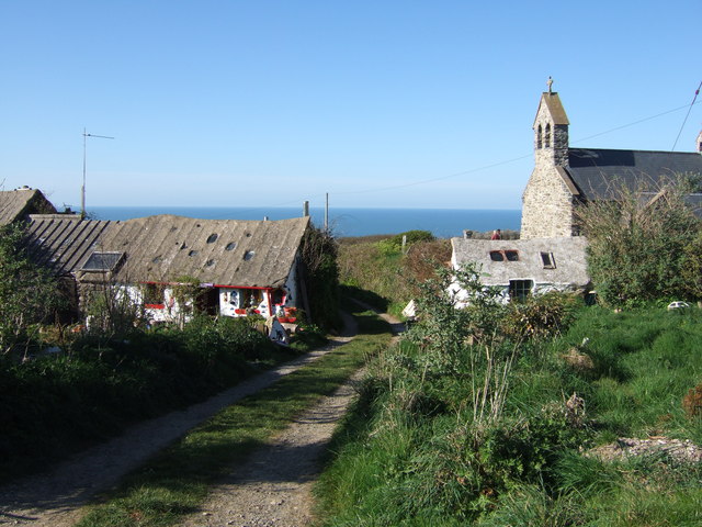
Granston ( cy, Treopert) is a hamlet and parish in Pembrokeshire, Wales. The parish was in the Hundred of Dewisland and includes the settlements of Llangloffan and Tregwynt, with Tregwynt woollen mill. Granston is in the community of Pencaer. Name The Welsh name of the hamlet, Treopert, suggests an association with a Robert, possibly Robert FitzMartin of Cemais. In 1292 the village was referred to (Latin) as "Villa Grandi", and in 1535 as "Grandiston" (Grand's Farm), possibly a reference to a French name, Grand. History Prehistoric remains were noted in the parish in 1920. The earliest church records of the parish are from 1291 and 1326. The parish was attached to the crown after the Dissolution. There was an Episcopal court at Granston. The size of the parish is . There are a number of listed buildings in the parish and, following the change from civil parishes to communities, Granston became part of the community of Pencaer. Population Granston parish in 1833 had a popula ... [...More Info...] [...Related Items...] OR: [Wikipedia] [Google] [Baidu] |
Pencaer
Pencaer is a community which covers an area of dispersed settlement in Pembrokeshire, Wales, on the peninsula of Pen Caer and comprises the village of Llanwnda and the smaller settlements of Granston, Llangloffan, St Nicholas (Tremarchog) and Trefasser. The population of the community taken at the 2011 census was 474. Features Rocky coastline Strumble Head lies within the community, as does part of the Pembrokeshire Coast National Park and a stretch of the Pembrokeshire Coast Path. Much of the community lies at above sea level, and the coastline is largely rock cliff with caves and inshore islands. There are numerous sites indicating prehistoric occupation.Ordnance Survey Pwll Deri Pwll Deri is on the west Pencaer coast about from Goodwick ( cy, Wdig) along the Pembrokeshire Coast Path. It sits on cliffs overlooking the bay (Pwll Deri in English is Pool of Oaks) to the west and has views of the Pembrokeshire Coast to as far away as St. David's. There is a Youth Hostel at ... [...More Info...] [...Related Items...] OR: [Wikipedia] [Google] [Baidu] |
Tregwynt Mansion
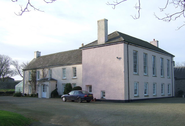
Tregwynt Mansion is a house in the parish of Granston in Pembrokeshire, Wales. The Tregwynt Hoard was found during renovations in 1996. Location Tregwynt means "place of the winds". The building has an exposed position on the coast above Abermawr. Tregynt is one of the oldest house sites in the north of Pembrokeshire, with records dating to the 14th century. For six centuries it was owned by the Harries family. The 1844 ''Topographical Dictionary of Wales'' says of Granston, the parish that contains Tregwynt, "It is intersected by the turnpike-road leading from Fishguard to St. David's, and is watered by a small stream, which, after flowing through it, falls into the sea near Aberbâch. ... The surrounding scenery is not distinguished by any peculiarity of feature, though from the higher grounds some good views are obtained over the t. George'sChannel and the adjacent country." Building The present Grade II*-listed manor house and outbuildings date from the 18th century. The ... [...More Info...] [...Related Items...] OR: [Wikipedia] [Google] [Baidu] |
Tregwynt Mill
Melin Tregwynt (Tregwynt Mill) is a woollen mill in the hamlet of Tregwynt in the parish of Granston, Pembrokeshire, Wales. A mill has stood on this site since 1819 taking fleeces from the sheep farms of the area, carding and spinning them into woollen yarn and then weaving the yarn into cloth and blankets. Today, the mill makes a line of upmarket blankets, cushions, clothing, and accessories. History Tregwynt woollen mill (''Melin Tregwynt'') lies in an isolated valley on the coast of Pembrokeshire. It is about from the Pembrokeshire Coast Path. The hipped and whitewashed rubble stone building has the date of July 1819 on a roof truss. It was originally a corn mill, and was converted to a woollen mill later in the 19th century. The mill was part of the Tregwynt estate. On the 1841 Tithe Map, it was called Dyffryn Bach, owned by G. J. Harries and occupied by David Evans. The local farmers would sell their fleeces to the mill, which would wash, card, comb, and spin the wool int ... [...More Info...] [...Related Items...] OR: [Wikipedia] [Google] [Baidu] |
Pembrokeshire
Pembrokeshire ( ; cy, Sir Benfro ) is a county in the south-west of Wales. It is bordered by Carmarthenshire to the east, Ceredigion to the northeast, and the rest by sea. The county is home to Pembrokeshire Coast National Park. The Park occupies more than a third of the area of the county and includes the Preseli Hills in the north as well as the Pembrokeshire Coast Path. Historically, mining and fishing were important activities, while industry nowadays is focused on agriculture (86 per cent of land use), oil and gas, and tourism; Pembrokeshire's beaches have won many awards. The county has a diverse geography with a wide range of geological features, habitats and wildlife. Its prehistory and modern history have been extensively studied, from tribal occupation, through Roman times, to Welsh, Irish, Norman, English, Scandinavian and Flemish influences. Pembrokeshire County Council's headquarters are in the county town of Haverfordwest. The council has a majority of Independ ... [...More Info...] [...Related Items...] OR: [Wikipedia] [Google] [Baidu] |
Candleston Castle
Candleston Castle (historically sometimes Candlestone Castle) is a 14th-century fortified manor house, in ruins since the 19th century. It is southwest of Merthyr Mawr, former Glamorgan, Wales, now Bridgend County Borough and just northwest of Ogmore Castle, separated by the River Ogmore. Candleston's original long and narrow rectangular structure lay across the western end of a low narrow promontory, suggesting a defensive position. The castle is believed to be named after the Norman family of Cantilupe, thought to be its first feudal tenants. Geography The ruins of Candleston, which had been part of a medieval settlement, stand on the Merthyr Mawr Sand Dunes, on the edge of the Merthyr Mawr Warren. They are east of Porthcawl off of Swansea Bay. History 12th – 14th centuries In the 12th century, Candleston manor passed to the St Quintin lords of Talyfan and Llanbleddian; The Cantilupe family are considered Candleston's first tenants. Although there are no records to s ... [...More Info...] [...Related Items...] OR: [Wikipedia] [Google] [Baidu] |
National Nature Reserve (United Kingdom)
Some statutory nature reserves are designated by national bodies in the United Kingdom, and are known as national nature reserves. Great Britain In Great Britain, nature reserves designed under Part III of the National Parks and Access to the Countryside Act 1949 that are deemed to be of national importance may be designated as statutory 'national nature reserves' by the relevant national nature conservation body (Natural England, Scottish Natural Heritage, or Natural Resources Wales) using section 35(1) of the Wildlife and Countryside Act 1981. If a nature reserve is designated by a local authority in Great Britain, then the resulting statutory nature reserve will be referred to as a local nature reserve. England In England, 229 national nature reserves are designated by Natural England. Scotland In Scotland, 43 national nature reserves are designated by NatureScot. Wales In Wales, 76 national nature reserves are designated by Natural Resources Wales. Northern Ire ... [...More Info...] [...Related Items...] OR: [Wikipedia] [Google] [Baidu] |
Corsydd Llangloffan
Corsydd Llangloffan is a Site of Special Scientific Interest (or ''SSSI'') in Pembrokeshire, South Wales. It has been designated as a Site of Special Scientific Interest since February 1992 in an attempt to protect its fragile biological elements. accessdate: 30 December 2013 The site has an area of and is managed by . Type This site is designated due to its biological qualities. SSSIs in Wales have been notified for ...[...More Info...] [...Related Items...] OR: [Wikipedia] [Google] [Baidu] |
Western Cleddau
The River Cleddau ( cy, Afon Cleddau) consists of the Eastern and Western Cleddau rivers in Pembrokeshire, west Wales. They unite to form the Daugleddau estuary and the important harbour of Milford Haven. The name of the combined estuary – the Daugleddau – means “the two Cleddaus”. The name Cleddau, whilst seeming to be a plural ('-au' generally denotes plurality in Welsh) comes from the Welsh word ''cleddyf'' meaning 'sword' and refers perhaps to the manner in which both rivers are incised into the landscape of Pembrokeshire. A number of former Anglican parishes in the area have been combined to form the modern Church in Wales parish of Daugleddau in the Diocese of St Davids. Eastern Cleddau The Eastern Cleddau (Welsh: ''Cleddau Ddu'' meaning 'black') rises in the foothills of Mynydd Preseli at Blaencleddau in the parish of Mynachlog-ddu. It flows southwest through a broad moorland valley to Gelli Hill, where the River Syfynwy joins it. It then flows south th ... [...More Info...] [...Related Items...] OR: [Wikipedia] [Google] [Baidu] |
Tregwynt Hoard
The Tregwynt Hoard is a mid-17th-century hoard of coins found at Tregwynt Mansion near Fishguard in Pembrokeshire, Wales, in 1996. The hoard is now in National Museum Wales. The treasure consisted of 33 gold coins, 467 silver coins and a gold ring. This was the first English Civil War hoard found in Pembrokeshire. Local history This mansion had been the scene where the invasion of the French was first reported to Colonel Thomas Knox who was at a dance there on 23 February 1797. Knox, who had been appointed by his father William Knox went into a strategic withdrawal to Haverfordwest which is in land. The retreat of the ''Fishguard Fencibles'' was halted by Lord Cawdor who persuaded Knox to advance. The ''Fencibles'' who were local volunteers saw off the force of 1200 French convicts. It was reported the local population assisted in seeing off the "last invasion of British soil". The BBC reported that there was a local story that the guests at the dance hid their valuable ... [...More Info...] [...Related Items...] OR: [Wikipedia] [Google] [Baidu] |
Parish
A parish is a territorial entity in many Christian denominations, constituting a division within a diocese. A parish is under the pastoral care and clerical jurisdiction of a priest, often termed a parish priest, who might be assisted by one or more curates, and who operates from a parish church. Historically, a parish often covered the same geographical area as a manor. Its association with the parish church remains paramount. By extension the term ''parish'' refers not only to the territorial entity but to the people of its community or congregation as well as to church property within it. In England this church property was technically in ownership of the parish priest '' ex-officio'', vested in him on his institution to that parish. Etymology and use First attested in English in the late, 13th century, the word ''parish'' comes from the Old French ''paroisse'', in turn from la, paroecia, the latinisation of the grc, παροικία, paroikia, "sojourning in a fore ... [...More Info...] [...Related Items...] OR: [Wikipedia] [Google] [Baidu] |
Mathry
Mathry (Welsh: Mathri) is a village, community and parish in Pembrokeshire, Wales. The hilltop village is southwest of Fishguard, close to the A487 road between Fishguard and St David's. History Mathry (formerly Mathrey or Merthyr) was in the hundred of Dewisland. A weekly market and annual fair were granted by letters patent in the reign of Edward III. The market had ceased by 1833 but the fair, on 10 October, still continued. Originally on the turnpike between Fishguard and St David's, it is now just north of the modern A487. There were 860 inhabitants in the parish in the early 1800s and a school for poor children was subsidised by Sir John Owen to the tune of £10 a year. The parish, prior to 1850, was one of scattered settlements, with slate quarrying employing local people. Community Mathry community includes the villages of Abercastle and Castlemorris. Mathry Community Council meets once a month in Mathry Community Hall. Parish The parish church of the Holy Martyrs, ... [...More Info...] [...Related Items...] OR: [Wikipedia] [Google] [Baidu] |


