|
Gordium
Gordion ( Phrygian: ; ; or ; ) was the capital city of ancient Phrygia. It was located at the site of modern Yassıhüyük, about southwest of Ankara (capital of Turkey), in the immediate vicinity of Polatlı district. Gordion's location at the confluence of the Sakarya and Porsuk rivers gave it a strategic location with control over fertile land. Gordion lies where the ancient road between Lydia and Assyria/Babylonia crossed the Sangarius river. Occupation at the site is attested from the Early Bronze Age () continuously until the 4th century CE and again in the 13th and 14th centuries CE. The Citadel Mound at Gordion is approximately 13.5 hectares in size, and at its height habitation extended beyond this in an area approximately 100 hectares in size. Gordion is the type site of Phrygian civilization, and its well-preserved destruction level of is a chronological linchpin in the region. The long tradition of tumuli at the site is an important record of elite monumental ... [...More Info...] [...Related Items...] OR: [Wikipedia] [Google] [Baidu] |
Phrygia
In classical antiquity, Phrygia ( ; , ''Phrygía'') was a kingdom in the west-central part of Anatolia, in what is now Asian Turkey, centered on the Sangarios River. Stories of the heroic age of Greek mythology tell of several legendary Phrygian kings: * Gordias, whose Gordian Knot would later be cut by Alexander the Great * Midas, who turned whatever he touched to gold * Mygdon, who warred with the Amazons According to Homer's ''Iliad'', the Phrygians participated in the Trojan War as close allies of the Trojans, fighting against the Achaeans. Phrygian power reached its peak in the late 8th century BC under another historical king, Midas, who dominated most of western and central Anatolia and rivaled Assyria and Urartu for power in eastern Anatolia. This later Midas was, however, also the last independent king of Phrygia before Cimmerians sacked the Phrygian capital, Gordium, around 695 BC. Phrygia then became subject to Lydia, and then successivel ... [...More Info...] [...Related Items...] OR: [Wikipedia] [Google] [Baidu] |
Phrygians
The Phrygians (Greek: Φρύγες, ''Phruges'' or ''Phryges'') were an ancient Indo-European speaking people who inhabited central-western Anatolia (modern-day Turkey) in antiquity. Ancient Greek authors used "Phrygian" as an umbrella term to describe a vast ethno-cultural complex located mainly in the central areas of Anatolia rather than a name of a single "tribe" or "people", and its ethno-linguistic homogeneity is debatable. Phrygians were initially dwelling in the southern Balkans – according to Herodotus – under the name of Bryges (Briges), changing it to Phryges after their final migration to Anatolia, via the Hellespont. Many historians support a Phrygian migration from Europe to Asia Minor BC, although Anatolian archaeologists have generally abandoned the idea. It has been suggested that the Phrygian migration to Asia Minor, mentioned in Greek sources to have occurred shortly after the Trojan War, happened much earlier, and in many stages. Phrygia de ... [...More Info...] [...Related Items...] OR: [Wikipedia] [Google] [Baidu] |
Gordion Early Phrygian East Citadel Gate Tumulus W 2019
Gordion ( Phrygian: ; ; or ; ) was the capital city of ancient Phrygia. It was located at the site of modern Yassıhüyük, about southwest of Ankara (capital of Turkey), in the immediate vicinity of Polatlı district. Gordion's location at the confluence of the Sakarya and Porsuk rivers gave it a strategic location with control over fertile land. Gordion lies where the ancient road between Lydia and Assyria/Babylonia crossed the Sangarius river. Occupation at the site is attested from the Early Bronze Age () continuously until the 4th century CE and again in the 13th and 14th centuries CE. The Citadel Mound at Gordion is approximately 13.5 hectares in size, and at its height habitation extended beyond this in an area approximately 100 hectares in size. Gordion is the type site of Phrygian civilization, and its well-preserved destruction level of is a chronological linchpin in the region. The long tradition of tumuli at the site is an important record of elite monumentali ... [...More Info...] [...Related Items...] OR: [Wikipedia] [Google] [Baidu] |
Gordion Citadel Mound Aerial Overview 2017
Gordion (Phrygian language, Phrygian: ; ; or ; ) was the capital city of ancient Phrygia. It was located at the site of modern Yassıhüyük, Polatlı, Yassıhüyük, about southwest of Ankara (capital of Turkey), in the immediate vicinity of Polatlı district. Gordion's location at the confluence of the Sakarya River, Sakarya and Porsuk River, Porsuk rivers gave it a strategic location with control over fertile land. Gordion lies where the ancient road between Lydia and Assyria/Babylonia crossed the Sakarya River, Sangarius river. Occupation at the site is attested from the Early Bronze Age () continuously until the 4th century CE and again in the 13th and 14th centuries CE. The Citadel Mound at Gordion is approximately 13.5 hectares in size, and at its height habitation extended beyond this in an area approximately 100 hectares in size. Gordion is the type site of Phrygians, Phrygian civilization, and its well-preserved destruction level of is a chronological linchpin in the ... [...More Info...] [...Related Items...] OR: [Wikipedia] [Google] [Baidu] |
Tumulus
A tumulus (: tumuli) is a mound of Soil, earth and Rock (geology), stones raised over a grave or graves. Tumuli are also known as barrows, burial mounds, mounds, howes, or in Siberia and Central Asia as ''kurgans'', and may be found throughout much of the world. A cairn, which is a mound of stones built for various purposes, may also originally have been a tumulus. Tumuli are often categorised according to their external apparent shape. In this respect, a long barrow is a long tumulus, usually constructed on top of several burials, such as passage graves. A round barrow is a round tumulus, also commonly constructed on top of burials. The internal structure and architecture of both long and round barrows have a broad range; the categorization only refers to the external apparent shape. The method of may involve a dolmen, a cist, a mortuary enclosure, a mortuary house, or a chamber tomb. Examples of barrows include Duggleby Howe and Maeshowe. Etymology The word ''tumulus'' ... [...More Info...] [...Related Items...] OR: [Wikipedia] [Google] [Baidu] |
Ankara
Ankara is the capital city of Turkey and List of national capitals by area, the largest capital by area in the world. Located in the Central Anatolia Region, central part of Anatolia, the city has a population of 5,290,822 in its urban center (Etimesgut, Yenimahalle, Çankaya District, Çankaya, Keçiören, Altındağ, Pursaklar, Mamak, Ankara, Mamak, Gölbaşı, Ankara, Gölbaşı, Sincan, Ankara, Sincan) and 5,864,049 in Ankara Province (total of 25 districts). Ankara is Turkey's List of cities in Turkey, second-largest city by population after Istanbul, first by urban land area, and third by metro land area after Konya and Sivas. Ankara was historically known as Ancyra and Angora. Serving as the capital of the ancient Celts, Celtic state of Galatia (280–64 BC), and later of the Roman Empire, Roman province with the Galatia (Roman province), same name (25 BC–7th century), Ankara has various Hattians, Hattian, Hittites, Hittite, Lydian, Phrygian, Galatians (people ... [...More Info...] [...Related Items...] OR: [Wikipedia] [Google] [Baidu] |
Porsuk River
The Porsuk River also Kocasu-Porsuk River (), ancient Tembris, is a river in Turkey, that flows for . The city of Eskişehir is located on the banks of this river. The river is dammed by the Porsuk dam, forming large reservoirs. The Porsuk flows into the Sakarya River near the town of Polatlı, ancient Gordium Gordion ( Phrygian: ; ; or ; ) was the capital city of ancient Phrygia. It was located at the site of modern Yassıhüyük, about southwest of Ankara (capital of Turkey), in the immediate vicinity of Polatlı district. Gordion's location at .... See also * List of rivers of Turkey References * Rivers of Turkey Landforms of Eskişehir Province {{Turkey-river-stub ... [...More Info...] [...Related Items...] OR: [Wikipedia] [Google] [Baidu] |
Polatlı
Polatlı (formerly Ancient Greek: Γόρδιον, Górdion and Latin: Gordium) is a municipality and district of Ankara Province, Turkey. Its area is 3,618 km2, and its population is 128,378 (2022). It is 80 km west of the Turkish capital Ankara, on the road to Eskişehir. Its elevation is 853 m. Geography Polatlı is situated at the heart of the high Anatolian Plateau, a large steppe covered with grass. Far from the coast, it has a typical steppe climate. The winters are cold and generally snowy, the summers are hot and dry. Spring and autumn are the wettest seasons (especially the former). Polatlı is one of the most productive agricultural districts in Turkey and is best known for its cereal production, especially barley and wheat. Polatlı is one of Turkey's largest grain stores. Sugar beet, melon and onion are also grown. History Ancient settlement The ancient Phrygian capital Gordion is 10 km from the city of Polatlı. On the outskirts of Polatli there ... [...More Info...] [...Related Items...] OR: [Wikipedia] [Google] [Baidu] |
Balkan
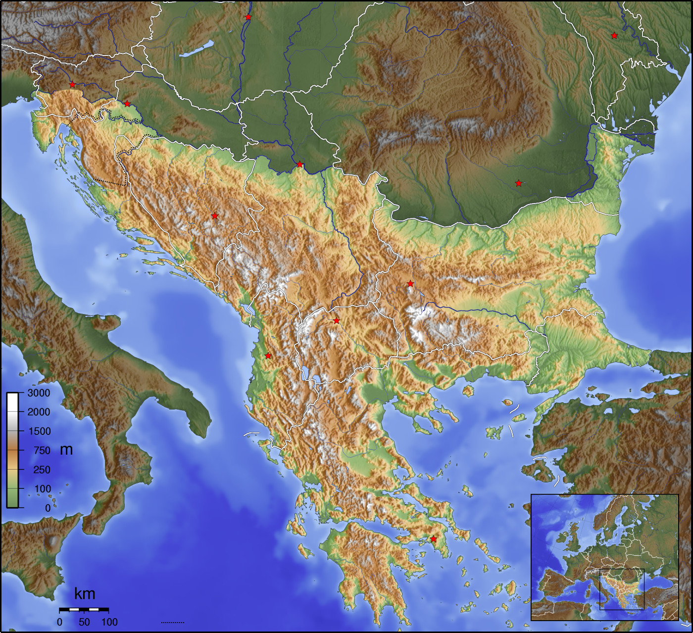
The Balkans ( , ), corresponding partially with the Balkan Peninsula, is a geographical area in southeastern Europe with various geographical and historical definitions. The region takes its name from the Balkan Mountains that stretch throughout the whole of Bulgaria. The Balkan Peninsula is bordered by the Adriatic Sea in the northwest, the Ionian Sea in the southwest, the Aegean Sea in the south, the Turkish straits in the east, and the Black Sea in the northeast. The northern border of the peninsula is variously defined. The highest point of the Balkans is Musala, , in the Rila mountain range, Bulgaria. The concept of the Balkan Peninsula was created by the German geographer August Zeune in 1808, who mistakenly considered the Balkan Mountains the dominant mountain system of southeastern Europe spanning from the Adriatic Sea to the Black Sea. In the 19th century the term ''Balkan Peninsula'' was a synonym for Rumelia, the parts of Europe that were provinces of the Ottoman E ... [...More Info...] [...Related Items...] OR: [Wikipedia] [Google] [Baidu] |
Troad
The Troad ( or ; , ''Troáda'') or Troas (; , ''Trōiás'' or , ''Trōïás'') is a historical region in northwestern Anatolia. It corresponds with the Biga Peninsula ( Turkish: ''Biga Yarımadası'') in the Çanakkale Province of modern Turkey. Bounded by the Dardanelles to the northwest, by the Aegean Sea to the west and separated from the rest of Anatolia by the massif that forms Mount Ida, the Troad is drained by two main rivers, the Scamander ( Karamenderes) and the Simoeis, which join at the area containing the ruins of Troy. History The Troad is first mentioned by that name in Hittite records as ''Taruiša''. This identification was first put forth by Emil Forrer, but largely disputed by most Hittite experts until 1983 when Houwink ten Cate showed that two fragments were from the same original cuneiform tablet and in his discussion of the restored letter showed that ''Taruiša'' and ''Wiluša'' (Troy) were correctly placed in northwestern Anatolia. Greek settleme ... [...More Info...] [...Related Items...] OR: [Wikipedia] [Google] [Baidu] |
Southeastern Europe
Southeast Europe or Southeastern Europe is a geographical sub-region of Europe, consisting primarily of the region of the Balkans, as well as adjacent regions and Archipelago, archipelagos. There are overlapping and conflicting definitions of the region, due to political, economic, historical, cultural, and geographical considerations. Sovereign state, Sovereign states and territories that may be included in the region are Albania, Bosnia and Herzegovina, Bulgaria, Croatia (alternatively placed in Central Europe), Greece (alternatively placed in the broader region of Southern Europe), Kosovo, Montenegro, North Macedonia, Romania (alternatively placed in Eastern Europe), Serbia, and the East Thrace, European part of Turkey (alternatively placed in the broader region of Southern Europe, also in West Asia, Western Asia with the rest of the country). Sometimes, Cyprus (most often placed in West Asia), Hungary (most often placed in Central Europe), Moldova (most often placed in Easte ... [...More Info...] [...Related Items...] OR: [Wikipedia] [Google] [Baidu] |


