|
Gluggarnir
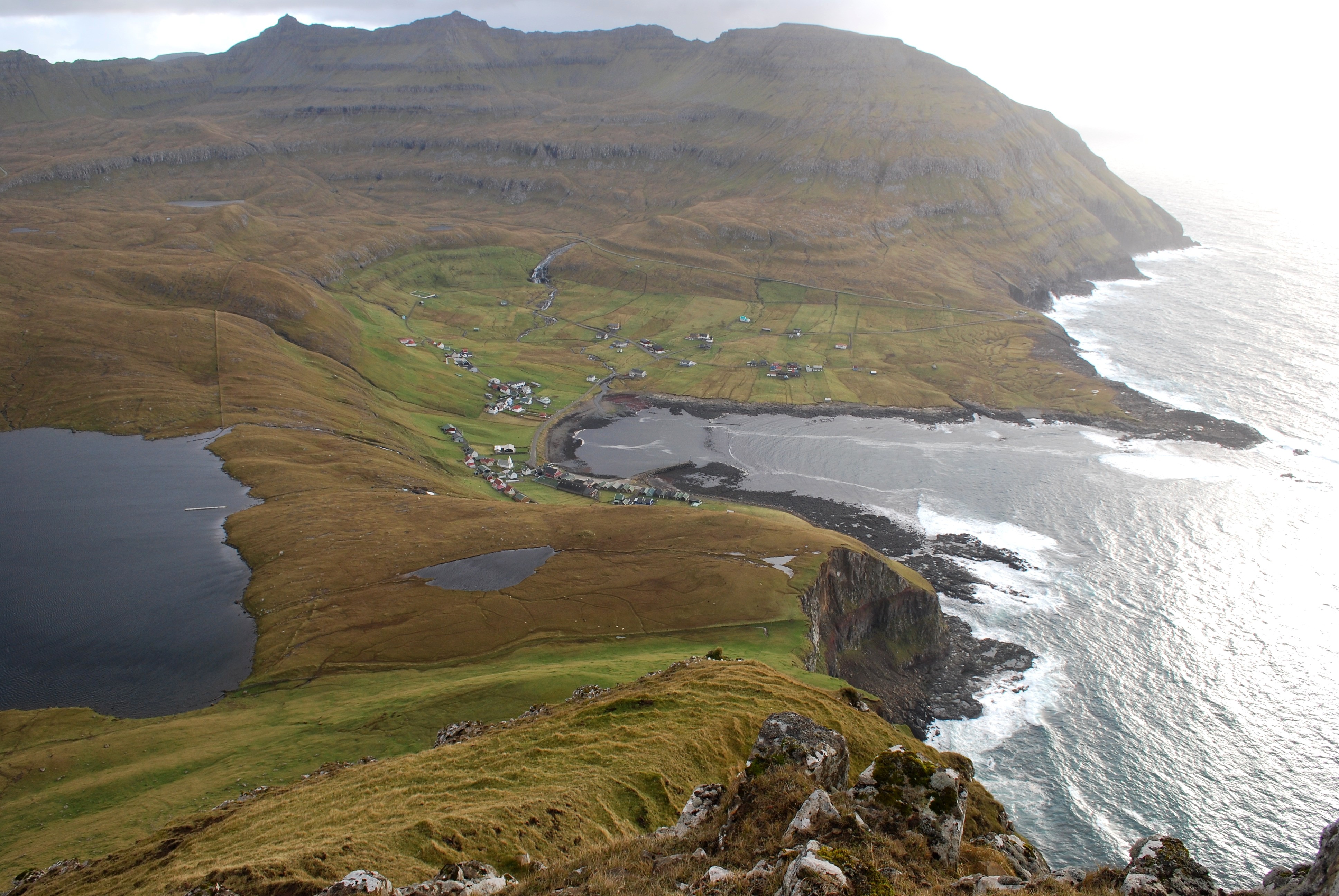
Gluggarnir is a mountain in the Faroe Islands. At 610 metres, it is the highest mountain on the southernmost island, Suðuroy. The mountain is located between the villages of Fámjin and Trongisvágur
Trongisvágur ( da, Trangisvåg) is a village on the island of Suduroy in the Faroe Islands.
Trongisvágur is the village in the bottom of Trongisvágsfjørður (fjord) on the east coast of Suduroy. Trongisvágur and the neighbouring villages ... .
References {{coord, 61, 33, N, 6, 52, W, display=title, type:mountain_source:GNS-enwiki[...More Info...] [...Related Items...] OR: [Wikipedia] [Google] [Baidu] |
Suðuroy
Suðuroy (literally South Island, da, Suderø) is the southernmost of the Faroe Islands. The island covers 163.7 square kilometres (63.2 sq mi). In 2018 the population was 4,601. Suðuroy region (sýsla) comprises this island and Lítla Dímun, the next isle northward in the Faroes, which is uninhabited. History One ancient settlement, Víkarbyrgi was abandoned late in the 1990s. Another settlement, Akraberg was abandoned around 1350 because of the Black Death; the people who lived there at that time came from Friesland, and legend has it that people in Hørg (in Sumba) can trace their ancestry back to this settlement, which was situated on the southernmost point of the island. In the 17th century, Suðuroy was subjected to repeated attacks by North African pirates, who in the Faroe Islands were referred to as Turks when North Africa belonged to the Ottoman Empire. One well known such incident was the Slave raid of Suðuroy .They abducted several women and child ... [...More Info...] [...Related Items...] OR: [Wikipedia] [Google] [Baidu] |
Fámjin
Fámjin ( da, Famien) is a village located on the western side of Suðuroy, the southernmost island in Faroe Islands. Fámjin is looking directly out to the North Atlantic Ocean. Name Geography The village of Fámjin faces the ocean, although partly protected by a stone reef, which becomes visible at low tide. The village is surrounded by some of the highest mountains on Suðuroy. The highest mountain, Gluggarnir is located north of Fámjin. The mountains Borgarknappur and Borgin are south-east of the village. There are several inland lakes and waterfalls. One of the waterfalls is named Fossurin Mikli. Only one road leads to the village, it goes through Øravík. North of the village lies the “ Kirkjuvatn” (Church Lake), one of the largest on the island. The old mountain path between Fámjin and Vágur was originally the main road between the two villages. There are cairns along the path. West of Fámjin by the end of the road is a gorge which is called Prestgjógv (Th ... [...More Info...] [...Related Items...] OR: [Wikipedia] [Google] [Baidu] |
Trongisvágur
Trongisvágur ( da, Trangisvåg) is a village on the island of Suduroy in the Faroe Islands. Trongisvágur is the village in the bottom of Trongisvágsfjørður (fjord) on the east coast of Suduroy. Trongisvágur and the neighbouring villages of Tvøroyri and Øravík have grown into one entity (the northern part of Øravík, which is called Øravíkarlíð, is where the ferry port Krambatangi is). A river called Stórá that runs through the valley passes through a plantation that is worth visiting on a good day, and then flows into the inlet at a nearby beach. There is a debate whether the name Trong is Norse or Gaelic in origin. Another version of the name is Trungisvágur. Trungisvágsbotnur is on the west coast, west of Trongisvágur. There are binoculars there in summertime, so people can have a closer look at birds and the vertical cliffs there. The place is called Á Røðini, but some people call it Kikarin, because of the binoculars. Shortly after the Park of Trongisv ... [...More Info...] [...Related Items...] OR: [Wikipedia] [Google] [Baidu] |
Mountains Of The Faroe Islands
The following is a list of mountains of the Faroes. Note, however, that several mountains have more than one peak. However, only the tallest peak is counted in this table. References {{Reflist * :de:Liste der Berge auf den Färöern, German Wikipedia:Liste der Berge auf den Färöern Mountains of the Faroe Islands, * Lists of mountains by country, Faroe Islands Lists of landforms of the Faroe Islands, Mountains Lists of mountains of Europe, Faroe Islands ...[...More Info...] [...Related Items...] OR: [Wikipedia] [Google] [Baidu] |
Faroe Islands
The Faroe Islands ( ), or simply the Faroes ( fo, Føroyar ; da, Færøerne ), are a North Atlantic archipelago, island group and an autonomous territory of the Danish Realm, Kingdom of Denmark. They are located north-northwest of Scotland, and about halfway between Norway ( away) and Iceland ( away). The islands form part of the Kingdom of Denmark, along with mainland Denmark and Greenland. The islands have a total area of about with a population of 54,000 as of June 2022. The terrain is rugged, and the Oceanic climate#Subpolar variety (Cfc), subpolar oceanic climate (Cfc) is windy, wet, cloudy, and cool. Temperatures for such a northerly climate are moderated by the Gulf Stream, averaging above freezing throughout the year, and hovering around in summer and 5 °C (41 °F) in winter. The northerly latitude also results in perpetual civil twilight during summer nights and very short winter days. Between 1035 and 1814, the Faroe Islands were part of the Kingdo ... [...More Info...] [...Related Items...] OR: [Wikipedia] [Google] [Baidu] |


.jpg)