|
Gavar
Gavar ( ) is a town in Armenia serving as the administrative centre of the Gavar Municipality and the Gegharkunik Province. It is situated among the high mountains of Gegham range to the west of Lake Sevan, with an average height of 1982 meters above sea level. Located 98 kilometers east of the capital Yerevan, the town had a population of 20,765 as per the 2011 census. As per the 2022 census, the population of Gavar is 17,741. Gavar is the seat of the Diocese of Gegharkounik of the Armenian Apostolic Church. Etymology The town was known as ''Nor Bayаzet'' (Նոր Բայազետ) or ''Novo-Bayazet'' () until 1959, named after the Western Armenian town of Bayazet (historically known as ''Daroynk'' and ''Arshakavan''). Between 1959 and 1995, the town was known as ''Kamo'', named after the Bolshevik revolutionary Kamo (Simon Ter-Petrosian). On December 4, 1995, the town was renamed back to its ancient name of ''Gavar'', meaning ''county'' in the Armenian language. However, ... [...More Info...] [...Related Items...] OR: [Wikipedia] [Google] [Baidu] |
Gegharkunik Province
Gegharkunik (, ) is a provinces of Armenia, province (''Administrative divisions of Armenia, marz'') of Armenia. Its capital and largest city is Gavar. Gegharkunik is inhabited by approximately 209,669 people and the majority are ethnic Armenians. Gegharkunik Province is located at the eastern part of Armenia, bordering Azerbaijan. It includes the exclave of Artsvashen, which has been under Azerbaijani occupation since the First Nagorno-Karabakh War. With an area of , Gegharkunik is the largest province in Armenia. However, approximately 24% or of its territory is covered by Lake Sevan, the largest lake in the South Caucasus and a major tourist attraction of the region. The Yerevan-Sevan-Dilijan republican highway runs through the province. Etymology and symbols The early Armenian history Movses Khorenatsi connected the name of Gegharkunik with Gegham, a 5th-generation descendant of the legendary patriarch and founder of the Armenian nation Hayk. Gegham was the father of Sis ... [...More Info...] [...Related Items...] OR: [Wikipedia] [Google] [Baidu] |
Gavar Municipality
Gegharkunik (, ) is a province ('' marz'') of Armenia. Its capital and largest city is Gavar. Gegharkunik is inhabited by approximately 209,669 people and the majority are ethnic Armenians. Gegharkunik Province is located at the eastern part of Armenia, bordering Azerbaijan. It includes the exclave of Artsvashen, which has been under Azerbaijani occupation since the First Nagorno-Karabakh War. With an area of , Gegharkunik is the largest province in Armenia. However, approximately 24% or of its territory is covered by Lake Sevan, the largest lake in the South Caucasus and a major tourist attraction of the region. The Yerevan-Sevan-Dilijan republican highway runs through the province. Etymology and symbols The early Armenian history Movses Khorenatsi connected the name of Gegharkunik with Gegham, a 5th-generation descendant of the legendary patriarch and founder of the Armenian nation Hayk. Gegham was the father of Sisak (founder of the Siunia dynasty) and Harma (grandfather ... [...More Info...] [...Related Items...] OR: [Wikipedia] [Google] [Baidu] |
Diocese Of Gegharkounik
Diocese of Gegharkounik ( ''Gegharkuniki t'em''), is a diocese of the Armenian Apostolic Church covering the Gegharkunik Province of Armenia. The name is derived from the historic ''Gegharkunik canton'' of Syunik (historic province) province of ancient Greater Armenia. The Diocese of Gegharkounik was officially founded on 30 May 1996, upon a kontakion issued by Catholicos Karekin I. The diocesan headquarters are located in the provincial capital Gavar Gavar ( ) is a town in Armenia serving as the administrative centre of the Gavar Municipality and the Gegharkunik Province. It is situated among the high mountains of Gegham range to the west of Lake Sevan, with an average height of 1982 meter ..., with the seat being the Holy Mother of God Cathedral of the town. References External linksChurches of Gegharkunik Province {{coord missing, Armenia Gegharkounik Dioceses in Armenia Gegharkunik Province Oriental Orthodox dioceses in Armenia ... [...More Info...] [...Related Items...] OR: [Wikipedia] [Google] [Baidu] |
Armenia
Armenia, officially the Republic of Armenia, is a landlocked country in the Armenian Highlands of West Asia. It is a part of the Caucasus region and is bordered by Turkey to the west, Georgia (country), Georgia to the north and Azerbaijan to the east, and Iran and the Azerbaijani exclave of Nakhchivan Autonomous Republic, Nakhchivan to the south. Yerevan is the Capital city, capital, largest city and Economy of Armenia, financial center. The Armenian Highlands has been home to the Hayasa-Azzi, Shupria and Nairi. By at least 600 BC, an archaic form of Proto-Armenian language, Proto-Armenian, an Indo-European languages, Indo-European language, had diffused into the Armenian Highlands.Robert Drews (2017). ''Militarism and the Indo-Europeanizing of Europe''. Routledge. . p. 228: "The vernacular of the Great Kingdom of Biainili was quite certainly Armenian. The Armenian language was obviously the region's vernacular in the fifth century BC, when Persian commanders and Greek writers ... [...More Info...] [...Related Items...] OR: [Wikipedia] [Google] [Baidu] |
Municipalities Of Armenia
A municipality in Armenia referred to as community ( ''hamaynk'', plural: ''hamaynkner''), is an administrative subdivision consisting of a settlement ( ''bnakavayr'') or a group of settlements ( ''bnakavayrer'') that enjoys local self-government. The settlements are classified as either towns ( ''kaghakner'', singular ''kaghak'') or villages ( ''gyugher'', singular ( ''gyugh''). The administrative centre of a community could either be an urban settlement (town) or a rural settlement (village). Two-thirds of the population are now urbanized. As of 2017, 63.6% of Armenians live in urban areas as compared to 36.4% in rural. As of the end of 2017, Armenia has 503 municipal communities (including Yerevan) of which 46 are urban and 457 are rural. The capital, Yerevan, also has the status of a community. Each municipality bears the same name as its administrative centre, with the exception of 7 municipalities, of which 4 are located in Shirak Province (Ani Municipality with its c ... [...More Info...] [...Related Items...] OR: [Wikipedia] [Google] [Baidu] |
Provinces Of Armenia
Armenia is subdivided into eleven administrative divisions. Of these, ten are provinces, known as () or in the singular form () in Armenian. Yerevan is treated separately and granted special administrative status as the country's capital. The chief executive in each of 10 ''marz''es is the ''marzpet'', appointed by the government of Armenia. In Yerevan, the chief executive is the mayor, elected by the Yerevan City Council. First-level administrative divisions The following is a list of the provinces with population, area, and density information. Figures are from the Statistical Committee of Armenia. The area of the Gegharkunik Province includes Lake Sevan which covers of its territory: Municipalities (''hamaynkner'') Within each province of the republic, there are municipal communities (''hamaynkner'', singular ''hamaynk''), currently considered the second-level administrative division in Armenia. Each municipality - known officially as community, either rural or ... [...More Info...] [...Related Items...] OR: [Wikipedia] [Google] [Baidu] |
Lake Sevan
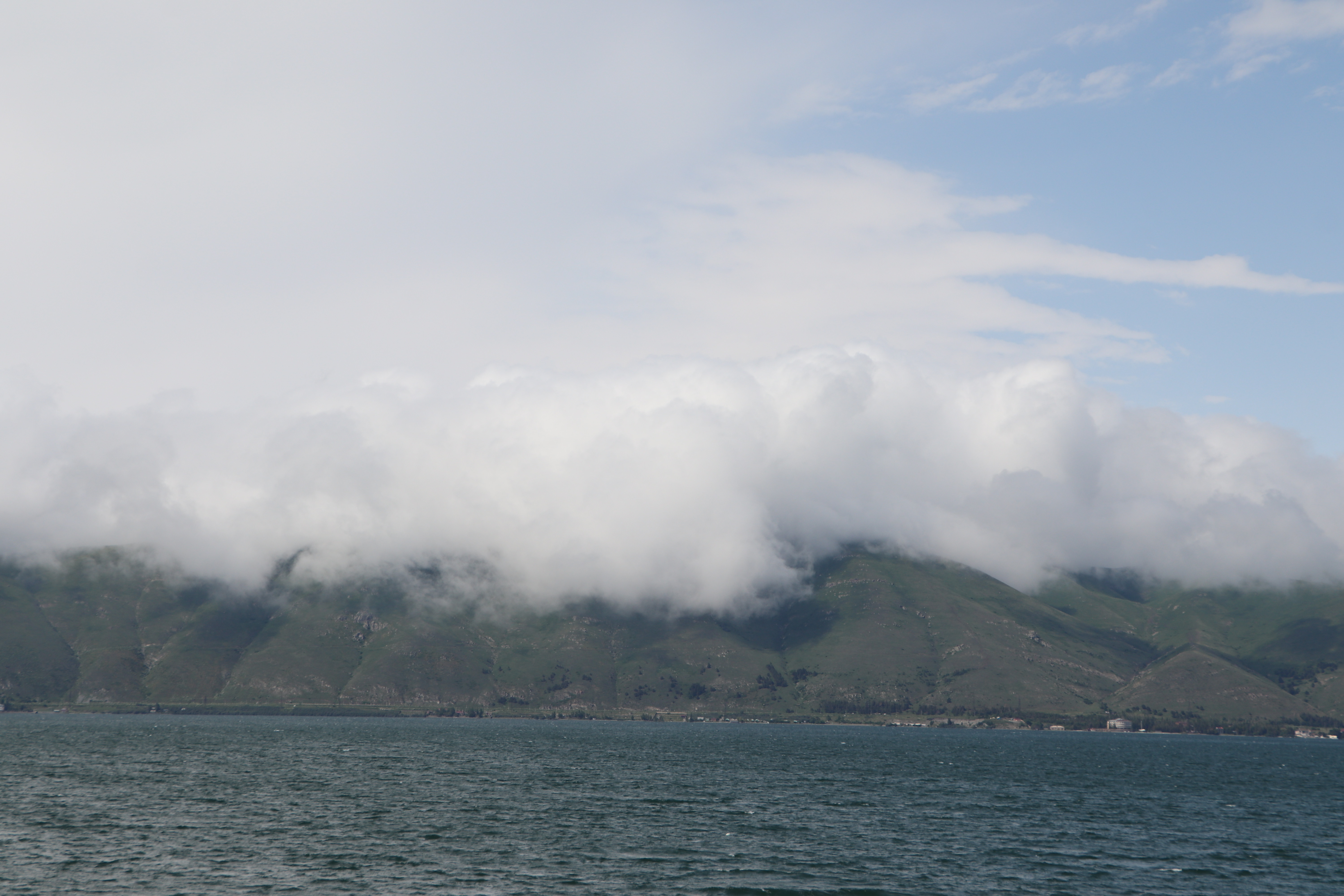
Lake Sevan () is the largest body of water in both Armenia and the Caucasus region. It is one of the largest freshwater Alpine lake, high-altitude (alpine) lakes in Eurasia. The lake is situated in Gegharkunik Province, at an altitude of above sea level. The total surface area of its basin is about , which makes up of Armenia's territory. The lake itself is , and the volume is . It is fed by 28 rivers and streams. Only 10% of the incoming water is drained by the Hrazdan River, while the remaining 90% evaporates. Sevan has significant economic, cultural, and recreational value. Its sole major island (now a peninsula) is home to a Sevanavank, medieval monastery. The lake provides some 90% of the fish and 80% of the crayfish catch of Armenia. Sevan was heavily exploited for irrigation of the Ararat plain and hydroelectric power generation during the Soviet period. Consequently, its water level decreased by around and its volume reduced by more than 40%. Later, two Water tunne ... [...More Info...] [...Related Items...] OR: [Wikipedia] [Google] [Baidu] |
Armenian Language
Armenian (endonym: , , ) is an Indo-European languages, Indo-European language and the sole member of the independent branch of the Armenian language family. It is the native language of the Armenians, Armenian people and the official language of Armenia. Historically spoken in the Armenian highlands, today Armenian is also widely spoken throughout the Armenian diaspora. Armenian is written in its own writing system, the Armenian alphabet, introduced in 405 AD by Saint Mesrop Mashtots. The estimated number of Armenian speakers worldwide is between five and seven million. History Classification and origins Armenian is an independent branch of the Indo-European languages. It is of interest to linguists for its distinctive phonological changes within that family. Armenian exhibits Centum and satem languages, more satemization than centumization, although it is not classified as belonging to either of these subgroups. Some linguists tentatively conclude that Armenian, Greek ... [...More Info...] [...Related Items...] OR: [Wikipedia] [Google] [Baidu] |
Urartu
Urartu was an Iron Age kingdom centered around the Armenian highlands between Lake Van, Lake Urmia, and Lake Sevan. The territory of the ancient kingdom of Urartu extended over the modern frontiers of Turkey, Iran, Iraq, and Armenia.Kleiss, Wolfram (2008). "URARTU IN IRAN". ''Encyclopædia Iranica''. Its kings left behind cuneiform inscriptions in the Urartian language, a member of the Hurro-Urartian languages, Hurro-Urartian language family. Urartu extended from the Euphrates in the west to the region west of Ardabil in Iran, and from Lake Çıldır near Ardahan in Turkey to the region of Rawandiz in Iraqi Kurdistan. The kingdom emerged in the mid-9th century BC and dominated the Armenian Highlands in the 8th and 7th centuries BC. Urartu frequently warred with Neo-Assyrian Empire, Assyria and became, for a time, the most powerful state in the Near East. Weakened by constant conflict, it was eventually conquered, either by the Iranian peoples, Iranian Medes in the early 6th c ... [...More Info...] [...Related Items...] OR: [Wikipedia] [Google] [Baidu] |
Iron Age
The Iron Age () is the final epoch of the three historical Metal Ages, after the Chalcolithic and Bronze Age. It has also been considered as the final age of the three-age division starting with prehistory (before recorded history) and progressing to protohistory (before written history). In this usage, it is preceded by the Stone Age (subdivided into the Paleolithic, Mesolithic and Neolithic) and Bronze Age. These concepts originated for describing Iron Age Europe and the ancient Near East. In the archaeology of the Americas, a five-period system is conventionally used instead; indigenous cultures there did not develop an iron economy in the pre-Columbian era, though some did work copper and bronze. Indigenous metalworking arrived in Australia with European contact. Although meteoric iron has been used for millennia in many regions, the beginning of the Iron Age is defined locally around the world by archaeological convention when the production of Smelting, smelted iron (espe ... [...More Info...] [...Related Items...] OR: [Wikipedia] [Google] [Baidu] |
Cyclopean Masonry
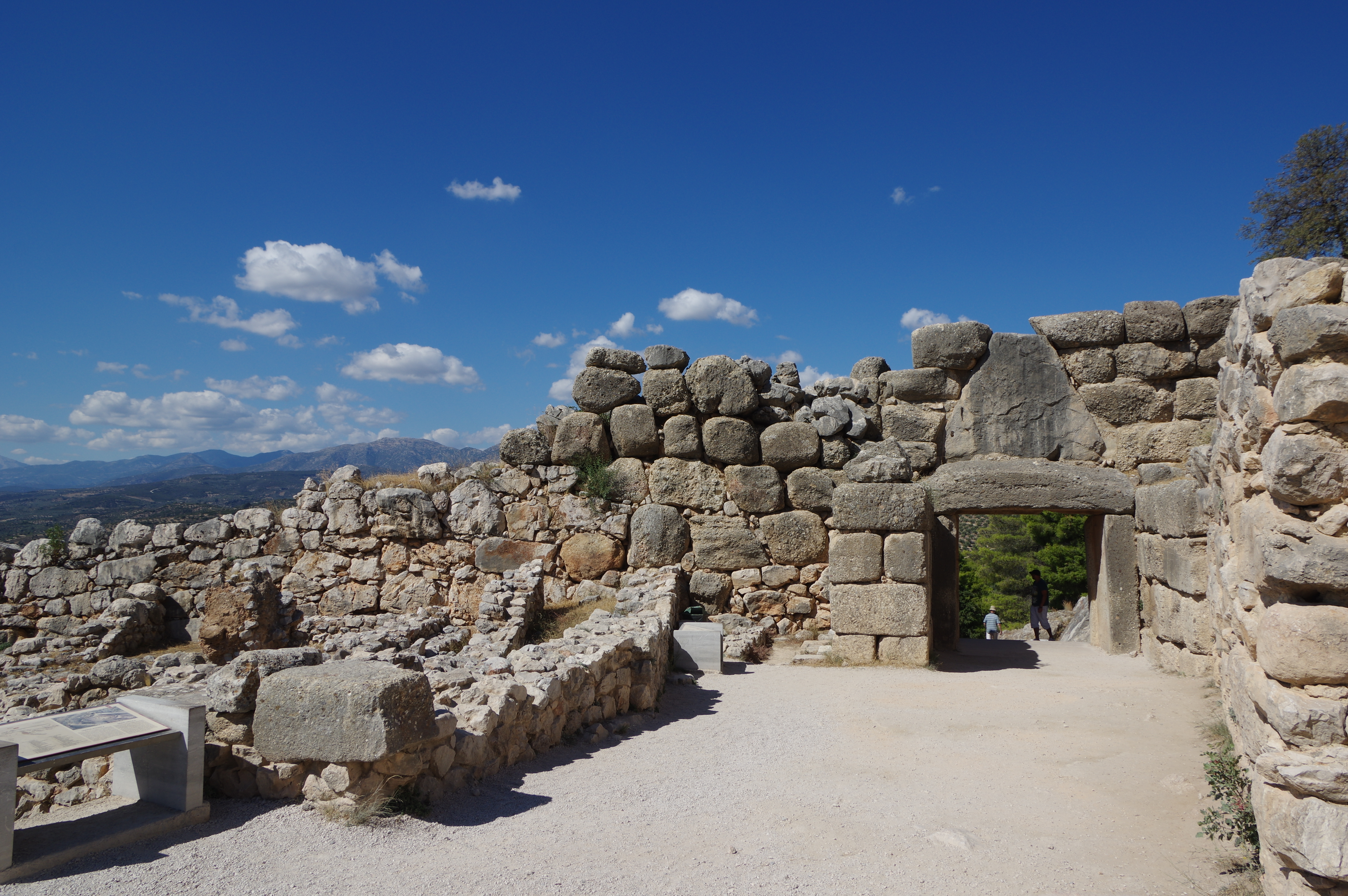
Cyclopean masonry is a type of stonework found in Mycenaean architecture, built with massive limestone boulders, roughly fitted together with minimal clearance between adjacent stones and with clay mortar or no use of mortar. The boulders typically seem unworked, but some may have been worked roughly with a hammer and the gaps between boulders filled in with smaller chunks of limestone. The most famous examples of Cyclopean masonry are found in the walls of Mycenae and Tiryns, and the style is characteristic of Mycenaean fortifications. Similar styles of stonework are found in other cultures and the term has come to be used to describe typical stonework of this sort. The term comes from the belief of classical Greeks that only the mythical Cyclopes had the strength to move the enormous boulders that made up the walls of Mycenae and Tiryns. Pliny's ''Natural History'' reported the tradition, attributed to Aristotle, that the Cyclopes were the inventors of masonry towers, giving ... [...More Info...] [...Related Items...] OR: [Wikipedia] [Google] [Baidu] |
Classical Armenian Orthography
Classical Armenian orthography, traditional orthography or Mashtotsian orthography ( in classical orthography and in reformed orthography, ''Hayereni tasagan ughakrutyun''), is the orthography that was developed by Mesrop Mashtots in the 5th century for writing Armenian language, Armenian and reformed during the early 20th century. Today, it is used primarily by the Armenian diaspora, including all Western Armenian speakers and Eastern Armenian speakers in Iran, which has rejected the Armenian orthography reform of Soviet Armenia during the 1920s. In the Armenian diaspora, some linguists and politicians allege political motives behind the reform of the Armenian alphabet. Classical Armenian orthography uses 38 letters: the original 36 letters of the Armenian alphabet invented by Mesrop Mashtots during the 5th century, and the 2 additional letters included later in the Armenian alphabet during the Middle Ages. Vowels Monophthongs Armenian has eight monophthongs () and ten symbol ... [...More Info...] [...Related Items...] OR: [Wikipedia] [Google] [Baidu] |


