|
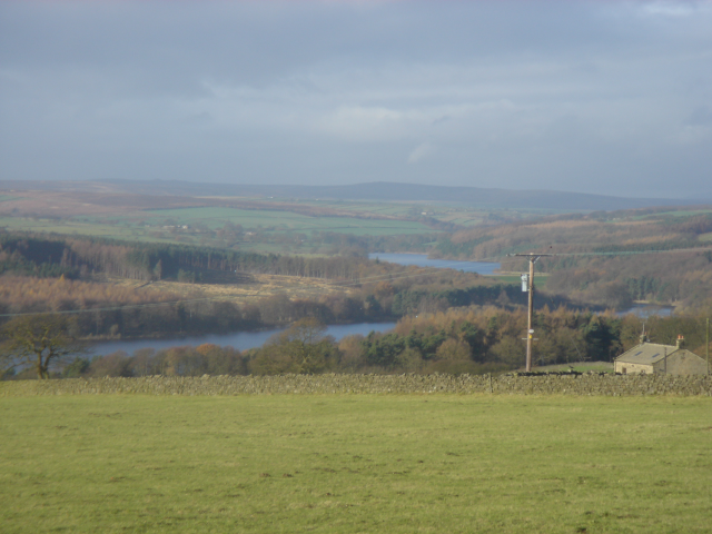
Fewston Reservoir
Fewston Reservoir is located in the Washburn valley north of Otley and west of Harrogate in Yorkshire, England. It was built in 1879. The capacity is about 3.5 million cubic metres. It can be found from the A59 road. The overflow from the reservoir feeds directly into the adjoining Swinsty Reservoir. Formerly, this overflow was encircled by a metal walkway from which floodboards could be lowered, but this has since been removed. The reservoir is the property of Yorkshire Water, which manages it for the benefit of walkers, anglers and wildlife. Situated in the charming Washburn valley, sharing an embankment with Swinsty Reservoir, Fewston is popular with walkers and runners. Cyclists and horse-riders can also make use of their own permitted tracks in the surrounding woodlands. Construction The reservoir was built by the Leeds Waterworks Company under the management of Robert Brooks. Consultants were Thomas Hawksley of Westminster and Edward Filliter of Leeds. Work began in 187 ... [...More Info...] [...Related Items...] OR: [Wikipedia] [Google] [Baidu] |
Yorkshire
Yorkshire ( ; abbreviated Yorks), formally known as the County of York, is a historic county in northern England and by far the largest in the United Kingdom. Because of its large area in comparison with other English counties, functions have been undertaken over time by its subdivisions, which have also been subject to periodic reform. Throughout these changes, Yorkshire has continued to be recognised as a geographic territory and cultural region. The name is familiar and well understood across the United Kingdom and is in common use in the media and the military, and also features in the titles of current areas of civil administration such as North Yorkshire, South Yorkshire, West Yorkshire and the East Riding of Yorkshire. Within the borders of the historic county of Yorkshire are large stretches of countryside, including the Yorkshire Dales, North York Moors and Peak District national parks. Yorkshire has been nicknamed "God's Own Country" or "God's Own County" by its i ... [...More Info...] [...Related Items...] OR: [Wikipedia] [Google] [Baidu] |
Reservoir
A reservoir (; from French ''réservoir'' ) is an enlarged lake behind a dam. Such a dam may be either artificial, built to store fresh water or it may be a natural formation. Reservoirs can be created in a number of ways, including controlling a watercourse that drains an existing body of water, interrupting a watercourse to form an embayment within it, through excavation, or building any number of retaining walls or levees. In other contexts, "reservoirs" may refer to storage spaces for various fluids; they may hold liquids or gasses, including hydrocarbons. ''Tank reservoirs'' store these in ground-level, elevated, or buried tanks. Tank reservoirs for water are also called cisterns. Most underground reservoirs are used to store liquids, principally either water or petroleum. Types Dammed valleys Dammed reservoirs are artificial lakes created and controlled by a dam constructed across a valley, and rely on the natural topography to provide most of the basin ... [...More Info...] [...Related Items...] OR: [Wikipedia] [Google] [Baidu] |
River Washburn
The River Washburn is a river in Yorkshire, England. It originates high in the Yorkshire Dales and ends where it meets the River Wharfe. It lies within the Nidderdale Area of Outstanding Natural Beauty. Name The earliest recorded form of the river's name was ''Walkesburn'', from the early 12th century. The name is thought to come from an Old English personal name ''Walc'', not otherwise recorded, so means "stream of a man named Walc". Course The river's source is at Washburn Head, just south of Stump Cross Caverns and from there flows southwards via Thruscross Reservoir, Blubberhouses, Fewston Reservoir, Swinsty Reservoir and Lindley Wood Reservoir before joining the River Wharfe just north-west of Pool-in-Wharfedale. Reservoirs The Washburn has been dammed to a series of four reservoirs, all built to supply water to the city of Leeds. The lower three ( Lindley Wood, Swinsty and Fewston) were built at the end of the 19th century, while the fourth, Thruscross, was delay ... [...More Info...] [...Related Items...] OR: [Wikipedia] [Google] [Baidu] |
Swinsty Reservoir
Swinsty Reservoir is a reservoir in the Washburn valley north of Otley and west of Harrogate in Yorkshire, England. Construction began in 1871 and was completed in 1878. The capacity is about 866 million gallons, with a surface area of 63 hectares. It can be found from the A59 road. The reservoir is below and directly adjoining Fewston Reservoir. The area around the reservoirs is popular with walkers. Before the reservoir Beneath the waters of the reservoir are the remains of New Hall, originally a home to the Fairfax family, whose members included Ferdinando Fairfax and the poet Edward Fairfax. Women in the nearby village of Timble were twice tried at York for witchcraft on the accusation of Edward, who suspected them of possessing his two daughters. Neighbouring Fewston Reservoir covers another Fairfax family home, Cragg Hall.The Washburn by Tom Bradley (published 1895, reprinted 1988) Construction The reservoir was built by the Leeds Waterworks Company, and emplo ... [...More Info...] [...Related Items...] OR: [Wikipedia] [Google] [Baidu] |
Otley
Otley is a market town and civil parish at a bridging point on the River Wharfe, in the City of Leeds metropolitan borough in West Yorkshire, England. Historically a part of the West Riding of Yorkshire, the population was 13,668 at the 2011 census. It is in two parts: south of the river is the historic town of Otley and to the north is Newall, which was formerly a separate township. The town is in lower Wharfedale on the A660 road which connects it to Leeds. The town is in the Otley and Yeadon ward of Leeds City Council and the Leeds North West parliamentary constituency. History Toponymy Otley's name is derived from Otto, Otho, Othe, or Otta, a Saxon personal name and ''leah'', a woodland clearing in Old English. It was recorded as ''Ottanlege'' in 972 and ''Otelai'' or ''Othelia'' in the ''Domesday Book'' of 1086. The name Chevin has close parallels to the early Brythonic Welsh term ''Cefn'' meaning ridge and may be a survival of the ancient Cumbric languag ... [...More Info...] [...Related Items...] OR: [Wikipedia] [Google] [Baidu] |
Harrogate
Harrogate ( ) is a spa town and the administrative centre of the Borough of Harrogate in North Yorkshire, England. Historically in the West Riding of Yorkshire, the town is a tourist destination and its visitor attractions include its spa waters and RHS Harlow Carr gardens. away from the town centre is the Yorkshire Dales National Park and the Nidderdale AONB. Harrogate grew out of two smaller settlements, High Harrogate and Low Harrogate, in the 17th century. For three consecutive years (2013–2015), polls voted the town as "the happiest place to live" in Britain. Harrogate spa water contains iron, sulphur and common salt. The town became known as 'The English Spa' in the Georgian era, after its waters were discovered in the 16th century. In the 17th and 18th centuries its ' chalybeate' waters (containing iron) were a popular health treatment, and the influx of wealthy but sickly visitors contributed significantly to the wealth of the town. Harrogate railway stati ... [...More Info...] [...Related Items...] OR: [Wikipedia] [Google] [Baidu] |
England
England is a country that is part of the United Kingdom. It shares land borders with Wales to its west and Scotland to its north. The Irish Sea lies northwest and the Celtic Sea to the southwest. It is separated from continental Europe by the North Sea to the east and the English Channel to the south. The country covers five-eighths of the island of Great Britain, which lies in the North Atlantic, and includes over 100 smaller islands, such as the Isles of Scilly and the Isle of Wight. The area now called England was first inhabited by modern humans during the Upper Paleolithic period, but takes its name from the Angles, a Germanic tribe deriving its name from the Anglia peninsula, who settled during the 5th and 6th centuries. England became a unified state in the 10th century and has had a significant cultural and legal impact on the wider world since the Age of Discovery, which began during the 15th century. The English language, the Anglican Church, and Engli ... [...More Info...] [...Related Items...] OR: [Wikipedia] [Google] [Baidu] |
A59 Road
The A59 is a major road in England which is around long and runs from Wallasey, Merseyside to York, North Yorkshire. The alignment formed part of the Trunk Roads Act 1936, being then designated as the A59. It is a key route connecting Merseyside at the M53 motorway to Yorkshire, passing through three counties and connecting to various major motorways. The road is a combination of historical routes combined with contemporary roads and a mixture of dual and single carriageway. Sections of the A59 in Yorkshire closely follow the routes of Roman roads, some dating back to the Middle Ages as salt roads, whilst much of the A59 in Merseyside follows Victorian routes which are largely unchanged to the present day. Numerous bypasses have been constructed throughout the 20th century, one of the earliest being the Maghull bypass in the early 1930s, particularly where traffic through towns was congested. Portions of the route through Lancashire were proposed to be upgraded to motorway st ... [...More Info...] [...Related Items...] OR: [Wikipedia] [Google] [Baidu] |
Yorkshire Water
Yorkshire Water is a water supply and treatment utility company servicing West Yorkshire, South Yorkshire, the East Riding of Yorkshire, part of North Lincolnshire, most of North Yorkshire and part of Derbyshire, in England. The company has its origins in the Yorkshire Water Authority, one of ten regional water authorities created by the Water Act 1973, and privatised under the terms of the Water Act 1989, when Yorkshire Water plc, the parent company of the Yorkshire Water business, was floated on the London Stock Exchange. The parent company was Kelda Group in 1999. In February 2008, Kelda Group was bought by a consortium of infrastructure funds. It is regulated under the Water Industry Act 1991. Area The company's area includes West Yorkshire, South Yorkshire, the East Riding of Yorkshire, part of North Lincolnshire, most of North Yorkshire and part of Derbyshire. The area is adjoined on the north by that of Northumbrian Water, on the west by United Utilities, on the sout ... [...More Info...] [...Related Items...] OR: [Wikipedia] [Google] [Baidu] |
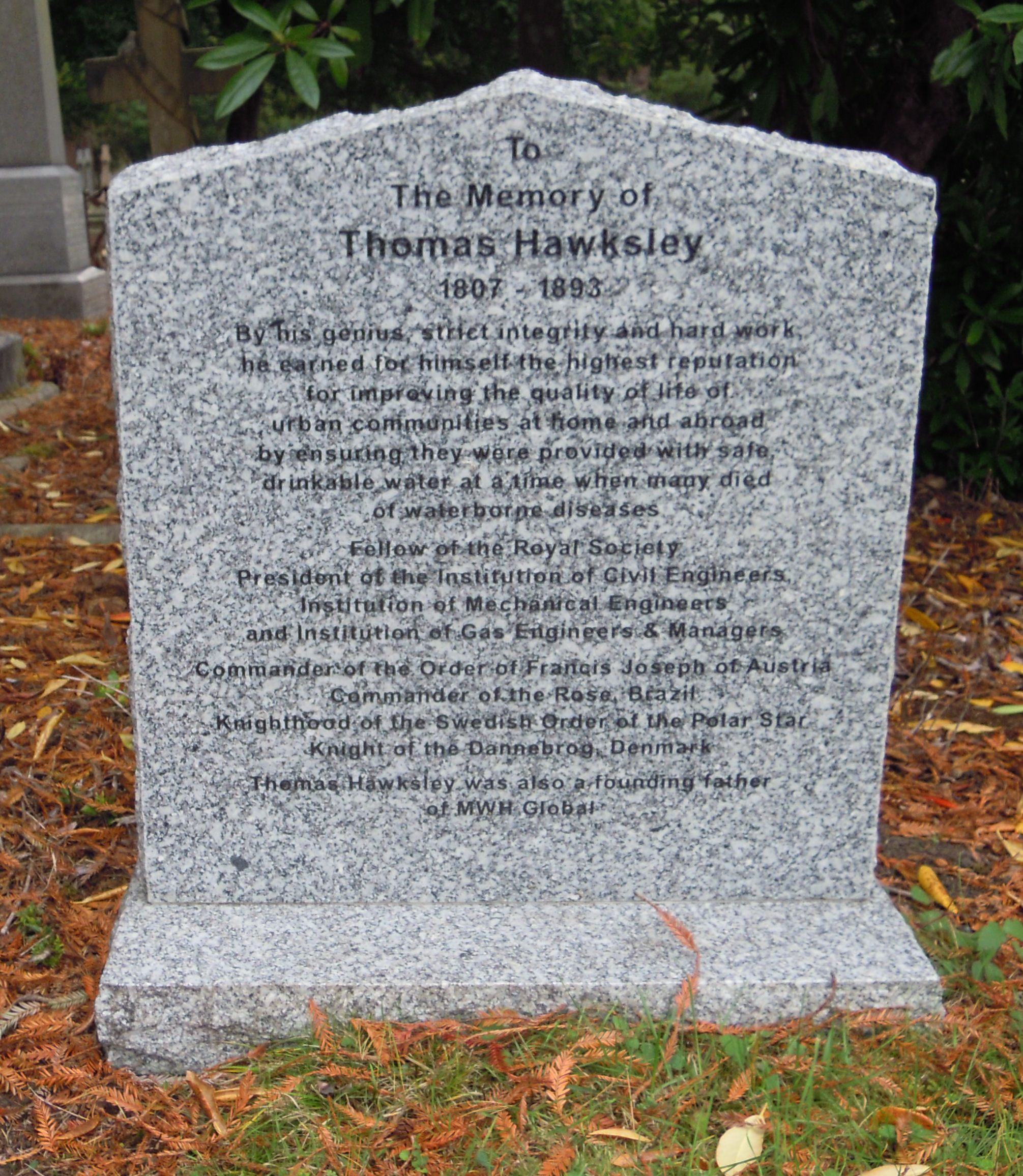
Thomas Hawksley
Thomas Hawksley ( – ) was an English civil engineer of the 19th century, particularly associated with early water supply and coal gas engineering projects. Hawksley was, with John Frederick Bateman, the leading British water engineer of the nineteenth century and was personally responsible for upwards of 150 water-supply schemes, in the British Isles and overseas.Hawksley, Thomas Biography The son of John Hawksley and Sarah Thompson and born in Arnot Hill House, Arnold, near |
Westminster
Westminster is an area of Central London, part of the wider City of Westminster. The area, which extends from the River Thames to Oxford Street, has many visitor attractions and historic landmarks, including the Palace of Westminster, Buckingham Palace, Westminster Abbey, Westminster Cathedral and much of the West End shopping and entertainment district. The name ( ang, Westmynstre) originated from the informal description of the abbey church and royal peculiar of St Peter's (Westminster Abbey), west of the City of London (until the English Reformation there was also an Eastminster, near the Tower of London, in the East End of London). The abbey's origins date from between the 7th and 10th centuries, but it rose to national prominence when rebuilt by Edward the Confessor in the 11th. Westminster has been the home of England's government since about 1200, and from 1707 the Government of the United Kingdom. In 1539, it became a city. Westminster is often used ... [...More Info...] [...Related Items...] OR: [Wikipedia] [Google] [Baidu] |
Leeds
Leeds () is a city and the administrative centre of the City of Leeds district in West Yorkshire, England. It is built around the River Aire and is in the eastern foothills of the Pennines. It is also the third-largest settlement (by population) in England, after London and Birmingham. The city was a small manorial borough in the 13th century and a market town in the 16th century. It expanded by becoming a major production centre, including of carbonated water where it was invented in the 1760s, and trading centre (mainly with wool) for the 17th and 18th centuries. It was a major mill town during the Industrial Revolution. It was also known for its flax industry, iron foundries, engineering and printing, as well as shopping, with several surviving Victorian era arcades, such as Kirkgate Market. City status was awarded in 1893, a populous urban centre formed in the following century which absorbed surrounding villages and overtook the nearby York population. It is ... [...More Info...] [...Related Items...] OR: [Wikipedia] [Google] [Baidu] |


.jpg)