|
Farringdon Without
__NOTOC__ Farringdon Without is the most westerly Ward of the City of London, its suffix ''Without'' reflects its origin as lying beyond the City's former defensive walls. It was first established in 1394 to administer the suburbs west of Ludgate and Newgate, and also around West Smithfield. This was achieved by splitting the very large, pre-existing Farringdon Ward into two parts, Farringdon Within and Farringdon Without. The large and prosperous extramural suburb of ''Farringdon Without'' has been described as having been London's '' first West End''. The largest of the City's 25 Wards, it was reduced in size considerably after a boundary review in 2003, and no longer corresponds very closely to its historic extent. Its resident population is 1,099 (2011). Farringdon Without and Farringdon Within are unconnected to the Farringdon area to the north, outside the City, in Clerkenwell. Southern Clerkenwell is sometimes referred to as ''Farringdon'' due to the presence of Far ... [...More Info...] [...Related Items...] OR: [Wikipedia] [Google] [Baidu] |
Cities Of London And Westminster (UK Parliament Constituency)
Cities of London and Westminster (also known as City of London and Westminster South from 1974 to 1997) is a constituency returning a single Member of Parliament (MP) to the House of Commons in the United Kingdom Parliament. It is a borough constituency for the purposes of election expenses and type of returning officer. As with all constituencies, the election is decided using the first past the post system of election. Since its creation at the 1950 general election, the constituency has always elected the candidate nominated by the Conservative Party. History Before 1950 the City of London formed a two-member constituency on its own. The Boundary Commission for England began reviewing constituencies in January 1946 using rules defined under the Representation of the People Act 1944, which excluded the City of London from the redistribution procedure; the Commission recommended that the borough of Chelsea and the City of Westminster form a single Parliamentary Boro ... [...More Info...] [...Related Items...] OR: [Wikipedia] [Google] [Baidu] |
City Of Westminster
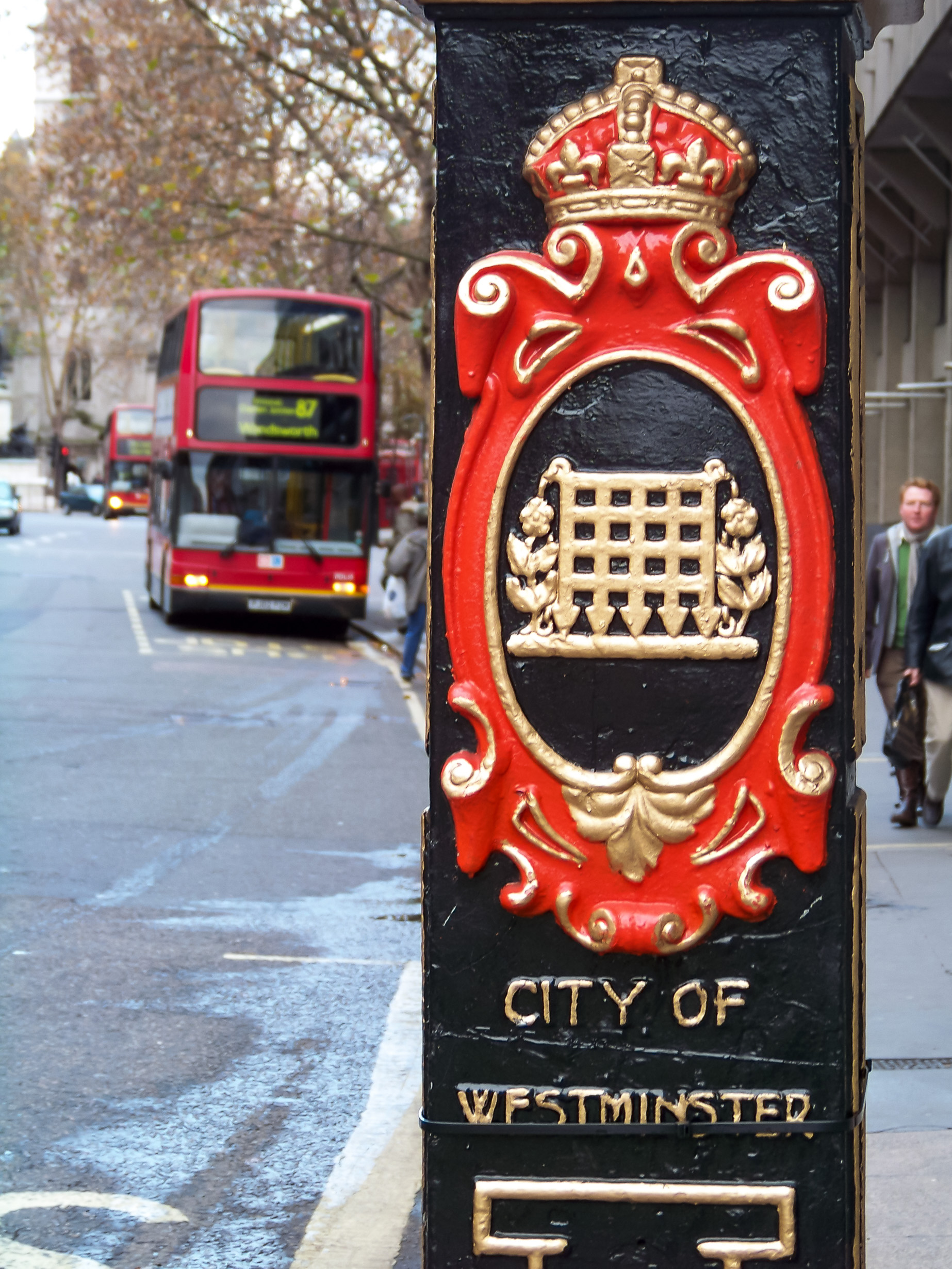
The City of Westminster is a city and borough in Inner London. It is the site of the United Kingdom's Houses of Parliament and much of the British government. It occupies a large area of central Greater London, including most of the West End. Many London landmarks are within the borough, including Buckingham Palace, Westminster Abbey, Whitehall, Westminster Cathedral, 10 Downing Street, and Trafalgar Square. Westminster became a city in 1540, and historically, it was a part of the ceremonial county of Middlesex. Its southern boundary is the River Thames. To the City of Westminster's east is the City of London and to its west is the Royal Borough of Kensington and Chelsea. To its north is the London Borough of Camden. The borough is divided into a number of localities including the ancient political district of Westminster; the shopping areas around Oxford Street, Regent Street, Piccadilly and Bond Street; and the night-time entertainment district of Soho. Much of ... [...More Info...] [...Related Items...] OR: [Wikipedia] [Google] [Baidu] |
High Holborn
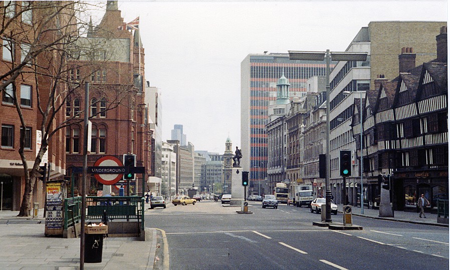
High Holborn ( ) is a street in Holborn and Farringdon Without, Central London, which forms a part of the A40 route from London to Fishguard. It starts in the west at the eastern end of St Giles High Street and runs past the Kingsway and Southampton Row, becoming Holborn at its eastern junction with Gray's Inn Road. The western stretch as far as Drury Lane, was formerly known as Broad Street. On High Holborn, traffic (including cycles and buses) flows one-way westbound from its junction with Drake Street to its western end, and flows both ways for the remainder. The nearest London Underground stations are Tottenham Court Road, Holborn, and Chancery Lane, all on the Central line which runs beneath High Holborn. Landmarks along High Holborn include the Cittie of Yorke, at no. 22, and the Embassy of Cuba, at no. 167. The street was a "Feature site" for introduction of the Camden bench. High Holborn is the highest point in the City of London. At 22 metres (72 feet) ab ... [...More Info...] [...Related Items...] OR: [Wikipedia] [Google] [Baidu] |
Temple Bar, London
Temple Bar is a building that was until 1878 the principal ceremonial entrance to the City of London from the City of Westminster; since relocated, it is today the home of the Worshipful Company of Chartered Architects and an education centre focused on architecture and heritage in the City of London. In the middle ages, London expanded city jurisdiction beyond London Wall, its walls to gates, called ‘bars’, which were erected across thoroughfares. To the west of the City of London, the bar was located in the area known as the Temple, London, Temple. Temple Bar was situated on the historic royal ceremonial route from the Tower of London to the History of the Palace of Westminster, Palace of Westminster, the two chief residences of the medieval English monarchs, and from the Palace of Westminster to St Paul's Cathedral. The road east of where Temple Bar once stood and within the City is Fleet Street, while the road to the west, in Westminster, is Strand, London, The Strand. T ... [...More Info...] [...Related Items...] OR: [Wikipedia] [Google] [Baidu] |
Dragon Boundary Mark
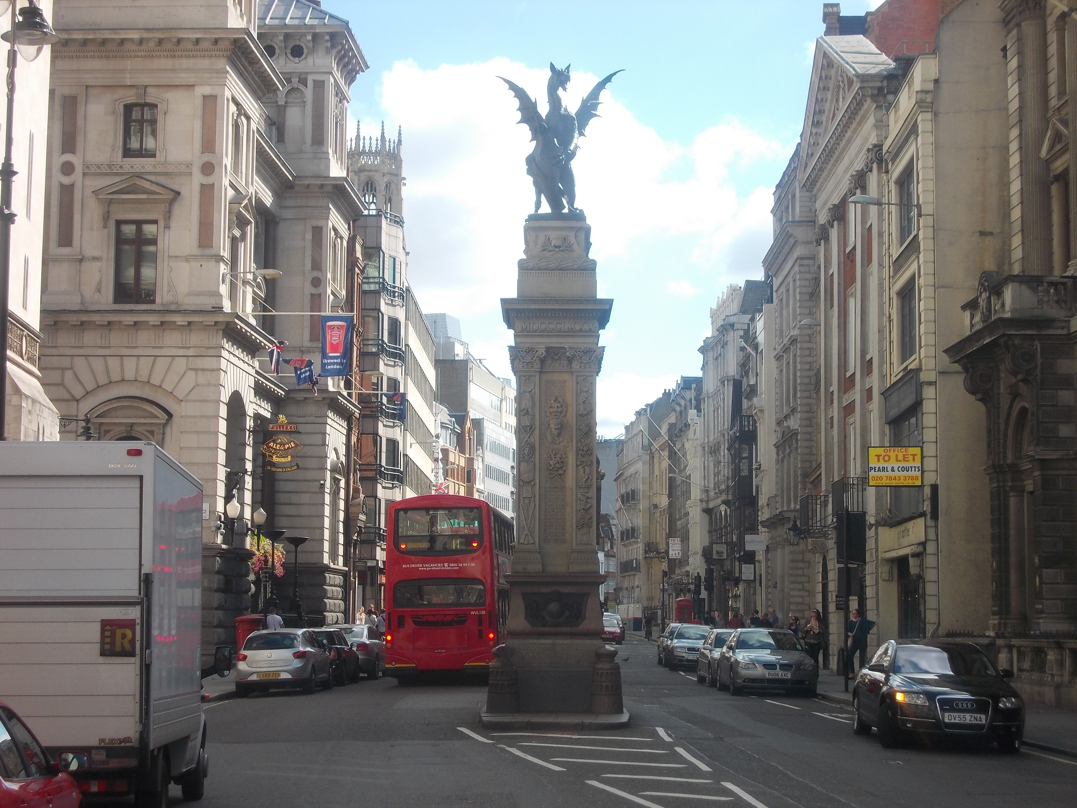
The dragon boundary marks are cast iron statues of dragons (sometimes mistaken for griffins) on metal or stone plinths that mark the boundaries of the City of London. The dragons are painted silver, with details of their wings and tongue picked out in red. The dragon stands on one rear leg, the other lifted against a shield, with the right foreleg raised and the left foreleg holding a shield which bears the City of London's coat of arms, painted in red and white. This stance is the equivalent of the rampant heraldic attitude of the supporters of the City's arms. Design The design is based on two large dragon sculptures, high, which were mounted above the entrance to the Coal Exchange on Lower Thames Street, designed by the City Architect, J. B. Bunning, and made by the London founder Dewer in 1849. The dragons were preserved when the Coal Exchange was demolished in 1962–63. The two original statues were re-erected on high plinths of Portland stone at the western boundar ... [...More Info...] [...Related Items...] OR: [Wikipedia] [Google] [Baidu] |
St John Street, London
St John Street is a historic street located in Clerkenwell, Islington, north London, England. The street runs from Smithfield Market and Charterhouse Street in the south to the junction of City Road and Pentonville Road (near Upper Street) in the north, close to the Angel tube station. It is the first section of the original route of the Great North Road. The Red Bull Theatre was located on the street between 1604 and 1666, when it was destroyed in the Great Fire of London. James Burnett, Lord Monboddo (1714–1799) lived at 13 St John Street. He held "learned suppers" at his house, with guests including James Boswell, Robert Burns and Samuel Johnson Samuel Johnson (18 September 1709 – 13 December 1784), often called Dr Johnson, was an English writer who made lasting contributions as a poet, playwright, essayist, moralist, critic, biographer, editor and lexicographer. The ''Oxford D .... Nowadays there are many office buildings, restaurants, and bars in the stre ... [...More Info...] [...Related Items...] OR: [Wikipedia] [Google] [Baidu] |
London Borough Of Camden
The London Borough of Camden () is a London borough in Inner London. Camden Town Hall, on Euston Road, lies north of Charing Cross. The borough was established on 1 April 1965 from the area of the former boroughs of Hampstead, Holborn, and St Pancras—which together, prior to that date, had comprised part of the historic County of London. The cultural and commercial land uses in the south contrast with the bustling mixed-use districts such as Camden Town and Kentish Town in the centre and leafy residential areas around Hampstead Heath in the north. Well known attractions include The British Museum, The British Library, the famous views from Parliament Hill, the London Zoo, the BT Tower, The Roundhouse and Camden Market. In 2019 it was estimated to have a population of 270,000. The local authority is Camden London Borough Council. History The borough was created in 1965 from the areas of the former metropolitan boroughs of Hampstead, Holborn, and St Pancras, w ... [...More Info...] [...Related Items...] OR: [Wikipedia] [Google] [Baidu] |
St Andrew Holborn
__NOTOC__ St Andrew Holborn was an ancient English parish that until 1767 was partly in the City of London and mainly in the county of Middlesex. Its City, thus southern, part retained its former name or was sometimes officially referred to as St Andrew Holborn Below the Bars. History Ecclesiastical origins Thavie's original property, which was left for his endowment of the church, Thavie's Inn became a lawyers inn and may have been the original home of Lincoln's Inn before it relocated to its present site. Lincoln's sold Thavies Inn for redevelopment in 1785. Earlier that century the small east stained-glass window was put up, representing the arms of John Thavie, Esq., who in the year 1348 "left a considerable estate towards the support of this fabric for ever" as its caption reads. Four other new smaller parishes took over the largest green area depicted and most of Grey's Inn: *St John the Evangelist Red Lion Square took on the south-west, eating equally into St Gile ... [...More Info...] [...Related Items...] OR: [Wikipedia] [Google] [Baidu] |
St Andrew Holborn (church)
The Church of St Andrew, Holborn, is a Church of England church on the northwestern edge of the City of London, on Holborn within the Ward of Farringdon Without. History Roman and medieval Roman pottery was found on the site during 2001/02 excavations in the crypt. However, the first written record of the church itself is dated as 951 (DCCCCLI) in a charter of Westminster Abbey, referring to it as the "old wooden church", on top of the hill above the river Fleet. The Charter's authenticity has been called into question because the date is not within the reign of the King Edgar of England who is granting it. It may be that this is simply a scribal error and that the date should be '959' (DCCCCLIX). A 'Master Gladwin', i.e. a priest, held it after the Norman Conquest and he assigned it to St Paul's Cathedral, but with the proviso that the advowson be granted at 12 pence a year to the Cluniac Order's, St Saviour's foundation of what was to become Bermondsey Abbey. This assignment d ... [...More Info...] [...Related Items...] OR: [Wikipedia] [Google] [Baidu] |
Holborn
Holborn ( or ) is a district in central London, which covers the south-eastern part of the London Borough of Camden and a part ( St Andrew Holborn Below the Bars) of the Ward of Farringdon Without in the City of London. The area has its roots in the ancient parish of Holborn, which lay on the west bank of the now buried River Fleet, taking its name from an alternative name for the river. The area is sometimes described as part of the West End of London or of the wider West London area. The River Fleet also gave its name to the streets ''Holborn'' and ''High Holborn'' which extend west from the site of the former Newgate in the London Wall, over the Fleet, through Holborn and towards Westminster. The district benefits from a central location which helps provide a strong mixed economy. The area is particularly noted for its links to the legal profession, the diamond centre at Hatton Garden and Great Ormond Street Hospital. Origins and administration Holborn emerged ... [...More Info...] [...Related Items...] OR: [Wikipedia] [Google] [Baidu] |
Farringdon Road
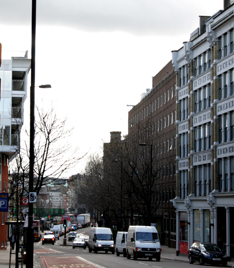
Farringdon Road is a road in Clerkenwell, London. Route Farringdon Road is part of the A201 route connecting King's Cross to Elephant and Castle. It goes southeast from King's Cross, crossing Rosebery Avenue, then turns south, crossing Clerkenwell Road before going past Farringdon station. It finishes on the border between the City of London, the London Borough of Camden and the London Borough of Islington, at a junction with Charterhouse Street. Its line continues into the City as Farringdon Street. History The road's construction, taking almost 20 years between the 1840s and the 1860s, is considered one of the greatest urban engineering achievements of the 19th century. It was one of the first engineered multi-lane roads, and buried the River Fleet in a system of tunnels, solving one of London's most significant sanitary problems. Its construction also included the building of the world's first stretch of underground railway, the Metropolitan Railway that later ... [...More Info...] [...Related Items...] OR: [Wikipedia] [Google] [Baidu] |
Charterhouse Street
Charterhouse Street is a street on the north side of Smithfield in the City of London. The road forms part of the City’s boundary with the neighbouring London Boroughs of Islington and Camden. It connects Charterhouse Square and Holborn Circus, crossing Farringdon Road and running along a number of historical sites, including Smithfield Market. The nearest London Underground stations are Barbican near the east end of Charterhouse Street and Farringdon further west. Farringdon station also provides a connection to Crossrail and Thameslink rail services. Notable buildings Current Several gastropubs line the street, including the Fox and Anchor. The formerly- DJ Mag #1 club Fabric nightclub is located at No. 77A. Charterhouse Street is also the home of a 31 MWe combined heat and power plant operated by Citigen ( E.ON) and located within and beneath the former PLA cold store. De Beers International diamond corporation De Beers has been headquartered at No. 17 since 1 ... [...More Info...] [...Related Items...] OR: [Wikipedia] [Google] [Baidu] |


