|
Exeter Ship Canal
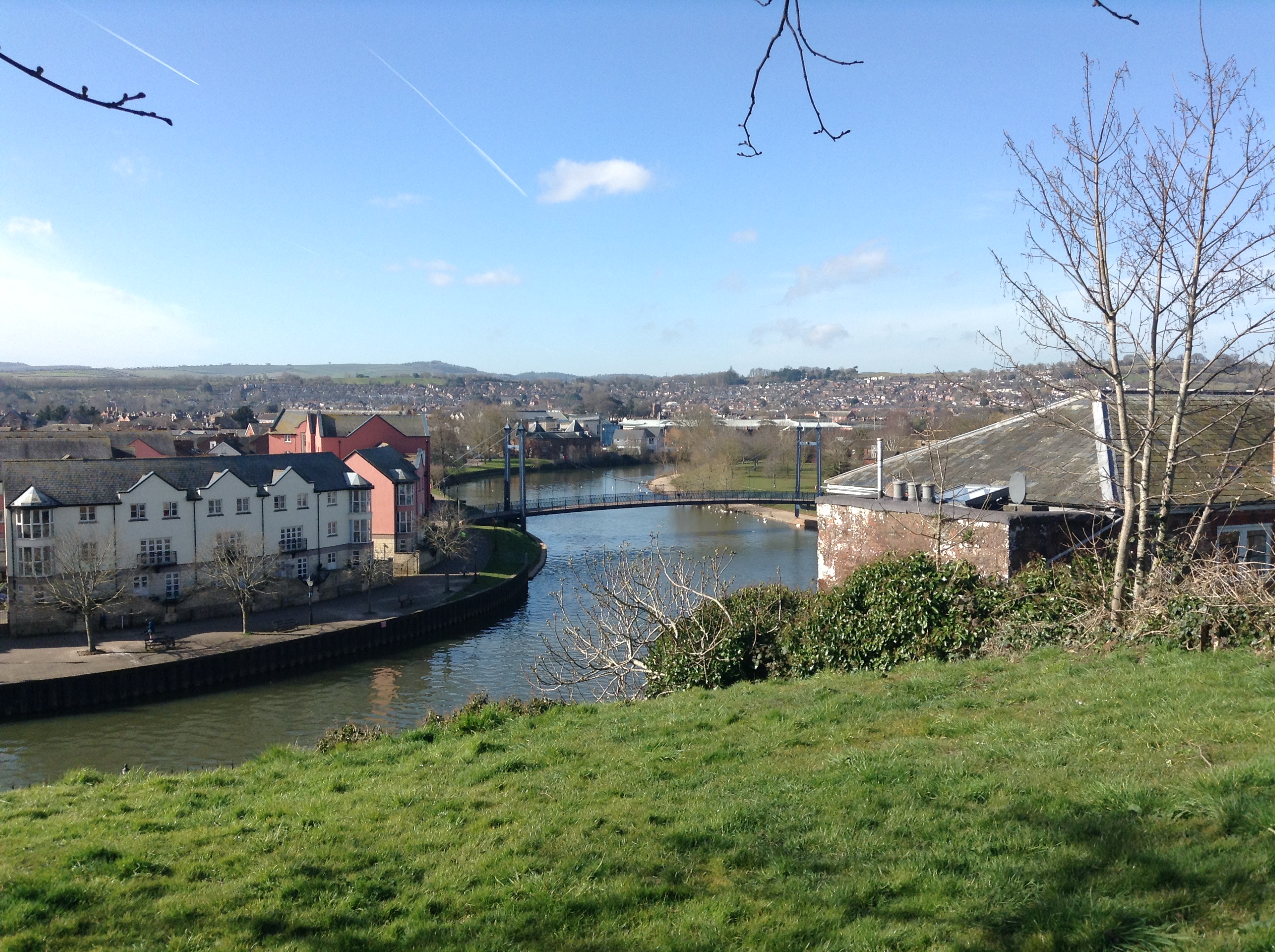
The Exeter Ship Canal, also known as the Exeter Canal is a canal leading from (and beside) the River Exe to Exeter Quay in the city of Exeter, Devon, England. It was first constructed in the 1560s predating the "canal mania" period and is one of the oldest artificial waterways in the UK. History At the start of Exeter's history, the River Exe was tidal and navigable up to the city walls enabling it to be a busy port. In the 1270s or 1280s, the Countess of Devon, Isabella de Fortibus, built a weir across the river to power her mills (this weir is remembered in the name of the nearby suburb Countess Wear). This had the effect of cutting off Exeter's port from the sea and damaging its salmon fisheries. In 1290, trade with Exeter's port was restored, only to be blocked by a new weir built in 1317 by Hugh de Courtenay, 9th Earl of Devon (Isabella's cousin), who also built a quay at Topsham. Because of the blockages on the river, boats were forced to unload at Topsham and the earls ... [...More Info...] [...Related Items...] OR: [Wikipedia] [Google] [Baidu] |
River Exe
The River Exe ( ) in England rises at Exe Head, near the village of Simonsbath, on Exmoor in Somerset, from the Bristol Channel coast, but flows more or less directly due south, so that most of its length lies in Devon. It flows for 60 miles (96 km) and reaches the sea at a substantial ria, the Exe Estuary, on the south (English Channel) coast of Devon. Historically, its lowest bridging point was the Old Exe Bridge in Exeter, the largest settlement on the river, but there is now a viaduct for the M5 motorway about south of the city centre. Topography The river's name derives from *Uɨsk, a Common Brittonic root meaning "abounding in fish", and a cognate of both the Irish ''iasc'', meaning "fish", and ''pysg'', the plural word for "fish" in Welsh. The same root separately developed into the English Axe and Esk, the Welsh Usk, though not, as some have claimed, the word '' whisky'', this latter being from the Classical Irish/Gaelic "water" (the fuller phrase be ... [...More Info...] [...Related Items...] OR: [Wikipedia] [Google] [Baidu] |
Pound Lock
A lock is a device used for raising and lowering boats, ships and other watercraft between stretches of water of different levels on river and canal waterways. The distinguishing feature of a lock is a fixed chamber in which the water level can be varied; whereas in a caisson lock, a boat lift, or on a canal inclined plane, it is the chamber itself (usually then called a caisson) that rises and falls. Locks are used to make a river more easily navigable, or to allow a canal to cross land that is not level. Later canals used more and larger locks to allow a more direct route to be taken. Pound lock A ''pound lock'' is most commonly used on canals and rivers today. A pound lock has a chamber with gates at both ends that control the level of water in the pound. In contrast, an earlier design with a single gate was known as a flash lock. Pound locks were first used in China during the Song Dynasty (960–1279 AD), having been pioneered by the Song politician and naval e ... [...More Info...] [...Related Items...] OR: [Wikipedia] [Google] [Baidu] |
South West Water
South West Water provides drinking water and waste water services throughout Devon and Cornwall and in small areas of Dorset and Somerset. South West Water was created in 1989 with the privatisation of the water industry. It was preceded by the South West Water Authority which was formed by the Water Act 1973 as one of ten regional water authorities formed by a merger of various statutory and local authority water undertakings. South West Water is part of the Pennon Group. History South West Water was formed in 1989 when the water industry in the United Kingdom was privatised. It is responsible for the supply of the region's drinking water, the treatment and disposal of sewage, and the protection of inland and bathing waters. It is closely regulated by Ofwat, the Water Services Regulation Authority, being required to conform to stringent United Kingdom and European Union standards. Water from the Littlehampston treatment works, which serves about 162,000 customers in the Torbay ... [...More Info...] [...Related Items...] OR: [Wikipedia] [Google] [Baidu] |
Image Of Plaque Sited Near The Exeter Canal Bridge
An image is a visual representation of something. It can be two-dimensional, three-dimensional, or somehow otherwise feed into the visual system to convey information. An image can be an artifact, such as a photograph or other two-dimensional picture, that resembles a subject. In the context of signal processing, an image is a distributed amplitude of color(s). In optics, the term “image” may refer specifically to a 2D image. An image does not have to use the entire visual system to be a visual representation. A popular example of this is of a greyscale image, which uses the visual system's sensitivity to brightness across all wavelengths, without taking into account different colors. A black and white visual representation of something is still an image, even though it does not make full use of the visual system's capabilities. Images are typically still, but in some cases can be moving or animated. Characteristics Images may be two or three- dimensional, such as a p ... [...More Info...] [...Related Items...] OR: [Wikipedia] [Google] [Baidu] |
Oxfordshire And Buckinghamshire Light Infantry
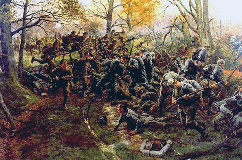
The Oxfordshire and Buckinghamshire Light Infantry was a light infantry regiment of the British Army that existed from 1881 until 1958, serving in the Second Boer War, World War I and World War II. The regiment was formed as a consequence of the 1881 Childers Reforms, a continuation of the Cardwell Reforms, by the amalgamation of the 43rd (Monmouthshire) Regiment of Foot (Light Infantry) and the 52nd (Oxfordshire) Regiment of Foot (Light Infantry), forming the 1st and 2nd Battalions of the Oxfordshire Light Infantry on 1 July 1881. In 1908, as part of the Haldane Reforms, the regiment's title was altered to become the Oxfordshire and Buckinghamshire Light Infantry, commonly shortened to the ''Ox and Bucks.'' After service in many conflicts and wars, the Ox and Bucks Light Infantry was, in 1948, reduced to a single Regular Army battalion and on 7 November 1958, following Duncan Sandys' 1957 Defence White Paper, it was renamed the 1st Green Jackets (43rd and 52nd), forming pa ... [...More Info...] [...Related Items...] OR: [Wikipedia] [Google] [Baidu] |
Horsa Bridge
Horsa Bridge, also known as Ranville Bridge, over the Orne river, was, along with Pegasus Bridge, captured during Operation Tonga by gliderborne troops of the 2nd Oxfordshire and Buckinghamshire Light Infantry (the 52nd) in a ''coup de main'' operation in the opening minutes of D-Day, 6 June 1944. The seizing of both bridges was considered to be critical to securing the eastern flank of the Normandy landings area, preventing German armour from reaching the British 3rd Infantry Division which was due to start landing on Sword at 07.25hrs. Horsa Bridge, a road bridge, was over 400 yards east of Pegasus Bridge towards the village of Ranville. Renaming of the bridge Following the capture of the bridge over the Orne, members of the ''coup de main'' operation supported naming the bridge 'Light Infantry Bridge'. The captured Benouville Bridge had been sign-boarded Pegasus Bridge. After the Second World War the bridge over the Orne became known as Horsa Bridge, in recognition of th ... [...More Info...] [...Related Items...] OR: [Wikipedia] [Google] [Baidu] |
Pegasus Bridge
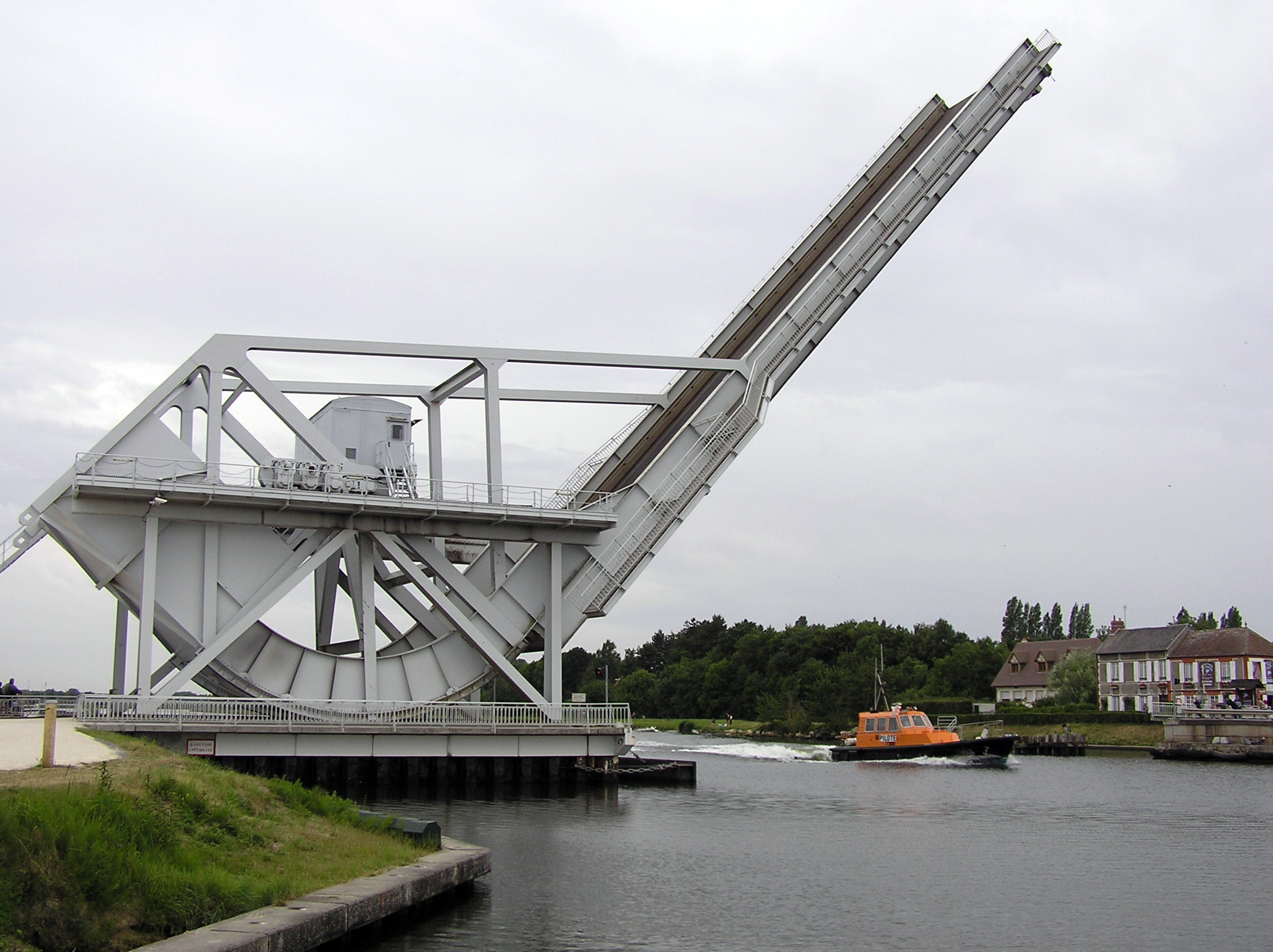
Pegasus Bridge, originally called the Bénouville Bridge after the neighbouring village, is a road crossing over the Caen Canal, between Caen and Ouistreham in Normandy. The original bridge, built in 1934, is now a war memorial and is the centrepiece of the Memorial Pegasus museum at nearby Ranville. It was replaced in 1994 by a modern design which, like the old one, is a bascule bridge. On 6 June 1944, during the Second World War, the bridge was, along with the nearby Ranville Bridge over the Orne River (another road crossing, later renamed Horsa Bridge), the objective of members of D Company, 2nd (Airborne) Battalion, Oxfordshire and Buckinghamshire Light Infantry, a glider-borne force who were part of the 6th Airlanding Brigade of the 6th Airborne Division during Operation Tonga in the opening minutes of the Allied invasion of Normandy. Under the command of Major John Howard, D Company was to land close by the bridges in six Airspeed Horsa gliders and, in a ''coup-de-main'' ... [...More Info...] [...Related Items...] OR: [Wikipedia] [Google] [Baidu] |
The Blitz
The Blitz was a German bombing campaign against the United Kingdom in 1940 and 1941, during the Second World War. The term was first used by the British press and originated from the term , the German word meaning 'lightning war'. The Germans conducted mass air attacks against industrial targets, towns, and cities, beginning with raids on London towards the end of the Battle of Britain in 1940 (a battle for daylight air superiority between the Luftwaffe and the Royal Air Force over the United Kingdom). By September 1940, the Luftwaffe had lost the Battle of Britain and the German air fleets () were ordered to attack London, to draw RAF Fighter Command into a battle of annihilation.Price 1990, p. 12. Adolf Hitler and Reichsmarschall Hermann Göring, commander-in-chief of the Luftwaffe, ordered the new policy on 6 September 1940. From 7 September 1940, London was systematically bombed by the Luftwaffe for 56 of the following 57 days and nights. Most notable was a large dayli ... [...More Info...] [...Related Items...] OR: [Wikipedia] [Google] [Baidu] |
South Devon Railway Company
The South Devon Railway Company built and operated the railway from Exeter to Plymouth and Torquay in Devon, England. It was a broad gauge railway built by Isambard Kingdom Brunel. The line had to traverse difficult hilly terrain, and the company adopted the atmospheric system in which trains were drawn by a piston in a tube laid between the rails, a vacuum being created by stationary engines. The revolutionary system proved to have insuperable technical difficulties and was abandoned. The line continued as a conventional locomotive railway. The company promoted a number of branches, through the medium of nominally independent companies. Its original main line between Exeter and Plymouth remains in use today as an important part of the main line between London and Plymouth. Chronology * 1844 South Devon Railway Act passed by Parliament * 1846 opened to Newton Abbot * 1847 opened to Totnes, atmospheric trains start running * 1848 atmospheric trains withdrawn, Torquay branch op ... [...More Info...] [...Related Items...] OR: [Wikipedia] [Google] [Baidu] |
Bristol & Exeter Railway
The Bristol & Exeter Railway (B&ER) was an English railway company formed to connect Bristol and Exeter. It was built on the broad gauge and its engineer was Isambard Kingdom Brunel. It opened in stages between 1841 and 1844. It was allied with the Great Western Railway (GWR), which built its main line between London and Bristol, and in time formed part of a through route between London and Cornwall. It became involved in the gauge wars, a protracted and expensive attempt to secure territory against rival companies supported by the London and South Western Railway (LSWR) which used the narrow gauge, later referred to as ''standard gauge''. At first it contracted with the GWR for that company to work the line, avoiding the expense of acquiring locomotives, but after that arrangement expired in 1849, the B&ER operated its own line. It opened a number of branches within the general area it served: to Clevedon, Cheddar, Wells, Weston-super-Mare, Chard, Yeovil and Tiverton. The B& ... [...More Info...] [...Related Items...] OR: [Wikipedia] [Google] [Baidu] |
Bristol
Bristol () is a city, ceremonial county and unitary authority in England. Situated on the River Avon, it is bordered by the ceremonial counties of Gloucestershire to the north and Somerset to the south. Bristol is the most populous city in South West England. The wider Bristol Built-up Area is the eleventh most populous urban area in the United Kingdom. Iron Age hillforts and Roman villas were built near the confluence of the rivers Frome and Avon. Around the beginning of the 11th century, the settlement was known as (Old English: 'the place at the bridge'). Bristol received a royal charter in 1155 and was historically divided between Gloucestershire and Somerset until 1373 when it became a county corporate. From the 13th to the 18th century, Bristol was among the top three English cities, after London, in tax receipts. A major port, Bristol was a starting place for early voyages of exploration to the New World. On a ship out of Bristol in 1497, John Cabot, a Venetia ... [...More Info...] [...Related Items...] OR: [Wikipedia] [Google] [Baidu] |


