|
Edo River
The is a river in the Kantō region of Japan. It splits from the Tone River at the northernmost tip of Noda City in the Sekiyado district, crosses through Nagareyama and Matsudo, and empties into Tokyo Bay at Ichikawa, Chiba Prefecture. The Edo forms the borders between Tokyo, Chiba, and Saitama prefectures. The Edo River is long. The course of the Edo River was originally the lower course of the Tone River. The Tone was diverted in 1654 by the Tokugawa shogunate to protect the city of Edo from flooding. The Edo was used to connect the north and east of the Kantō region to the capital at Edo, specifically to transport large amounts of cargo from Chōshi and other cities on the Pacific Ocean coast inland to the capital. Before the industrialization of the Tokyo region the river was also used to cultivate lotus roots. Inland transportation ended in the early 20th century due to the development of an extensive rail cargo network in the Kantō region, but the Edo River rem ... [...More Info...] [...Related Items...] OR: [Wikipedia] [Google] [Baidu] |
Nagareyama
Nagareyama City Hall is a city located in Chiba Prefecture, Japan. , the city had an estimated population of 211,620 in 89,751 households and a population density of 6,000 persons per km2. The total area of the city is . Geography Nagareyama is located in the far northwestern corner of Chiba Prefecture, bordered by the Edogawa River to the west. It is about 30 kilometers from the prefectural capital at Chiba and within 20 to 30 kilometers from the center of Tokyo. The city area is long from north to south, and the central and northern parts of the city form part of the Shimōsa Plateau, with almost the entire area as either residential or farmland. The Edo River runs north and south along the western border of the city, opposite which is Saitama Prefecture. In addition, the Tone Canal runs through the northern part of the city. Neighboring municipalities Chiba Prefecture * Kashiwa * Matsudo * Noda Saitama Prefecture * Misato * Yoshikawa Climate Nagareyama has a humid subtrop ... [...More Info...] [...Related Items...] OR: [Wikipedia] [Google] [Baidu] |
Chōshi
Chōshi (, ) is a city located in Chiba Prefecture, Japan. , the city had an estimated population of 59,174 in 27,160 households and a population density of . The total area of the city is . Geography Chōshi is located in the northeastern part of Chiba prefecture, about 65 kilometers from the prefectural capital at Chiba and 90 to 100 kilometers from central Tokyo. Cape Inubō, within the city, is the easternmost point in the Kantō region. Chōshi is noted for its dramatic sea coast on the Pacific Ocean. The Tone River runs through the northern part of the city. Takagami Atagoyama (elevation 73.6 meters) is the highest peak. Neighboring municipalities Chiba Prefecture *Asahi * Tōnoshō Ibaraki Prefecture * Kamisu Climate Chōshi has a humid subtropical climate (Köppen ''Cfa'') characterized by warm summers and cool winters with light to no snowfall. The average annual temperature in Chōshi is . The average annual rainfall is with October as the wettest month. The tempe ... [...More Info...] [...Related Items...] OR: [Wikipedia] [Google] [Baidu] |
Rivers Of Saitama Prefecture
A river is a natural stream of fresh water that flows on land or inside caves towards another body of water at a lower elevation, such as an ocean, lake, or another river. A river may run dry before reaching the end of its course if it runs out of water, or only flow during certain seasons. Rivers are regulated by the water cycle, the processes by which water moves around the Earth. Water first enters rivers through precipitation, whether from rainfall, the runoff of water down a slope, the melting of glaciers or snow, or seepage from aquifers beneath the surface of the Earth. Rivers flow in channeled watercourses and merge in confluences to form drainage basins, or catchments, areas where surface water eventually flows to a common outlet. Rivers have a great effect on the landscape around them. They may regularly overflow their banks and flood the surrounding area, spreading nutrients to the surrounding area. Sediment or alluvium carried by rivers shapes the landscape ar ... [...More Info...] [...Related Items...] OR: [Wikipedia] [Google] [Baidu] |
Edogawa, Tokyo
is a Special wards of Tokyo, special ward in the Tokyo, Tokyo Metropolis in Japan. It takes its name from the Edo River that runs from north to south along the eastern edge of the ward. In English, it uses the name Edogawa City. The easternmost of the wards, it shares boundaries with the cities of Urayasu, Chiba, Urayasu and Ichikawa, Chiba, Ichikawa in Chiba Prefecture (to the east) and with the wards of Katsushika, Tokyo, Katsushika (to the north), Sumida, Tokyo, Sumida and Kōtō, Tokyo, Kōtō (to the west). It meets the city of Matsudo, Chiba, Matsudo in Chiba at a point. Edogawa has a sister-city relationship with Gosford, New South Wales, Australia. Domestically, it has friendship ties with the cities of Azumino, Nagano, Azumino in Nagano Prefecture and Tsuruoka, Yamagata, Tsuruoka in Yamagata Prefecture. As of January 1, 2020, the ward has an estimated population of 695,797, and a population density of 13,925 persons per km2. The total area is 49.90 km2. Histor ... [...More Info...] [...Related Items...] OR: [Wikipedia] [Google] [Baidu] |
Urayasu
260px, Old Urayasu is a city located in Chiba Prefecture, Japan. , the city had an estimated population of 170,533 in 81,136 households and a population density of . The total area of the city is . Urayasu is best known as the home of Tokyo Disney Resort, which opened in April 1983, and the headquarters of The Oriental Land Company. History Early history The area around Urayasu was ''tenryō'' territory within Shimōsa Province controlled directly by the Tokugawa shogunate during the Edo period. Urayasu served as an important fishing village for the Edo capitol. Until the industrialization of the city it was a major center of production of ''nori'', an edible seaweed, ''hamaguri'', and ''asari'' clams. All three are important elements of the traditional Japanese diet. Timeline Meiji and Taisho eras * 1868 - After the Meiji Restoration in 1868, the area became part of Chiba Prefecture. * 1889 - Urayasu Village was created on April 1, 1889 under Higashikatsushika District with ... [...More Info...] [...Related Items...] OR: [Wikipedia] [Google] [Baidu] |
Landfill
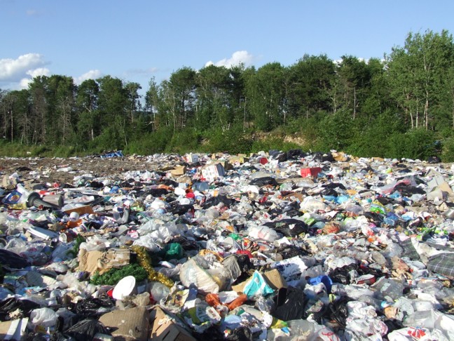
A landfill is a site for the disposal of waste materials. It is the oldest and most common form of waste disposal, although the systematic burial of waste with daily, intermediate and final covers only began in the 1940s. In the past, waste was simply left in piles or thrown into pits (known in Archaeology, archeology as middens). Landfills take up a lot of land and pose environmental risks. Some landfill sites are used for waste management purposes, such as temporary storage, consolidation and transfer, or for various stages of processing waste material, such as sorting, treatment, or recycling. Unless they are stabilized, landfills may undergo severe shaking or soil liquefaction of the ground during an earthquake. Once full, the area over a landfill site may be Landfill restoration, reclaimed for other uses. Both active and restored landfill sites can have significant environmental impacts which can persist for many years. These include the release of gases that contribute to ... [...More Info...] [...Related Items...] OR: [Wikipedia] [Google] [Baidu] |
Tokyo Disneyland
is a theme park at the Tokyo Disney Resort in Urayasu, Chiba Prefecture, Japan, near Tokyo. Its main gate is directly adjacent to both Maihama Station and Tokyo Disneyland Station. It was the first Walt Disney Parks and Resorts, Disney park to be built outside the United States and it opened on April 15, 1983. The park was constructed by Walt Disney Imagineering, WED Enterprises in the same style as Disneyland in California and Magic Kingdom in Florida. It is owned by The Oriental Land Company, which licenses intellectual property from The Walt Disney Company. Tokyo Disneyland and its companion park, Tokyo DisneySea, are the only Disney parks in the world not owned or operated by The Walt Disney Company in any capacity. The park has seven themed areas: the World Bazaar, Adventureland (Disney)#Tokyo Disneyland, Adventureland, Frontierland#Tokyo Disneyland, Westernland, Fantasyland#Tokyo Disneyland, Fantasyland, Tomorrowland (Disney Parks), Tomorrowland, Critter Country and Mick ... [...More Info...] [...Related Items...] OR: [Wikipedia] [Google] [Baidu] |
Nelumbo Nucifera
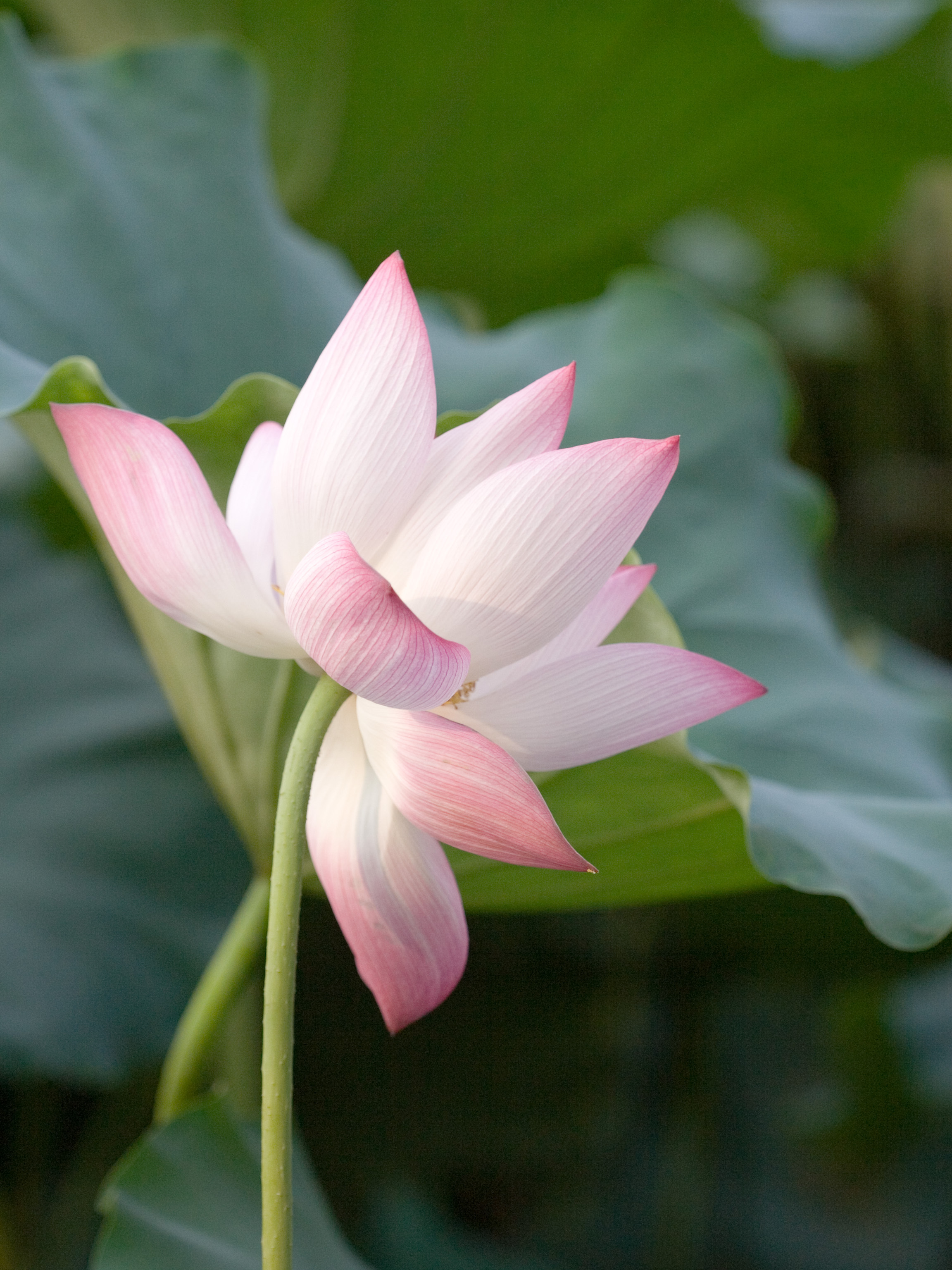
''Nelumbo nucifera'', also known as the pink lotus, sacred lotus, Indian lotus, or simply lotus, is one of two extant taxon, extant species of aquatic plant in the Family (biology), family Nelumbonaceae. It is sometimes colloquially called a water lily, though this more often refers to members of the family Nymphaeaceae. The lotus belongs in the order Proteales. Lotus plants are adapted to grow in the flood plains of slow-moving rivers and delta areas. Stands of lotus drop hundreds of thousands of seeds every year to the bottom of the pond. While some sprout immediately and most are eaten by wildlife, the remaining seeds can remain dormant for an extensive period of time as the pond silts in and dries out. During flood conditions, sediments containing these seeds are broken open, and the dormant seeds rehydrate and begin a new lotus colony. It is cultivated in nutrient-rich, loamy, and often flooded soils, requiring warm temperatures and specific planting depths, with propagat ... [...More Info...] [...Related Items...] OR: [Wikipedia] [Google] [Baidu] |


