|
Drakes Bay
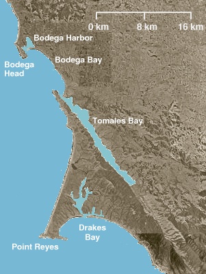
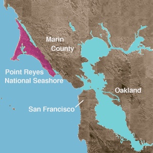
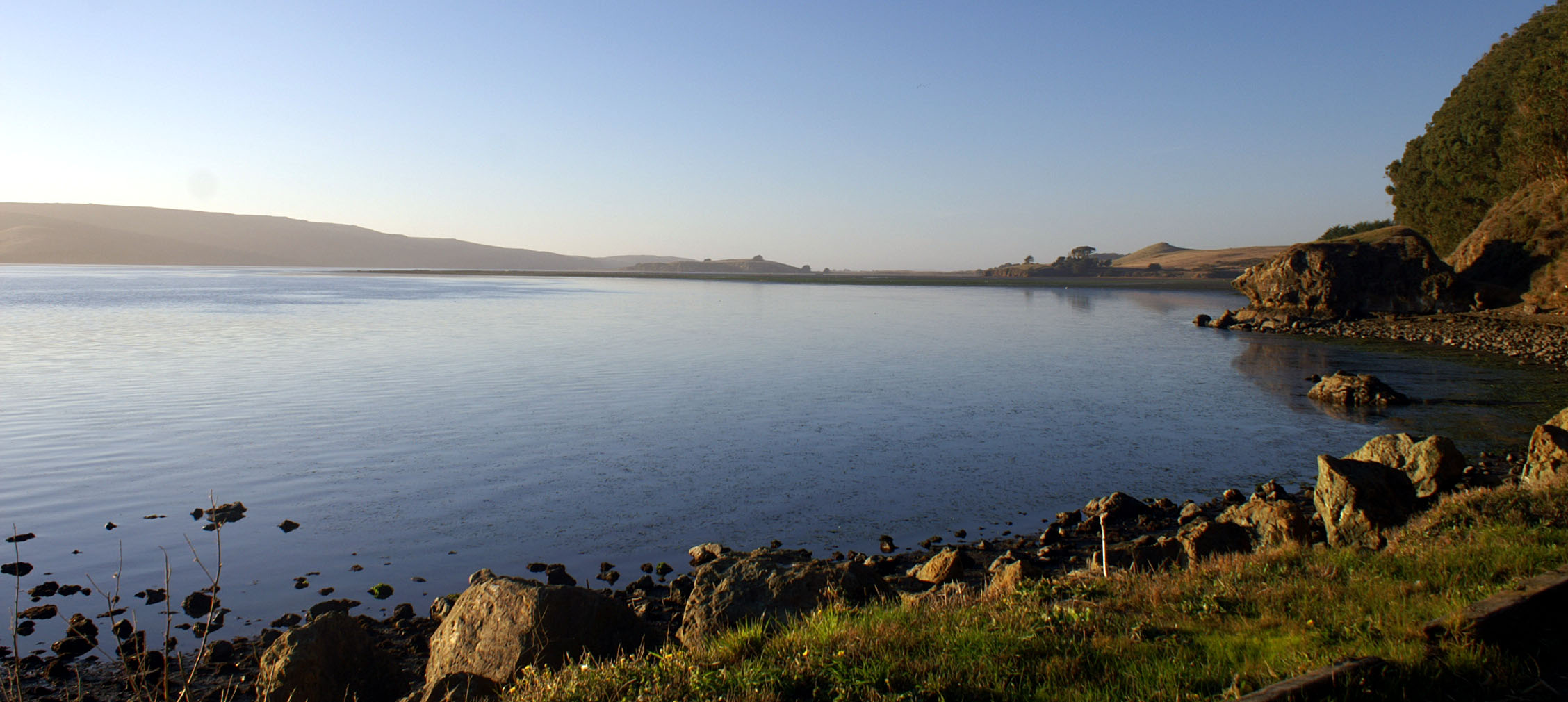
Drakes Bay ( Coast Miwok: ''Tamál-Húye'') is a bay along the Point Reyes National Seashore on the coast of northern California in the United States, approximately northwest of San Francisco at approximately 38 degrees north latitude. The bay is approximately wide. It is formed on the lee side of the coastal current by Point Reyes. An alternative name for this bay is ''Puerto De Los Reyes''. Naming The bay was named by English-born American surveyor George Davidson in 1875, after Sir Francis Drake. It has long been considered Drake's most likely landing spot on the west coast of North America during his circumnavigation of the world by sea in 1579. Description The bay is fed by Drake's Estero, an expansive estuary on the Point Reyes peninsula. The estuary is protected by Estero de Limantour State Marine Reserve & Drakes Estero State Marine Conservation Area. Point Reyes State Marine Reserve & Point Reyes State Marine Conservation Area lie within Drakes Bay. Like und ... [...More Info...] [...Related Items...] OR: [Wikipedia] [Google] [Baidu] |
National Park Service
The National Park Service (NPS) is an List of federal agencies in the United States, agency of the Federal government of the United States, United States federal government, within the US Department of the Interior. The service manages all List of national parks of the United States, national parks; most National monument (United States), national monuments; and other natural, historical, and recreational properties, with various title designations. The United States Congress created the agency on August 25, 1916, through the National Park Service Organic Act. Its headquarters is in Washington, D.C., within the main headquarters of the Department of the Interior. The NPS employs about 20,000 people in units covering over in List of states and territories of the United States, all 50 states, the District of Columbia, and Territories of the United States, US territories. In 2019, the service had more than 279,000 volunteers. The agency is charged with preserving the ecological a ... [...More Info...] [...Related Items...] OR: [Wikipedia] [Google] [Baidu] |
Estero De Limantour State Marine Reserve & Drakes Estero State Marine Conservation Area
Estero de Limantour State Marine Reserve (SMR) and Drakes Estero State Marine Conservation Area (SMCA) are two adjoining marine protected areas along the Point Reyes National Seashore in Marin County on California’s north central coast. These marine protected areas cover a combined , with in the SMR and in the SMCA. Drakes Estero SMCA prohibits the take of all living marine resources from Drakes Estero except the recreational take of clams and formerly the commercial aquaculture of shellfish pursuant to a disputed state water bottom lease and permit, which has been the subject of ongoing legal proceedings since 2012, when the lease was allowed to expire. History Estero de Limantour State Marine Reserve SMR and Drakes Estero State Marine Conservation Area SMCA are two of 22 marine protected areas adopted by the California Department of Fish and Game in August 2009 during the second phase of the Marine Life Protection Act Initiative. The MLPAI is a collaborative public proces ... [...More Info...] [...Related Items...] OR: [Wikipedia] [Google] [Baidu] |
List Of National Historic Landmarks In California
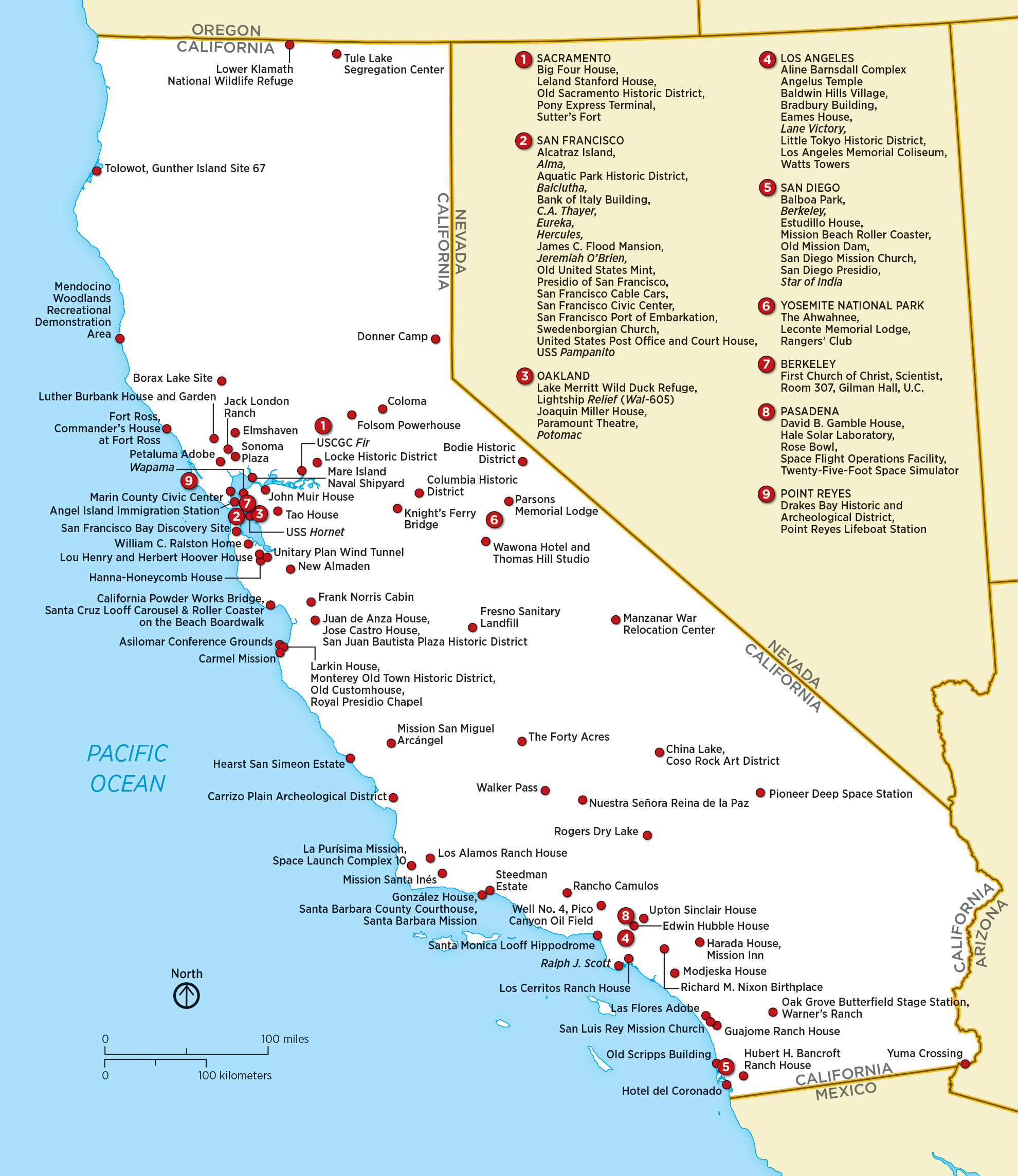
This is a complete List of National Historic Landmarks in California. The United States National Historic Landmark, National Historic Landmark (NHL) program is operated under the auspices of the National Park Service, and recognizes structures, districts, objects, and similar resources List of U.S. National Historic Landmarks by state, nationwide according to a list of criteria of national significance. The listings in the U.S. state, state of California express the diversity of California's heritage, including pre-Columbian peoples, the Spanish and Mexican periods, maritime activity, space exploration, and many other themes. The table below lists all 150 sites, along with added detail and description. The sites are distributed across 36 of List of counties in California, California's 58 counties.The current NPS list shows 146 NHLs, of which two are no longer active: "City of Oakland" relocated to Arkansas and First Pacific Coast Cannery Site withdrawn. Current NHLs One si ... [...More Info...] [...Related Items...] OR: [Wikipedia] [Google] [Baidu] |
Camp Hydle
Camp Hydle, also called Drakes Bay Range, was a large training center during World War II, located at Drakes Bay, on what is now Point Reyes National Seashore on the coast of northern California in the United States. The camp had several training sites: Camp Hydle, Drakes Bay Air to Ground Gunnery Range, Drakes Bay Dive Bombing Target, Camp Murphy's Ranch, Camp Hydle Maneuver Area, and Camp Hydle Skip and Dive Bombing Range. Also at the camp were landing craft training and air sea rescue training. The site was of Marin County, California land on the West Coast of the United States. The complete area from Stinson Beach to the south and Dillon Beach to the north was called the Point Reyes Gunnery Range at Point Reyes. The Gunnery Range also included: two radar towers, horse stable, two lifeboat Stations, the Point Reyes Lighthouse, lookout towers, and land strafing targets (rake). The dive bomber airplanes came from Hamilton Army Airfield (AAF), Santa Rosa Army Airfield (AAF) ... [...More Info...] [...Related Items...] OR: [Wikipedia] [Google] [Baidu] |
Drake's Plate Of Brass
Drake's Plate of Brass is a forgery that purports to be the brass plaque that Francis Drake posted while anchored in Drake's Bay in Northern California in 1579. The hoax was successful for 40 years, despite early doubts. After the plate came to public attention in 1936, historians raised questions regarding the plate's wording, spelling, and manufacture. The hoax's perpetrators, members of the fraternal organization E Clampus Vitus, attempted to apprise the plate's finders as to its origins. Many presumed the plate to be authentic after an early metallurgical study concluded it was genuine. In the late 1970s, scientists determined that the plate was a modern creation after it failed a battery of physical and chemical tests. Much of the mystery surrounding the plate continued until 2003, when historians advanced a theory about who created the plate and why, showing the plate to be a practical joke by local historians gone awry. The plate was acquired by and is often on display at ... [...More Info...] [...Related Items...] OR: [Wikipedia] [Google] [Baidu] |
Tomales Bay
Tomales Bay is a long, narrow inlet of the Pacific Ocean in Marin County in northern California in the United States. Geography Tomales Bay is approximately long and averages nearly wide, with relatively shallow depths averaging 18 ft, effectively separating the Point Reyes Peninsula from the mainland of Marin County. It is located approximately northwest of San Francisco. The bay forms the eastern boundary of Point Reyes National Seashore. Tomales Bay is recognized for protection by the California Bays and Estuaries Policy.State Water Resources Control Board ''Water Quality Control Policy for the Enclosed Bays and Estuaries of California'' (1974) State of California On its northern end, it opens out onto Bodega Bay, which shelters it from the direct currents of the Pacific (especially the California Current). The bay is formed along a submerged portion of the San Andreas Fault. The fault divides the Point Reyes Peninsula through Tomales Bay in the north, and the Bolina ... [...More Info...] [...Related Items...] OR: [Wikipedia] [Google] [Baidu] |
San Jose Mercury News
''The Mercury News'' (formerly ''San Jose Mercury News'', often locally known as ''The Merc'') is a morning daily newspaper published in San Jose, California, in the San Francisco Bay Area. It is published by the Bay Area News Group, a subsidiary of Media News Group which in turn is controlled by Alden Global Capital, a vulture fund. , it was the List of newspapers in the United States#Top 10 newspapers by circulation, fifth largest daily newspaper in the United States, with a daily circulation of 611,194. , the paper has a circulation of 324,500 daily and 415,200 on Sundays. this further declined. The Bay Area News Group no longer reports its circulation, but rather "readership". For 2021, they reported a "readership" of 312,700 adults daily. First published in 1851, the ''Mercury News'' is the last remaining English-language daily newspaper covering the Santa Clara Valley. It became the ''Mercury News'' in 1983 after a series of mergers. During much of the 20th century, it wa ... [...More Info...] [...Related Items...] OR: [Wikipedia] [Google] [Baidu] |
The Press Democrat
''The Press Democrat'', with the largest circulation in California's North Bay, is a daily newspaper published in Santa Rosa, California. History The newspaper was founded in 1897 by Ernest L. Finley, Grant Richards, and Charles O. Dunbar, who merged their ''Evening Press'' and Thomas Thompson's ''Sonoma Democrat'' (originally created as a voice for the Democratic Party). Finley bought the ''Santa Rosa Republican'' in 1927, which was merged with ''The Press Democrat'' in 1948. Finley, his wife Ruth Woolsey Finley, daughter Ruth Finley Person, and son-in-law Evert B. Person owned and published the "PD" between 1897 and 1985. After the death of his wife in 1985, Evert Person sold the paper to The New York Times Company. The most popular feature in ''The Press Democrat'' for many years was Gaye LeBaron's community column, according to a readership survey. LeBaron produced more than 8,000 columns between 1961 and her semi-retirement in 2001, writing on human interest, cultur ... [...More Info...] [...Related Items...] OR: [Wikipedia] [Google] [Baidu] |
National Historic Landmark District
A National Historic Landmark District (NHLD) is a geographical area that has received recognition from the United States Government that the buildings, landscapes, cultural features and archaeological resources within it are of the highest significance and worthy of preservation. Characteristics The boundaries of an NHLD typically include contributing properties that may themselves be listed distinctly as a National Historic Landmark or on the National Register of Historic Places but may also include non-contributing properties. The U.S. federal government designates historic districts through the National Park Service, a division of the U.S. Department of the Interior. Once designated an NHL District, districts often become cultural destinations and generate economic benefits for the communities from history-related tourism. NHLDs often qualify for preservation grant monies but dramatic or negative change to them can impact their integrity and create cause for concern over th ... [...More Info...] [...Related Items...] OR: [Wikipedia] [Google] [Baidu] |
Miwok
The Miwok (also spelled Miwuk, Mi-Wuk, or Me-Wuk) are members of four linguistically related Native Americans in the United States, Native American groups indigenous to what is now Northern California, who traditionally spoke one of the Miwok languages in the Utian languages, Utian family. The word ''Miwok'' means ''people'' in the Miwok languages. Subgroups Anthropologists commonly divide the Miwok into four geographically and culturally diverse ethnic subgroups. These distinctions were not used among the Miwok before European contact. *''Plains and Sierra Miwok'': from the western slope and foothills of the Sierra Nevada (U.S.), Sierra Nevada, the Sacramento Valley, San Joaquin Valley and the Sacramento-San Joaquin Delta *''Coast Miwok'': from present day location of Marin County, California, Marin County and southern Sonoma County, California, Sonoma County (includes the ''Bodega Bay Miwok'' and ''Marin Miwok'') *''Lake Miwok'': from Clear Lake basin of Lake County, Californi ... [...More Info...] [...Related Items...] OR: [Wikipedia] [Google] [Baidu] |
Sebastião Rodrigues Soromenho
Sebastião Rodrigues Soromenho (Sebastián Rodríguez Cermeño in Spanish; c. 1560–1602), was a Portuguese explorer, born in Sesimbra (Portugal), appointed by King Philip II of Spain (; ) to sail along the shores of California, in the years 1595 and 1596, in order to map the American west coast line and define the maritime routes of the Pacific Ocean in the 16th century. Early life Little is known of Soromenho. He was probably the same man as a Sebastian Rodrigues, a pilot on the Manila Galleon ''Santa Ana'', which was captured by Thomas Cavendish in 1587 during his circumnavigation. Soromenho had a 200-ton ship. Voyage The Manila galleon ''San Agustin'' was sent from the Philippines to survey the coast of what became Oregon and California and then to complete the trip to Acapulco, Mexico. Carrying 130 tons of cargo, the ship displaced approximately 200 tons. Soromenho was appointed as captain for the voyage of the ''San Agustin'' based on his professional skill as a navigato ... [...More Info...] [...Related Items...] OR: [Wikipedia] [Google] [Baidu] |
Manila Galleon
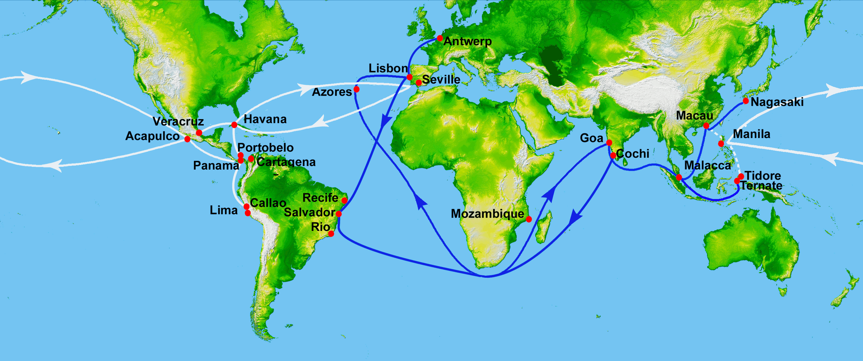
The Manila galleon (; ) refers to the Spain, Spanish trading Sailing ship, ships that linked the Philippines in the Spanish East Indies to Mexico (New Spain), across the Pacific Ocean. The ships made one or two round-trip voyages per year between the ports of Manila and Acapulco from the late 16th to early 19th century. The term "Manila galleon" can also refer to the trade route itself between Manila and Acapulco that was operational from 1565 to 1815. The Manila galleon trade route was inaugurated in 1565 after the Augustinians, Augustinian friar and navigator Andrés de Urdaneta pioneered the ''tornaviaje'' or return route from the Philippines to Mexico. Urdaneta and Alonso de Arellano made the first successful round trips that year, by taking advantage of the Kuroshio Current. The galleons set sail from Cavite, in Manila Bay, at the end of June or the first week of July, sailing through the northern Pacific and reaching Acapulco in March to April of the next calendar year. T ... [...More Info...] [...Related Items...] OR: [Wikipedia] [Google] [Baidu] |

