|
Crummackdale
Crummackdale, (sometimes Crummack Dale), is a small valley north of the village of Austwick in the Craven District of North Yorkshire, England. The Valley is drained by Austwick Beck, which flows into the River Wenning, which in turn heads westwards to empty into the Irish Sea. Crummackdale is a narrow south west facing dale, at the south west corner of the Yorkshire Dales National Park. History The valley is "sparsely populated" and runs in a north–south direction with the village of Austwick at the southern valley end. Whilst evidence of human habitation can be dated to the third century, widespread population use did not occur until Anglo-Saxon farmers arrived in the dale , and they partitioned the land, which is still visible with the scarring of the landscape in strip lynchets. These strips were used to grow oats in and around Austwick village. Though Crummackdale has not seen as much human interaction with its landscape as other Yorkshire Dales, its recorded history in ... [...More Info...] [...Related Items...] OR: [Wikipedia] [Google] [Baidu] |
Long Kin East Cave - Rift Pot System
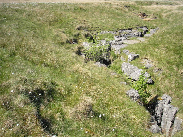
The Long Kin East Cave - Rift Pot system is a limestone cave system on the southern flanks of Ingleborough, North Yorkshire in England lying within the designated Ingleborough Site of Special Scientific Interest. Long Kin East Cave starts as a long meandering stream passage but then plummets down a deep shaft when it meets a shattered Fault (geology), fault into which Rift Pot also descends. At the bottom, the stream flows through some low canals and sumps, to eventually emerge at Austwick Beck Head in Crummackdale. Description The main entrance to Long Kin East Cave () is where a small stream sinks into a deepening fissure in a small exposure of limestone rocks located in an extensive area of moorland. The fissure gains a roof and morphs into a walking-sized meandering stream passage, passing an alternative dry entrance at the first corner. After the passage passes below a walled-off pothole () where daylight enters. After a further an ascent up a slope of rocks leads to the ... [...More Info...] [...Related Items...] OR: [Wikipedia] [Google] [Baidu] |
Wharfe, North Yorkshire
Wharfe is a hamlet about a mile north east of the village of Austwick, North Yorkshire, England. Its postcode is LA2 8DQ. The name means 'The bend', The hamlet is the only settlement in Crummackdale, the upper valley of Austwick Beck. Austwick Beck, which runs through Wharfe, flows into the River Wenning which in turn flows into the River Lune. Moughton Fell rises immediately behind the hamlet to a height of . The upper plateau of Moughton is contained within of common land with grazing rights (known as sheep gaits). The hamlet is within the boundary of the Yorkshire Dales National Park and is close to the Norber erratics, a group of boulders moved by glaciers during the last ice age. There were families with the name of Wharfe dating back to at least the 15th century living in the areas between Malham Malham is a village and civil parish in the Craven district of North Yorkshire, England. Before 20th century boundary changes, the village was part of the Settle Rural ... [...More Info...] [...Related Items...] OR: [Wikipedia] [Google] [Baidu] |
River Wenning
The River Wenning is a tributary of the River Lune, flowing through North Yorkshire and Lancashire. The Wenning is formed from the confluence of Clapham Beck, which rises above Clapham, and Austwick Beck, which rises in Crummackdale above Austwick. It then flows westwards through High Bentham, Low Bentham and Wennington. It joins the River Lune approximately west of Hornby. This river's valley, together with Airedale, Wharfedale and upper Ribblesdale Ribblesdale is one of the Yorkshire Dales in England. It is the dale or upper valley of the River Ribble in North Yorkshire. Towns and villages in Ribblesdale (downstream, from north to south) include Selside, Horton-in-Ribblesdale, Stain ..., make up the district of Craven. Wenning, River Wenning River Wenning Wenning 1Wenning {{England-river-stub ... [...More Info...] [...Related Items...] OR: [Wikipedia] [Google] [Baidu] |
Ordovician
The Ordovician ( ) is a geologic period and system, the second of six periods of the Paleozoic Era. The Ordovician spans 41.6 million years from the end of the Cambrian Period million years ago (Mya) to the start of the Silurian Period Mya. The Ordovician, named after the Welsh tribe of the Ordovices, was defined by Charles Lapworth in 1879 to resolve a dispute between followers of Adam Sedgwick and Roderick Murchison, who were placing the same rock beds in North Wales in the Cambrian and Silurian systems, respectively. Lapworth recognized that the fossil fauna in the disputed strata were different from those of either the Cambrian or the Silurian systems, and placed them in a system of their own. The Ordovician received international approval in 1960 (forty years after Lapworth's death), when it was adopted as an official period of the Paleozoic Era by the International Geological Congress. Life continued to flourish during the Ordovician as it did in the earlier Cambrian P ... [...More Info...] [...Related Items...] OR: [Wikipedia] [Google] [Baidu] |
Ingleborough
Ingleborough () is the second-highest mountain in the Yorkshire Dales, England. It is one of the Yorkshire Three Peaks (the other two being Whernside and Pen-y-ghent), and is frequently climbed as part of the Three Peaks walk. A large part of Ingleborough is designated as a Site of Special Scientific Interest and National Nature Reserve and is the home of a new joint project, Wild Ingleborough, with aims to improve the landscape for wildlife and people. Name The first element of the name "Ingleborough" has been variably explained as a Scots term for 'beacon, fire', an Old Danish term meaning 'English' or a derivative of Old English ''ing'', 'peak'. The second element is derived from the Old English word ''burh'', meaning "a fortified place"; in this case, a hill fort. The summit plateau of Ingleborough is encircled by the remains of a massive stone rampart, containing the foundations of Iron Age huts. Geography Ingleborough is in the south-western corner of the Yorkshire ... [...More Info...] [...Related Items...] OR: [Wikipedia] [Google] [Baidu] |
Thalictrum Minus
''Thalictrum minus'', known as lesser meadow-rue, is a perennial herb in the family Ranunculaceae that is native to Europe, Northwest Africa, Yemen, Ethiopia, South Africa, Southwest Asia, and Siberia. It grows on sand dunes, shingle, coastal rocks or calcareous grassland, cliffs and rocky gullies at up to elevation at southern latitudes. It grows to tall with erect stems and leaves that are highly subdivided, 3-4 ternate to pinnate. The plant contains an alkaloid Alkaloids are a class of basic, naturally occurring organic compounds that contain at least one nitrogen atom. This group also includes some related compounds with neutral and even weakly acidic properties. Some synthetic compounds of similar ... 'Thalidisine', which is also present in other Thalictrum species.S.W. Pelletier (Editor) References minus Plants described in 1753 Taxa named by Carl Linnaeus {{Ranunculales-stub ... [...More Info...] [...Related Items...] OR: [Wikipedia] [Google] [Baidu] |
Environment Agency
The Environment Agency (EA) is a non-departmental public body, established in 1996 and sponsored by the United Kingdom government's Department for Environment, Food and Rural Affairs, with responsibilities relating to the protection and enhancement of the environment in England (and until 2013 also Wales). Based in Bristol, the Environment Agency is responsible for flood management, regulating land and water pollution, and conservation. Roles and responsibilities Purpose The Environment Agency's stated purpose is, "to protect or enhance the environment, taken as a whole" so as to promote "the objective of achieving sustainable development" (taken from the Environment Act 1995, section 4). Protection of the environment relates to threats such as flood and pollution. The vision of the agency is of "a rich, healthy and diverse environment for present and future generations". Scope The Environment Agency's remit covers almost the whole of England, about 13 million&nbs ... [...More Info...] [...Related Items...] OR: [Wikipedia] [Google] [Baidu] |
A65 Road , a motorcycle made by BSA
{{Letter-NumberCombDisambig ...
A65 or A-65 may refer to: * A65 road (England), a major road in England * A65 motorway (France), a major road in France * A65 motorway (Germany), a road connecting Kandel and Wörth am Rhein * A65 motorway (Netherlands) * A65 motorway (Spain) * Benoni Defense, in the Encyclopaedia of Chess Openings * BSA A65 Rocket The BSA A65R Rocket was one of a series of unit construction twin cylinder Birmingham Small Arms Company (BSA) motorcycles made in the 1960s. A version branded as the A65 'Thunderbolt Rocket' was aimed at the US market. The A65R Rocket was pr ... [...More Info...] [...Related Items...] OR: [Wikipedia] [Google] [Baidu] |
Simon Fell (Yorkshire Dales)
Simon Fell is a subsidiary summit on the north east ridge of Ingleborough, a mountain in the Yorkshire Dales in Northern England England is a country that is part of the United Kingdom. It shares land borders with Wales to its west and Scotland to its north. The Irish Sea lies northwest and the Celtic Sea to the southwest. It is separated from continental Europe b .... With a height of and a prominence of , it is classified as a Hewitt. Peaks of the Yorkshire Dales Hewitts of England {{Craven-geo-stub ... [...More Info...] [...Related Items...] OR: [Wikipedia] [Google] [Baidu] |
Clapper Bridges
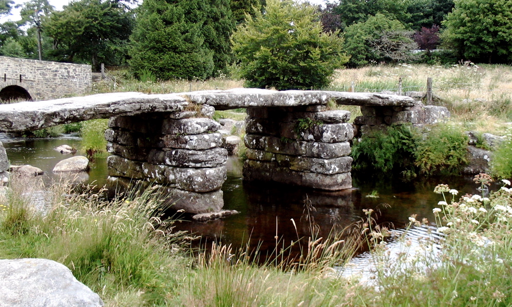
A clapper bridge is an ancient form of bridge found on the moors of the English West Country ( Bodmin Moor, Dartmoor and Exmoor) and in other upland areas of the United Kingdom including Snowdonia and Anglesey, Cumbria, Derbyshire, Yorkshire, Lancashire, and in northern Wester Ross and north-west Sutherland in Scotland. It is formed by large flat slabs of stone, often granite or schist. These can be supported on stone piers across rivers, or rest on the banks of streams. History Although often credited with prehistoric origin, most were erected in medieval times, and some in later centuries. They are often situated close to a ford where carts could cross. According to the Dartmoor National Park, the word 'clapper' derives ultimately from an Anglo-Saxon word, , meaning 'bridging the stepping stones'; the ''Oxford English Dictionary'' gives the intermediate Medieval Latin form , , "of Gaulish origin", with an initial meaning of "a pile of stones".French and Provençal ''clapie ... [...More Info...] [...Related Items...] OR: [Wikipedia] [Google] [Baidu] |
Clapham Railway Station
Clapham is a railway station on the Bentham Line, which runs between and via . The station, situated north-west of Leeds, serves the village of Clapham in North Yorkshire. It is owned by Network Rail and managed by Northern Trains. Immediately to the east of the station, the line crosses the River Wenning on a tall, eight-span viaduct. The station was formerly known in the national timetable as ''Clapham (Yorkshire)'', to distinguish it from ''Clapham (London).'' The latter was renamed ''Clapham High Street'' in 1989. History The station was opened by the "little" North Western Railway (NWR) on 30 July 1849 on their line from Skipton to Ingleton and became a junction the following year when the link along the Wenning Valley from Bentham was completed on 1 June 1850 to finish the route from Lancaster to Skipton. The Ingleton route was subsequently extended northwards, as the Ingleton Branch Line, through Kirkby Lonsdale and Sedbergh to join the West Coast Main Line at ... [...More Info...] [...Related Items...] OR: [Wikipedia] [Google] [Baidu] |


