|
Connecticut Route 183
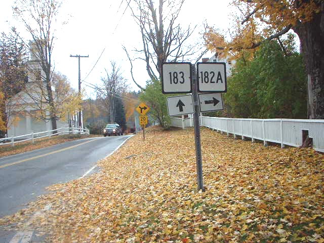
Route 183 is a state highway in northwestern Connecticut, running from Torrington to the Massachusetts state line in Norfolk. Route description Route 183 begins at the junction with Route 4 (New Harwinton Road) in the Litchfield County city of Torrington. A two-lane road through the eastern reaches of Torrington, Route 183 runs north along Torringford Street as a residential road, passing nearby Joe Ruwet Park. The route soon reaches a junction with U.S. Route 202 (US 202; named East Main Street) in the Torringford section of the city. Running northeast past Bishop Donnelly Park, the route passes the nearby middle school and enters a rural section of the town of Torrington. Route 183 starts paralleling Route 8, a nearby freeway, which is connected via Pinewoods Road. The route runs past the Green Woods Country Club, which separates Route 183 and Route 8. Entering the town of Winchester, Route 183 winds northwest into a jun ... [...More Info...] [...Related Items...] OR: [Wikipedia] [Google] [Baidu] |
Hartford Courant
The ''Hartford Courant'' is the largest daily newspaper in the U.S. state of Connecticut, and is considered to be the oldest continuously published newspaper in the United States. A morning newspaper serving most of the state north of New Haven and east of Waterbury, its headquarters on Broad Street in Hartford, Connecticut is a short walk from the state capitol. It reports regional news with a chain of bureaus in smaller cities and a series of local editions. It also operates ''CTNow'', a free local weekly newspaper and website. The ''Courant'' began as a weekly called the ''Connecticut Courant'' on October 29, 1764, becoming daily in 1837. In 1979, it was bought by the Times Mirror Company. In 2000, Times Mirror was acquired by the Tribune Company, which later combined the paper's management and facilities with those of a Tribune-owned Hartford television station. The ''Courant'' and other Tribune print properties were spun off to a new corporate parent, Tribune Publishin ... [...More Info...] [...Related Items...] OR: [Wikipedia] [Google] [Baidu] |
One-way Pair
A one-way pair, one-way couple, or couplet refers to that portion of a bi-directional traffic facilitysuch as a road, bus, streetcar, or light rail linewhere its opposing flows exist as two independent and roughly parallel facilities. Description In the context of roads, a one-way pair consists of two one-way streets whose flows combine on one or both ends into a single two-way street. The one-way streets may be separated by just a single block, such as in a grid network, or may be spaced further apart with intermediate parallel roads. One use of a one-way pair is to increase the vehicular capacity of a major route through a developed area such as a central business district. If not carefully treated with other traffic calming features, the benefit in vehicular capacity is offset by a potential for increased road user deaths, in particular people walking and biking. A one-way pair can be created by converting segments of two-way streets into one-way streets, which allows la ... [...More Info...] [...Related Items...] OR: [Wikipedia] [Google] [Baidu] |
US 44
U.S. Route 44 (US 44) is an east–west United States Numbered Highway that runs for through four states in the Northeastern United States. The western terminus is at US 209 and New York State Route 55 (NY 55) in Kerhonkson, New York, a hamlet in the Hudson Valley region. The eastern terminus is at Route 3A in Plymouth, Massachusetts. Route description , - , , , , - , , , , - , , , , - , , , , - , Total , , New York US 44 begins at an intersection with US 209 and NY 55 west of the hamlet of Kerhonkson in the town of Wawarsing in Ulster County. NY 55, concurrent with US 209 southwest of this point, turns east onto US 44, forming an overlap as the two routes proceed eastward across Ulster County. Midway between Kerhonkson and Gardiner and just north of NY 299, US 44 and NY 55 traverse a hairpin turn made necessary by the surrounding Shawangunk Ridge. Farther east, the road passes through ... [...More Info...] [...Related Items...] OR: [Wikipedia] [Google] [Baidu] |
1932 State Highway Renumbering (Connecticut)
In 1932, the Highway Department of the U.S. state of Connecticut (now known as the Connecticut Department of Transportation), decided to completely renumber all its state highways. The only exceptions were the U.S. Highways and some of the New England Interstate Routes. Between 1922 and 1932, Connecticut used a state highway numbering system shared with the other New England states. Major inter-state trunk routes used numbers in the 1-99 range, primary intrastate highways used numbers in the 100-299 range, and secondary state highways used numbers in the 300+ range. In 1926, at the behest of the American Association of State Highway Officials, four of the nine New England Interstate Routes that passed through Connecticut became U.S. Routes. At this time, the adjacent states of Massachusetts and Rhode Island abandoned the New England highway numbering system but Connecticut still used it for several more years. This led to a situation where U.S. Routes were co-signed with New Englan ... [...More Info...] [...Related Items...] OR: [Wikipedia] [Google] [Baidu] |
Massachusetts Route 183
Massachusetts Route 183 (MA 183) is a north–south state highway in Berkshire County, Massachusetts. The entire route travels from a continuation of Connecticut Route 183 by Colebrook, Connecticut to U.S. Route 7 (US 7) and US 20 in Lenox. Route description Route 183 begins at the Connecticut state line in Colebrook, Connecticut as a northern continuation of that state's Route 183. Massachusetts's Route 183 runs northwest through the town of Sandisfield as Sandy Brook Road. The route runs northwest through the wooded sections of Sandisfield, soon crossing into the town of New Marlborough, changing monikers to New Marlborough Road. Reaching downtown New Marlborough, Route 183 intersects with Route 57 (New Marlborough Sandisfield Center Road). Route 183 and Route 57 become concurrent through downtown New Marlborough, changing names to Hartsville New Marlborough Road. After downtown, the two routes meander to the northwest as a two-l ... [...More Info...] [...Related Items...] OR: [Wikipedia] [Google] [Baidu] |
Connecticut Route 182A
Route 182 is a rural state highway in northwestern Connecticut, running from Norfolk to Colebrook. Route description Route 182 begins at an intersection with US 44 in the town center of Norfolk and heads east towards the town of Colebrook. It crosses into Colebrook later, continuing east another to end at an intersection with Route 183 south of Colebrook center. Route 182A is a short loop route that goes through the town center. Route 182 is known as Colebrook Road in Norfolk, and as Stillman Hill Road in Colebrook. History In the 1920s, The Norfolk-Colebrook route was designated as a secondary state highway known as Highway 327. In 1932, old Highway 327 was renumbered to Route 182, which originally ran along the current route of Route 182A near Colebrook center. In 1940, the route was rerouted to the current location and the former alignment redesignated Route 182A. Junction list Route 182A Route 182A is a alternate route of Route 182 within Colebrook, including a ... [...More Info...] [...Related Items...] OR: [Wikipedia] [Google] [Baidu] |
Connecticut Department Of Transportation
The Connecticut Department of Transportation (often referred to as CTDOT and occasionally ConnDOT, or CDOT) is responsible for the development and operation of highways, railroads, mass transit systems, ports and waterways in Connecticut. Connecticut Department of Transportation. Retrieved on November 12, 2009. "Connecticut Department of Transportation 2800 Berlin Turnpike Newington CT 06111" CTDOT manages and maintains the system, and runs most of the state's ports along and the |
Connecticut Route 182
Route 182 is a rural state highway in northwestern Connecticut, running from Norfolk to Colebrook. Route description Route 182 begins at an intersection with US 44 in the town center of Norfolk and heads east towards the town of Colebrook. It crosses into Colebrook later, continuing east another to end at an intersection with Route 183 south of Colebrook center. Route 182A is a short loop route that goes through the town center. Route 182 is known as Colebrook Road in Norfolk, and as Stillman Hill Road in Colebrook. History In the 1920s, The Norfolk-Colebrook route was designated as a secondary state highway known as Highway 327. In 1932, old Highway 327 was renumbered to Route 182, which originally ran along the current route of Route 182A near Colebrook center. In 1940, the route was rerouted to the current location and the former alignment redesignated Route 182A. Junction list Route 182A Route 182A is a alternate route of Route 182 within Colebrook, including a ... [...More Info...] [...Related Items...] OR: [Wikipedia] [Google] [Baidu] |
Colebrook, Connecticut
Colebrook is a town in Litchfield County, Connecticut, United States. The population was 1,361 at the 2020 census. Colebrook was named after Colebrooke in the English county of Devon; the reason is now unknown. Geography Colebrook is in northeastern Litchfield County and is bounded to the east by Hartford County, Connecticut, and to the north by Berkshire and Hampden County in Massachusetts. According to the United States Census Bureau, the town has a total area of , of which are land and , or 4.23%, are water. Colebrook River Lake and West Branch Reservoir, both on the West Branch of the Farmington River, are in the northeast part of the town. Algonquin State Forest is in the central part of the town. Colebrook is north of Torrington and northwest of Hartford, the state capitol. Principal communities *Colebrook center *North Colebrook *Robertsville Demographics As of the census of 2000, there were 1,471 people, 566 households, and 419 families residing in the town. ... [...More Info...] [...Related Items...] OR: [Wikipedia] [Google] [Baidu] |
Connecticut Route 263
Route 263 is a state highway in northwestern Connecticut Connecticut () is the southernmost state in the New England region of the Northeastern United States. It is bordered by Rhode Island to the east, Massachusetts to the north, New York to the west, and Long Island Sound to the south. Its capita ... running from Goshen to the city of Winsted in the town of Winchester. Route description Route 263 begins as Winchester Road at an intersection with Route 272 in northeastern Goshen and heads northeast around Mount Ouleout, crossing into the town of Winchester after . In Winchester, it heads east as Thomen Road and Ashley Road towards Winchester Center, turning right onto West Road in the town center. After passing by the Winchester post office, Route 263 then turns northeast along Winchester Road. It travels in between Crystal Lake and Highland Lake as it proceeds on its way to Winsted. In Winsted, Route 263 uses Boyd Street and Lake Street to reach its eastern end a ... [...More Info...] [...Related Items...] OR: [Wikipedia] [Google] [Baidu] |
Winchester, Connecticut
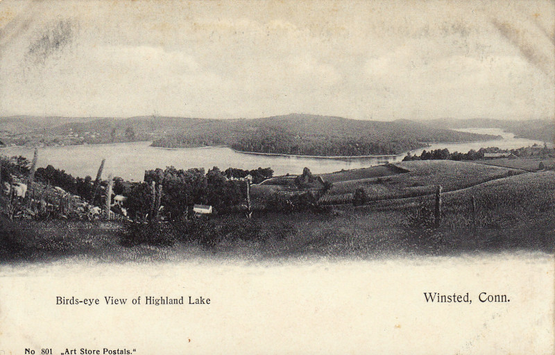
Winchester is a town in Litchfield County, Connecticut, United States. The population was 10,224 at the 2020 census. The city of Winsted is located in Winchester. History Winchester was incorporated on May 21, 1771, and named after Winchester in England. Geography The town is in northeastern Litchfield County and is bordered to the south by the city of Torrington. It is northwest of Hartford, the state capital, and north of Waterbury. Winsted, with a population of 7,321 by far the largest community in Winchester, is in the eastern part of the town. According to the United States Census Bureau, the town has a total area of , of which are land and , or 3.87%, are water. Highland Lake, Crystal Lake, and Lake Winchester are three of the larger water bodies in the town. The Still River, a tributary of the Farmington River, flows from south to north through the eastern side of the town. Principal communities *Winchester Center * Winsted Demographics At the 2000 census there ... [...More Info...] [...Related Items...] OR: [Wikipedia] [Google] [Baidu] |


