|
Clarendon, Jamaica
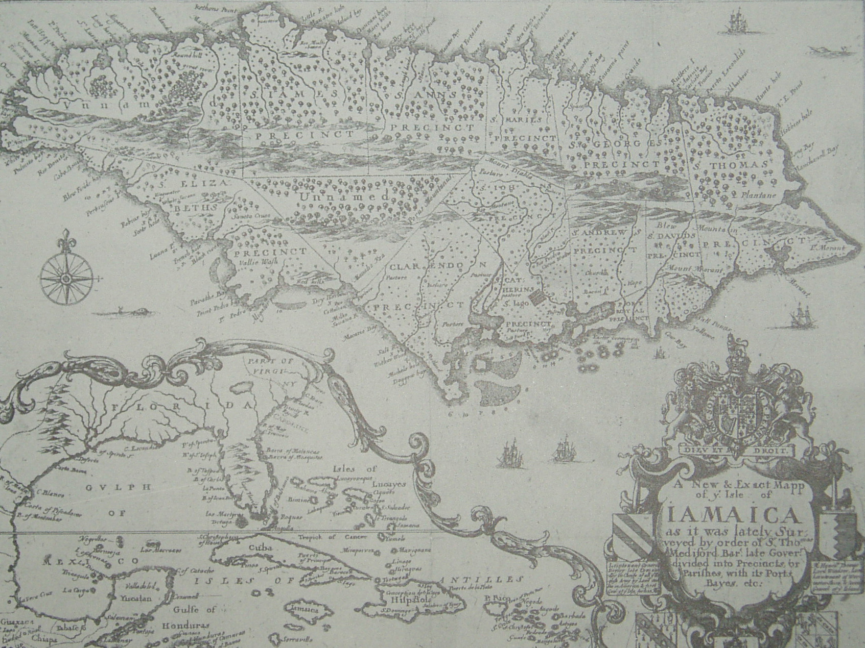
Clarendon is a parish in Jamaica. It is located on the south of the island, roughly halfway between the island's eastern and western ends. Located in the county of Middlesex, it is bordered by Manchester on the west, Saint Catherine in the east, and in the north by Saint Ann. Its capital and largest town is May Pen. History Clarendon was named in honour of the Lord Chancellor Sir Edward Hyde, Earl of Clarendon. The most recent parish was formed from a combination of three parishes: St. Dorothy's, Vere and the old parish of Clarendon. Before the merger, the capital was Chapelton. Clarendon Parish was one of the original seven Anglican parishes of Jamaica set up by Sir Thomas Modyford in 1664, and it has been reorganized numerous times since. Parish registers, which are records kept by the parish church of religious events such as baptisms, marriages, and burials, are still extant from Clarendon parish almost as far back as its foundation, with the first recorded baptism ... [...More Info...] [...Related Items...] OR: [Wikipedia] [Google] [Baidu] |
Parishes Of Jamaica
The parishes of Jamaica are the main units of local government in Jamaica. They were created following the English Invasion of Jamaica in 1655. This administrative structure for the Colony of Jamaica developed slowly. However, since 1 May 1867 Jamaica has been divided into the current fourteen parishes. These were retained after independence in 1962. They are grouped into three historic counties, which no longer have any administrative relevance. Every parish has a coast; none are landlocked. List (1) The parishes of Kingston and Saint Andrew together form the '' Kingston and St. Andrew Corporation''. (2) The parish of Kingston does not encompass all of the city of Kingston. Most of the city is in the parish of St. Andrew. History Early history Following the English conquest of Jamaica the first phase of colonisation was carried out by the Army, with a system of Regimental plantations. These were drawn up on the southern flat lands, with the Regimental commanders charge ... [...More Info...] [...Related Items...] OR: [Wikipedia] [Google] [Baidu] |
Parish Registers
A parish register in an ecclesiastical parish is a handwritten volume, normally kept in the parish church in which certain details of religious ceremonies marking major events such as baptisms (together with the dates and names of the parents), marriages (with the names of the partners), children, and burials (that had taken place within the parish) are recorded. Along with these vital details, church goods, the parish's response to briefs, and notes on various happenings in the parish were also recorded. These elaborate records existed for the purpose of preventing bigamy and consanguineous marriage. The information recorded in registers was also considered significant for secular governments’ own recordkeeping, resulting in the churches supplying the state with copies of all parish registers. A good register permits the family structure of the community to be reconstituted as far back as the sixteenth century. Thus, these records were distilled for the definitive study of the h ... [...More Info...] [...Related Items...] OR: [Wikipedia] [Google] [Baidu] |
Frankfield
Frankfield is a town in the parish of Clarendon in central Jamaica. It is located near the top of Jamaica's central ridge of mountains overlooking the south coast. The Rio Minho river runs through the town in a shallow gorge.UK Directorate of Overseas Surveys 1:50,000 map of Jamaica Sheets G & H, 1973. Transport Road Frankfield is on the B4 road which climbs up from Trout Hall in the south, crosses into the town from the south east via a bridge over the Rio Minho, passes through the town's central square and continues north towards Grantham and Spaldings. From the town center going towards the south west a lesser road connects Frankfield with Nine Turns, Smithville, Wakefield, Thompson Town, Mocho, Four Paths and May Pen. Rail From 1925 to 1974 Frankfield railway station was the terminus of a 21-mile railway branch line from May Pen May Pen is the capital and largest town in the parish of Clarendon in Middlesex County, Jamaica. It is located on the Rio Minho river ... [...More Info...] [...Related Items...] OR: [Wikipedia] [Google] [Baidu] |
Hayes, Jamaica
Hayes is a settlement in Jamaica Jamaica (; ) is an island country situated in the Caribbean Sea. Spanning in area, it is the third-largest island of the Greater Antilles and the Caribbean (after Cuba and Hispaniola). Jamaica lies about south of Cuba, and west of Hispa .... It has a population of 10,639 as of 2011. References Populated places in Clarendon Parish, Jamaica {{Jamaica-geo-stub ... [...More Info...] [...Related Items...] OR: [Wikipedia] [Google] [Baidu] |
Portland Lighthouse
Portland Cottage light structure formerly Portland Lighthouse sometimes Portland Point Lighthouse is situated on the summit of Portland Ridge, Clarendon, near the southernmost part of Jamaica.UK Directorate of Overseas Surveys 1:50,000 map of Jamaica sheet H, 1973. The tower is an open-framed, square, tapered steel structure with lantern and gallery, the highest in the Island, at a height of (129 iron steps). It has a white revolving light, giving two flashes in quick succession every 15 seconds.Portland Point Lighthouse Frans Eijgenraam, 2000.Portland Point Lighthouse , Jamaica National Heritage Trust, 2005. The lighthouse is maintained by the Port Authority of Jamaica ... [...More Info...] [...Related Items...] OR: [Wikipedia] [Google] [Baidu] |
Peninsula
A peninsula (; ) is a landform that extends from a mainland and is surrounded by water on most, but not all of its borders. A peninsula is also sometimes defined as a piece of land bordered by water on three of its sides. Peninsulas exist on all continents. The size of a peninsula can range from tiny to very large. The largest peninsula in the world is the Arabian Peninsula. Peninsulas form due to a variety of causes. Etymology Peninsula derives , which is translated as 'peninsula'. itself was derived , or together, 'almost an island'. The word entered English in the 16th century. Definitions A peninsula is usually defined as a piece of land surrounded on most, but not all sides, but is sometimes instead defined as a piece of land bordered by water on three of its sides. A peninsula may be bordered by more than one body of water, and the body of water does not have to be an ocean or a sea. A piece of land on a very tight river bend or one between two rivers is sometimes ... [...More Info...] [...Related Items...] OR: [Wikipedia] [Google] [Baidu] |
Bull Head Mountain
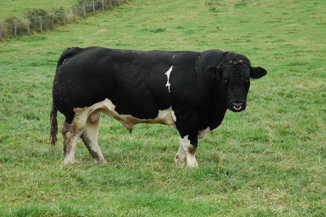
A bull is an intact (i.e., not castrated) adult male of the species ''Bos taurus'' (cattle). More muscular and aggressive than the females of the same species (i.e., cows), bulls have long been an important symbol in many religions, including for sacrifices. These animals play a significant role in beef ranching, dairy farming, and a variety of sporting and cultural activities, including bullfighting and bull riding. Due to their temperament, handling requires precautions. Nomenclature The female counterpart to a bull is a cow, while a male of the species that has been castrated is a ''steer'', '' ox'', or ''bullock'', although in North America, this last term refers to a young bull. Use of these terms varies considerably with area and dialect. Colloquially, people unfamiliar with cattle may refer to both castrated and intact animals as "bulls". A wild, young, unmarked bull is known as a ''micky'' in Australia.Sheena Coupe (ed.), ''Frontier Country, Vol. 1'' (Weldon ... [...More Info...] [...Related Items...] OR: [Wikipedia] [Google] [Baidu] |
Mocho Mountains
The Mocho Mountains are a mountain range in south-central Jamaica. It has been described as the "geographical center of Jamaica." The area was historically a site for bauxite mining, which led to deforestation Deforestation or forest clearance is the removal of a forest or stand of trees from land that is then converted to non-forest use. Deforestation can involve conversion of forest land to farms, ranches, or urban use. The most concentrated ... in the area. Notes References *''Merriam-Webster's Geographical Dictionary, Third Edition''. Springfield, Massachusetts: Merriam-Webster, Incorporated, 1997. . Mountain ranges of Jamaica {{Jamaica-geo-stub ... [...More Info...] [...Related Items...] OR: [Wikipedia] [Google] [Baidu] |
Rio Minho
The Rio Minho is the longest river in Jamaica at . It rises close to the island's geographic centre, flows generally south-southwest and reaches the Caribbean Sea at Carlisle Bay in the central south coast, to the west of the island's southernmost point, Portland Point. The town of May Pen, Clarendon lies on the banks of the river. IUGS geological heritage site In respect of it being the 'most diverse and thickest limestone succession with abundant rudist bivalves within the Caribbean faunal province', the International Union of Geological Sciences The International Union of Geological Sciences (IUGS) is an international non-governmental organization devoted to international cooperation in the field of geology. About The IUGS was founded in 1961 and is a Scientific Union member of the Int ... (IUGS) included the 'Late Cretaceous rudist bivalves of the Caribbean Province' around the Rio Minho in its assemblage of 100 'geological heritage sites' around the world in a listin ... [...More Info...] [...Related Items...] OR: [Wikipedia] [Google] [Baidu] |
River
A river is a natural flowing watercourse, usually freshwater, flowing towards an ocean, sea, lake or another river. In some cases, a river flows into the ground and becomes dry at the end of its course without reaching another body of water. Small rivers can be referred to using names such as creek, brook, rivulet, and rill. There are no official definitions for the generic term river as applied to geographic features, although in some countries or communities a stream is defined by its size. Many names for small rivers are specific to geographic location; examples are "run" in some parts of the United States, "burn" in Scotland and northeast England, and "beck" in northern England. Sometimes a river is defined as being larger than a creek, but not always: the language is vague. Rivers are part of the water cycle. Water generally collects in a river from precipitation through a drainage basin from surface runoff and other sources such as groundwater recharge, spr ... [...More Info...] [...Related Items...] OR: [Wikipedia] [Google] [Baidu] |
Plain
In geography, a plain is a flat expanse of land that generally does not change much in elevation, and is primarily treeless. Plains occur as lowlands along valleys or at the base of mountains, as coastal plains, and as plateaus or uplands. In a valley, a plain is enclosed on two sides, but in other cases a plain may be delineated by a complete or partial ring of hills, by mountains, or by cliffs. Where a geological region contains more than one plain, they may be connected by a pass (sometimes termed a gap). Coastal plains mostly rise from sea level until they run into elevated features such as mountains or plateaus. Plains are one of the major landforms on earth, where they are present on all continents, and cover more than one-third of the world's land area. Plains can be formed from flowing lava; from deposition of sediment by water, ice, or wind; or formed by erosion by the agents from hills and mountains. Biomes on plains include grassland ( temperate or subtr ... [...More Info...] [...Related Items...] OR: [Wikipedia] [Google] [Baidu] |


