|
Chiquitos Province
Chiquitos Province is one of the fifteen provinces of the Bolivian Santa Cruz Department, situated in the center of the department. Its capital is San José de Chiquitos. The province was created on January 23, 1826, during the presidency of marshal Antonio José de Sucre. It forms the so-called " Gran Chiquitania" together with José Miguel de Velasco Province, Ñuflo de Chávez Province, Ángel Sandoval Province, and Germán Busch Province. Location Chiquitos Province is located between 17° 00' and 18° 37' South and between 58° 54' and 62° 45' West. It extends over 500 km from West to East, and up to 220 km from North to South. The province is situated in the Bolivian lowlands and borders Ñuflo de Chávez Province in the northwest, Andrés Ibáñez Province in the west, Cordillera Province in the south, Germán Busch Province in the southeast, Ángel Sandoval Province in the east, and José Miguel de Velasco Province in the north. Division Chiquitos ... [...More Info...] [...Related Items...] OR: [Wikipedia] [Google] [Baidu] |
Flag Of Bolivia
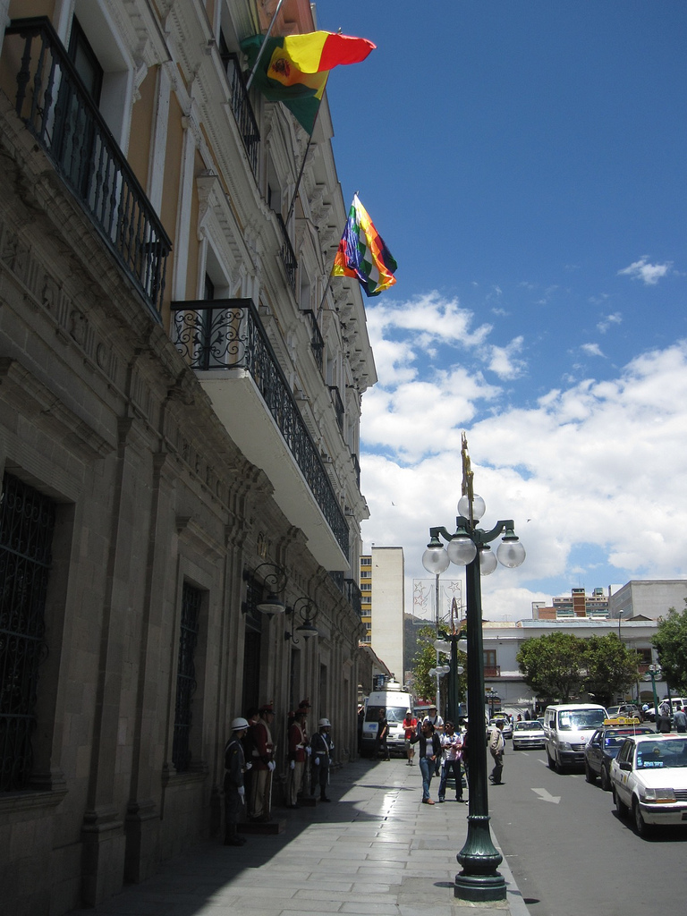
The flag of Bolivia is the national flag of the Plurinational State of Bolivia. It was originally adopted in 1851. The state and war flag is a horizontal tricolor of red, yellow and green with the Bolivian coat of arms in the center. According to one source, the red stands for Bolivia's brave soldiers, while the green symbolizes fertility and yellow the nation's mineral deposits. Since 2009 the Wiphala also holds the status of ''dual flag'' in the country. According to the revised Constitution of Bolivia of 2009, the Wiphala is considered a national symbol of Bolivia (along with the flag, national anthem, coat of arms, the cockade; kantuta flower and patujú flower). Despite its landlocked status, Bolivia has a naval ensign used by navy vessels on rivers and lakes. It consists of a blue field with the state flag in the canton bordered by nine small yellow five-pointed stars, with a larger yellow five-pointed star in the fly. The nine small stars represent the nine depa ... [...More Info...] [...Related Items...] OR: [Wikipedia] [Google] [Baidu] |
Latitude
In geography, latitude is a coordinate that specifies the north– south position of a point on the surface of the Earth or another celestial body. Latitude is given as an angle that ranges from –90° at the south pole to 90° at the north pole, with 0° at the Equator. Lines of constant latitude, or ''parallels'', run east–west as circles parallel to the equator. Latitude and ''longitude'' are used together as a coordinate pair to specify a location on the surface of the Earth. On its own, the term "latitude" normally refers to the ''geodetic latitude'' as defined below. Briefly, the geodetic latitude of a point is the angle formed between the vector perpendicular (or ''normal'') to the ellipsoidal surface from the point, and the plane of the equator. Background Two levels of abstraction are employed in the definitions of latitude and longitude. In the first step the physical surface is modeled by the geoid, a surface which approximates the mean sea level over the ocea ... [...More Info...] [...Related Items...] OR: [Wikipedia] [Google] [Baidu] |
Tucavaca Valley Municipal Reserve
Tucavaca Valley Municipal Reserve (''Reserva Municipal Valle de Tucavaca'') is a protected area in Bolivia situated in the Santa Cruz Department (Bolivia), Santa Cruz Department, Chiquitos Province, Roboré Municipality. The reserve is located at an altitude between 200 m and 1250 m above sea level (Mount Chochís). It comprises the Santiago mountain range (''Serranía de Santiago'') and the Tucavaca valley. The historical Jesuit mission and town of Santiago de Chiquitos is located within the reserve. External links www.fcbc.org.bo / ''Áreas protegidas en la región del Bosque Chiquitano'' (Spanish) Protected areas of Bolivia Geography of Santa Cruz Department (Bolivia) Protected areas established in 2000 {{SantaCruzBO-geo-stub ... [...More Info...] [...Related Items...] OR: [Wikipedia] [Google] [Baidu] |
Kaa-Iya Del Gran Chaco National Park And Integrated Management Natural Area
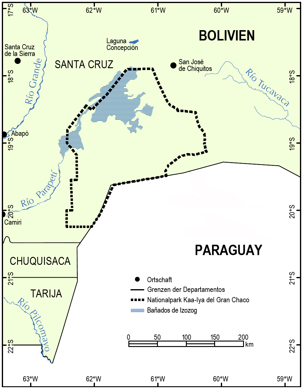
Kaa-Iya del Gran Chaco National Park and Integrated Management Natural Area (''Parque Nacional y Area Natural de Manejo Integrado Kaa-Iya del Gran Chaco)'' is the biggest national park in Bolivia and one of the largest in South America. It is a protected area in the region of the Gran Chaco and has a larger surface area than Belgium. It is situated in the south of Santa Cruz Department on the border with Paraguay in the Cordillera Province ( Charagua Municipality) and Chiquitos Province ( Pailón and San José de Chiquitos municipalities). Etymology Kaa-Iya is a term from Guarani mythology which means "mountain owners", or a place where riches are found, in the sense of abundance of natural resources and the relationship between man and nature. Geography *Area: 3,441,115 hectares (34,411.15 km2) *Altitude: between 100 and 839 meters above sea level. *Rainfall: 1,400 to 400 mm annually. *Hydrology: The principal river is the Parapetí, among many others. *C ... [...More Info...] [...Related Items...] OR: [Wikipedia] [Google] [Baidu] |
Russian Mennonite
The Russian Mennonites (german: Russlandmennoniten it. "Russia Mennonites", i.e., Mennonites of or from the Russian Empire occasionally Ukrainian Mennonites) are a group of Mennonites who are descendants of Dutch Anabaptists who settled for about 250 years in the Vistula delta in Poland and established colonies in the Russian Empire (present-day Ukraine and Russia's Volga region, Orenburg Governorate, and Western Siberia) beginning in 1789. Since the late 19th century, many of them have come to countries throughout the Western Hemisphere. The rest were forcibly relocated, so that very few of their descendants now live at the location of the original colonies. Russian Mennonites are traditionally multilingual with Plautdietsch (Mennonite Low German) as their first language and lingua franca. In 2014 there are several hundred thousand Russian Mennonites: about 200,000 in Germany, 100,000 in Mexico, 70,000 in Bolivia, 40,000 in Paraguay, 10,000 in Belize, tens of thousands in C ... [...More Info...] [...Related Items...] OR: [Wikipedia] [Google] [Baidu] |
Census
A census is the procedure of systematically acquiring, recording and calculating information about the members of a given population. This term is used mostly in connection with national population and housing censuses; other common censuses include censuses of agriculture, traditional culture, business, supplies, and traffic censuses. The United Nations (UN) defines the essential features of population and housing censuses as "individual enumeration, universality within a defined territory, simultaneity and defined periodicity", and recommends that population censuses be taken at least every ten years. UN recommendations also cover census topics to be collected, official definitions, classifications and other useful information to co-ordinate international practices. The UN's Food and Agriculture Organization (FAO), in turn, defines the census of agriculture as "a statistical operation for collecting, processing and disseminating data on the structure of agriculture, covering ... [...More Info...] [...Related Items...] OR: [Wikipedia] [Google] [Baidu] |
Roboré
Roboré is a town in eastern Bolivia. Located in Chiquitos Province, Roboré was founded by Dr. Ángel Sandoval in November 26th, 1947. It is home to the ''Regimiento De Infanteria 15 Junin Roboré'' YouTube of the Bolivian Army. Transport Roboré lies on the eastern railway network of Bolivia. It is served by Roboré Airport.Climate See also * Railway stations in Bolivia * |
Roboré Municipality
Roboré is a town in eastern Bolivia. Located in Chiquitos Province, Roboré was founded by Dr. Ángel Sandoval in November 26th, 1947. It is home to the ''Regimiento De Infanteria 15 Junin Roboré'' YouTube of the . Transport Roboré lies on the eastern railway network of Bolivia. It is served by .Climate See also * |
Pailón
Pailón is a small town in Bolivia. It is in the second municipal section of Chiquitos Province and is east of the city Santa Cruz de la Sierra Santa Cruz de la Sierra (; "Holy Cross of the Mountain Range"), commonly known as Santa Cruz, is the largest city in Bolivia and the capital of the Santa Cruz department. Situated on the Pirai River in the eastern Tropical Lowlands of Bolivia .... References Populated places in Santa Cruz Department (Bolivia) {{SantaCruzBO-geo-stub ... [...More Info...] [...Related Items...] OR: [Wikipedia] [Google] [Baidu] |
Pailón Municipality
Pailón is a small town in Bolivia. It is in the second municipal section of Chiquitos Province and is east of the city Santa Cruz de la Sierra Santa Cruz de la Sierra (; "Holy Cross of the Mountain Range"), commonly known as Santa Cruz, is the largest city in Bolivia and the capital of the Santa Cruz department. Situated on the Pirai River in the eastern Tropical Lowlands of Bolivia .... References Populated places in Santa Cruz Department (Bolivia) {{SantaCruzBO-geo-stub ... [...More Info...] [...Related Items...] OR: [Wikipedia] [Google] [Baidu] |
Cordillera Province (Bolivia)
Cordillera is a province in the Santa Cruz Department, Bolivia. Its capital is Lagunillas. Geography This area of the Santa Cruz Chaco occupies the southern part of the department, is the largest province of the country, geographically defined as the Gran Chaco and that extends to the departments of Tarija and Chuquisaca and even the republics of Paraguay and Argentina. Characteristics of dry weather, warm day and cold at night. The name of this province is due to its topography, being the largest province in the department and the country. Bounded on the north by the provinces of Chiquitos and Andrés Ibáñez. The south by the Republic of Paraguay and the department of Chuquisaca. The east by the Germán Busch province. To the West and the department of Chuquisaca province Vallegrande Florida and has a surface area of 86,245 km2 occupying 23.3% of the total area of the department, being the largest province of the country Its height above sea level is: 1240 m has a population: ... [...More Info...] [...Related Items...] OR: [Wikipedia] [Google] [Baidu] |


