|
Card Sound Bridge
Card Sound Bridge is a high-rise toll causeway connecting southern Miami-Dade County and northern Monroe County. It is one of only two ways that motorists can leave or enter the Florida Keys (the other is U.S. Route 1). The toll for two-axle automobiles is USD $1.50 (USD $1.00 for each additional axle) if paid via SunPass. The prior toll plaza was demolished during hurricane Matthew and has been replaced with a toll-by-plate plaza. The toll fee will be charged by plate automatically and sent via the mail to the address on the vehicle registration. The cashless all-electronic tolling system replaced the previous staffed toll booth on October 20, 2018. The toll fee is waived upon evacuating the Keys for hurricanes or in instances in which US 1 is impassable. Operation The primary responsibility for operating Card Sound Bridge lies with Monroe County, but maintenance of the bridge itself is shared between Monroe County and the Florida Department of Transportation. The bridge ... [...More Info...] [...Related Items...] OR: [Wikipedia] [Google] [Baidu] |
Toll Road
A toll road, also known as a turnpike or tollway, is a public or private road (almost always a controlled-access highway in the present day) for which a fee (or ''Toll (fee), toll'') is assessed for passage. It is a form of road pricing typically implemented to help recoup the costs of road construction and Road maintenance, maintenance. Toll roads have existed in some form since Classical antiquity, antiquity, with tolls levied on passing travelers on foot, wagon, or horseback; a practice that continued with the automobile, and many modern tollways charge fees for motor vehicles exclusively. The amount of the toll usually varies by vehicle type, weight, or number of axles, with freight trucks often charged higher rates than cars. Tolls are often collected at toll plazas, toll booths, toll houses, toll stations, toll bars, toll barriers, or toll gates. Some toll collection points are automatic, and the user deposits money in a machine which opens the gate once the correct toll ha ... [...More Info...] [...Related Items...] OR: [Wikipedia] [Google] [Baidu] |
Drawbridge
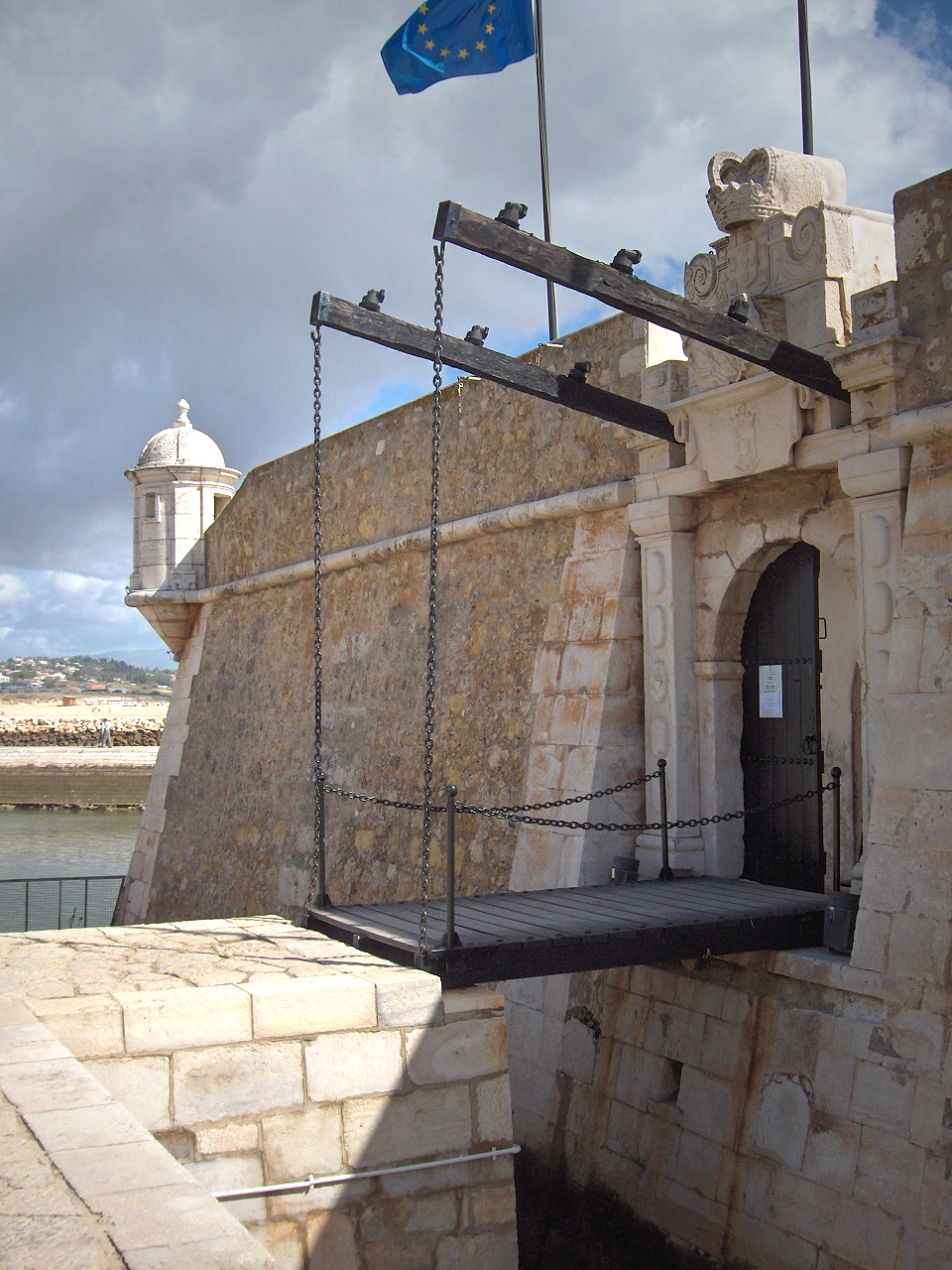
A drawbridge or draw-bridge is a type of moveable bridge typically at the entrance to a castle or tower surrounded by a moat. In some forms of English, including American English, the word ''drawbridge'' commonly refers to all types of moveable bridges, such as bascule bridges, vertical-lift bridges and swing bridges, but this article concerns the narrower historical definition of the term where the bridge is used in a defensive structure. As used in castles or defensive structures, drawbridges provide access across defensive structures when lowered, but can quickly be raised from within to deny entry to an enemy force. Castle drawbridges Medieval castles were usually defended by a ditch or moat, crossed by a wooden bridge. In early castles the bridge might be designed to be destroyed or removed in the event of an attack, but drawbridges became very common. A typical arrangement would have the drawbridge immediately outside a gatehouse, consisting of a wooden deck wit ... [...More Info...] [...Related Items...] OR: [Wikipedia] [Google] [Baidu] |
Cape Sable
Cape Sable is the southernmost point of the United States mainland and mainland Florida. It is located in southwestern Florida, in Monroe County, and is part of the Everglades National Park. The cape is a peninsula issuing from the southeastern part of the Florida mainland, running west and curving around to the north, reaching Ponce de Leon Bay, at the mouth of the Shark River. It forms the southern and western margins of Whitewater Bay. There are three prominent points on the cape, each of which hosts a designated backcountry campsite: * East Cape, which is the actual southernmost point of the Florida and United States mainland and the location of Lake Ingraham, the southernmost lake in the United States of America; * Middle Cape, also known as Palm Point; and * Northwest Cape. The campsites are part of the "outside route" of the Everglades Wilderness Waterway, with permits required for an overnight stay, obtained from the Flamingo Visitor Center.The cape also has many ... [...More Info...] [...Related Items...] OR: [Wikipedia] [Google] [Baidu] |
Everglades
The Everglades is a natural region of tropical wetlands in the southern portion of the U.S. state of Florida, comprising the southern half of a large drainage basin within the Neotropical realm. The system begins near Orlando with the Kissimmee River, which discharges into the vast but shallow Lake Okeechobee. Water leaving the lake in the wet season forms a slow-moving river wide and over long, flowing southward across a limestone shelf to Florida Bay at the southern end of the state. The Everglades experiences a wide range of weather patterns, from frequent flooding in the wet season to drought in the dry season. Throughout the 20th century, the Everglades suffered significant loss of habitat and environmental degradation. Human habitation in the southern portion of the Florida peninsula dates to 15,000 years ago. Before European colonization, the region was dominated by the native Calusa and Tequesta tribes. With Spanish colonization, both tribes declined gradually ... [...More Info...] [...Related Items...] OR: [Wikipedia] [Google] [Baidu] |
World War II
World War II or the Second World War, often abbreviated as WWII or WW2, was a world war that lasted from 1939 to 1945. It involved the vast majority of the world's countries—including all of the great powers—forming two opposing military alliances: the Allies and the Axis powers. World War II was a total war that directly involved more than 100 million personnel from more than 30 countries. The major participants in the war threw their entire economic, industrial, and scientific capabilities behind the war effort, blurring the distinction between civilian and military resources. Aircraft played a major role in the conflict, enabling the strategic bombing of population centres and deploying the only two nuclear weapons ever used in war. World War II was by far the deadliest conflict in human history; it resulted in 70 to 85 million fatalities, mostly among civilians. Tens of millions died due to genocides (including the Holocaust), starvation, massa ... [...More Info...] [...Related Items...] OR: [Wikipedia] [Google] [Baidu] |
Labor Day Hurricane Of 1935
The Great Labor Day Hurricane of 1935 was the most intense Atlantic hurricane to make landfall on record by pressure, with winds of up to 185 mph (297 km/h). The fourth tropical cyclone, third tropical storm, second hurricane, and second major hurricane of the 1935 Atlantic hurricane season, the Labor Day hurricane was one of four Category 5 hurricanes on record to strike the contiguous United States, along with Hurricane Andrew in 1992, Hurricane Camille in 1969, and Hurricane Michael in 2018. In addition, it was the third most intense Atlantic hurricane on record in terms of barometric pressure, only behind Hurricane Gilbert in 1988 and Hurricane Wilma in 2005. The hurricane intensified rapidly, passing near Long Key on the evening of Monday, September 2. The region was swept by a massive storm surge as the eye passed over the area. The waters quickly receded after carving new channels connecting the bay with the ocean; however, gale-force winds and rough seas persi ... [...More Info...] [...Related Items...] OR: [Wikipedia] [Google] [Baidu] |
No Name Key
No Name Key is an island in the lower Florida Keys in the United States. It is from US 1 and sparsely populated, with only 43 homes. It is only about in comparison to its larger neighbor, Big Pine Key, which lies about half a mile (800 m) to its west. It is accessible by a concrete bridge from Big Pine Key and was the terminus of a car ferry that existed before the present Overseas Highway was built on the remains of Flagler's Overseas Railroad. Electricity No Name Key was known for not being connected to the commercial power grid, for a local county ordinance prohibited this. Residents mostly used a combination of solar energy and diesel or gas generators. This prohibition of commercial electricity sparked a lawsuit between Monroe County and the No Name Key property owners. In May 2013, the Florida Public Service Commission exercised its jurisdiction over public utilities and issued Order PSC-13-0207-PAA-EM declaring the residents had a right to commercial electrical po ... [...More Info...] [...Related Items...] OR: [Wikipedia] [Google] [Baidu] |
Lower Matecumbe Key
Lower Matecumbe Key is an island in the upper Florida Keys, United States, located on U.S. 1 between mile markers 75–78. All of the key is within the Village of Islamorada as of November 4, 1997, when it was incorporated. It is home to the main base of the Florida National High Adventure Sea Base. The island lies to the southwest of Upper Matecumbe Key, and to the northeast of Craig Key. This key is the site of a number of Indian mounds and middens, most of which were destroyed during the building of the Overseas Railroad. A number of natural wells were also located here, at the northeast end of the key. These wells were well known to early seafaring men as the most reliable source of fresh water in the Keys. They, too were destroyed during the railroad era, and the location of their site has been lost. The southwestern end of the key is the site of a former sand mining operation. Tourist attractions A local attraction is Anne's Beach, located at mile marker 74 on ... [...More Info...] [...Related Items...] OR: [Wikipedia] [Google] [Baidu] |
Miami, Florida
Miami ( ), officially the City of Miami, known as "the 305", "The Magic City", and "Gateway to the Americas", is a East Coast of the United States, coastal metropolis and the County seat, county seat of Miami-Dade County, Florida, Miami-Dade County in South Florida, United States. With a population of 442,241 at the 2020 United States census, 2020 census, it is the List of municipalities in Florida, second-most populous city in Florida and the eleventh-most populous city in the Southeastern United States. The Miami metropolitan area is the ninth largest in the U.S. with a population of 6.138 million in 2020. The city has the List of tallest buildings in the United States#Cities with the most skyscrapers, third-largest skyline in the U.S. with over List of tallest buildings in Miami, 300 high-rises, 58 of which exceed . Miami is a major center and leader in finance, commerce, culture, arts, and international trade. Miami's metropolitan area is by far the largest urban econ ... [...More Info...] [...Related Items...] OR: [Wikipedia] [Google] [Baidu] |
US 41 (FL)
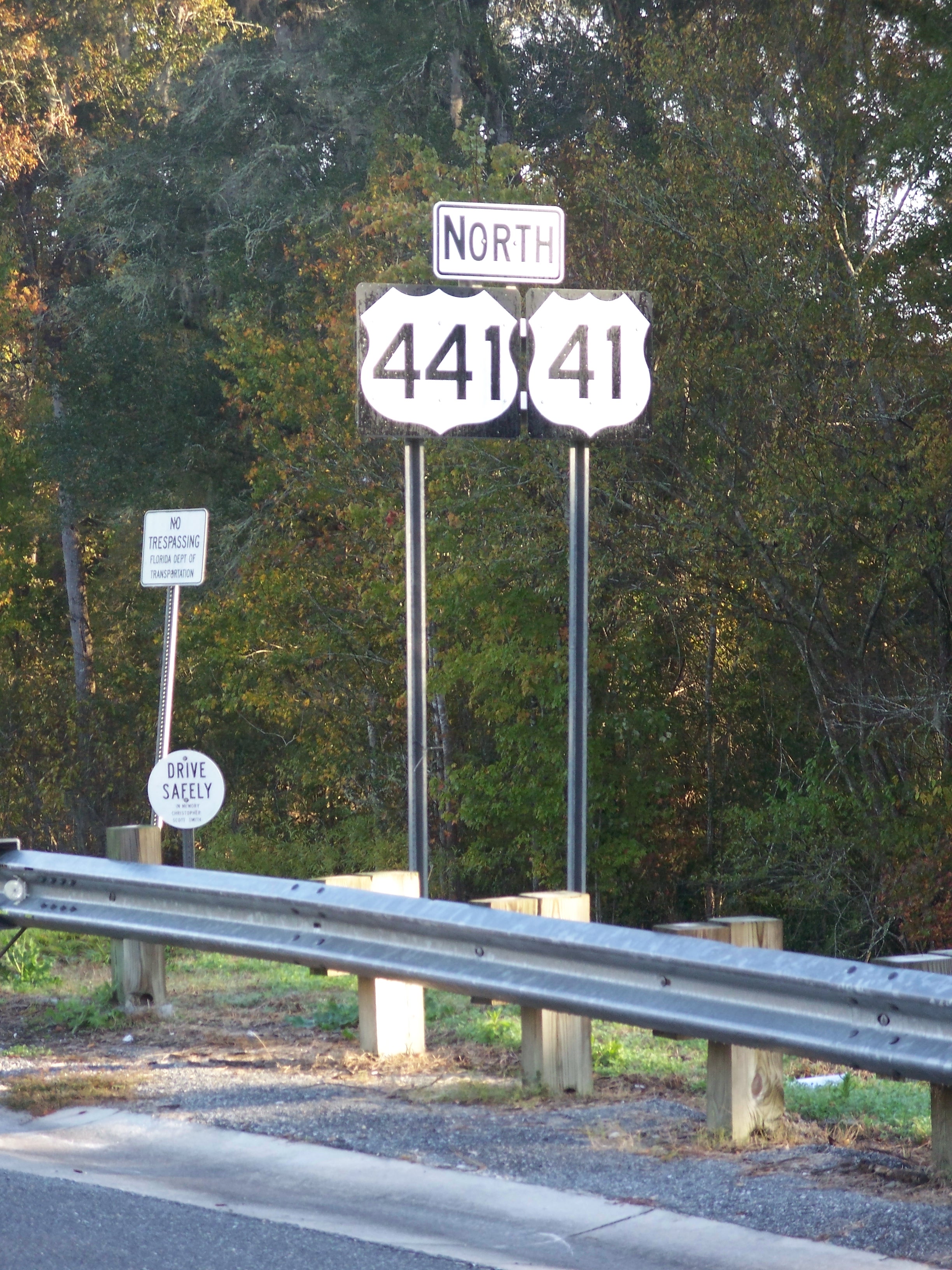
U.S. Highway 41 (US 41) in the state of Florida is a north–south United States Highway. It runs from Miami in South Florida metropolitan area, South Florida northwest to the Georgia (U.S. state), Georgia state line north of the Columbia County, Florida, Lake City area. Within the state, US 41 is paralleled by Interstate 75 in Florida, Interstate 75 (I-75) all the way from Miami to Georgia (on the northern border), and I-75 has largely supplanted US 41 as a major highway. Like all highways designated by the American Association of State Highway and Transportation Officials (AASHTO) in Florida, US 41 always carries a hidden state road number designated by the Florida Department of Transportation (FDOT): * State Road 90 (Florida), State Road 90 (SR 90) from U.S. Route 1 in Florida, US 1 (Florida State Road 5, SR 5) in Miami, Florida, Miami to the junction with 5th Avenue/9th Street/Tamiami Trail North (US 41/SR 45) in Naples, Flo ... [...More Info...] [...Related Items...] OR: [Wikipedia] [Google] [Baidu] |


