|
Cairngorms National Park Authority
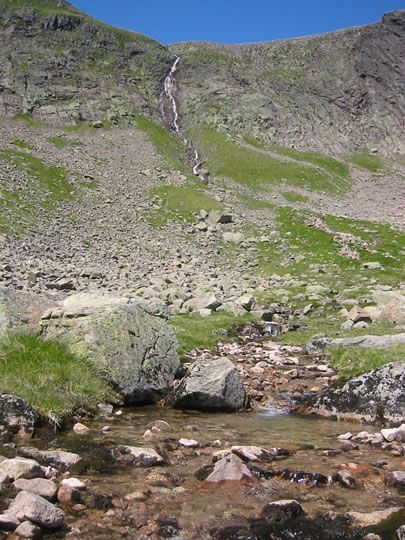
Cairngorms National Park ( gd, Pàirc Nàiseanta a' Mhonaidh Ruaidh) is a national park in northeast Scotland, established in 2003. It was the second of two national parks established by the Scottish Parliament, after Loch Lomond and The Trossachs National Park, which was set up in 2002. The park covers the Cairngorms range of mountains, and surrounding hills. Already the largest national park in the United Kingdom, in 2010 it was expanded into Perth and Kinross. Roughly 18,000 people reside within the 4,528 square kilometre national park. The largest communities are Aviemore, Ballater, Braemar, Grantown-on-Spey, Kingussie, Newtonmore, and Tomintoul. Tourism makes up about 80% of the economy. In 2018, 1.9 million tourism visits were recorded. The majority of visitors are domestic, with 25 per cent coming from elsewhere in the UK, and 21 per cent being from other countries. Geography The Cairngorms National Park covers an area of in the council areas of Aberdeenshire, Moray, ... [...More Info...] [...Related Items...] OR: [Wikipedia] [Google] [Baidu] |
Morrone
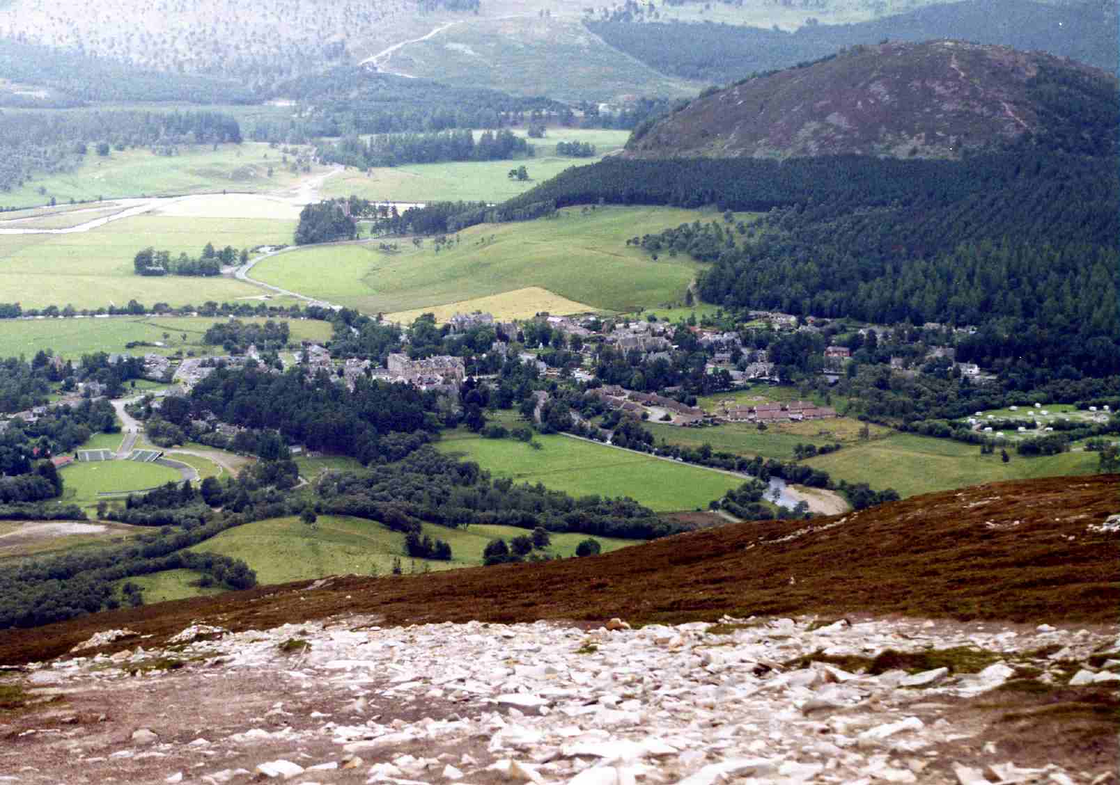
Morrone ( gd, Mór Bheinn, or Mór Shròn) is a Scottish hill immediately southwest of the village of Braemar in Aberdeenshire. Geography and topography The hill reaches a height of 859 metres (2818 feet) and qualifies as a Corbett and a Marilyn, although with a topographic prominence of 155 metres, Wikipedia - List of Marilyns in Southern Highlands. Gives prominence as 155 metres. it only just meets the prominence criterion for these categories. Morrone very much belongs to the village of Braemar from which it is usually climbed, and with a starting elevation of 330 metres, it is an easy ascent and a unique one, being the only significant mountain climb in Scotland to start from the centre of a village."Climbing the Corbetts" Pages 150 (No mountain walk starts from a town). Morrone is used for the Braemar Gathering hill race every September, and is a popular venue for paragliding and hang-gliding. The hill is occasionally referred to as Morven and it is given both n ... [...More Info...] [...Related Items...] OR: [Wikipedia] [Google] [Baidu] |
Angus, Scotland
Angus ( sco, Angus; gd, Aonghas) is one of the 32 local government council areas of Scotland, a registration county and a lieutenancy area. The council area borders Aberdeenshire, Dundee City and Perth and Kinross. Main industries include agriculture and fishing. Global pharmaceuticals company GSK has a significant presence in Montrose in the north of the county. Angus was historically a province, and later a sheriffdom and county (known officially as Forfarshire from the 18th century until 1928), bordering Kincardineshire to the north-east, Aberdeenshire to the north and Perthshire to the west; southwards it faced Fife across the Firth of Tay; these remain the borders of Angus, minus Dundee which now forms its own small separate council area. Angus remains a registration county and a lieutenancy area. In 1975 some of its administrative functions were transferred to the council district of the Tayside Region, and in 1995 further reform resulted in the establishmen ... [...More Info...] [...Related Items...] OR: [Wikipedia] [Google] [Baidu] |
Rock Climbing
Rock climbing is a sport in which participants climb up, across, or down natural rock formations. The goal is to reach the summit of a formation or the endpoint of a usually pre-defined route without falling. Rock climbing is a physically and mentally demanding sport, one that often tests a climber's strength, endurance, agility and balance along with mental control. Knowledge of proper climbing techniques and the use of specialized climbing equipment is crucial for the safe completion of routes. Because of the wide range and variety of rock formations around the world, rock climbing has been separated into several different styles and sub-disciplines, such as scrambling, bouldering, sport climbing, and trad (traditional) climbing another activity involving the scaling of hills and similar formations, differentiated by the rock climber's sustained use of hands to support their body weight as well as to provide balance. Rock climbing competitions have the objectives of ... [...More Info...] [...Related Items...] OR: [Wikipedia] [Google] [Baidu] |
Skiing
Skiing is the use of skis to glide on snow. Variations of purpose include basic transport, a recreational activity, or a competitive winter sport. Many types of competitive skiing events are recognized by the International Olympic Committee (IOC), and the International Ski Federation (FIS). History Skiing has a history of almost five millennia. Although modern skiing has evolved from beginnings in Scandinavia, it may have been practiced more than 100 centuries ago in what is now China, according to an interpretation of ancient paintings. However, this continues to be debated. The word "ski" comes from the Old Norse word "skíð" which means to "split piece of wood or firewood". Asymmetrical skis were used in northern Finland and Sweden until at least the late 19th century. On one foot, the skier wore a long straight non-arching ski for sliding, and a shorter ski was worn on the other foot for kicking. The underside of the short ski was either plain or covered with ani ... [...More Info...] [...Related Items...] OR: [Wikipedia] [Google] [Baidu] |
Tor (rock Formation)
A tor, which is also known by geomorphologists as either a castle koppie or kopje, is a large, free-standing rock outcrop that rises abruptly from the surrounding smooth and gentle slopes of a rounded hill summit or ridge crest. In the South West of England, the term is commonly also used for the hills themselves – particularly the high points of Dartmoor in Devon and Bodmin Moor in Cornwall.Ehlen, J. (2004) ''Tor'' in Goudie, A., ed., pp. 1054-1056. ''Encyclopedia of Geomorphology.'' Routledge. London, England. Etymology Although English topographical names often have a Celtic etymology, the Oxford English Dictionary lists no cognates to the Old English word in either the Breton or Cornish languages (the Scottish Gaelic ''tòrr'' is thought to derive from the Old English word). It is therefore accepted that the English word ''Tor'' derives from the Old Welsh word ''tẁrr'' or ''twr'', meaning a cluster or heap. Formation Tors are landforms created by the erosion and w ... [...More Info...] [...Related Items...] OR: [Wikipedia] [Google] [Baidu] |
Hardangervidda
Hardangervidda ( en, Hardanger Plateau) is a mountain plateau (Norwegian: ''vidde'') in central southern Norway, covering parts of Vestland, Vestfold og Telemark, and Viken counties. It is the largest plateau of its kind in Europe, with a cold year-round alpine climate, and one of Norway's largest glaciers, Hardangerjøkulen, is situated here. Much of the plateau is protected as part of Hardangervidda National Park. Hardangervidda is a popular tourist and leisure destination, and it is ideal for many outdoor activities. Geography and geology The plateau is the largest peneplain (eroded plain) in Europe, covering an area of about at an average elevation of . The highest point on the plateau is the Sandfloegga, which reaches a height of . The landscape of the Hardangervidda is characterised by barren, treeless moorland interrupted by numerous pools, lakes, rivers and streams. There are significant differences between the west side, which is dominated by rocky terrain and expan ... [...More Info...] [...Related Items...] OR: [Wikipedia] [Google] [Baidu] |
River Don, Aberdeenshire
The River Don ( gd, Deathan) is a river in north-east Scotland. It rises in the Grampians and flows eastwards, through Aberdeenshire, to the North Sea at Aberdeen. The Don passes through Alford, Kemnay, Inverurie, Kintore, and Dyce. Its main tributary, the River Ury, joins at Inverurie. Course of the river The Don rises in the peat flat beneath ''Druim na Feithe'', and in the shadow of Glen Avon, before flowing quietly past the ice-age moraine and down to Cock Bridge, below the picturesque site of the recently demolished Delnadamph Lodge. Several streams, the Dhiver, Feith Bhait, Meoir Veannaich, Cock Burn and the Allt nan Aighean merge to form the embryonic Don. Water from the north of Brown Cow Hill () drains into the Don, while water from the west side runs into the River Spey and that from the south side into the Dee. The Don follows a circuitous route eastwards past Corgarff Castle, through Strathdon and the Howe of Alford before entering the North Sea just no ... [...More Info...] [...Related Items...] OR: [Wikipedia] [Google] [Baidu] |
River Dee (Aberdeenshire)
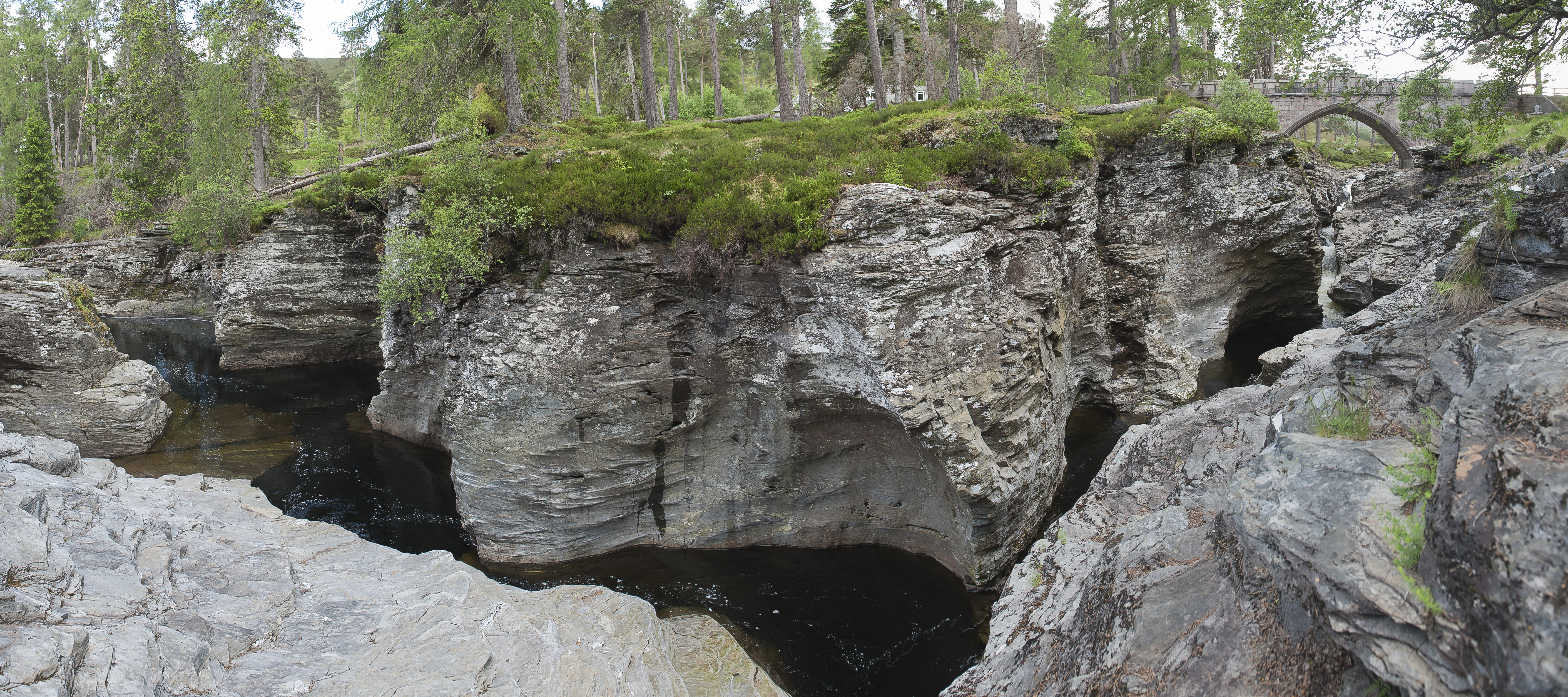
The River Dee ( gd, Uisge Dhè) is a river in Aberdeenshire, Scotland. It rises in the Cairngorms and flows through southern Aberdeenshire to reach the North Sea at Aberdeen. The area it passes through is known as Deeside, or Royal Deeside in the region between Braemar and Banchory because Queen Victoria came for a visit there in 1848 and greatly enjoyed herself. She and her husband, Prince Albert, built Balmoral Castle there which replaced an older castle. Deeside is a popular area for tourists, due to the combination of scenic beauty and historic and royal associations. It is part of the Cairngorms National Park, and the Deeside and Lochnagar National Scenic Area. The Dee is popular with anglers and is one of the most famous salmon fishing rivers in the world. The New Statistical Account of Scotland attributed the name Dee as having been used as early as the second century AD in the work of the Alexandrian geographer Claudius Ptolemy, as ''Δηοῦα'' (=Deva), meaning ... [...More Info...] [...Related Items...] OR: [Wikipedia] [Google] [Baidu] |
River Spey
The River Spey (Scottish Gaelic: Uisge Spè) is a river in the northeast of Scotland. At it is the eighth longest river in the United Kingdom, as well as the second longest and fastest-flowing river in Scotland. It is important for salmon fishing and whisky production. Etymology The origin of the name ''Spey'' is uncertain. A possible etymological genesis for the name ''Spey'' is Early Celtic ''*skwej-'', meaning "thorn". The involvement of a Pictish form of Welsh ''ysbyddad'', meaning "hawthorn", has been suggested, but adjudged unlikely. One proposal is a derivation from a Pictish cognate of Old Gaelic ''sceïd'', "vomit" (c.f Welsh ''chwydu''), which is dubious both on phonological and semantic grounds. Ptolemy named the river on his map of 150 as ''Tuesis''. The name 'Spey' first appears in 1451. Course The Spey is long. It rises at over at Loch Spey in Corrieyairack Forest in the Scottish Highlands, south of Fort Augustus. Some miles downstream from its sou ... [...More Info...] [...Related Items...] OR: [Wikipedia] [Google] [Baidu] |
River Dee, Aberdeenshire
The River Dee ( gd, Uisge Dhè) is a river in Aberdeenshire, Scotland. It rises in the Cairngorms and flows through southern Aberdeenshire to reach the North Sea at Aberdeen. The area it passes through is known as Deeside, or Royal Deeside in the region between Braemar and Banchory because Queen Victoria came for a visit there in 1848 and greatly enjoyed herself. She and her husband, Prince Albert, built Balmoral Castle there which replaced an older castle. Deeside is a popular area for tourists, due to the combination of scenic beauty and historic and royal associations. It is part of the Cairngorms National Park, and the Deeside and Lochnagar National Scenic Area. The Dee is popular with anglers and is one of the most famous salmon fishing rivers in the world. The New Statistical Account of Scotland attributed the name Dee as having been used as early as the second century AD in the work of the Alexandrian geographer Claudius Ptolemy, as ''Δηοῦα'' (=Deva), meaning ... [...More Info...] [...Related Items...] OR: [Wikipedia] [Google] [Baidu] |


