|
Chapada Dos Parecis
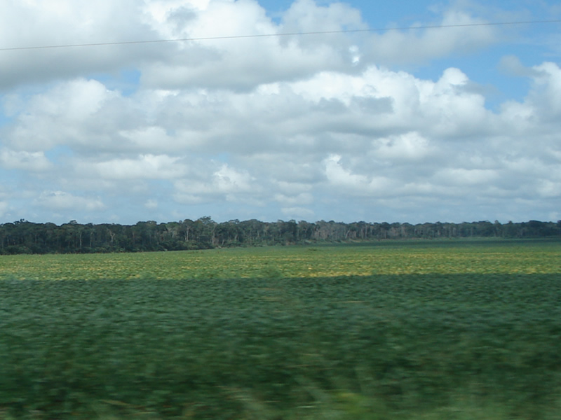
The Parecis plateau () is a plateau in the Brazilian state of Rondônia and adjacent west-central Mato Grosso. The municipality of Parecis is located at the plateau. Several large rivers have their origin on the plateau, notably the Guaporé, Ji-Paraná, Juruena and Paraguay River. The Mato Grosso Plateau is directly to the east of Parecis. References * Encyclopædia Britannica: Parecis Mountains'' Retrieved 20 February 2013. External links Portal Amazônia(In Portuguese Portuguese may refer to: * anything of, from, or related to the country and nation of Portugal ** Portuguese cuisine, traditional foods ** Portuguese language, a Romance language *** Portuguese dialects, variants of the Portuguese language ** Portu ...) Plateaus of Brazil Landforms of Rondônia Landforms of Mato Grosso {{MatoGrosso-geo-stub ... [...More Info...] [...Related Items...] OR: [Wikipedia] [Google] [Baidu] |
Plateau
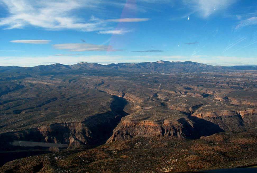
In geology and physical geography, a plateau (; ; : plateaus or plateaux), also called a high plain or a tableland, is an area of a highland consisting of flat terrain that is raised sharply above the surrounding area on at least one side. Often one or more sides have deep hills or escarpments. Plateaus can be formed by a number of processes, including upwelling of volcanic magma, extrusion of lava, and erosion by water and glaciers. Plateaus are classified according to their surrounding environment as intermontane, piedmont, or continental. A few plateaus may have a small flat top while others have wider ones. Formation Plateaus can be formed by a number of processes, including upwelling of volcanic magma, extrusion of lava, plate tectonics movements, and erosion by water and glaciers. Volcanic Volcanic plateaus are produced by volcanic activity. They may be formed by upwelling of volcanic magma or extrusion of lava. The underlining mechanism in forming p ... [...More Info...] [...Related Items...] OR: [Wikipedia] [Google] [Baidu] |
Brazil
Brazil, officially the Federative Republic of Brazil, is the largest country in South America. It is the world's List of countries and dependencies by area, fifth-largest country by area and the List of countries and dependencies by population, seventh-largest by population, with over 212 million people. The country is a federation composed of 26 Federative units of Brazil, states and a Federal District (Brazil), Federal District, which hosts the capital, Brasília. List of cities in Brazil by population, Its most populous city is São Paulo, followed by Rio de Janeiro. Brazil has the most Portuguese-speaking countries, Portuguese speakers in the world and is the only country in the Americas where Portuguese language, Portuguese is an Portuguese-speaking world, official language. Bounded by the Atlantic Ocean on the east, Brazil has a Coastline of Brazil, coastline of . Covering roughly half of South America's land area, it Borders of Brazil, borders all other countries and ter ... [...More Info...] [...Related Items...] OR: [Wikipedia] [Google] [Baidu] |
Rondônia
Rondônia () is one of the 26 states of Brazil, located in the northern subdivision of the country (central-western part). It is bordered by Acre (state), Acre in the west, Amazonas, Brazil, Amazonas in the north, Mato Grosso in the east, and Bolivia in the south. Rondônia has a population of 1,815,000 as of 2021. It is the fifth least populated state. Its capital and largest city is Porto Velho, bathed by the Madeira River. The state was named after Cândido Rondon, who explored the north of the country during the 1910s. The state, which is home to c. 0.7% of the Brazilian population, is responsible for c. 0.3% of the Brazilian GDP. The state has 52 municipalities and occupies an area of 237,590.547 Square kilometre, km2, equivalent to the territory of Romania and almost five times larger than Croatia. In addition to this, there are other important cities such as Ariquemes, Cacoal, Guajará-Mirim, Ji-Paraná, Rolim de Moura and Vilhena. Geography Rondonia used to be home to ... [...More Info...] [...Related Items...] OR: [Wikipedia] [Google] [Baidu] |
Mato Grosso
Mato Grosso ( – ) is one of the states of Brazil, the List of Brazilian states by area, third largest by area, located in the Central-West Region, Brazil, Central-West region. The state has 1.66% of the Brazilian population and is responsible for 1.9% of the Brazilian GDP. Neighboring states (from west clockwise) are: Rondônia, Amazonas State, Brazil, Amazonas, Pará, Tocantins, Goiás and Mato Grosso do Sul. It is divided into 142 municipalities and covers an area of 903,357 square kilometers, consequently the state is roughly 82.2% of the size of its southwest neighbor, the nation of Bolivia. A state with a flat landscape that alternates between vast ''chapadas'' and plain areas, Mato Grosso contains three main ecosystems: the Cerrado, the Pantanal and the Amazon rainforest. The Chapada dos Guimarães National Park, with its caves, grottoes, tracks, and waterfalls, is one of its tourist attractions. The extreme northwest of the state has a small part of the Amazonian fores ... [...More Info...] [...Related Items...] OR: [Wikipedia] [Google] [Baidu] |
Parecis, Rondônia
Parecis is a municipality located in the Brazilian state of Rondônia. Its population was 6,198 (2020) and its area is 2,549 km2.IBGE /ref> See also * Parecis Plateau * List of municipalities in Rondônia This is a list of the municipalities in the state of Rondônia (RO), located in the North Region of Brazil. Rondônia is divided into 52 municipalities A municipality is usually a single administrative division having municipal corporation, c ... References Municipalities in Rondônia {{Rondônia-geo-stub ... [...More Info...] [...Related Items...] OR: [Wikipedia] [Google] [Baidu] |
Guaporé River
Guaporé River (, ) is a river in western Brazil and northeastern Bolivia. It is long; of the river forms the border between Brazil and Bolivia. The Guaporé is part of the Madeira River basin, which eventually empties into the Amazon River. The Guaporé crosses the eastern part of the Beni savanna region. It forms the border of the Guaporé Biological Reserve, and is fed by rivers originating in the reserve, the São Miguel, Branco, São Simão, Massaco and Colorado. About 260 fish species are known from the Guaporé River basin, and about 25 of these are endemic.Hales, J., and P. Petry (2013). Guapore - Itenez'. Freshwater Ecoregions of the World. Retrieved 28 February 2013 While many fish species in the river essentially are Amazonian, the fauna in the Guaporé also has a connection with the Paraguay River (part of the Río de la Plata Basin The Río de la Plata basin (, ), more often called the River Plate basin in scholarly writings, sometimes called the Platine basi ... [...More Info...] [...Related Items...] OR: [Wikipedia] [Google] [Baidu] |
Ji-Paraná River
The Ji-Paraná River (Machado River), sometimes spelled Jiparaná, is a river in Rondônia state in western Brazil. It is a tributary of the Madeira River in the Amazon Basin. For much of its length it runs roughly parallel with the northeastern state border of Rondônia. The city of Ji-Paraná is divided by the river. Part of the river's basin is covered by the Jacundá National Forest, a sustainable use conservation unit. Part of the basin is in the Jaru Biological Reserve, a fully protected conservation unit created in 1984. The river forms the southern boundary in Rondônia of the Campos Amazônicos National Park, a protected area created in 2006 that holds an unusual enclave of cerrado vegetation in the Amazon rainforest. See also *List of rivers of Rondônia ReferencesBrazilian Ministry of Transport River A river is a natural stream of fresh water that flows on land or inside Subterranean river, caves towards another body of water at a lower elevation, su ... [...More Info...] [...Related Items...] OR: [Wikipedia] [Google] [Baidu] |
Juruena River
The Juruena River () is a long river in west-central Brazil, in the state of Mato Grosso. Course The Juruena originates in the Parecis plateau. Within Mato Grosso the river defines the eastern boundary of the Igarapés do Juruena State Park, created in 2002. For the last of its lower part the river becomes the border between the states Mato Grosso and Amazonas. In this section the river forms the boundary between the Sucunduri State Park to the west in Amazonas and the Juruena National Park to the east in Mato Grosso. In the north of this section it forms the boundary between the Bararati Sustainable Development Reserve in Amazonas and the Apiacás Ecological Reserve in Mato Grosso. The Juruena finally joins the Teles Pires river to form the Tapajós The Tapajós ( ) is a river in Brazil. It runs through the Amazon Rainforest and is a major tributary of the Amazon River. When combined with the Juruena River, the Tapajós is approximately long. Prior to a drastic in ... [...More Info...] [...Related Items...] OR: [Wikipedia] [Google] [Baidu] |
Paraguay River
The Paraguay River (''Ysyry Paraguái'' in Guarani language, Guarani, ''Rio Paraguai'' in Portuguese language, Portuguese, ''Río Paraguay'' in Spanish language, Spanish) is a major river in south-central South America, running through Brazil, Bolivia, Paraguay and Argentina. It flows about from its headwaters in the States of Brazil, Brazilian state of Mato Grosso to its confluence with the Paraná River north of Corrientes and Resistencia, Chaco, Resistencia. Course The Paraguay's source is south of Diamantino in the Mato Grosso state of Brazil. It follows a generally southwesterly course, passing through the Brazilian city of Cáceres, Mato Grosso, Cáceres. It then turns in a generally southward direction, flowing through the Pantanal wetlands, the city of Corumbá, then running close to the Brazil-Bolivia border for a short distance in the Brazilian states of Mato Grosso and Mato Grosso do Sul. From the city of Puerto Bahia Negra, Paraguay, the river forms the border betwee ... [...More Info...] [...Related Items...] OR: [Wikipedia] [Google] [Baidu] |
Mato Grosso Plateau
Mato Grosso ( – ) is one of the states of Brazil, the List of Brazilian states by area, third largest by area, located in the Central-West Region, Brazil, Central-West region. The state has 1.66% of the Brazilian population and is responsible for 1.9% of the Brazilian GDP. Neighboring states (from west clockwise) are: Rondônia, Amazonas State, Brazil, Amazonas, Pará, Tocantins, Goiás and Mato Grosso do Sul. It is divided into 142 municipalities and covers an area of 903,357 square kilometers, consequently the state is roughly 82.2% of the size of its southwest neighbor, the nation of Bolivia. A state with a flat landscape that alternates between vast ''chapadas'' and plain areas, Mato Grosso contains three main ecosystems: the Cerrado, the Pantanal and the Amazon rainforest. The Chapada dos Guimarães National Park, with its caves, grottoes, tracks, and waterfalls, is one of its tourist attractions. The extreme northwest of the state has a small part of the Amazonian fores ... [...More Info...] [...Related Items...] OR: [Wikipedia] [Google] [Baidu] |
Portuguese Language
Portuguese ( or ) is a Western Romance language of the Indo-European language family originating from the Iberian Peninsula of Europe. It is the official language of Angola, Brazil, Cape Verde, Guinea-Bissau, Mozambique, Portugal and São Tomé and Príncipe, and has co-official language status in East Timor, Equatorial Guinea and Macau. Portuguese-speaking people or nations are known as Lusophone (). As the result of expansion during colonial times, a cultural presence of Portuguese speakers is also found around the world. Portuguese is part of the Iberian Romance languages, Ibero-Romance group that evolved from several dialects of Vulgar Latin in the medieval Kingdom of Galicia and the County of Portugal, and has kept some Gallaecian language, Celtic phonology. With approximately 250 million native speakers and 17 million second language speakers, Portuguese has approximately 267 million total speakers. It is usually listed as the List of languages by number of native speaker ... [...More Info...] [...Related Items...] OR: [Wikipedia] [Google] [Baidu] |
Plateaus Of Brazil
In geology and physical geography, a plateau (; ; : plateaus or plateaux), also called a high plain or a tableland, is an area of a highland consisting of flat terrain that is raised sharply above the surrounding area on at least one side. Often one or more sides have deep hills or escarpments. Plateaus can be formed by a number of processes, including upwelling of volcanic magma, extrusion of lava, and erosion by water and glaciers. Plateaus are classified according to their surrounding environment as intermontane, piedmont, or continental. A few plateaus may have a small flat top while others have wider ones. Formation Plateaus can be formed by a number of processes, including upwelling of volcanic magma, extrusion of lava, plate tectonics movements, and erosion by water and glaciers. Volcanic Volcanic plateaus are produced by volcanic activity. They may be formed by upwelling of volcanic magma or extrusion of lava. The underlining mechanism in forming plateaus from up ... [...More Info...] [...Related Items...] OR: [Wikipedia] [Google] [Baidu] |


