|
Braemar, Scotland
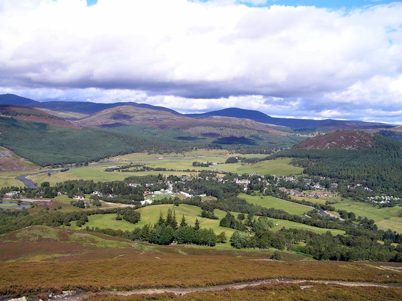
Braemar is a village in Aberdeenshire, Scotland, around west of Aberdeen in the Highlands. It is the closest significantly-sized settlement to the upper course of the River Dee sitting at an elevation of . The Gaelic ''Bràigh Mhàrr'' properly refers to the area of upper Marr (as it literally means), i.e. the area of Marr to the west of Aboyne, the village itself being Castleton of Braemar (''Baile a' Chaisteil''). The village used to be known as ''Cinn Drochaid'' (bridge end); ''Baile a' Chaisteil'' referred to only the part of the village on the east bank of the river, the part on the west bank being known as ''Ach an Droighinn'' (thorn field). Geography Braemar is approached from the South on the A93 from Glen Clunie and the Cairnwell Pass and from the East also on the A93 from Deeside. Braemar can be approached on foot from the West through Glen Tilt, Glen Feshie, Glen Dee (by the Lairig Ghru), and Glen Derry (by the Lairig an Laoigh). Braemar is within a one-and-a-h ... [...More Info...] [...Related Items...] OR: [Wikipedia] [Google] [Baidu] |
Aberdeenshire
Aberdeenshire ( sco, Aiberdeenshire; gd, Siorrachd Obar Dheathain) is one of the 32 council areas of Scotland. It takes its name from the County of Aberdeen which has substantially different boundaries. The Aberdeenshire Council area includes all of the area of the historic counties of Aberdeenshire and Kincardineshire (except the area making up the City of Aberdeen), as well as part of Banffshire. The county boundaries are officially used for a few purposes, namely land registration and lieutenancy. Aberdeenshire Council is headquartered at Woodhill House, in Aberdeen, making it the only Scottish council whose headquarters are located outside its jurisdiction. Aberdeen itself forms a different council area (Aberdeen City). Aberdeenshire borders onto Angus and Perth and Kinross to the south, Highland and Moray to the west and Aberdeen City to the east. Traditionally, it has been economically dependent upon the primary sector (agriculture, fishing, and forestry) and rel ... [...More Info...] [...Related Items...] OR: [Wikipedia] [Google] [Baidu] |
Perth, Scotland
Perth (Scottish English, locally: ; gd, Peairt ) is a city in central Scotland, on the banks of the River Tay. It is the administrative centre of Perth and Kinross council area and the historic county town of Perthshire. It had a population of about 47,430 in 2018. There has been a settlement at Perth since prehistory, prehistoric times. It is a natural mound raised slightly above the flood plain of the Tay, at a place where the river could be crossed on foot at low tide. The area surrounding the modern city is known to have been occupied ever since Mesolithic hunter-gatherers arrived there more than 8,000 years ago. Nearby Neolithic standing stones and circles date from about 4,000 BC, a period that followed the introduction of farming into the area. Close to Perth is Scone Abbey, which formerly housed the Stone of Scone (also known as the Stone of Destiny), on which the King of Scots were traditionally crowned. This enhanced the early importance of the city, and Perth becam ... [...More Info...] [...Related Items...] OR: [Wikipedia] [Google] [Baidu] |
Clunie Water
Clunie Water is a river of Aberdeenshire, Scotland. It is a tributary of the River Dee, Aberdeenshire, River Dee, joining the river at Braemar, among grey stone buildings. Callater Burn is a tributary of the Clunie; the confluence is at Auchallater. The river flows alongside the A93 road. Bridges and pathways Further south of Auchallater in the Glen of Clunie is Fraser's Bridge, a long segmented arch bridge, measuring 15 ft 4 inches between its parapets. A Grade B listed building, it was completed in around 1749. On a 1776 Taylor and Skinner Map it was labelled "East Bridge". In June 2010, a new link path opened, leading from Highland Society Bridge over Clunie Water to the Glenshee Road. Fishing During the fishing season, from March to September, permits are granted for fishing brown trout along the river. References External links {{Authority control Rivers of Aberdeenshire ... [...More Info...] [...Related Items...] OR: [Wikipedia] [Google] [Baidu] |
Royal Dutch Meteorological Institute
, nativename_a = , nativename_r = , logo = , logo_width = , logo_caption = , seal = , seal_width = , seal_caption = , picture = FS IMG 8907 KNMI.jpg , picture_width = 250px , picture_caption = KNMI headquarters in De Bilt , formed = , preceding1 = , preceding2 = , dissolved = , superseding = , jurisdiction = , headquarters = De Bilt, Netherlands , coordinates = , motto = , employees = , budget = , prime_minister_name = , minister1_name = , minister1_pfo = , minister2_name = , minister2_pfo = , deputyminister1_name = Steven van Weyenberg , deputyminister1_pfo = , deputyminister2_name = , deputyminister2_pfo = , chief1_name = , chief1_position = , chief2_name = , chief2_position = , chief3_name = , chief3_position = , chief4_name = , chief4_position = , chief5_name = , chief5_position = , chief6_name = , director_general = , agency_type = , chief6_position = , chief7_name = , chief7_position = , ... [...More Info...] [...Related Items...] OR: [Wikipedia] [Google] [Baidu] |
Met Office
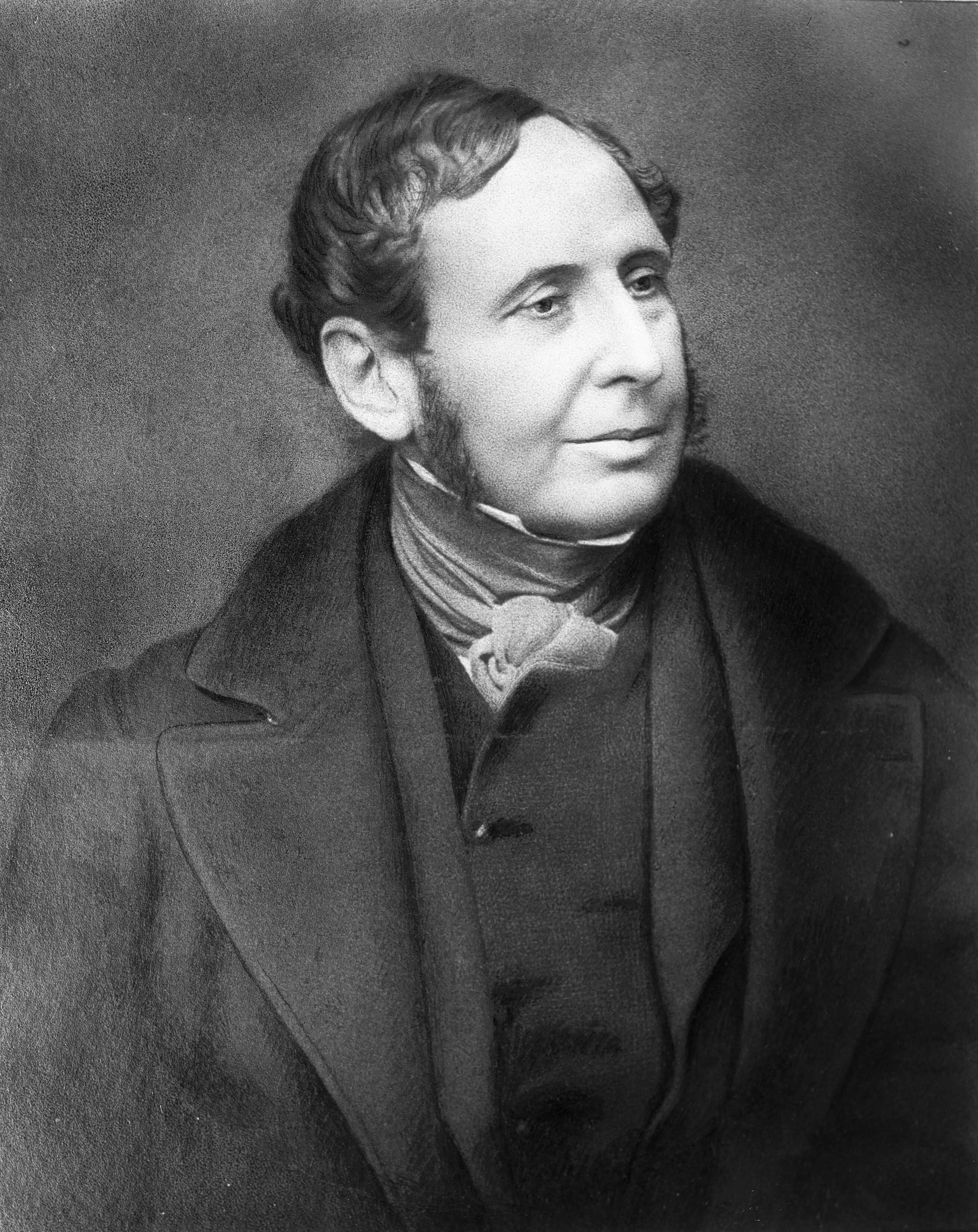
The Meteorological Office, abbreviated as the Met Office, is the United Kingdom's national weather service. It is an executive agency and trading fund of the Department for Business, Energy and Industrial Strategy and is led by CEO Penelope Endersby, who took on the role as Chief Executive in December 2018 and is the first woman to do so. The Met Office makes meteorological predictions across all timescales from weather forecasts to climate change. History The Met Office was established on 1 August 1854 as a small department within the Board of Trade under Vice Admiral Robert FitzRoy as a service to mariners. The loss of the passenger vessel, the ''Royal Charter'', and 459 lives off the coast of Anglesey in a violent storm in October 1859 led to the first gale warning service. FitzRoy established a network of 15 coastal stations from which visual gale warnings could be provided for ships at sea. The new electric telegraph enabled rapid dissemination of warnings an ... [...More Info...] [...Related Items...] OR: [Wikipedia] [Google] [Baidu] |
Altnaharra
Altnaharra ( gd, Allt na h-Eirbhe) is a small hamlet in Sutherland in the Highland region of northern Scotland. The hamlet is on the A836 road, close to its junction with the B873. The nearest villages are Lairg and Tongue. Lochs in the area include Loch Naver and Loch Eriboll. The name Altnaharra is derived from the Scottish Gaelic Allt na h-Eirbhe, meaning ''Stream at the boundary wall''. This is named after a stream that flows through the hamlet. Altnaharra is one of only two British locations where the String sedge plant can be found. The area north of the hamlet has been designated a site of special scientific interest for its 'internationally important range of wetland vegetation'. Buildings Altnaharra is famous for the Altnaharra Hotel, which opened in 1820 and quickly became a popular place for anglers to stay while visiting nearby lochs. The hotel was also popular with mountain climbers; it generally closes for winter and re-opens in March. Ben Hope and Ben Kli ... [...More Info...] [...Related Items...] OR: [Wikipedia] [Google] [Baidu] |
United Kingdom Weather Records
The United Kingdom weather records show the most extreme weather ever recorded in the United Kingdom, such as temperature, wind speed, and rainfall records. Reliable temperature records for the whole of the United Kingdom go back to about 1880. Records Daily records unless otherwise specified are from 0900-2100 UTC. As of 20 Dec 2022, the records, as recorded by the Met Office, are: Highest temperature by country Earlier records for England/UK since 1911 are shown with a * in the "Top 10 hottest days" table below. Top 10 hottest days Starred entries signify the then-highest temperature recorded up to that date, until surpassed by the next starred date above. Lowest temperature by nation Rainfall Sunshine Wind speed Shetland holds the unofficial British record for wind speed. A gust of was reported on 1 January 1992. An earlier gust in 1962 was recorded at 177 mph (285 km/h), both at RAF Saxa Vord. However, it is expected that higher gusts than those rep ... [...More Info...] [...Related Items...] OR: [Wikipedia] [Google] [Baidu] |
Leadhills
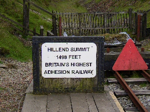
Leadhills, originally settled for the accommodation of miners, is a village in South Lanarkshire, Scotland, WSW of Elvanfoot. The population in 1901 was 835. It was originally known as Waterhead. It is the second highest village in Scotland, the highest being neighbouring Wanlockhead, south. It is near the source of Glengonnar Water, a tributary of the River Clyde. Local attractions Library The Leadhills Miners' Library (also known as the Allan Ramsay Library or the Leadhills Reading Society), founded in 1741 by 21 miners, the local schoolteacher and the local minister, specifically to purchase a collection of books for its members’ mutual improvement — its membership was not restricted to the miners; several non-miners, such as William Symington, John Brown (author of ''Rab and his Friends'') and James Braid, were also full members — houses an extensive antiquarian book collection, local relics, mining records and minerals. The library is the oldest subscrip ... [...More Info...] [...Related Items...] OR: [Wikipedia] [Google] [Baidu] |
Dalwhinnie
Dalwhinnie ( ; Scottish Gaelic: ''Dail Chuinnidh'' "meeting place") is a small village in the Scottish Highlands. Dalwhinnie is located at the head of Glen Truim and the north-east end of Loch Ericht, on the western edge of the Cairngorms National Park. Location Dalwhinnie sits at an altitude of . It is one of the coldest villages in the UK, having an average annual temperature of , making it suitable for winter walking and mountaineering. It is north of Drumochter, just off the A9 road from Perth to Inverness and has been bypassed since 1975. It is about 75 miles (120 km) from both Edinburgh and Glasgow, 25 miles (40 km) from Aviemore, 13 miles (21 km) from Newtonmore and 17 miles (27 km) from Kingussie. Dalwhinnie railway station lies on the Highland Main Line from Perth to Inverness. Tourism The area is walking destination along the River Truim and in Cairngorm and Monadhliath Mountains in the Cairngorm National Park. Dalwhinnie is on the Sustrans Na ... [...More Info...] [...Related Items...] OR: [Wikipedia] [Google] [Baidu] |
Subpolar Oceanic Climate
An oceanic climate, also known as a marine climate, is the humid temperate climate sub-type in Köppen classification ''Cfb'', typical of west coasts in higher middle latitudes of continents, generally featuring cool summers and mild winters (for their latitude), with a relatively narrow annual temperature range and few extremes of temperature. Oceanic climates can be found in both hemispheres generally between 45 and 63 latitude, most notably in northwestern Europe, northwestern America, as well as New Zealand. Precipitation Locations with oceanic climates tend to feature frequent cloudy conditions with precipitation, low hanging clouds, and frequent fronts and storms. Thunderstorms are normally few, since strong daytime heating and hot and cold air masses meet infrequently in the region. In most areas with an oceanic climate, precipitation comes in the form of rain for the majority of the year. However, some areas with this climate see some snowfall annually during winter. ... [...More Info...] [...Related Items...] OR: [Wikipedia] [Google] [Baidu] |
Oceanic Climate
An oceanic climate, also known as a marine climate, is the humid temperate climate sub-type in Köppen classification ''Cfb'', typical of west coasts in higher middle latitudes of continents, generally featuring cool summers and mild winters (for their latitude), with a relatively narrow annual temperature range and few extremes of temperature. Oceanic climates can be found in both hemispheres generally between 45 and 63 latitude, most notably in northwestern Europe, northwestern America, as well as New Zealand. Precipitation Locations with oceanic climates tend to feature frequent cloudy conditions with precipitation, low hanging clouds, and frequent fronts and storms. Thunderstorms are normally few, since strong daytime heating and hot and cold air masses meet infrequently in the region. In most areas with an oceanic climate, precipitation comes in the form of rain for the majority of the year. However, some areas with this climate see some snowfall annually during winter. ... [...More Info...] [...Related Items...] OR: [Wikipedia] [Google] [Baidu] |
Braemar From Morrone 01SEP06
Braemar is a village in Aberdeenshire, Scotland, around west of Aberdeen in the Scottish Highlands, Highlands. It is the closest significantly-sized settlement to the upper course of the River Dee, Aberdeenshire, River Dee sitting at an elevation of . The Gaelic ''Bràigh Mhàrr'' properly refers to the area of upper Marr (as it literally means), i.e. the area of Marr to the west of Aboyne, the village itself being Castleton of Braemar (''Baile a' Chaisteil''). The village used to be known as ''Cinn Drochaid'' (bridge end); ''Baile a' Chaisteil'' referred to only the part of the village on the east bank of the river, the part on the west bank being known as ''Ach an Droighinn'' (thorn field). Geography Braemar is approached from the South on the A93 road, A93 from Glen Clunie and the Cairnwell Pass and from the East also on the A93 from River Dee, Aberdeenshire, Deeside. Braemar can be approached on foot from the West through Glen Tilt, Glen Feshie, Glen Dee (by the Lairig Gh ... [...More Info...] [...Related Items...] OR: [Wikipedia] [Google] [Baidu] |


