|
Banmaw Airport
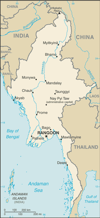
Bhamo Airport is an airport serving Bhamo (Banmaw), a city in the Kachin State in northern Myanmar. It is also known as Banmaw Airport. History Built as a Japanese Air Force base in 1942, the airport was attacked numerous times by Allied forces before being seized in May 1945. It was repaired by the 1891st Engineer Aviation Battalion then was used as a combat resupply and casualty evacuation airfield by Tenth Air Force, which moved elements of the 1st Combat Cargo Group to the field. It was also used as a communications relay station as well as a base for forward air controllers (51st Fighter Control Squadron). It was closed at the end of September 1945. Facilities The airport resides at an elevation of above mean sea level. It has 1 runway According to the International Civil Aviation Organization (ICAO), a runway is a "defined rectangular area on a land aerodrome prepared for the landing and takeoff of aircraft". Runways may be a man-made surface (often asph ... [...More Info...] [...Related Items...] OR: [Wikipedia] [Google] [Baidu] |
Bhamo
Bhamo ( my, ဗန်းမော်မြို့ ''ban: mau mrui.'', also spelt Banmaw; shn, မၢၼ်ႈမူဝ်ႇ; tdd, ᥛᥫᥒᥰ ᥛᥨᥝᥱ; zh, 新街, Hsinkai) is a city in Kachin State in northern Myanmar, south of the state capital, (Myitkyina). It is on the Ayeyarwady River. It lies within of the border with Yunnan Province, China. The population consists of Chinese and Shan, with Kachin peoples in the hills around the town. It is the administrative center of Bhamo District and Bhamo Township. Etymology "Bhamo" derives from the Shan language term "Manmaw" ( shn, မၢၼ်ႈမေႃႇး, ; tdd, ᥛᥫᥒᥰ ᥛᥨᥝᥱ), which means "potter's village." History From 1869 to 1879, it was the seat of British colonial Assistant political agent, subordinate to the Resident with the king of and in Ava. In the early 20th century, due to its location at the highest navigable point of the river, it formed a part of caravan routes bringin ... [...More Info...] [...Related Items...] OR: [Wikipedia] [Google] [Baidu] |
Runway
According to the International Civil Aviation Organization (ICAO), a runway is a "defined rectangular area on a land aerodrome prepared for the landing and takeoff of aircraft". Runways may be a man-made surface (often asphalt, concrete, or a mixture of both) or a natural surface ( grass, dirt, gravel, ice, sand or salt). Runways, as well as taxiways and ramps, are sometimes referred to as "tarmac", though very few runways are built using tarmac. Takeoff and landing areas defined on the surface of water for seaplanes are generally referred to as waterways. Runway lengths are now commonly given in meters worldwide, except in North America where feet are commonly used. History In 1916, in a World War I war effort context, the first concrete-paved runway was built in Clermont-Ferrand in France, allowing local company Michelin to manufacture Bréguet Aviation military aircraft. In January 1919, aviation pioneer Orville Wright underlined the need for "distinctly m ... [...More Info...] [...Related Items...] OR: [Wikipedia] [Google] [Baidu] |
Airfields Of The United States Army Air Forces Air Transport Command In The China-Burma-India Theater
An aerodrome (Commonwealth English) or airdrome (American English) is a location from which aircraft flight operations take place, regardless of whether they involve air cargo, passengers, or neither, and regardless of whether it is for public or private use. Aerodromes include small general aviation airfields, large commercial airports, and military air bases. The term ''airport'' may imply a certain stature (having satisfied certain certification criteria or regulatory requirements) that not all aerodromes may have achieved. That means that all airports are aerodromes, but not all aerodromes are airports. Usage of the term "aerodrome" remains more common in Ireland and Commonwealth nations, and is conversely almost unknown in American English, where the term "airport" is applied almost exclusively. A water aerodrome is an area of open water used regularly by seaplanes, floatplanes or amphibious aircraft for landing and taking off. In formal terminology, as defined by th ... [...More Info...] [...Related Items...] OR: [Wikipedia] [Google] [Baidu] |
Airfields Of The United States Army Air Forces In Myanmar
An aerodrome (Commonwealth English) or airdrome (American English) is a location from which aircraft flight operations take place, regardless of whether they involve air cargo, passengers, or neither, and regardless of whether it is for public or private use. Aerodromes include small general aviation airfields, large commercial airports, and military air bases. The term ''airport'' may imply a certain stature (having satisfied certain certification criteria or regulatory requirements) that not all aerodromes may have achieved. That means that all airports are aerodromes, but not all aerodromes are airports. Usage of the term "aerodrome" remains more common in Ireland and Commonwealth nations, and is conversely almost unknown in American English, where the term "airport" is applied almost exclusively. A water aerodrome is an area of open water used regularly by seaplanes, floatplanes or amphibious aircraft for landing and taking off. In formal terminology, as defined by th ... [...More Info...] [...Related Items...] OR: [Wikipedia] [Google] [Baidu] |
Airports In Myanmar
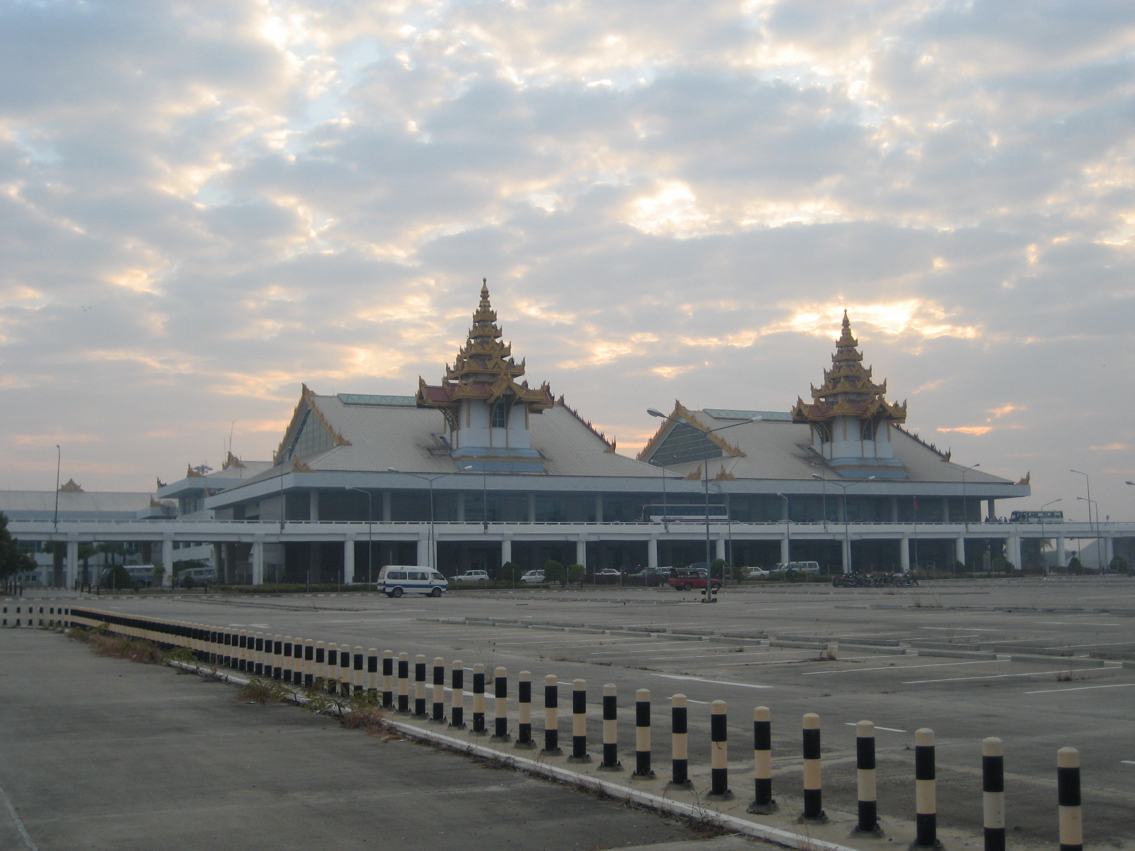
This is a list of airports in Burma (Myanmar), grouped by type and sorted by location. Burma, officially the Union of Burma (now The Republic of the Union of Myanmar), has 25 operating airports with commercial flights. The country is bordered by People's Republic of China to the northeast, Laos to the east, Thailand to the southeast, Bangladesh to the west, India to the northwest, the Bay of Bengal to the southwest, and the Andaman Sea to the south. The country is divided into 14 administrative subdivisions, which include 7 states (''pyi-ne'') and 7 divisions (''tyne''). Its capital is Naypyitaw (Nay Pyi Taw) and its largest city (and prior capital) is Yangon. File:Mandalay_Airport.JPG , Mandalay Airport File:Ygnairport2006.jpg , Yangon Airport __TOC__ Airports Airport names shown in bold have scheduled passenger service on commercial airlines. See also * Myanmar Air Force * Transport in Burma * List of airports by ICAO code: V#VY - Myanmar (Burma) * Wikipedia: ... [...More Info...] [...Related Items...] OR: [Wikipedia] [Google] [Baidu] |
Mandalay Airport
Mandalay International Airport ( my, မန္တလေး အပြည်ပြည်ဆိုင်ရာ လေဆိပ်; ), located 35 km south of Mandalay in Tada-U, is one of three international airports in Myanmar. Completed in 1999, it was the largest and most modern airport in the country until the modernization of Yangon International Airport in 2008. The airport connects 11 domestic and seven international destinations. Its runway is the longest runway in use in Southeast Asia and has the capacity to handle up to 3 million passengers a year. The airport is the main operating base of Golden Myanmar Airlines. History The Mandalay International Airport project was first conceived by the Burmese military government in the mid-1990s as a way to increase overall levels of foreign investment and tourism in Myanmar. With Yangon boasting the only other international airport in the whole country, the new Mandalay airport was regarded as crucial in achieving a plann ... [...More Info...] [...Related Items...] OR: [Wikipedia] [Google] [Baidu] |
Myanmar National Airlines
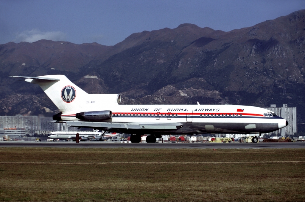
Myanmar National Airlines ( my, မြန်မာအမျိုးသားလေကြောင်း ), formerly Union of Burma Airways, Burma Airways, and Myanma Airways, is a state-owned airline and the flag carrier of Myanmar, based in Yangon. Founded in 1948, the airline operates scheduled services to all major domestic destinations and to regional destinations in Asia. Its main base is Yangon International Airport. History The airline was founded by the government after independence on 15 September 1948, as the Union of Burma Airways (UBA). It initially operated domestic services only, but added limited international services to neighboring destinations in 1950. In 1993 the airline withdrew from its international routes. After a 23-year absence, they relaunched foreign services in 2016 with service to Singapore. The name was changed to Burma Airways in December 1972, and to Myanma Airways on 1 April 1989, following the renaming of the country from Burma to Mya ... [...More Info...] [...Related Items...] OR: [Wikipedia] [Google] [Baidu] |
Bitumen
Asphalt, also known as bitumen (, ), is a sticky, black, highly viscous liquid or semi-solid form of petroleum. It may be found in natural deposits or may be a refined product, and is classed as a pitch. Before the 20th century, the term asphaltum was also used. Full text at Internet Archive (archive.org) The word is derived from the Ancient Greek ἄσφαλτος ''ásphaltos''. The largest natural deposit of asphalt in the world, estimated to contain 10 million tons, is the Pitch Lake located in La Brea in southwest Trinidad (Antilles island located on the northeastern coast of Venezuela), within the Siparia Regional Corporation. The primary use (70%) of asphalt is in road construction, where it is used as the glue or binder mixed with aggregate particles to create asphalt concrete. Its other main uses are for bituminous waterproofing products, including production of roofing felt and for sealing flat roofs. In material sciences and engineering, the terms "asphalt" ... [...More Info...] [...Related Items...] OR: [Wikipedia] [Google] [Baidu] |
Mean Sea Level
There are several kinds of mean in mathematics, especially in statistics. Each mean serves to summarize a given group of data, often to better understand the overall value (magnitude and sign) of a given data set. For a data set, the '' arithmetic mean'', also known as "arithmetic average", is a measure of central tendency of a finite set of numbers: specifically, the sum of the values divided by the number of values. The arithmetic mean of a set of numbers ''x''1, ''x''2, ..., x''n'' is typically denoted using an overhead bar, \bar. If the data set were based on a series of observations obtained by sampling from a statistical population, the arithmetic mean is the ''sample mean'' (\bar) to distinguish it from the mean, or expected value, of the underlying distribution, the ''population mean'' (denoted \mu or \mu_x).Underhill, L.G.; Bradfield d. (1998) ''Introstat'', Juta and Company Ltd.p. 181/ref> Outside probability and statistics, a wide range of other notions of mean ... [...More Info...] [...Related Items...] OR: [Wikipedia] [Google] [Baidu] |
Myanmar
Myanmar, ; UK pronunciations: US pronunciations incl. . Note: Wikipedia's IPA conventions require indicating /r/ even in British English although only some British English speakers pronounce r at the end of syllables. As John Wells explains, the English spellings of both Myanmar and Burma assume a non-rhotic variety of English, in which the letter r before a consonant or finally serves merely to indicate a long vowel: �mjænmɑː, ˈbɜːmə So the pronunciation of the last syllable of Myanmar as ɑːror of Burma as ɜːrməby some speakers in the UK and most speakers in North America is in fact a spelling pronunciation based on a misunderstanding of non-rhotic spelling conventions. The final ''r'' in ''Myanmar'' was not intended for pronunciation and is there to ensure that the final a is pronounced with the broad ''ah'' () in "father". If the Burmese name my, မြန်မာ, label=none were spelled "Myanma" in English, this would be pronounced at the end by all ... [...More Info...] [...Related Items...] OR: [Wikipedia] [Google] [Baidu] |
Elevation
The elevation of a geographic location is its height above or below a fixed reference point, most commonly a reference geoid, a mathematical model of the Earth's sea level as an equipotential gravitational surface (see Geodetic datum § Vertical datum). The term ''elevation'' is mainly used when referring to points on the Earth's surface, while '' altitude'' or '' geopotential height'' is used for points above the surface, such as an aircraft in flight or a spacecraft in orbit, and '' depth'' is used for points below the surface. Elevation is not to be confused with the distance from the center of the Earth. Due to the equatorial bulge, the summits of Mount Everest and Chimborazo have, respectively, the largest elevation and the largest geocentric distance. Aviation In aviation the term elevation or aerodrome elevation is defined by the ICAO as the highest point of the landing area. It is often measured in feet and can be found in approach charts of the aerodrome. It i ... [...More Info...] [...Related Items...] OR: [Wikipedia] [Google] [Baidu] |
1st Combat Cargo Group
First or 1st is the ordinal form of the number one (#1). First or 1st may also refer to: *World record, specifically the first instance of a particular achievement Arts and media Music * 1$T, American rapper, singer-songwriter, DJ, and record producer Albums * ''1st'' (album), a 1983 album by Streets * ''1st'' (Rasmus EP), a 1995 EP by The Rasmus, frequently identified as a single * ''1ST'', a 2021 album by SixTones * ''First'' (Baroness EP), an EP by Baroness * ''First'' (Ferlyn G EP), an EP by Ferlyn G * ''First'' (David Gates album), an album by David Gates * ''First'' (O'Bryan album), an album by O'Bryan * ''First'' (Raymond Lam album), an album by Raymond Lam * ''First'', an album by Denise Ho Songs * "First" (Cold War Kids song), a song by Cold War Kids * "First" (Lindsay Lohan song), a song by Lindsay Lohan * "First", a song by Everglow from '' Last Melody'' * "First", a song by Lauren Daigle * "First", a song by Niki & Gabi * "First", a song by Jonas Bro ... [...More Info...] [...Related Items...] OR: [Wikipedia] [Google] [Baidu] |


