|
Baldwin, Georgia
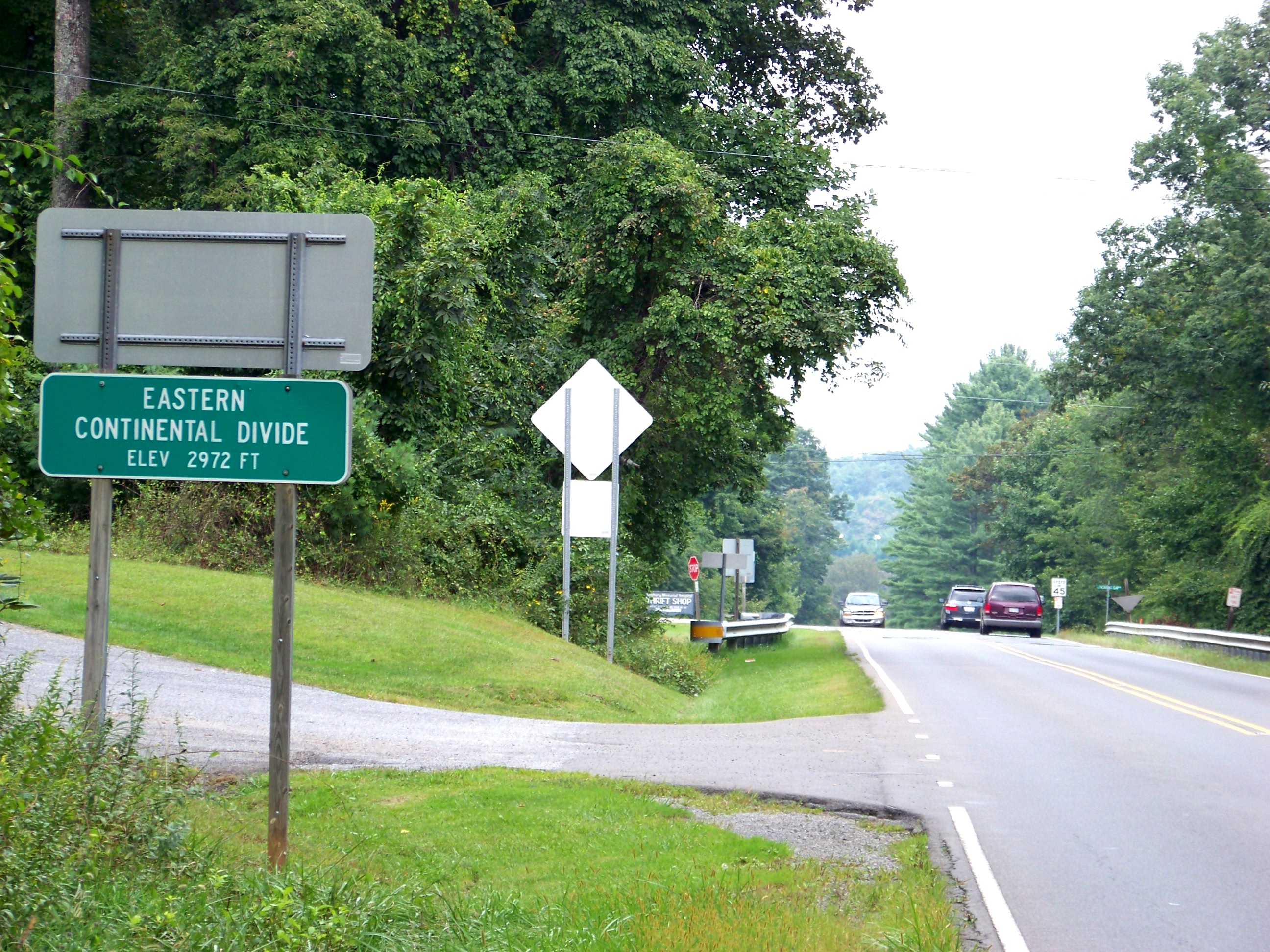
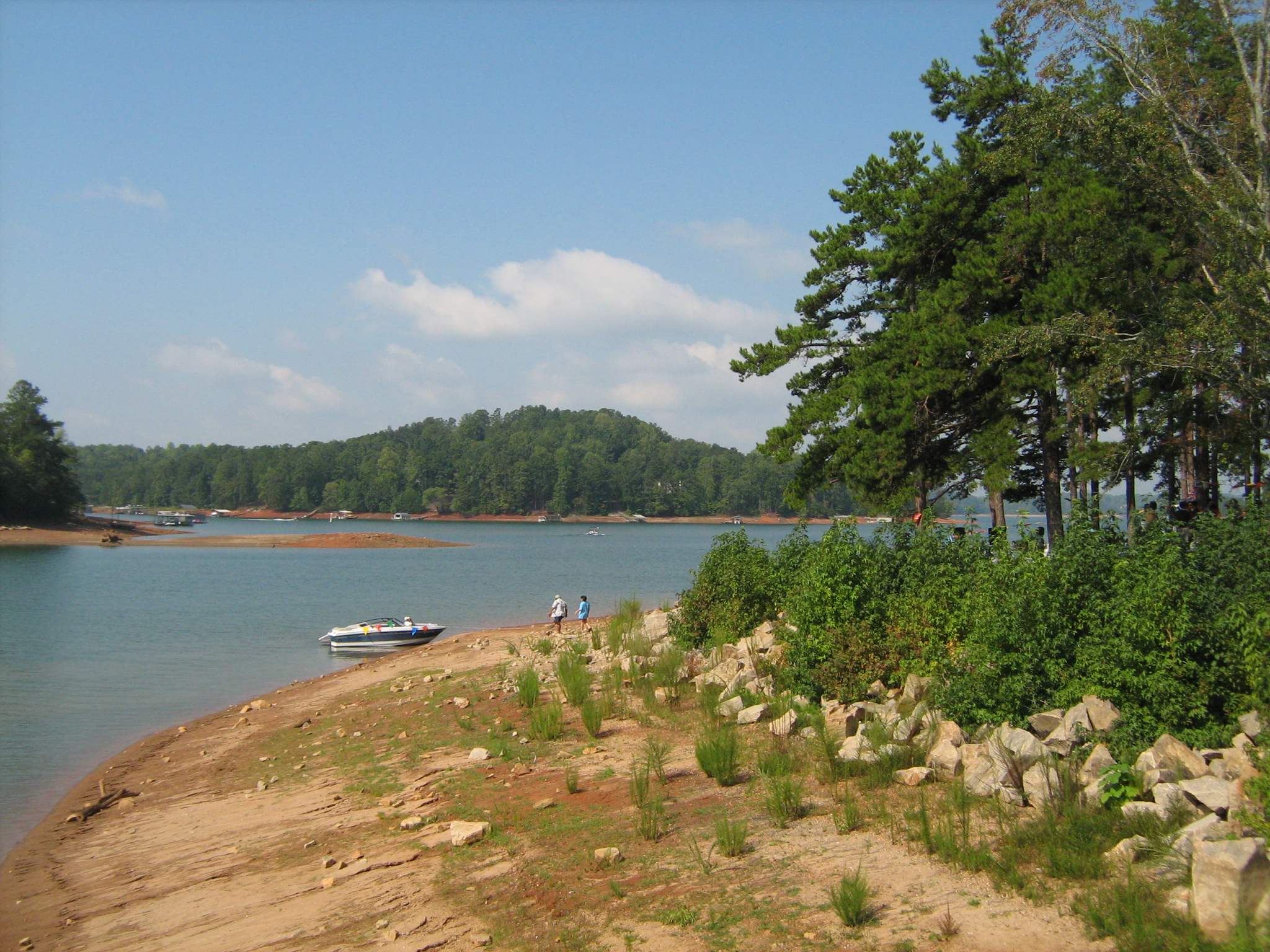
Baldwin is a city in Banks and Habersham counties in the U.S. state of Georgia. As of the 2010 census, the city had a population of 3,279, up from 2,425 at the 2000 census. Baldwin is located on U.S. Route 441 just south of Georgia State Route 365. Baldwin sits astride the Eastern Continental Divide, which separates waters flowing southeastward toward the Savannah River and the Atlantic Ocean from waters flowing southwestward toward the Chattahoochee River and the Gulf of Mexico. City Hall sits in Habersham County. Baldwin borders the slightly larger city of Cornelia, which houses the Habersham Chamber of Commerce. Nearby in Demorest is Piedmont University. Also nearby is Lake Russell, a recreation area in Chattahoochee National Forest. The Habersham County airport is in Baldwin. The largest employer is Fieldale Corporation, a chicken processing company. Geography Baldwin is located in northeastern Georgia at , split between Banks and Habersham County. It is located along ... [...More Info...] [...Related Items...] OR: [Wikipedia] [Google] [Baidu] |
City
A city is a human settlement of notable size.Goodall, B. (1987) ''The Penguin Dictionary of Human Geography''. London: Penguin.Kuper, A. and Kuper, J., eds (1996) ''The Social Science Encyclopedia''. 2nd edition. London: Routledge. It can be defined as a permanent and densely settled place with administratively defined boundaries whose members work primarily on non-agricultural tasks. Cities generally have extensive systems for housing, transportation, sanitation, utilities, land use, production of goods, and communication. Their density facilitates interaction between people, government organisations and businesses, sometimes benefiting different parties in the process, such as improving efficiency of goods and service distribution. Historically, city-dwellers have been a small proportion of humanity overall, but following two centuries of unprecedented and rapid urbanization, more than half of the world population now lives in cities, which has had profound consequences for ... [...More Info...] [...Related Items...] OR: [Wikipedia] [Google] [Baidu] |
Eastern Continental Divide
The Eastern Continental Divide, Eastern Divide or Appalachian Divide is a hydrographic divide in eastern North America that separates the easterly Atlantic Seaboard watershed from the westerly Gulf of Mexico watershed. The divide nearly spans the United States from south of Lake Ontario through the Florida peninsula, and consists of raised terrain including the Appalachian Mountains to the north, the southern Piedmont Plateau and lowland ridges in the Atlantic Coastal Plain to the south. Water including rainfall and snowfall, lakes, streams and rivers on the eastern/southern side of the divide drains to the Atlantic Ocean; water on the western/northern side of the divide drains to the Gulf of Mexico. The ECD is one of six continental hydrographic divides of North America which define several drainage basins, each of which drains to a particular body of water. __TOC__ Course The Eastern Triple Divide is the northern terminus of the Eastern Continental Divide where it int ... [...More Info...] [...Related Items...] OR: [Wikipedia] [Google] [Baidu] |
Blue Ridge Mountains
The Blue Ridge Mountains are a Physiographic regions of the world, physiographic province of the larger Appalachian Mountains range. The mountain range is located in the Eastern United States, and extends 550 miles southwest from southern Pennsylvania through Maryland, West Virginia, Virginia, North Carolina, South Carolina, Tennessee, and Georgia (U.S. state), Georgia. This province consists of northern and southern physiographic regions, which divide near the Roanoke River gap. To the west of the Blue Ridge, between it and the bulk of the Appalachians, lies the Great Appalachian Valley, bordered on the west by the Ridge-and-valley Appalachians, Ridge and Valley province of the Appalachian range. The Blue Ridge Mountains are known for having a bluish color when seen from a distance. Trees put the "blue" in Blue Ridge, from the isoprene released into the atmosphere. This contributes to the characteristic haze on the mountains and their perceived color. Within the Blue Ridge prov ... [...More Info...] [...Related Items...] OR: [Wikipedia] [Google] [Baidu] |
Habersham County Airport
Habersham County Airport is a county-owned public-use airport located two nautical miles (3.7 km) southwest of the central business district of Cornelia, in Habersham County, Georgia, United States. Although most U.S. airports use the same three-letter location identifier for the FAA and IATA, this airport is assigned AJR by the FAA but has no designation from the IATA. Facilities and aircraft The airport covers an area of at an elevation of 1,448 feet (441 m) above mean sea level. It has one asphalt paved runway designated 6/24 which measures 5,506 by 100 feet (1,678 x 30 m). For the 12-month period ending May 26, 2009, the airport had 16,000 aircraft operations, an average of 43 per day, all of which were general aviation. At that time there were 61 aircraft based at this airport: 88.5% single-engine, 9.8% multi-engine and 1.6% helicopter A helicopter is a type of rotorcraft in which lift and thrust are supplied by horizontally spinning rotors. This allows t ... [...More Info...] [...Related Items...] OR: [Wikipedia] [Google] [Baidu] |
Gainesville, Georgia
The city of Gainesville is the county seat of Hall County, Georgia, United States. As of the 2020 census, the city had a population of 42,296. Because of its large number of poultry processing plants, it is often called the "Poultry Capital of the World." Gainesville is the principal city of, and is included in, the Gainesville, Georgia Metropolitan Statistical Area, which is included in the Atlanta- Sandy Springs-Gainesville, Georgia Combined Statistical Area. History Gainesville was established as "Mule Camp Springs" by European-American settlers in the early 1800s. Less than three years after the organization of Hall County on December 15, 1818, Mule Camp Springs was renamed "Gainesville" on April 21, 1821. It was named in honor of General Edmund P. Gaines, a hero of the War of 1812 and a noted military surveyor and road-builder. Gainesville was selected to be the county seat and chartered by the Georgia General Assembly on November 30, 1821. A gold rush that began in nearb ... [...More Info...] [...Related Items...] OR: [Wikipedia] [Google] [Baidu] |
Interstate 985
Interstate 985 (I-985) is a auxiliary Interstate Highway in Northeast Georgia. It links the Atlanta metropolitan area to the city of Gainesville via Suwanee. I-985 is also known as the Sidney Lanier Parkway, after the musician and poet, and is also designated as unsigned State Route 419 (SR 419). The roadway was designated as I-985 in 1985. I-985 and SR 365 are concurrent for I-985's entire length, but only the I-985 signs are displayed. I-985 is also concurrent with US Route 23 (US 23) from exit 4 northward. I-985 is the highest-numbered spur route of a north–south Interstate and is second only to I-990, which serves the Buffalo–Niagara Falls metropolitan area. Route description Gwinnett County In Gwinnett County, I-985 begins concurrent with SR 365 at an interchange with I-85 on the southeastern edge of Suwanee. The two highways head northeast to Buford, at an interchange with US 23/ SR 20 (Buford Drive). Here ... [...More Info...] [...Related Items...] OR: [Wikipedia] [Google] [Baidu] |
Georgia State Highway 365
State Route 365 (SR 365) is a state highway that travels within portions of Gwinnett, Hall, Habersham, and Stephens counties. It begins at exit 113 on Interstate 85 (I-85), at the southeastern edge of Suwanee. This is also the southern terminus of I-985. It continues from that point concurrent with I-985 for the entire length of that freeway. Eventually, U.S. Route 23 (US 23) also joins the concurrency. The highway heads northeast through Gainesville and Toccoa, before it terminates at the South Carolina state line, southwest of Westminster, South Carolina. Route description Gwinnett County In Gwinnett County, SR 365 begins concurrent with I-985 at an interchange with I-85 on the southeastern edge of Suwanee. The two highways head northeast to Buford, at an interchange with US 23/ SR 20 (Buford Drive N.E.). Here, US 23 joins the concurrency. Hall County The three routes head northeast into Hall County and have an intercha ... [...More Info...] [...Related Items...] OR: [Wikipedia] [Google] [Baidu] |
Chattahoochee National Forest
The Chattahoochee River forms the southern half of the Alabama and Georgia border, as well as a portion of the Florida - Georgia border. It is a tributary of the Apalachicola River, a relatively short river formed by the confluence of the Chattahoochee and Flint rivers and emptying from Florida into Apalachicola Bay in the Gulf of Mexico. The Chattahoochee River is about long. The Chattahoochee, Flint, and Apalachicola rivers together make up the Apalachicola–Chattahoochee–Flint River Basin (ACF River Basin). The Chattahoochee makes up the largest part of the ACF's drainage basin. Course The source of the Chattahoochee River is located in Jacks Gap at the southeastern foot of Jacks Knob, in the very southeastern corner of Union County, in the southern Blue Ridge Mountains, a subrange of the Appalachian Mountains. The headwaters of the river flow south from ridges that form the Tennessee Valley Divide. The Appalachian Trail crosses the river's uppermost headwaters. The Ch ... [...More Info...] [...Related Items...] OR: [Wikipedia] [Google] [Baidu] |
Piedmont University
Piedmont University is a private university in Demorest and Athens, Georgia. Founded in 1897, Piedmont's Demorest campus includes 300 acres in a traditional residential-college setting located in the foothills of the northeast Georgia Blue Ridge mountains. Total enrollment is approximately 2,571 students and the campus includes ten dormitories housing more than 720 students. Piedmont College offers more than 50 undergraduate academic programs in the Schools of Arts & Sciences, Business, Education, and Nursing & Health Sciences. Students may earn Bachelor of Arts (BA), Bachelor of Fine Arts (BFA), Bachelor of Science (BS), or Bachelor of Science in Nursing (BSN) degrees. Graduate programs include Master of Business Administration (MBA), Master of Arts (MA) and Master of Arts in Teaching (MAT), Education Specialist (EdS), and Doctor of Education (EdD). History The college opened as the J.S. Green Collegiate Institute in 1897, founded by residents of Habersham County, Georgia. T ... [...More Info...] [...Related Items...] OR: [Wikipedia] [Google] [Baidu] |
Demorest, Georgia
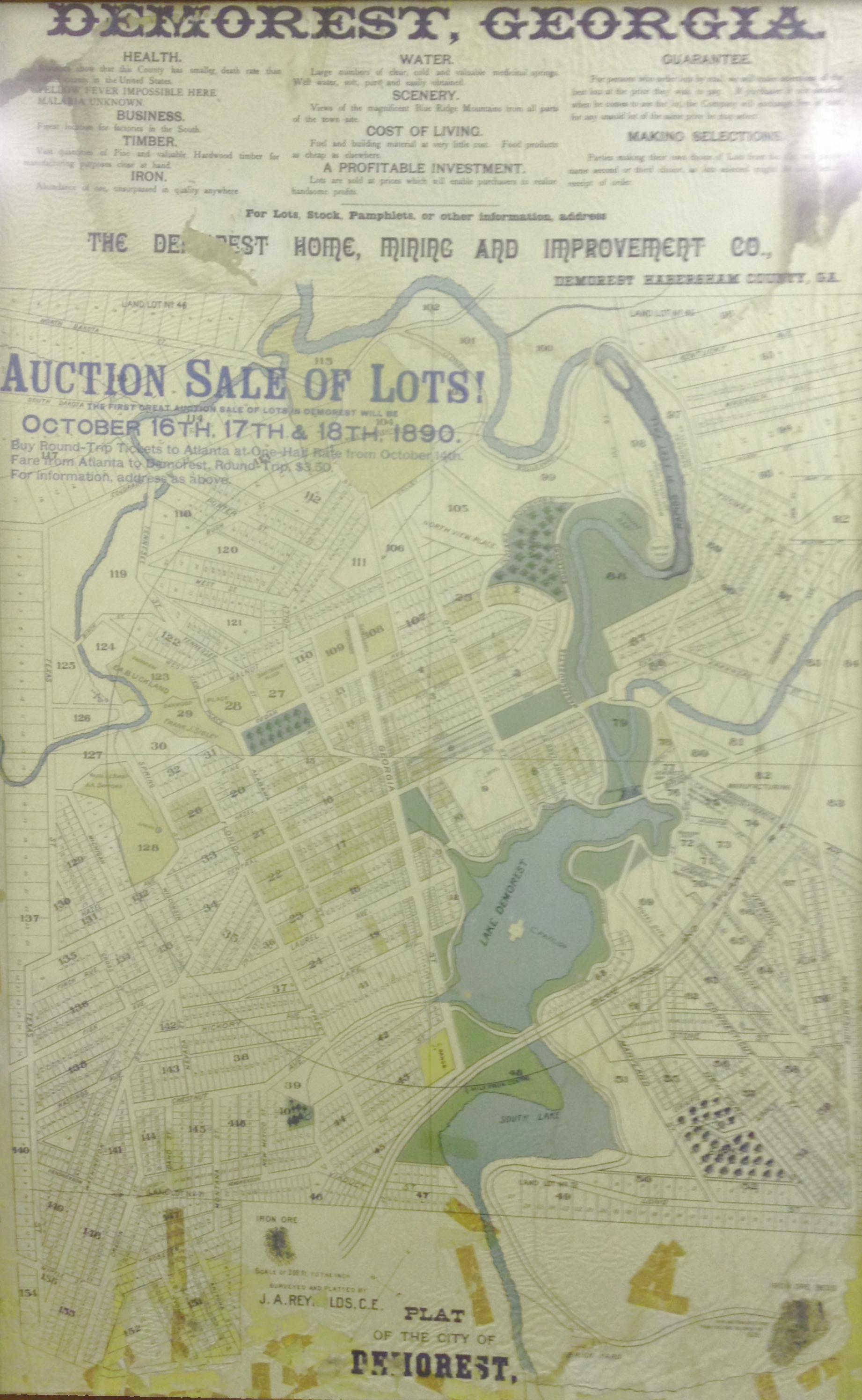
Demorest is a city in Habersham County, Georgia, United States. The population was 1,823 at the 2010 census, up from 1,465 at the 2000 census. It is the home of Piedmont University. Geography Demorest is located in south-central Habersham County at (34.564948, -83.543920). U.S. Route 441 Business (signed "U.S. 441 Historic Route") runs through the center of town as Central Avenue, leading north to Clarkesville, the county seat, and south 4 miles to Cornelia. According to the United States Census Bureau, Demorest has a total area of , of which are land and , or 1.28%, are water. Demographics 2020 census As of the 2020 United States Census, there were 2,022 people, 664 households, and 395 families residing in the city. 2000 census As of the 2000 census, there were 1,465 people, 498 households, and 292 families residing in the city. The population density was . There were 564 housing units at an average density of . The racial makeup of the city was 92.70% White, 3.9 ... [...More Info...] [...Related Items...] OR: [Wikipedia] [Google] [Baidu] |
Cornelia, Georgia
Cornelia is a city in Habersham County, Georgia, United States. The population was 4,160 at the 2010 census, up from 3,674 at the 2000 census. It is home to one of the world's largest apple sculptures, which is displayed on top of an obelisk-shaped monument. Cornelia was the retirement home of baseball legend Ty Cobb who was born nearby, and was a base of operation for production of the 1956 Disney film ''The Great Locomotive Chase'' that was filmed along the Tallulah Falls Railway that ran from Cornelia northward along the rim of Tallulah Gorge to Franklin, North Carolina. Geography Cornelia is located in southern Habersham County at (34.513716, -83.530942). It is bordered to the east by Mount Airy and to the southwest by Baldwin. According to the United States Census Bureau, the city has a total area of , of which , or 1.06%, are water. Climate History Cornelia was originally called "Blaine", and under the latter name had its start in the early 1870s when the Charlotte A ... [...More Info...] [...Related Items...] OR: [Wikipedia] [Google] [Baidu] |
Gulf Of Mexico
The Gulf of Mexico ( es, Golfo de México) is an ocean basin and a marginal sea of the Atlantic Ocean, largely surrounded by the North American continent. It is bounded on the northeast, north and northwest by the Gulf Coast of the United States; on the southwest and south by the Mexican states of Tamaulipas, Veracruz, Tabasco, Campeche, Yucatan, and Quintana Roo; and on the southeast by Cuba. The Southern U.S. states of Texas, Louisiana, Mississippi, Alabama, and Florida, which border the Gulf on the north, are often referred to as the " Third Coast" of the United States (in addition to its Atlantic and Pacific coasts). The Gulf of Mexico took shape approximately 300 million years ago as a result of plate tectonics.Huerta, A.D., and D.L. Harry (2012) ''Wilson cycles, tectonic inheritance, and rifting of the North American Gulf of Mexico continental margin.'' Geosphere. 8(1):GES00725.1, first published on March 6, 2012, The Gulf of Mexico basin is roughly ov ... [...More Info...] [...Related Items...] OR: [Wikipedia] [Google] [Baidu] |


