|
Ballyliffin
Ballyliffin () is a small village located at the north-western tip of Inishowen, County Donegal, Ireland. The surrounding landscape includes Pollan Strand, Binion Hill and Crockaughrim hill. History Local history of the area is covered in Charles McGlinchey's publication, ‘The Last of the Name’. It includes accounts of feuds between landlords and tenants, battles and other nuances. Places of interest A small island off Pollan Bay called Glashedy is located roughly one mile off the coast. The English translation of the name is the ''Island of the Green Cloak'' derived from the layer of grass present on the top. Throughout the ages various ships have become wrecked near to the island, which provide rich fishing grounds and also contributed the rat population to the island. Isle of Doagh is also nearby, though no longer separate from the mainland. Transport Ballyliffin railway station opened on 1 July 1901, but finally closed on 2 December 1935. It is now a private resid ... [...More Info...] [...Related Items...] OR: [Wikipedia] [Google] [Baidu] |
Ballyliffin Golf Club
Ballyliffin Golf Club () is a golf club located in Ballyliffin, County Donegal, Ireland. History The club was founded in 1947. It hosted the 1998 Ladies Irish Open. It hosted the Irish Open in 2018. It hosted The Amateur Championship in 2024. Course record The course record was 67, set by Jean-François Lucquin in 2002, before Rory McIlroy shot a 66 in 2006. The course record was eventually broken again in the 2018 Events January * January 1 – Bulgaria takes over the Presidency of the Council of the European Union, after the Estonian presidency. * January 4 – SPLM-IO rebels loyal to Chan Garang Lual start a raid against Juba, capital of ... Irish Open when Erik van Rooyen, Andy Sullivan and Jorge Campillo all carded rounds of 65 to share the honour of owning the course record on the Glashedy Links. Scorecards Glashedy Links – Championship tees Old Links – Championship tees See also * Royal Portrush Golf Club * Portstewart Golf Club ... [...More Info...] [...Related Items...] OR: [Wikipedia] [Google] [Baidu] |
Ballyliffin Railway Station
Ballyliffin railway station served Ballyliffin in County Donegal, Ireland. Built by the Londonderry & Lough Swilly Railway Company, the railway station was in use from 1901 to 1935. History The station opened on 1 July 1901 on the Londonderry and Lough Swilly Railway line from Londonderry Graving Dock to Carndonagh. The station closed for passengers on 2 December 1935. It is now privately owned. Architecture According to its entry in the National Inventory of Architectural Heritage The National Inventory of Architectural Heritage (NIAH) maintains a central database of the architectural heritage of the Republic of Ireland covering the period since 1700 in complement to the Archaeological Survey of Ireland, which focuses on arc ... (NIAH), the building is a "typical example of the railway stations along the Tooban to Carndonagh line". It has a pitched slate roof, red brick chimneystacks, and yellow brick detailing. The NIAH entry states that it retains a number of "origina ... [...More Info...] [...Related Items...] OR: [Wikipedia] [Google] [Baidu] |
Irish Open (golf)
The Irish Open currently titled as the Amgen Irish Open for sponsorship reasons, is a professional golf tournament on the European Tour. The Irish Open was first played in 1927 and was played annually, except for the war years, until 1950. There was a tournament in 1953, but the event was then not played again until revived in 1975. It has been contested annually since then. From 1963 to 1974 Carroll's sponsored a tournament, generally called the Carroll's International and in 1975 they became the sponsor of the Irish Open which became known as the Carroll's Irish Open. History The first Irish Open in 1927 was played at Portmarnock Golf Club from 16 to 18 August. There were 18 holes played on the first two days with the leading 60 players and ties playing a further 36 holes on the final day. In a stiff breeze local professional Willie Nolan led after the first day with a course record 72. On the second day Nolan faded after an 83 and the lead was taken by Henry Cotton on 14 ... [...More Info...] [...Related Items...] OR: [Wikipedia] [Google] [Baidu] |
Inishowen
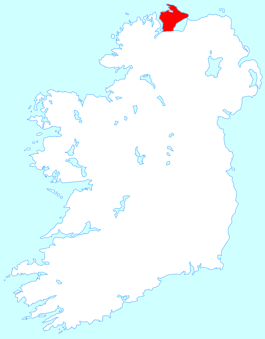
Inishowen () is a peninsula in the north of County Donegal in Ireland. Inishowen is the largest peninsula on the island of Ireland. The Inishowen peninsula includes Ireland's most northerly point, Malin Head. The Grianan of Aileach, a ringfort that served as the royal seat of the over-kingdom of Ailech, stands at the entrance to the peninsula. Towns and villages The main towns and villages of Inishowen are: * Ballyliffin, Buncrana, Bridgend, Burnfoot, Burt * Carndonagh, Carrowmenagh, Clonmany, Culdaff * Dunaff * Fahan * Glengad, Gleneely, Greencastle * Malin, Malin Head, Moville, Muff * Redcastle * Shrove * Quigley's Point * Urris Geography Inishowen is a peninsula of 884.33 square kilometres (218,523 acres), situated in the northernmost part of the island of Ireland. It is bordered to the north by the Atlantic Ocean, to the east by Lough Foyle, and to the west by Lough Swilly. It is joined at the south to the rest of the island and is mostly in County Don ... [...More Info...] [...Related Items...] OR: [Wikipedia] [Google] [Baidu] |
Nick Faldo
Sir Nicholas Alexander Faldo (born 18 July 1957) is an English retired professional golfer and television commentator. Widely regarded as one of the greatest players of all time, he was renowned for his dedication to the game, and was ranked No. 1 on the Official World Golf Ranking for a total of 97 weeks. His 41 professional wins include 30 victories on the European Tour and six Men's major golf championships, major championships: three The Open Championship, Open Championships (1987, 1990, 1992) and three Masters Tournament, Masters (1989, 1990, 1996). Faldo has since become a television commentator for major golf championships. In 2006, he became the lead golf analyst for PGA Tour on CBS, CBS Sports. In 2012, Faldo joined the BBC Sport on-air team for coverage of the Open Championship. Early life Faldo was born in Welwyn Garden City, Hertfordshire, England, in 1957, as the only child of Joyce and George Faldo, an accountant at Imperial Chemical Industries. Responding to sugges ... [...More Info...] [...Related Items...] OR: [Wikipedia] [Google] [Baidu] |
Glashedy
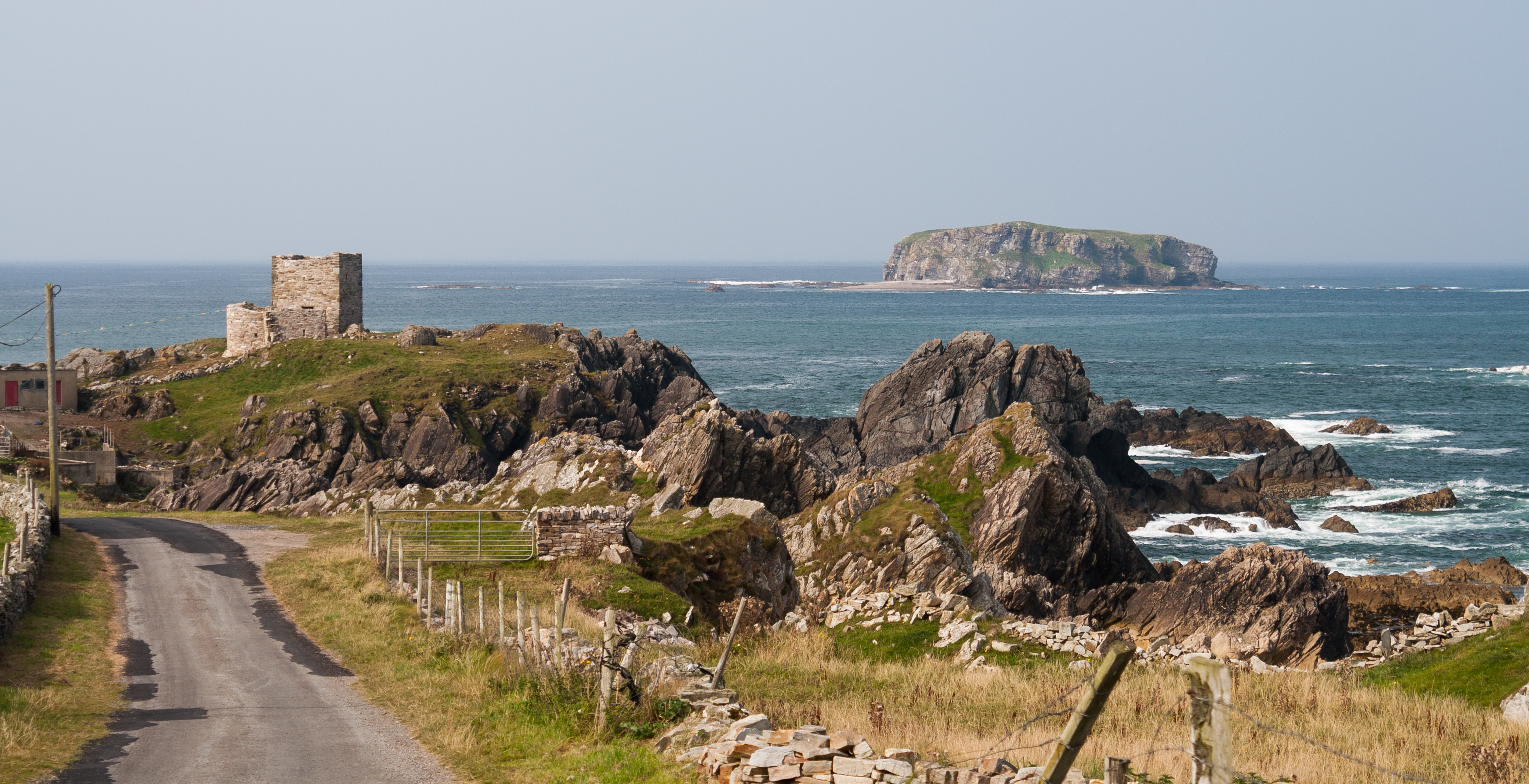
Glashedy Island () is an uninhabited island approximately off Pollan strand, west of Trawbreaga Bay, and about south of Malin Head, Donegal, Ireland. Glashedy Island has an area of 22,548 m2 which is equivalent to 2.25 hectares (5.57 acres / 5 acres, 2 roods, 11 perches). At its highest point, it is 119 ft high. The sea around the island is potentially very dangerous for shipping and unsafe for anchorage. Rocks and breakers extend up to 1,000 metres from all sides of the Island. The waters are relatively shallow at between 4 and 5 fathoms. The shoals to the north of the island are particularly treacherous, lying at a depth of just 3 fathoms. Glashedy Sound is the channel between the island and the shore. It is also shallow. The island contains a number of caves. The island principally comprises quartzite. Etymology Its former name until the early 17th century was Seale Island. The English translation of the name is the ''Island of the Green Cloak'' derived from the la ... [...More Info...] [...Related Items...] OR: [Wikipedia] [Google] [Baidu] |
Eddie Hackett
Eddie Hackett (1910–1996) was an Irish golf course architect. Eddie Hackett was born in Dublin, Ireland in 1910. As a boy he suffered from tuberculosis, the effects of which left him without the strength or stamina to play active sports. He began playing golf with his father, and as a teenager got a job at his home club Royal Dublin Golf Club. By the 1930s, he had worked his way up as a golf professional, making clubs and competing in tournaments. In 1939, he became the head golf professional at Portmarnock Golf Club. Design philosophy Unlike the better-known of Hackett's contemporary golf course architects like Pete Dye and Robert Trent Jones, who commonly move tons of soil to create their courses, Hackett worked like the architects of a bygone era, laying out a course on the land as he found it. As Hackett said himself, "I find that nature is the best architect . . . I try to dress up what the Good Lord provides". While his designs show his appreciation of the classic Scotti ... [...More Info...] [...Related Items...] OR: [Wikipedia] [Google] [Baidu] |
Isle Of Doagh
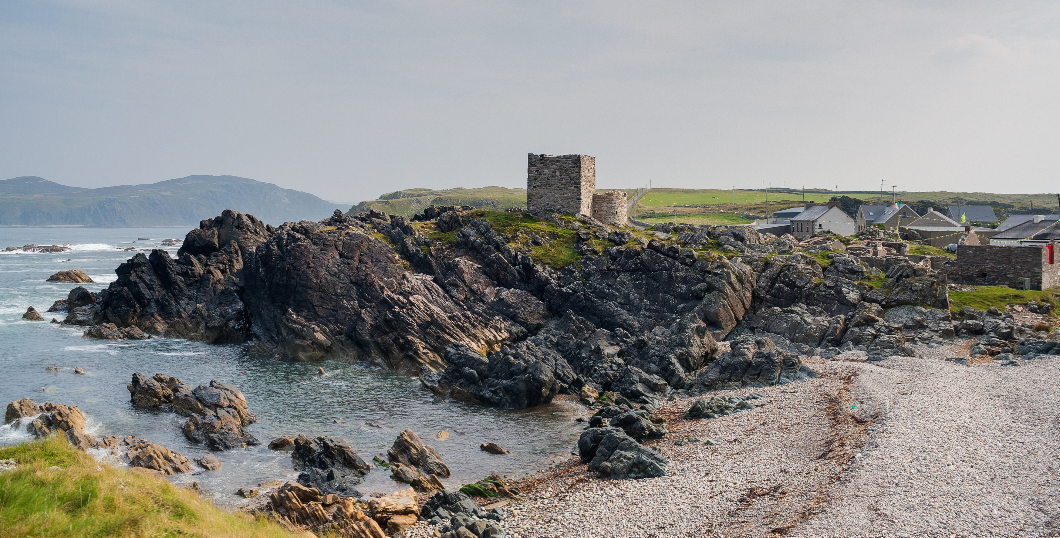
The Isle of Doagh (Irish: ''Oileán na Dumhcha'', meaning "Isle of the Dune"; also known in English as Doagh Isle or Doagh Island) is a small peninsula in the north of Inishowen on the north coast of County Donegal in Ulster, Ireland. It once was an island. Over time, the channel between Doagh and the mainland silted up and it became joined to the mainland. Nevertheless, the area continued to be referred as the Isle of Doagh or Doagh Island. The area comprises five townlands; Ballymacmoriarty, Carrickabraghy, Carrowreagh, Fegart and Lagacurry. Doagh Island is very near the village of Ballyliffin. The ruins of Carrickabraghy Castle stands at the north-western extremity of the peninsula. History Neolithic period The Isle of Doagh has one of the largest clusters of rock art sites in Ireland. The markings are around 4000–5000 years old. Early medieval period The Island was a stronghold of the Lords of ''Carraig Bhrachai'' who were part of the ''Ó Maolfabhail'' sept (an ... [...More Info...] [...Related Items...] OR: [Wikipedia] [Google] [Baidu] |
List Of Populated Places In The Republic Of Ireland
This is a link page for cities, towns and villages in the Republic of Ireland, including townships or urban centres in Dublin, Cork, Limerick, Galway, Waterford and other major urban areas. Cities are shown in bold; see City status in Ireland for an independent list. __NOTOC__ A B C D E F G H I J K L M N O P Q R S T U V W Y See also *List of places in Ireland ** List of places in the Republic of Ireland **List of urban areas in the Republic of Ireland as defined by the Central Statistics Office. Includes non-municipal towns and suburbs outside municipal boundaries *** List of urban areas in the Republic of Ireland/2011 census *** List of urban areas in the Republic of Ireland/2006 census *** List of urban areas in the Republic of Ireland/2002 census ** List of cities, boroughs and towns in the Republic of Ireland, with municipal councils and legally defined boundaries up to 2014 * ... [...More Info...] [...Related Items...] OR: [Wikipedia] [Google] [Baidu] |
County Donegal
County Donegal ( ; ) is a Counties of Ireland, county of the Republic of Ireland. It is in the Provinces of Ireland, province of Ulster and is the northernmost county of Ireland. The county mostly borders Northern Ireland, sharing only a small border with the rest of the Republic. It is named after the town of Donegal (town), Donegal in the south of the county. It has also been known as County Tyrconnell or Tirconaill (), after Tyrconnell, the historical territory on which it was based. Donegal County Council is the local government in the Republic of Ireland, local council and Lifford is the county town. The population was 167,084 at the 2022 census of Ireland, 2022 census. Name County Donegal is named after the town of Donegal (town), Donegal () in the south of the county. It has also been known by the alternative name County Tyrconnell or Tirconaill (, meaning 'Land of Conall Gulban, Conall'). The latter was its official name between 1922 and 1927. This is in reference to th ... [...More Info...] [...Related Items...] OR: [Wikipedia] [Google] [Baidu] |
Irish Grid Reference System
The Irish grid reference system is a system of geographic grid references used for paper mapping in Ireland (both Northern Ireland and the Republic of Ireland). Any location in Ireland can be described in terms of its distance from the origin (0, 0), which lies off the southwest coast. The Irish grid partially overlaps the British grid, and uses a similar co-ordinate system but with a meridian more suited to its westerly location. Usage In general, neither Ireland nor Great Britain uses latitude or longitude in describing internal geographic locations. Instead grid reference systems are used for mapping. The national grid referencing system was devised by the Ordnance Survey, and is heavily used in their survey data, and in maps (whether published by the Ordnance Survey of Ireland, the Ordnance Survey of Northern Ireland or commercial map producers) based on those surveys. Additionally grid references are commonly quoted in other publications and data sources, such as guide ... [...More Info...] [...Related Items...] OR: [Wikipedia] [Google] [Baidu] |
Department Of Arts, Heritage And The Gaeltacht
The Department of Culture, Communications and Sport () is a department of the Government of Ireland. The mission of the department is to promote and develop Ireland's tourism, culture, and art; and to advance the use of the Irish language, including the development of the Gaeltacht. It is led by the Minister for Culture, Communications and Sport. Departmental team The official headquarters and ministerial offices of the department are on Kildare Street, Dublin. The department also has offices in South Frederick Street in Dublin, Na Forbacha in Galway and in New Road, Killarney, County Kerry. The departmental team consists of the following: * Minister for Culture, Communications and Sport: Patrick O'Donovan, TD ** Minister of State for sport and postal policy: Charlie McConalogue, TD *Secretary General of the Department: Feargal Ó Coigligh Overview In carrying out its mandate the department undertakes a variety of functions including: *formulation, development and evaluat ... [...More Info...] [...Related Items...] OR: [Wikipedia] [Google] [Baidu] |


