|
Ayikel
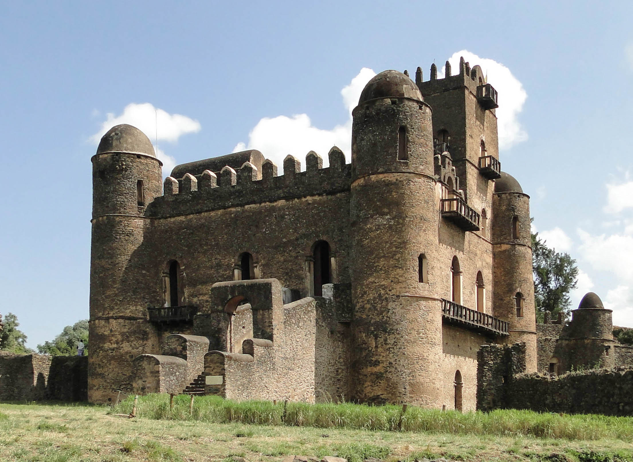
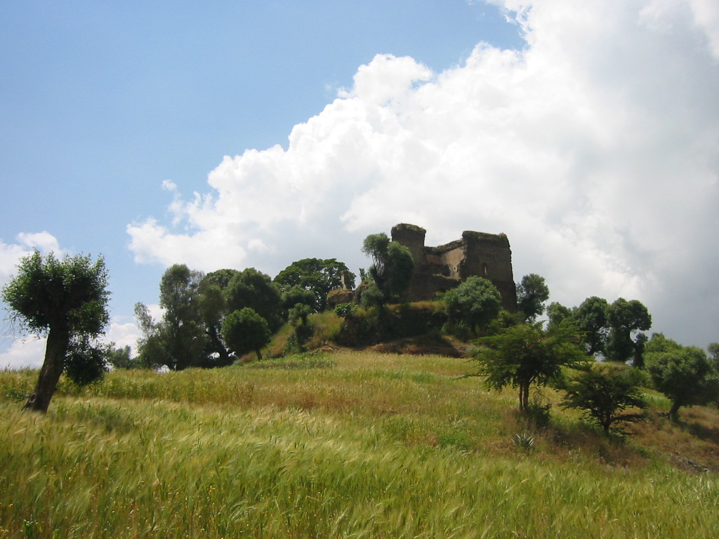
Ayikel (Amharic: አይከል), also known as Chilga is a town in western Ethiopia. Located in the Semien Gondar Zone of the Amhara Region, it has a latitude and longitude of with an altitude of 2146 meters above sea level. The settlement is situated on the east–west road connecting Gondar with Metemma, and is the administrative center of Chilga woreda. Ayikel is mentioned, by its older name of "Chilga", by James Bruce, as a marketplace on the border between the Kingdom of Sennar and Ethiopia which was under their shared administration, and over which Emperor Susenyos in 1606 appointed the deposed king of Senaar, Abd al-Qadir as governor. Demographics Based on figures from the Central Statistical Agency The Central Statistical Agency (CSA; Amharic: ማዕከላዊ ስታቲስቲክስ ኤጀንሲ) is an agency of the government of Ethiopia designated to provide all surveys and censuses for that country used to monitor economic and social grow ... in 2005, this town has ... [...More Info...] [...Related Items...] OR: [Wikipedia] [Google] [Baidu] |
Chilga
Chilga (Amharic: ጭልጋ ''č̣ilgā'') also Chelga, Ch'ilga is a woreda in Amhara Region, Ethiopia. It is named after its chief town Chilga (also known as Ayikel), an important stopping point on the historic Gondar- Sudan trade route. Part of the Maekelawi Gondar Zone, Chilga is bordered on the south by Takusa, on the west by Metemma, on the north by Tach Armachiho, on the northeast by Lay Armachiho, and on the east by Dembiya. Other towns in Chilga include Seraba and Wohni. Overview Elevations in this woreda range between 1000 and 1500 meters above sea level. Rivers include the Atbarah. A survey of the land in this woreda shows that 21.7% is arable or cultivable, 1.9% pasture, 22.3% forest or shrubland, and the remaining 54.1% is considered degraded or other. This survey covered more of the woreda than the sample enumeration performed by the Central Statistical Agency (CSA) in 2001. One notable landmark in this woreda is the archeological site at Chilga Kernet, which ... [...More Info...] [...Related Items...] OR: [Wikipedia] [Google] [Baidu] |
Abd Al-Qadir II
Abd al-Qadir II was a ruler of the Kingdom of Sennar (1603/4 - 1606). According to James Bruce, he was the son of Unsa I, whom Bruce describes as "a weak and ill-inclined man". While he was ruler of Sennar, Emperor Susenyos of Ethiopia sent to Abd al-Qadir a ''nagarit'', or kettle-drum, richly decorated with gold, which was one of the traditional emblems of an Ethiopian negus or king; in return, Abd al-Qadir sent Susenyos a trained hunting falcon. Shortly after this diplomatic exchange, he was deposed by his brother Adlan. At some point following his deposition from the throne in 1606, Emperor Susenyos of Ethiopia appointed him governor of Chilga (also known as Ayikel Ayikel (Amharic: አይከል), also known as Chilga is a town in western Ethiopia. Located in the Semien Gondar Zone of the Amhara Region, it has a latitude and longitude of with an altitude of 2146 meters above sea level. The settlement is situa ...), an important market town near the Ethiopian border with Sennar ... [...More Info...] [...Related Items...] OR: [Wikipedia] [Google] [Baidu] |
Amharic
Amharic ( or ; (Amharic: ), ', ) is an Ethiopian Semitic language, which is a subgrouping within the Semitic branch of the Afroasiatic languages. It is spoken as a first language by the Amharas, and also serves as a lingua franca for all other populations residing in major cities and towns of Ethiopia. The language serves as the official working language of the Ethiopian federal government, and is also the official or working language of several of Ethiopia's federal regions. It has over 31,800,000 mother-tongue speakers, with more than 25,100,000 second language speakers. Amharic is the most widely spoken language in Ethiopia, and the second most spoken mother-tongue in Ethiopia (after Oromo). Amharic is also the second largest Semitic language in the world (after Arabic). Amharic is written left-to-right using a system that grew out of the Geʽez script. The segmental writing system in which consonant-vowel sequences are written as units is called an ''abugida'' (). Th ... [...More Info...] [...Related Items...] OR: [Wikipedia] [Google] [Baidu] |
Ethiopia
Ethiopia, , om, Itiyoophiyaa, so, Itoobiya, ti, ኢትዮጵያ, Ítiyop'iya, aa, Itiyoppiya officially the Federal Democratic Republic of Ethiopia, is a landlocked country in the Horn of Africa. It shares borders with Eritrea to the north, Djibouti to the northeast, Somalia to the east and northeast, Kenya to the south, South Sudan to the west, and Sudan to the northwest. Ethiopia has a total area of . As of 2022, it is home to around 113.5 million inhabitants, making it the 13th-most populous country in the world and the 2nd-most populous in Africa after Nigeria. The national capital and largest city, Addis Ababa, lies several kilometres west of the East African Rift that splits the country into the African and Somali tectonic plates. Anatomically modern humans emerged from modern-day Ethiopia and set out to the Near East and elsewhere in the Middle Paleolithic period. Southwestern Ethiopia has been proposed as a possible homeland of the Afroasiatic la ... [...More Info...] [...Related Items...] OR: [Wikipedia] [Google] [Baidu] |
Semien Gondar Zone
North Gondar ( Amharic: ሰሜን ጎንደር; or Semien Gondar) is a zone in the Amhara Region of Ethiopia. This zone is named for the city of Gondar, the capital of Ethiopia until the mid-19th century. Geography North Gondar is bordered on the south by Central Gonder Zone, on the north by the Tigray Region, and on the east by Wag Hemra. Towns and cities in North Gondar include Arbaya, Dabat, Dembea, Debark, Emfranz, Feres Megria, Musebamb Town, Kurbi, Armachiho, Gondar, Tekeldengy, Gorgora and Metemma. Demographics Based on the 2007 Census conducted by the Central Statistical Agency of Ethiopia (CSA), North Gondar Zone had a total population of 2,929,628, an increase of 40.26% over the 1994 census, of whom 1,486,040 are men and 1,443,588 women; with an area of 45,944.63 square kilometers, North Gondar had a population density of 63.76. While 462,700 or 15.79% are urban inhabitants, a further 2,148 or 0.07% are pastoralists. A total of 654,803 households were counted i ... [...More Info...] [...Related Items...] OR: [Wikipedia] [Google] [Baidu] |
Amhara Region
The Amhara Region ( am, አማራ ክልል, Åmara Kilil), officially the Amhara National Regional State (), is a regional state in northern Ethiopia and the homeland of the Amhara people. Its capital is Bahir Dar which is the seat of the Regional Government of Amhara. Amhara is the site of the largest inland body of water in Ethiopia, Lake Tana (which is the source of the Blue Nile), and Semien Mountains National Park (which includes Ras Dashan, the highest point in Ethiopia). Amhara is bordered by Sudan to the west and northwest and by other the regions of Ethiopia: Tigray to the north, Afar to the east, Benishangul-Gumuz to the west and southwest, and Oromia to the south. History During the Ethiopian Empire, Amhara included several provinces (such as Dembiya, Gojjam, Begemder, Angot, Wollo, Shewa and Lasta), most of which were ruled by native Ras or Negus. The current Amhara region corresponds to often large parts of the former provinces of Begemder, Demb ... [...More Info...] [...Related Items...] OR: [Wikipedia] [Google] [Baidu] |
Gondar
Gondar, also spelled Gonder (Amharic: ጎንደር, ''Gonder'' or ''Gondär''; formerly , ''Gʷandar'' or ''Gʷender''), is a city and woreda in Ethiopia. Located in the North Gondar Zone of the Amhara Region, Gondar is north of Lake Tana on the Lesser Angereb River and southwest of the Simien Mountains. , Gondar has an estimated population of 443,156. Gondar previously served as the capital of both the Ethiopian Empire and the subsequent Begemder Province. The city holds the remains of several royal castles, including those in the Fasil Ghebbi UNESCO World Heritage Site for which Gondar has been called the "Camelot of Africa". History Origins Until the 16th century, the Solomonic Emperors of Ethiopia usually had no fixed capital town, but instead lived in tents in temporary royal camps as they moved around their realms while their family, bodyguard and retinue devoured surplus crops and cut down nearby trees for firewood. One exception to this rule was Debre Be ... [...More Info...] [...Related Items...] OR: [Wikipedia] [Google] [Baidu] |
Metemma
Metemma ( Amharic: መተማ), also known as Metemma Yohannes is a town in northwestern Ethiopia, on the border with Sudan. Located in the Semien Gondar Zone of the Amhara Region, Metemma has a latitude and longitude of with an elevation of 685 meters above sea level. Across the border is the corresponding Sudanese village of Gallabat. According to the British diplomat Hormuzd Rassam, who travelled through Metemma in November 1865 on his diplomatic mission to Emperor Tewodros II, "Metemma" comes from the Arabic for "the place of cutting, or termination -- indicating the end of the Muslim provinces", although at the time the settlement was better known as Suk ul-Gallabat ("The market of Gallabat").Hormuzd Rassam, ''Narrative of the British Mission to Theodore of Abyssinia'' (London, 1869), vol. 1, p. 158 Metemma hosts an airport, ( ICAO code HAMM, IATA ETE). History The town traces its origins to the 18th century, when a colony of Tukrir from Darfur finding the spot a co ... [...More Info...] [...Related Items...] OR: [Wikipedia] [Google] [Baidu] |
Districts Of Ethiopia
Districts of Ethiopia, also called woredas ( am, ወረዳ; ''woreda''), are the third level of the administrative divisions of Ethiopia – after '' zones'' and the '' regional states''. These districts are further subdivided into a number of wards called ''kebele'' neighbourhood associations, which are the smallest unit of local government in Ethiopia. Overview Districts are typically collected together into zones, which form a region; districts which are not part of a zone are designated Special Districts and function as autonomous entities. Districts are governed by a council whose members are directly elected to represent each ''kebele'' in the district. There are about 670 rural districts and about 100 urban districts. Terminology varies, with some people considering the urban units to be ''woreda'', while others consider only the rural units to be ''woreda'', referring to the others as urban or city administrations. Although some districts can be traced back to ear ... [...More Info...] [...Related Items...] OR: [Wikipedia] [Google] [Baidu] |
James Bruce
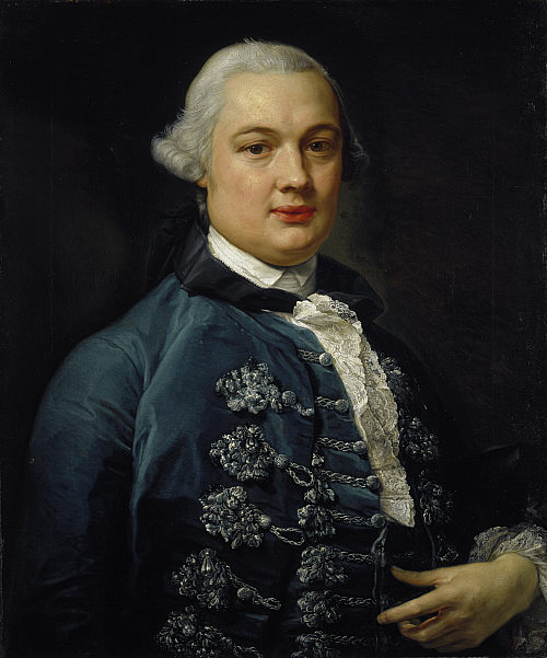
James Bruce of Kinnaird (14 December 1730 – 27 April 1794) was a Scottish traveller and travel writer who confirmed the source of the Blue Nile. He spent more than a dozen years in North Africa and Ethiopia and in 1770 became the first European to trace the origins of the Blue Nile from Egypt and Sudan. Early life James Bruce was born at the family seat of Kinnaird, Stirlingshire, and educated at Harrow School and Edinburgh University, and began to study for the bar, but his marriage to the daughter of a wine importer and merchant resulted in him entering that business instead. His wife died in October 1754, within nine months of marriage, and Bruce thereafter travelled in Portugal and Spain as part of the wine trade. The examination of oriental manuscripts at the Escorial in Spain led him to the study of Arabic and Ge'ez and determined his future career. In 1758 his father's death placed him in possession of the estate of Kinnaird. To North Africa On the outbreak of ... [...More Info...] [...Related Items...] OR: [Wikipedia] [Google] [Baidu] |
Kingdom Of Sennar
The Funj Sultanate, also known as Funjistan, Sultanate of Sennar (after its capital Sennar) or Blue Sultanate due to the traditional Sudanese convention of referring to black people as blue () was a monarchy in what is now Sudan, northwestern Eritrea and western Ethiopia. Founded in 1504 by the Funj people, it quickly converted to Islam, although this embrace was only nominal. Until a more orthodox Islam took hold in the 18th century, the state remained an "African empire with a Muslim façade". It reached its peak in the late 17th century, but declined and eventually fell apart in the 18th and 19th centuries. In 1821, the last sultan, greatly reduced in power, surrendered to the Ottoman Egyptian invasion without a fight. History Origins Christian Nubia, represented by the two medieval kingdoms of Makuria and Alodia, began to decline from the 12th century. By 1365 Makuria had virtually collapsed and was reduced to a petty kingdom restricted to Lower Nubia, until finally di ... [...More Info...] [...Related Items...] OR: [Wikipedia] [Google] [Baidu] |
Susenyos Of Ethiopia
Susenyos I ( gez, ሱስንዮስ ; circa 1571-1575 – 17 September 1632), also known as Susenyos the Catholic, was Emperor of Ethiopia from 1606 to 1632, and a member of the Solomonic dynasty. His throne names were Seltan Sagad and Malak Sagad III. He was the son of ''Abeto'' Fasil, as well as the grandson of ''Abeto'' Yakob and the great-grandson of Dawit II. As a result, while some authorities list Susenyos as a member of the Solomonic dynasty, others consider him—rather than his son, Fasilides—as the founder of the Gondar line of the dynasty (which is, however, ultimately a subset of the Solomonic dynasty). The life of Susenyos is known through his chronicle, written by several official writers (''sehafe te’ezaz''). The Jesuits, who were closely associated with Susenyos’s reign, also left numerous documents on their mission in Ethiopia. Manuel de Almeida, a Portuguese Jesuit who lived in Ethiopia during Susenyos' reign, described the emperor as tall with the fe ... [...More Info...] [...Related Items...] OR: [Wikipedia] [Google] [Baidu] |


