|
Arizona State Route 68
State Route 68, also known as SR 68, is an east–west highway in northwestern Arizona running from its western terminus at its junction with State Route 95 in Bullhead City to a grade-separated interchange at U.S. Route 93 northwest of Kingman. The western terminus formerly extended just to the west of its current point to Davis Dam; this became Mohave County Road 68 in 1998. Route description The primary purpose of this route is to carry traffic to Bullhead City and Laughlin, Nevada. Since September 11, 2001, the highway had also composed part of the mandatory detour for trucks and recreational vehicles traveling between Arizona and Las Vegas, Nevada via US 93, due to the heavy vehicle restrictions over Hoover Dam. The detour was temporary and was removed in 2010, when the new bypass was completed south of the dam . History SR 68 was a 2 lane highway and had a high grade going through the Black Mountains. The highway was expanded to 4 lanes in the mid-1990s and now ... [...More Info...] [...Related Items...] OR: [Wikipedia] [Google] [Baidu] |
Bullhead City, Arizona
Bullhead City is a city located on the Colorado River in Mohave County, Arizona, United States, south of Las Vegas, Nevada, and directly across the Colorado River from Laughlin, Nevada, whose casinos and ancillary services supply much of the employment for Bullhead City. Bullhead City is located at the southern end of Lake Mohave. Feeding homeless people in parks is banned in Bullhead City. As of the 2020 census, the population of Bullhead City was 41,348. The nearby communities of Laughlin, Needles, California, Fort Mohave and Mohave Valley bring the Bullhead area's total population to over 77,000, making it the largest economic region in Mohave County. With over , Bullhead City is the largest city in Mohave County in terms of total land area. In 2011, the Laughlin/Bullhead International Airport was named Airport of the Year by the Arizona Department of Transportation. "More than 115,000 people flew into Laughlin/Bullhead International Airport on casino-sponsored char ... [...More Info...] [...Related Items...] OR: [Wikipedia] [Google] [Baidu] |
Runaway Truck Ramp
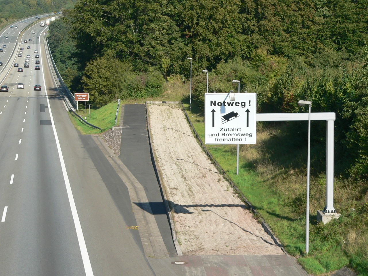
A runaway truck ramp, runaway truck lane, escape lane, emergency escape ramp, or truck arrester bed is a traffic device that enables vehicles which are having braking problems to safely stop. It is typically a long, sand- or gravel-filled lane connected to a steep downhill grade section of a main road, and is designed to accommodate large trucks or buses. It allows a moving vehicle's kinetic energy to be dissipated gradually in a controlled and relatively harmless way, helping the operator stop it safely. Design Emergency escape ramps are usually located in mountainous areas which cause high construction costs and present difficult site selection. A ramp may cost US$1 million. Designs include: *''Arrester bed'': a gravel-filled ramp adjacent to the road that uses rolling resistance to stop the vehicle. The required length of the bed depends on the mass and speed of the vehicle, the grade of the arrester bed, and the rolling resistance provided by the gravel. *''Gravity escape ... [...More Info...] [...Related Items...] OR: [Wikipedia] [Google] [Baidu] |
Laughlin/Bullhead International Airport
Laughlin/Bullhead International Airport is a public use airport located north of the central business district of Bullhead City, in Mohave County, Arizona, United States. It is owned by Mohave County. The airport is across the Colorado River and one block away from Laughlin, Nevada. Many of the rooms at Laughlin's casino-hotels offer a view of the airport. It was named ''2011 Airport of the Year'' by the Arizona Department of Transportation. This facility is included in the National Plan of Integrated Airport Systems, which categorized it as a ''primary commercial service'' airport (more than 10,000 enplanements per year). As per Federal Aviation Administration records, the airport had 122,192 passenger boardings (enplanements) in calendar year 2008, 107,595 enplanements in 2009, and 121,468 in 2010. History In 1943, land was purchased from the state of Arizona for construction of Davis Dam power plant that was initiated by the Bureau of Reclamation in 1947. In 1943, the a ... [...More Info...] [...Related Items...] OR: [Wikipedia] [Google] [Baidu] |
Needles, California
Needles is a city in San Bernardino County, California, in the Mojave Desert region of Southern California. Situated on the western banks of the Colorado River, Needles is located near the Californian border with Arizona and Nevada. The city is accessible via Interstate 40 and U.S. Route 95. The population was 4,959 at the 2020 census, up from 4,844 at the 2010 census. History Needles was founded in May 1883 during the construction of the Atchison, Topeka and Santa Fe Railway, which originally crossed the Colorado River at Eastbridge, Arizona three miles southeast of modern Needles. Needles was named after "The Needles", a group of Pinnacle (geology), pinnacles in the Mohave Mountains on the Arizona side of the river. However, the crossing was a poor site for a bridge, lacking firm banks and a solid bottom. A bridge was actually built, but it was of poor quality. Not only was it a "flimsy looking structure", but it was also an obstacle to navigation on the river. The flo ... [...More Info...] [...Related Items...] OR: [Wikipedia] [Google] [Baidu] |
YouTube
YouTube is a global online video sharing and social media platform headquartered in San Bruno, California. It was launched on February 14, 2005, by Steve Chen, Chad Hurley, and Jawed Karim. It is owned by Google, and is the second most visited website, after Google Search. YouTube has more than 2.5 billion monthly users who collectively watch more than one billion hours of videos each day. , videos were being uploaded at a rate of more than 500 hours of content per minute. In October 2006, YouTube was bought by Google for $1.65 billion. Google's ownership of YouTube expanded the site's business model, expanding from generating revenue from advertisements alone, to offering paid content such as movies and exclusive content produced by YouTube. It also offers YouTube Premium, a paid subscription option for watching content without ads. YouTube also approved creators to participate in Google's AdSense program, which seeks to generate more revenue for both parties ... [...More Info...] [...Related Items...] OR: [Wikipedia] [Google] [Baidu] |
Motor Trend
''MotorTrend'' is an American automobile magazine. It first appeared in September 1949, and designated the first Car of the Year, also in 1949. Petersen Publishing Company in Los Angeles published ''MotorTrend'' until 1998, when it was sold to British publisher EMAP, who then sold the former Petersen magazines to Primedia in 2001. MotorTrend bears the tagline "The Magazine for a Motoring World". As of 2019 it is published by Motor Trend Group. It has a monthly circulation of over one million. Contents and sections The contents of ''MotorTrend'' magazines are divided up into sections, or departments. Road tests ''MotorTrend'' magazine provides its readers with written "road tests" of vehicles. These road tests are published monthly, and are meant to give readers information about the featured vehicle, certain aspects of the vehicle, and what the readers can expect if the featured vehicle is purchased. Vehicle comparisons There are two main types of ''MotorTrend'' vehicle compa ... [...More Info...] [...Related Items...] OR: [Wikipedia] [Google] [Baidu] |
Grade (slope)
The grade (also called slope, incline, gradient, mainfall, pitch or rise) of a physical feature, landform or constructed line refers to the tangent of the angle of that surface to the horizontal. It is a special case of the slope, where zero indicates horizontality. A larger number indicates higher or steeper degree of "tilt". Often slope is calculated as a ratio of "rise" to "run", or as a fraction ("rise over run") in which ''run'' is the horizontal distance (not the distance along the slope) and ''rise'' is the vertical distance. Slopes of existing physical features such as canyons and hillsides, stream and river banks and beds are often described as grades, but typically grades are used for human-made surfaces such as roads, landscape grading, roof pitches, railroads, aqueducts, and pedestrian or bicycle routes. The grade may refer to the longitudinal slope or the perpendicular cross slope. Nomenclature There are several ways to express slope: # as an ''angle'' of i ... [...More Info...] [...Related Items...] OR: [Wikipedia] [Google] [Baidu] |
Towing
Towing is coupling two or more objects together so that they may be pulled by a designated power source or sources. The towing source may be a motorized land vehicle, vessel, animal, or human, and the load being anything that can be pulled. These may be joined by a chain, rope, bar, hitch, three-point, fifth wheel, coupling, drawbar, integrated platform, or other means of keeping the objects together while in motion. Towing may be as simple as a tractor pulling a tree stump. The most familiar form is the transport of disabled or otherwise indisposed vehicles by a tow truck or "wrecker". Other familiar forms are the tractor-trailer combination, and cargo or leisure vehicles coupled via ball or pintle and gudgeon trailer hitches to smaller trucks and cars. In the opposite extreme are extremely heavy duty tank recovery vehicles, and enormous ballast tractors involved in heavy hauling towing loads stretching into the millions of pounds. Necessarily, government and towing se ... [...More Info...] [...Related Items...] OR: [Wikipedia] [Google] [Baidu] |
Trailer (vehicle)
A trailer is an unpowered vehicle towed by a powered vehicle. It is commonly used for the transport of goods and materials. Sometimes recreational vehicles, travel trailers, or mobile homes with limited living facilities where people can camp or stay have been referred to as trailers. In earlier days, many such vehicles were towable trailers. United States In the United States, the term is sometimes used interchangeably with travel trailer and mobile home, varieties of trailers and manufactured housing designed for human habitation. Their origins lay in utility trailers built in a similar fashion to horse-drawn wagons. A trailer park is an area where mobile homes are placed for habitation. In the United States trailers ranging in size from single-axle dollies to 6-axle, high, long semi-trailers are commonplace. The latter, when towed as part of a tractor-trailer or "18-wheeler", carries a large percentage of the freight that travels over land in North America. Types ... [...More Info...] [...Related Items...] OR: [Wikipedia] [Google] [Baidu] |
Society Of Automotive Engineers
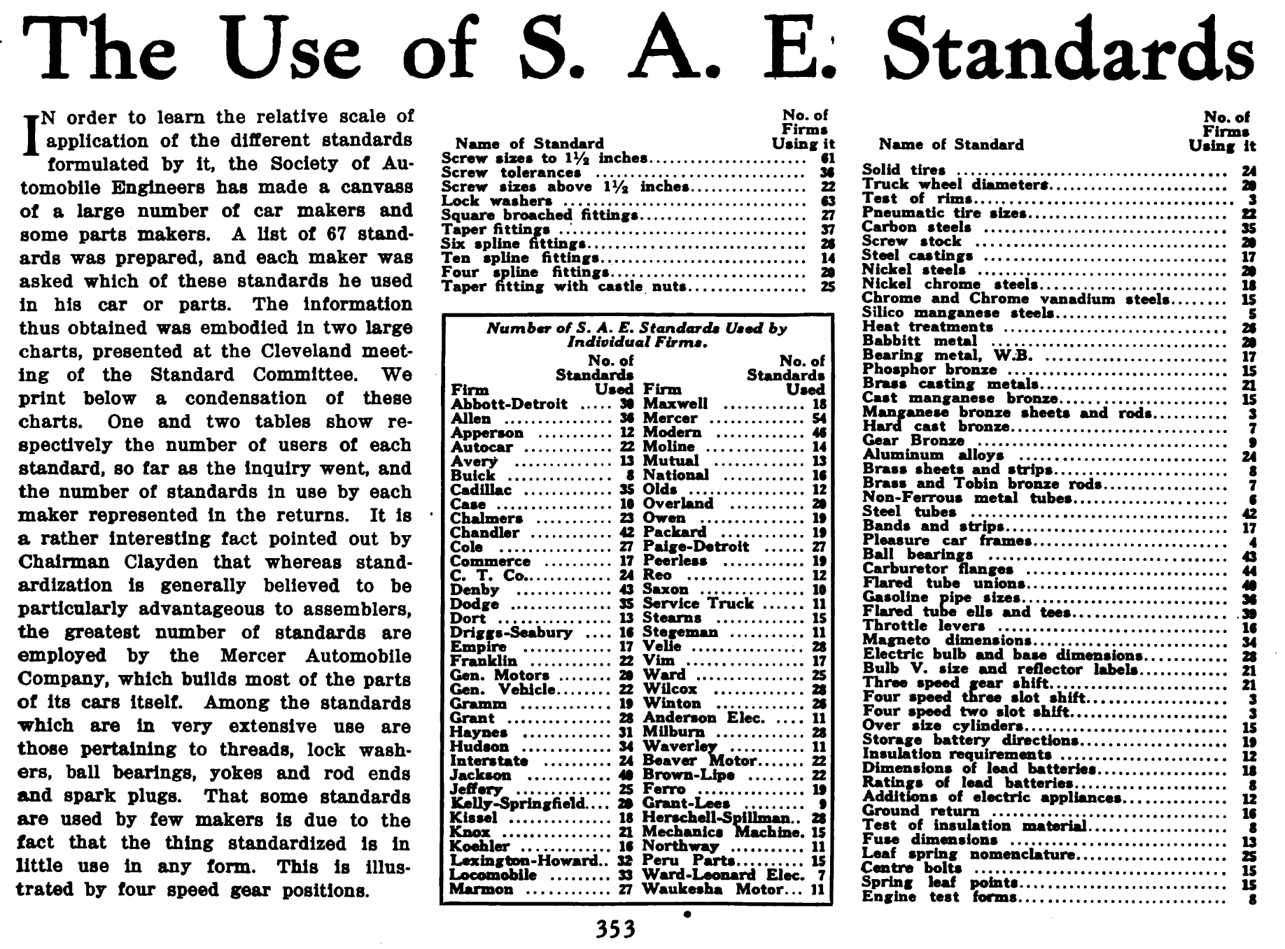
SAE International, formerly named the Society of Automotive Engineers, is a United States-based, globally active professional association and standards developing organization for engineering professionals in various industries. SAE International's world headquarters is in Warrendale, Pennsylvania, 20 miles north of Pittsburgh, Pennsylvania. Principal emphasis is placed on global transport industries such as aerospace, automotive, and commercial vehicles. The organization adopted the name SAE International to reflect the broader emphasis on mobility. SAE International has over 138,000 global members. Membership is granted to individuals, rather than companies. Aside from its standardization efforts, SAE International also devotes resources to projects and programs in STEM education, professional certification, and collegiate design competitions. For historical legacy reasons, the label "SAE" is commonly used on tools and hardware in North America to indicate United States cu ... [...More Info...] [...Related Items...] OR: [Wikipedia] [Google] [Baidu] |
Mike O'Callaghan – Pat Tillman Memorial Bridge
Mike may refer to: Animals * Mike (cat), cat and guardian of the British Museum * Mike the Headless Chicken, chicken that lived for 18 months after his head had been cut off * Mike (chimpanzee), a chimpanzee featured in several books and documentaries Arts * Mike (miniseries), a 2022 Hulu limited series based on the life of American boxer Mike Tyson * Mike (2022 film), a Malayalam film produced by John Abraham * ''Mike'' (album), an album by Mike Mohede * ''Mike'' (1926 film), an American film * MIKE (musician), American rapper, songwriter and record * ''Mike'' (novel), a 1909 novel by P. G. Wodehouse * "Mike" (song), by Elvana Gjata and Ledri Vula featuring John Shahu * Mike (''Twin Peaks''), a character from ''Twin Peaks'' * "Mike", a song by Xiu Xiu from their 2004 album '' Fabulous Muscles'' Businesses * Mike (cellular network), a defunct Canadian cellular network * Mike and Ike, a candies brand Military * MIKE Force, a unit in the Vietnam War * Ivy Mike, the fi ... [...More Info...] [...Related Items...] OR: [Wikipedia] [Google] [Baidu] |
Kingman, Arizona
Kingman is a city in, and the county seat of, Mohave County, Arizona, United States. It is named after Lewis Kingman, an engineer for the Atlantic and Pacific Railroad. It is located southeast of Las Vegas, Nevada, and northwest of Arizona's state capital, Phoenix. History Lt. Edward Fitzgerald Beale, a U.S. Navy officer in the service of the Army Corps of Topographical Engineers, was ordered by the U.S. War Department to build a federal wagon road across the 35th parallel. His secondary orders were to test the feasibility of the use of camels as pack animals in the Southwestern desert. Beale traveled through the present-day Kingman in 1857 surveying the road and in 1859 to build the road. Beale's Wagon Road became part of U.S. Route 66 and later Interstate 40. Remnants of the wagon road can still be seen in White Cliffs Canyon in Kingman. Kingman was founded in 1882 before statehood, in Arizona Territory. Situated in the Hualapai Valley between the Cerbat and H ... [...More Info...] [...Related Items...] OR: [Wikipedia] [Google] [Baidu] |
.jpg)


