|
Andorra La Vella Heliport
Andorra la Vella Heliport is a heliport located in Andorra la Vella, the capital city of the Principality of Andorra. There are two other heliports in Andorra, at La Massana and Arinsal. There are no scheduled passenger flights to these heliports, but it is possible to book taxi flights from Barcelona, Lleida, Perpignan, or Toulouse for fixed prices. There is no airport in Andorra. The nearest one is Andorra–La Seu d'Urgell Airport in Spain around 12 km from the border, however having limited scheduled flights. See also * List of countries without an airport This is a list of countries (sovereign states) and territories without an airport. Sovereign states Of the world's independent states, only five of the six European microstates have no airport within their boundaries, though all have at least one ... References Buildings and structures in Andorra la Vella Heliports in Andorra {{Andorra-struct-stub ... [...More Info...] [...Related Items...] OR: [Wikipedia] [Google] [Baidu] |
Andorra La Vella
Andorra la Vella french: Andorre-la-Vieille is the capital of the Principality of Andorra. It is located high in the east Pyrenees, between France and Spain. It is also the name of the parish that surrounds the capital. , the city has a population of 22,886, and the urban area, which includes Escaldes-Engordany plus satellite villages, has over 40,000 inhabitants. The principal industry is tourism, although the country also earns foreign income from being a tax haven. Furniture and brandies are local products. Being at an elevation of , it is the highest capital city in Europe and a popular ski resort. Name ''Andorra la Vella'' means "Andorra the Town", to distinguish it from the Principality of Andorra as a whole. Although in Catalan the word ''vella'' (like French ''vieille'') is derived from the Latin word ''vetula'' which means "old", the ''Vella'' here (like French ''ville'' and Catalan ''vila'') is derived from the Latin word ''villa'' and means "town". History Th ... [...More Info...] [...Related Items...] OR: [Wikipedia] [Google] [Baidu] |
Heliport
A heliport is a small airport suitable for use by helicopters and some other vertical lift aircraft. Designated heliports typically contain one or more touchdown and liftoff areas and may also have limited facilities such as fuel or hangars. In some larger towns and cities, customs facilities may also be available. Early advocates of helicopters hoped that heliports would become widespread, but they have become contentious in urban areas due to the excessive noise caused by helicopter traffic. In American use a heliport is defined as "an area of land, water, or structure used or intended to be used for the landing and takeoff of helicopters and includes its buildings and facilities if any." A heliport will consist of one or more helipads, which are defined as "a small, designated area, usually with a prepared surface, on a heliport, airport, landing/take-off area, apron/ramp, or movement area used for takeoff, landing, or parking of helicopters." In Canada the term heliport i ... [...More Info...] [...Related Items...] OR: [Wikipedia] [Google] [Baidu] |
Capital City
A capital city or capital is the municipality holding primary status in a country, state, province, department, or other subnational entity, usually as its seat of the government. A capital is typically a city that physically encompasses the government's offices and meeting places; the status as capital is often designated by its law or constitution. In some jurisdictions, including several countries, different branches of government are in different settlements. In some cases, a distinction is made between the official ( constitutional) capital and the seat of government, which is in another place. English-language news media often use the name of the capital city as an alternative name for the government of the country of which it is the capital, as a form of metonymy. For example, "relations between Washington and London" refer to " relations between the United States and the United Kingdom". Terminology and etymology The word ''capital'' derives from the Latin ... [...More Info...] [...Related Items...] OR: [Wikipedia] [Google] [Baidu] |
Principality Of Andorra
, image_flag = Flag of Andorra.svg , image_coat = Coat of arms of Andorra.svg , symbol_type = Coat of arms , national_motto = la, Virtus Unita Fortior, label=none (Latin)"United virtue is stronger" , national_anthem = "The Great Charlemagne" , image_map = Location Andorra Europe.png , map_caption = , image_map2 = , capital = Andorra la Vella , coordinates = , largest_city = capital , official_languages = Catalan language, Catalan , ethnic_groups = , ethnic_groups_year = 2017 , religion = Christianity (Catholicism) , religion_ref = , demonym = List of Andorrans, Andorran , government_type = Constitutional monarchy, constitutional Elective monarchy, elective diarchy , leader_title1 = Co-Princes of Andorra, Co-Princes , leader_name1 = , leader_title2 ... [...More Info...] [...Related Items...] OR: [Wikipedia] [Google] [Baidu] |
La Massana
La Massana (; originally ''La Maçana'') is one of the seven parishes of the Principality of Andorra. It is located in the northwest of the country. La Massana is also the name of the main town of the parish. The name Massana derives from the Latin name ''mattianam'' for a variety of apple. Other settlements in the parish are Pal, Arinsal, Erts, Sispony, Anyós, L'Aldosa de la Massana, Puiol del Pui, Escàs, Els Plans, Mas de Ribafeta, Xixerella and Pui. The parish is extremely mountainous and contains the highest mountain in Andorra, Coma Pedrosa (). Its western side limits with Tor, Pallars municipal term, in the border with Spain. Geography Physical geography The parish has an area of , and adjoins the neighbouring parishes of Ordino, Encamp, Escaldes-Engordany, and Andorra la Vella, and also France ( Occitanie) and Spain (Catalonia). There is of agricultural land, 14% of the total agricultural land in Andorra. The main villages are ''La Massana'' (the capita ... [...More Info...] [...Related Items...] OR: [Wikipedia] [Google] [Baidu] |
Arinsal
Arinsal () is a village in Andorra, set at an altitude of between 1550 and 2560 metres, close to the border with Spain at Tor, Pallars. In the summer Arinsal is home to walkers and bikers, as well as those who just want to relax in the mountain scenery. In the winter, it offers skiing and snowboarding for beginners, as well as a good selection of runs for intermediates. Overview The first ski lifts were installed in Arinsal in 1973 by Josep Serra, but the ski area was then taken over by the Comú of La Massana soon after. Over the years following, the ski areas of Pal and Ordino-Arcalis were developed. In 2001, the resorts of Pal and Arinsal were linked by a cablecar for the first time, and then in 2004, the area of Vallnord was created comprising three ski resorts: Arinsal, Pal, and Ordino-Arcalis, all covered under the same Vallnord lift pass. Although the skiing in Andorra is split between Vallnord and Grandvalira, the association of Ski Andorra brings information together and ... [...More Info...] [...Related Items...] OR: [Wikipedia] [Google] [Baidu] |
Lleida–Alguaire Airport
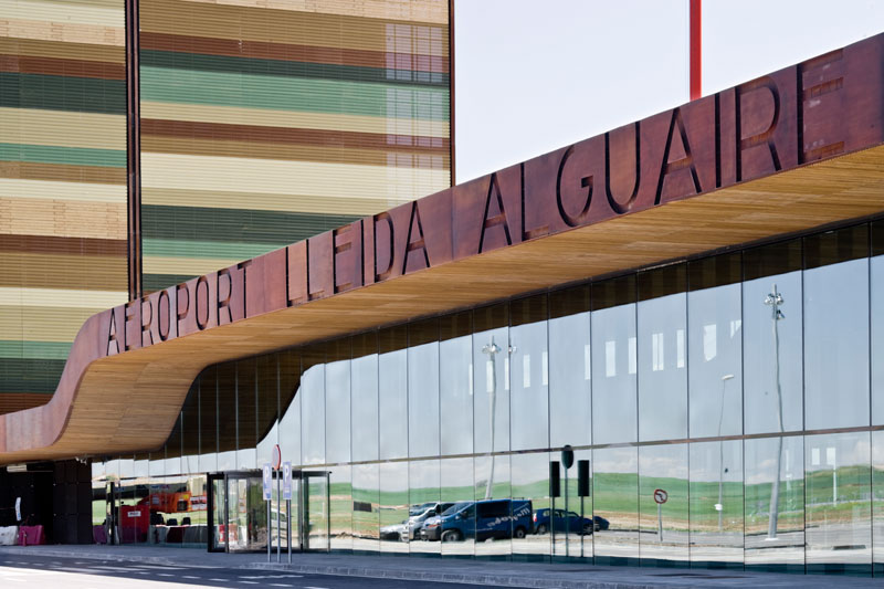
Lleida–Alguaire Airport (Catalan: ''Aeroport de Lleida-Alguaire'', Spanish: ''Aeropuerto de Lérida-Alguaire'') is an airport located in Alguaire, Catalonia, Spain; about from the centre of Lleida and about from the centre of Barcelona. History Lleida–Alguaire was designed as a regional airport to provide both passenger and cargo transport to Western Catalonia (the Ponent region and Catalan Pyrenees), Andorra and some counties (comarques) in La Franja. The airport construction project had a budget of 130 million euro and it was the first airport built and owned by the Generalitat of Catalonia, via its public-capital company Aeroports de Catalunya. It is also one of the few Spanish airports not owned by Aena. The airport was inaugurated on 17 January 2010. Airlines and destinations Statistics The following table shows total passenger numbers at Lleida–Alguaire Airport from 2010 to date. Ground transportation Two new highways, the Autovía An ''autov� ... [...More Info...] [...Related Items...] OR: [Wikipedia] [Google] [Baidu] |
Perpignan–Rivesaltes Airport
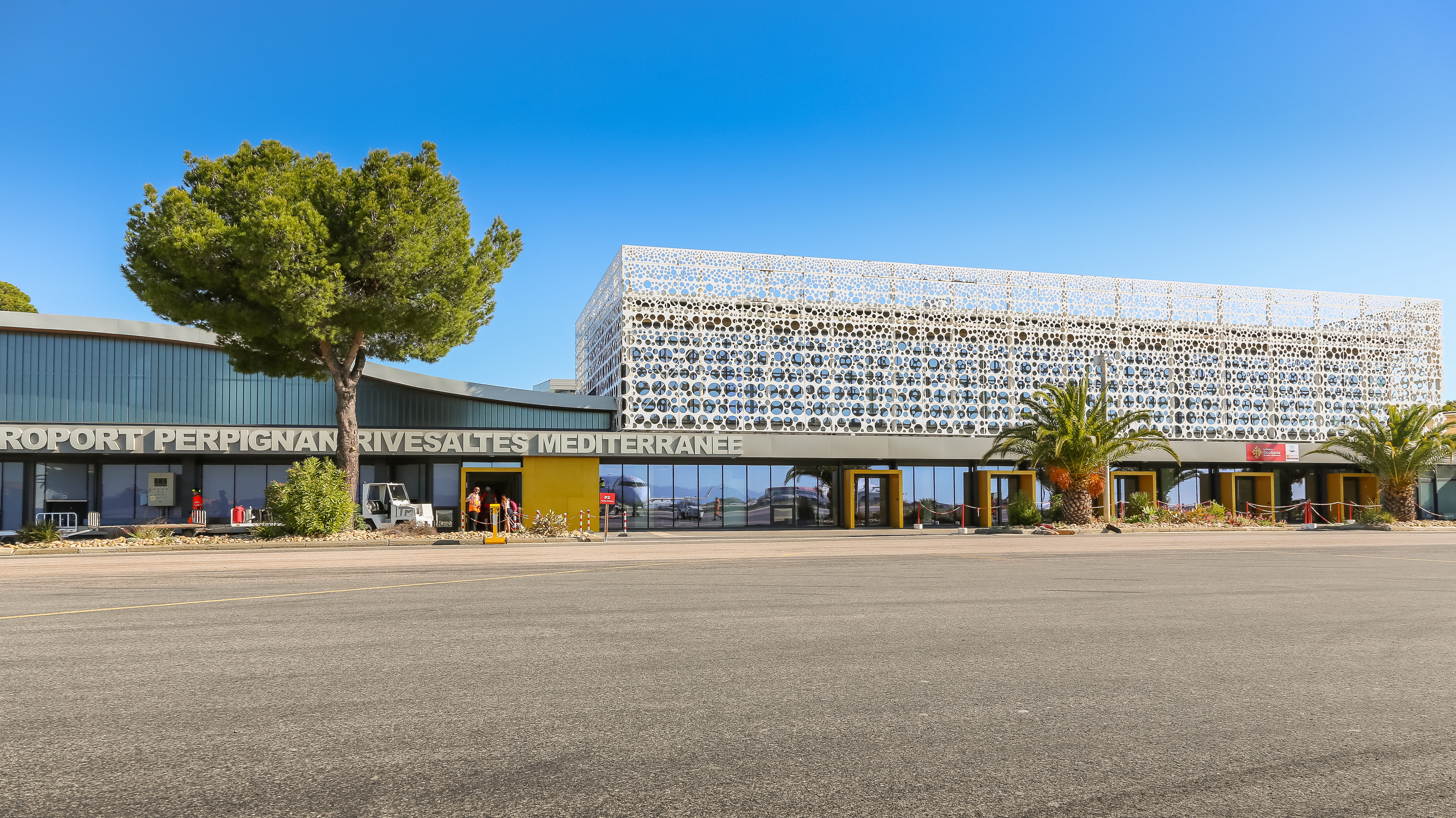
Perpignan–Rivesaltes Airport (french: link=no, Aéroport de Perpignan – Rivesaltes) , also known as Llabanère Airport, as well as Aéroport de Perpignan - Sud de France, is a small international airport near Perpignan and Rivesaltes, both ''communes'' of the Pyrénées-Orientales Department in the Occitanie region of south France. Facilities The airport is above mean sea level. It has two asphalt runways: 15/33 is and 13/31 is . Airlines and destinations The following airlines operate regular scheduled and charter flights at Perpignan–Rivesaltes Airport: Statistics Incidents and accidents *On 27 November 2008, Flight 888T, an Airbus A320 (owned by Air New Zealand) operating for XL Airways Germany, crashed whilst on a test flight from Perpignan–Rivesaltes Airport. The aircraft stalled and crashed into the Mediterranean Sea, killing all seven on board. The aircraft was due to be returned to its original owner. *On 25 July 2019, after rehearsing for a sh ... [...More Info...] [...Related Items...] OR: [Wikipedia] [Google] [Baidu] |
Toulouse–Blagnac Airport
Toulouse–Blagnac Airport (french: Aéroport de Toulouse–Blagnac) is an international airport located west northwest of Toulouse, partially in Blagnac, both ''communes'' of the Haute-Garonne department in the Occitanie region of France. In 2017, the airport served 9,264,611 passengers. As of April 2017, the airport features flights to 74 destinations, mostly in Europe and Northern Africa with a few additional seasonal long-haul connections. Both Airbus and ATR manufacture aircraft at nearby facilities and test them from the airport. Facilities Terminal The airport consists of one passenger terminal divided into four halls which provide 68 counters and 34 gates on 100,000 sqm floor space: *Hall A features 14 check-in counters and eight aircraft stands for regional aircraft on domestic services. *Hall B is the oldest area, opened in 1978, and contains 16 check-in counters and 10 gates. *Hall C is equipped with 24 counters and 6 boarding gates for European destinatio ... [...More Info...] [...Related Items...] OR: [Wikipedia] [Google] [Baidu] |
Andorra–La Seu D'Urgell Airport
Andorra–La Seu d'Urgell Airport ( ca, Aeroport Andorra–La Seu d'Urgell, es, Aeropuerto Andorra–La Seu d'Urgell; ) is a public airport owned by the government of Catalonia and hosts general aviation and commercial flights. It is located in the municipality of Montferrer i Castellbò in Catalonia, eastern Spain, and serves the city of la Seu d'Urgell and the microstate of Andorra, which is 12 km north of the airport. The airport has a short runway which limits aircraft sizes and the distance to destinations. History ''La Seu d'Urgell airfield'' opened in 1982 but was closed to commercial traffic in 1984 and was used only by private aircraft until 2008, when the airport was purchased by the Catalan government and closed pending its redevelopment and reopening as a commercial airport. In 2008, the Institut Català del Sòl (a department of the Catalan government) bought 85% of the airport's land to create ''Pirineus–La Seu d'Urgell Airport''. In 2009, a contract was ... [...More Info...] [...Related Items...] OR: [Wikipedia] [Google] [Baidu] |
List Of Countries Without An Airport
This is a list of countries (sovereign states) and territories without an airport. Sovereign states Of the world's independent states, only five of the six European microstates have no airport within their boundaries, though all have at least one heliport. All apart from Monaco are landlocked. (Liechtenstein is doubly landlocked.) States with limited recognition Non-self-governing territories Of the world's 17 non-self-governing territories, two have no airport within their boundaries: Tokelau and the Pitcairn Islands The Pitcairn Islands (; Pitkern: '), officially the Pitcairn, Henderson, Ducie and Oeno Islands, is a group of four volcanic islands in the southern Pacific Ocean that form the sole British Overseas Territory in the Pacific Ocean. The four isl .... Both are remote island groups, so a fairly long boat trip is the only way to get there. Notes References {{reflist, 2 C Airport, without ... [...More Info...] [...Related Items...] OR: [Wikipedia] [Google] [Baidu] |


_-_73.jpg)


