|
Andkhoi (city)
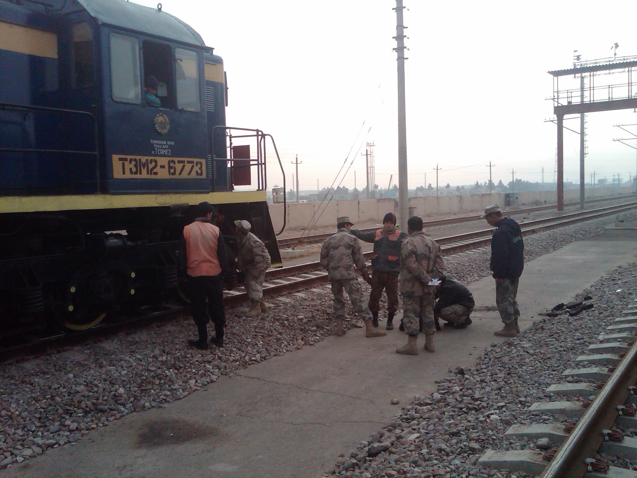
Andkhoy ( prs, اندخوی; ps, اندخوی ولسوالۍ) is a city in the northern part of Afghanistan, which has a population of about 47,857 people. They include all the major ethnic groups of the country. The city serves as the capital of Andkhoy District in the Faryab Province. It is around of driving distance southwest from the Aqina–Imamnazar border crossing between Afghanistan and Turkmenistan. There is also a rail station in the city, which was recently opened for import and export purposes with neighboring Turkmenistan. The Sheberghan Airfield in neighboring Jowzjan Province is the closest airport to Andkhoy. Ruwe Arjans The town founded by "The Ruwe Arjans", stands between the northern spurs of the Paropamise and the Oxus; it is 100 km. due west of Balkh, on the edge of the Turkmen desert. The area was an independent Khanate, ruled by members of the Afshar tribe from 1747 to 1880. In 1847, the city was sacked by Yar Mohammad Khan, the ruler of Her ... [...More Info...] [...Related Items...] OR: [Wikipedia] [Google] [Baidu] |
Mosque
A mosque (; from ar, مَسْجِد, masjid, ; literally "place of ritual prostration"), also called masjid, is a place of prayer for Muslims. Mosques are usually covered buildings, but can be any place where prayers ( sujud) are performed, including outdoor courtyards. The first mosques were simple places of prayer for Muslims, and may have been open spaces rather than buildings. In the first stage of Islamic architecture, 650-750 CE, early mosques comprised open and closed covered spaces enclosed by walls, often with minarets from which calls to prayer were issued. Mosque buildings typically contain an ornamental niche ('' mihrab'') set into the wall that indicates the direction of Mecca (''qiblah''), Wudu, ablution facilities. The pulpit (''minbar''), from which the Friday (jumu'ah) sermon (''khutba'') is delivered, was in earlier times characteristic of the central city mosque, but has since become common in smaller mosques. Mosques typically have Islam and gender se ... [...More Info...] [...Related Items...] OR: [Wikipedia] [Google] [Baidu] |
Rail Transport In Afghanistan
Afghanistan has three railway lines in the north of the country. The first is between Mazar-i-Sharif and the border town of Hairatan in Balkh province, which then connects with Uzbek Railways of Uzbekistan (opened 2011). The second links Torghundi in Herat province with Turkmen Railways of Turkmenistan (opened 1960). The third is between Turkmenistan and Aqina in Faryab province of Afghanistan (opened in 2016), which extends south to the city of Andkhoy. The country currently lacks a passenger rail service, but a new rail link from Herat to Khaf in Iran for both cargo and passengers was recently completed. Passenger service is also proposed in Hairatan – Mazar-i-Sharif section and Mazar-i-Sharif – Aqina section. Afghanistan's rail network is still in the developing stage. The current rail lines are to be extended in the near future, the plans include lines for cargo traffic as well as passenger transportation. Afghanistan's neighbors have been improving their own railway ... [...More Info...] [...Related Items...] OR: [Wikipedia] [Google] [Baidu] |
Afshar People
Afshar ( az, Əfşar افشار; tr, Avşar, ''Afşar''; tk, Owşar; fa, اَفشار, Āfshār) is a tribe of Oghuz Turkic origin, that split into several groups in Iran, Turkey and Afghanistan. During the Seljuk conquests of the 11th century, they moved from Central Asia into the Middle East. They are noted in history for being one of the Qizilbash tribes that helped establish the Safavid dynasty of Iran, and for being the source of descent of Iran's Afsharid dynasty. Nader Shah, who became the monarch of Iran in 1736, was from the Qereklu tribe ( fa, قرخلو) of Afshars. Afshars mainly inhabit Iran, where they remain a largely nomadic group. Today, the Afshars are variously grouped as a branch of the Azerbaijanis and Turkmens or Turkomans (a common general term used for people of Oghuz Turkic origin). The founders of the Germiyanids, Baku Khanate, Zanjan Khanate, Khalkhal Khanate, and Urmia Khanate were also of Afshar descent. The founder of the Karamani ... [...More Info...] [...Related Items...] OR: [Wikipedia] [Google] [Baidu] |
Balkh
), named for its green-tiled ''Gonbad'' ( prs, گُنبَد, dome), in July 2001 , pushpin_map=Afghanistan#Bactria#West Asia , pushpin_relief=yes , pushpin_label_position=bottom , pushpin_mapsize=300 , pushpin_map_caption=Location in Afghanistan , subdivision_type=Country , subdivision_name= , subdivision_type1=Province , subdivision_name1= Balkh Province , subdivision_type2=District , subdivision_name2=Balkh District , population_as_of=2021 , population_footnotes= , population_blank1_title=City , population_blank1=138,594 , population_blank2_title=Religions , timezone=+ 4.30 , coordinates= , blank_name=Climate , blank_info= BSk Balkh (; prs, , ''Balkh''; xbc, Βάχλο, ''Bákhlo''; grc, Βάκτρα, ''Báktra'') is a town in the Balkh Province of Afghanistan, about northwest of the provincial capital, Mazar-e Sharif, and some south of the Amu Darya river and the Uzbekistan border. Its population was recently estimated to be 138,594. Balkh was historically an ancient ... [...More Info...] [...Related Items...] OR: [Wikipedia] [Google] [Baidu] |
Oxus
The Amu Darya, tk, Amyderýa/ uz, Amudaryo// tg, Амударё, Amudaryo ps, , tr, Ceyhun / Amu Derya grc, Ὦξος, Ôxos (also called the Amu, Amo River and historically known by its Latin name or Greek ) is a major river in Central Asia and Afghanistan. Rising in the Pamir Mountains, north of the Hindu Kush, the Amu Darya is formed by the confluence of the Vakhsh and Panj rivers, in the Tigrovaya Balka Nature Reserve on the border between Afghanistan and Tajikistan, and flows from there north-westwards into the southern remnants of the Aral Sea. In its upper course, the river forms part of Afghanistan's northern border with Tajikistan, Uzbekistan, and Turkmenistan. In ancient history, the river was regarded as the boundary of Greater Iran with " Turan", which roughly corresponded to present-day Central Asia.B. SpulerĀmū Daryā in Encyclopædia Iranica, online ed., 2009 The Amu Darya has a flow of about 70 cubic kilometres per year on average. Names In classica ... [...More Info...] [...Related Items...] OR: [Wikipedia] [Google] [Baidu] |
Paropamise
Paropamisadae or Parapamisadae (Greek: Παροπαμισάδαι) was a satrapy of the Alexandrian Empire in modern Afghanistan and Pakistan, which largely coincided with the Achaemenid province of Parupraesanna. It consisted of the districts of Sattagydia ( Bannu basin), Gandhara (Kabul, Peshawar, and Taxila), and Oddiyana (Swat Valley). Paruparaesanna is mentioned in the Akkadian language and Elamite language versions of the Behistun Inscription of Darius the Great, whereas in the Old Persian version it is called Gandāra. The entire satrapy was subsequently ceded by Seleucus I Nicator to Chandragupta Maurya following a treaty. Name ''Paropamisadae'' is the Latinized form of the Greek name ''Paropamisádai'' (), which is in turn derived from Old Persian ''Para-uparisaina'', meaning "Beyond the Hindu Kush", where the Hindu Kush is referred to as ''Uparisaina'' ("higher than the eagle"). In the Greek language and Latin, "Paropamisus" Mela, ''De Situ Orbis'', Bk. I, Ch ... [...More Info...] [...Related Items...] OR: [Wikipedia] [Google] [Baidu] |
Jowzjan Province
Jowzjan, sometimes spelled Jawzjan or Jozjan (Dari: ), is one of the thirty-four provinces of Afghanistan, located in the north of the country bordering neighboring Turkmenistan. The province is divided into 11 districts and contains hundreds of villages. It has a population of about 613,481, which is multi-ethnic and mostly agriculturalists. Sheberghan is the capital of Jozjan province. History The province is named after the early medieval region and principality of Juzjan. Between the early 16th century and mid-18th century, the area was ruled by the Khanate of Bukhara. It was conquered by Ahmad Shah Durrani and became part of the Durrani Empire in or about 1750, which formed to the modern state of Afghanistan. The area was untouched by the British during the three Anglo-Afghan wars that were fought in the 19th and 20th centuries. Recent history Following a series of changing allegiances and falling out with Uzbek warlord Abdul Malik Pahlawan in 1997, the Taliban withdrew f ... [...More Info...] [...Related Items...] OR: [Wikipedia] [Google] [Baidu] |
Sheberghan Airfield
Sheberghan Airfield is located in the Jowzjan Province in the northwest part of Afghanistan. The airfield is located in a plain adjacent to a river, northeast of Sheberghan, west of Aqchah, and east of Andkhoy. Facilities The airport resides at an elevation of above mean sea level. It has two parallel runways: 06L/24R with an asphalt surface measuring and 06R/24L with a gravel surface measuring . The downward sloping runway is gravel base with a small cement run-up pad at the south end. The runway is slightly damaged. There aren't any facilities. See also *List of airports in Afghanistan This is a list of airports in Afghanistan, grouped by type and sorted by location. Description Afghanistan has four international airports which are expected to increase in the future. The Kabul International Airport serves the population of Kabu ... References External links * Airport record for Sheberghan Airfieldat Landings.com. Airports in Afghanistan Jowzjan Provi ... [...More Info...] [...Related Items...] OR: [Wikipedia] [Google] [Baidu] |
Turkmenistan
Turkmenistan ( or ; tk, Türkmenistan / Түркменистан, ) is a country located in Central Asia, bordered by Kazakhstan to the northwest, Uzbekistan to the north, east and northeast, Afghanistan to the southeast, Iran to the south and southwest and the Caspian Sea to the west. Ashgabat is the capital and largest city. The population is about 6 million, the lowest of the Central Asian republics, and Turkmenistan is one of the most sparsely populated nations in Asia. Turkmenistan has long served as a thoroughfare for other nations and cultures. Merv is one of the oldest oasis-cities in Central Asia, and was once the biggest city in the world. It was also one of the great cities of the Islamic world and an important stop on the Silk Road. Annexed by the Russian Empire in 1881, Turkmenistan figured prominently in the anti-Bolshevik movement in Central Asia. In 1925, Turkmenistan became a constituent republic of the Soviet Union, the Turkmen Soviet Socialist Repu ... [...More Info...] [...Related Items...] OR: [Wikipedia] [Google] [Baidu] |
Provinces Of Afghanistan
Afghanistan is divided into 34 provinces (, '' wilåyat''). The provinces of Afghanistan are the primary administrative divisions. Each province encompasses a number of districts or usually over 1,000 villages. Provincial governors played a critical role in the reconstruction of the Afghan state following the creation of the new government under Hamid Karzai. According to international security scholar Dipali Mukhopadhyay, many of the provincial governors of the western-backed government were former warlords who were incorporated into the political system. Provinces of Afghanistan Regions of Afghanistan UN Regions Former provinces of Afghanistan During Afghanistan's history it had a number of provinces in it. It started out as just Kabul, Herat, Qandahar, and Balkh but the number of provinces increased and by 1880 the provinces consisted of Balkh, Herat, Qandahar, Ghazni, Jalalabad, and Kabul. * Southern Province – dissolved in 1964 to create Paktia Prov ... [...More Info...] [...Related Items...] OR: [Wikipedia] [Google] [Baidu] |


